1000 Acre Plateau
… “it might be a bit muddy” my friend said casually, a few nights before we ambled up to the 1000 Acre Plateau for a Winter Queens Birthday-weekend three day trip. We discovered a few days later that our interpretation of that is quite different. The horrors of Ratea Forest, Pirongia and Longwood Forest on Te Araroa Trail are long gone. Give me a nice dry path along a tussocked ridge with epic views on a sunny day and I’m in my element. ‘A bit muddy’ (with my rose-tinted glasses on) means having to hop over a puddle or two. By contrast, give him a bush bash in the rain with some sketchy navigation, knee-high sphagnum bog, slippery creeks and the knowledge that the hut is ‘… somewhere’ and he’s in his. Let’s just say that the tramping around the 1000 Acre Plateau is a bit muddy. Take from it whatever you need to.
Check out the DOC information on walking the 1000 acre plateau.
Getting There 1000 Acre Plateau
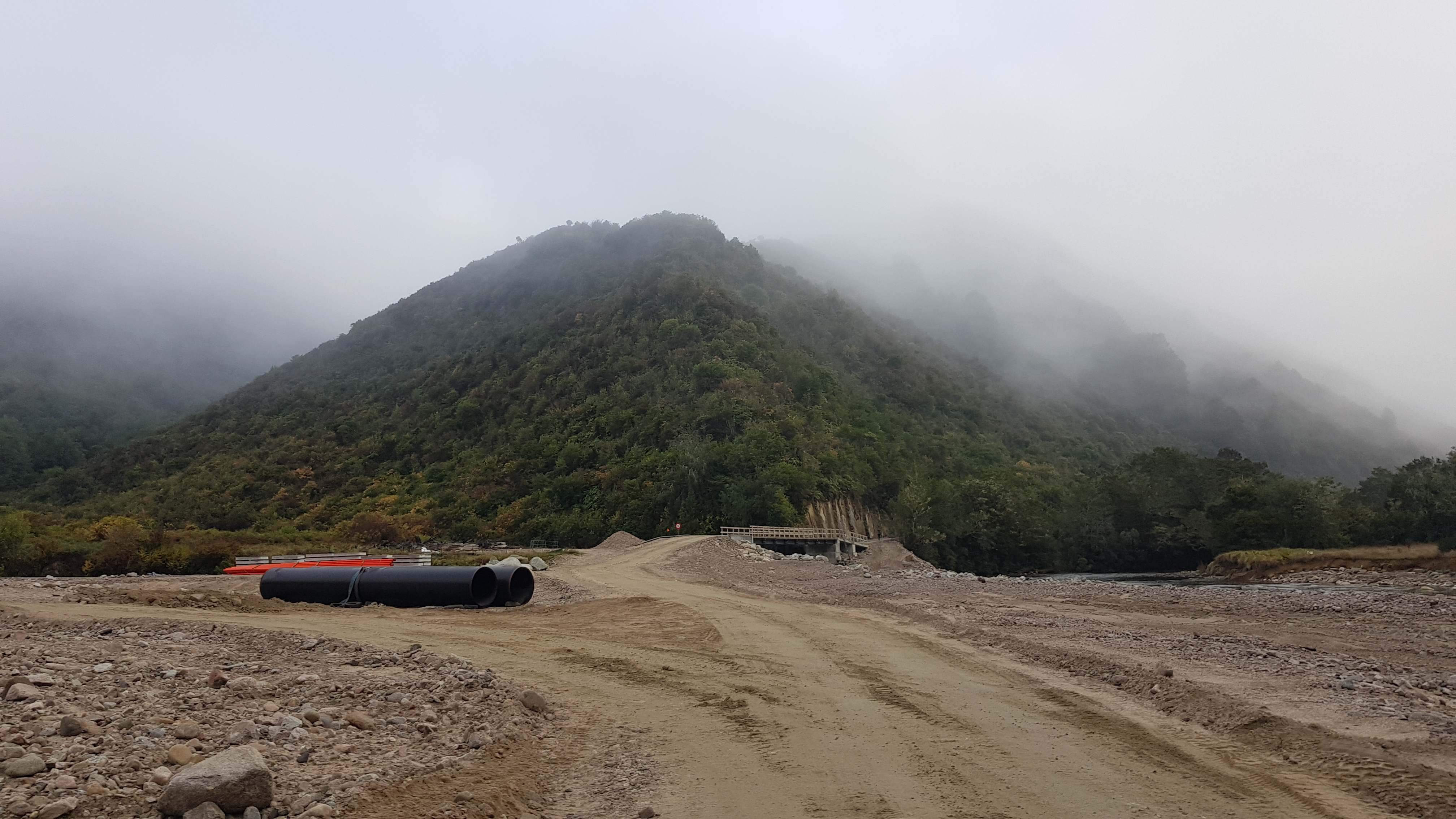
We left Nelson at 7 am and headed South towards Murchison down the SH6. After around 1.5 hours we took a right onto the Matriri Valley Road and swung North on a mostly unsealed road (in great condition) for another 20 minutes or so. We parked very close to the West Branch of the Matiri River where a hydroelectric scheme is being built. This made access easy, and there is a bridge over the West Branch, so we didn’t have to get wet immediately.
In the car park our group of four trampers met another group of four trampers. They too were heading for 1000 Acre Plateau and Larrikins hut. The hut is a 4 bedder, so we knew we’d probably be in for a cosy night (and I knew I’d be tenting – as I’m such a light sleeper).
Day 1 – Lake Matiri to Larrikins Hut
*Update Jan ’23 – this post was written in 2020, so things may now have changed re. access from the car park – in terms of better signage/tracks etc.*
We started walking around 9.15 am and having crossed the bridge over the Matriri River West Branch, we walked the unsealed road alongside the Matiri River. The first 20 minutes were pretty easy going, then we headed away from the river. Faced with a fork in the road and no signage, we took the wrong fork (and carried straight on when we should have gone left).
We ended up with no road and a 30-minute bush bash. Having discovered the road again, we followed it wrongly, to the right (East) down to a small stream leading to the lake. We crossed the stream and headed down to the edge of Lake Matiri to see if we could find the trail (we didn’t).
Backtracking up the same road, we puzzled for a while over my topo map having the DOC track heading into the bush where there definitely wasn’t one. Then we came to a small portacabin/hut with a handwritten sign to Lake Matiri. It turned out that the trail on the ground (according to my map and GPS at least) goes approximately 150m west of the trail on the topo map, which of course is rather unusual.
We discovered later that evening, that the other group 20 minutes behind us, made the same mistakes as we did.

We think it went something like this…
Green = wrong way down the right-hand fork to 30 min bash, then to lake
Yellow spot = portacabin pointing to the trail straight ahead
Blue = the trail on the ground (different to the map).
Red spot = marked waypoint on my GPS whilst on ‘the trail’.

Lake Matiri
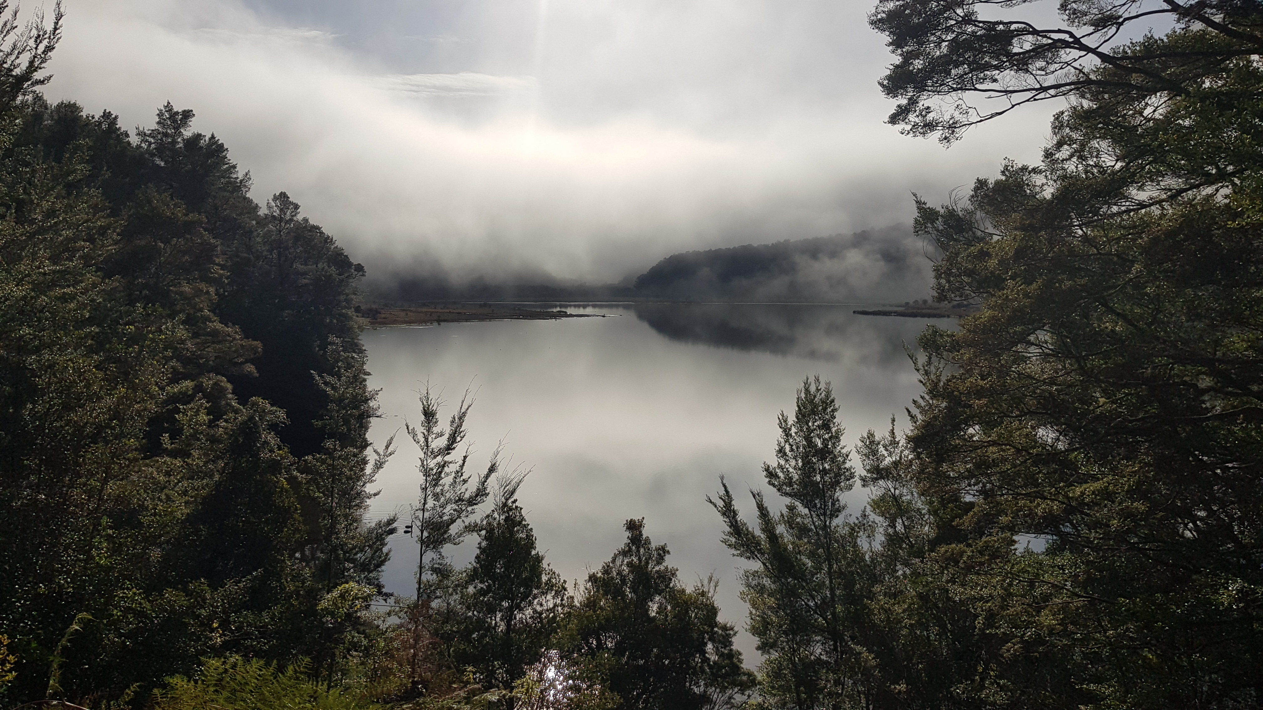
At 10.50 am we finally arrived at the cute 8-bed Lake Matiri hut. Putting the detour episode behind us we enjoyed a break and the lovely views. It would be a great spot to bask in the sun, but the morning mist hadn’t cleared yet.

Lake Matiri hut to 1000 Acre Plateau
The leg from Lake Matiri hut up onto the plateau started with a river crossing, leading into a large wet bog and then a climb for 3 km and around 750m elevation. We made pretty decent time of it, starting the climb at 11.15 am and arriving on the plateau by 1.15 pm.
The climb itself started with a steep, muddy, tree-rooty beech forest. The midsection was thankfully flatter and very pretty, with dracophyllum trees and some excellent views. The final leg was more rocky and became more open.


1000 Acre Plateau to Poor Pete’s Hut
Clear skies greeted us on top of the plateau and we enjoyed the warmth of the Winter sun. The plateau was beautiful, and a sometimes-boggy trail snaked its way through the undulating tussock to the 2-bed Poor Pete’s hut. Poor Pete’s has a lovely deck, a conservatory and resident weka. We reached the hut at 1.40 pm – around 2 hours and 20 mins after leaving Lake Matiri hut (DOC recommends 3 hours).
Lunch was a hurried affair of crackers and cheese, while the weka poked around for anything and everything. We set off again around 2 pm.

Poor Pete’s Hut to Larrikin Hut
DOC recommends 3 hours from Poor Pete’s to Larrikin Creek hut, so we made haste of our final leg as we wanted to get there before dark. It was one of those weekends where everyone else’s brisk walk was almost a jog for me. I’m no slowcoach, but sometimes being a tiny tramper (the height of your average thirteen-year-old) and not having those few extra inches on every stride, every step up or down, having to find another way over that easy jump, and not being able to reach the usual hand/foot placements on a climb, can put you at a bit of a disadvantage – so it was a weekend bringing up the rear.
I spent the next few hours nose to the ground as we hurried our way through the boggy tussock, then into the final stretch of boggy forest before reaching the four-bunk Larrikin Creek hut around 4.40 pm. The hut was nestled beneath the mudstone cliffs of the ‘Haystack’. The sun was low when we arrived, so we were cloaked in shadow, but it was a beautiful, if chilly spot.


Larrikin Creek Hut
We didn’t know if the group behind us would have tents, so rather than try to cram lots of people into a four-bed hut, we found a wonderful camp spot in the forest behind the hut. As it turned out the other party all tented too. When we were all set up, we all spent some time collecting firewood and enjoyed an evening together in front of the fire before having an early night.

Day 2 – The Needle and 100-Acre Plateau
The next morning we all met for a chilly breakfast in the hut. The other group left first and crunched their way through the frosty grass towards the first climb. We were all heading up to the Needle and across the plateau to Mount Misery today. Our group took things at a more leisurely pace and left the hut at around 10 am.
The day started with a small river crossing then a short climb up a wet, muddy gully to a mid-level plateau. There are no trails, so it’s up to you to pick your route. We decided to head up to our right through the knobbly tussock and the odd speargrass to sidle up to the ridge between the Haystack and the Needle. Once on the ridge, we travelled East-West towards the Needle. We could see the other team had approached the Needle from the South, so they must have continued along the lower plateau, past the tarns.


Up to The Needle
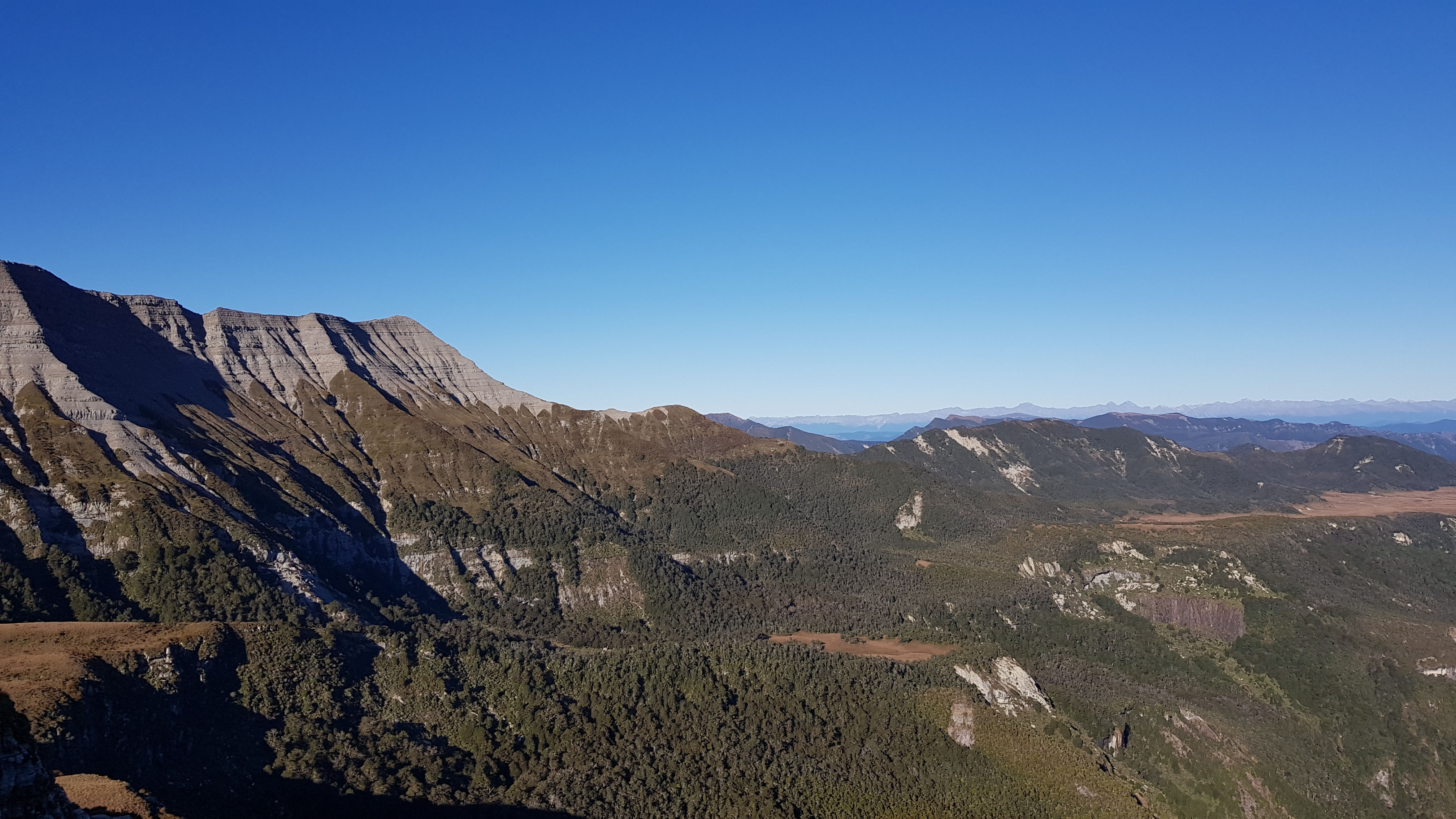
Within 40 minutes of leaving the hut, we were up on the ridge between the Needle and the Haystack, with spectacular views all around. It is possible to walk the ridge up to the Haystack from here – but that wasn’t today’s mission.
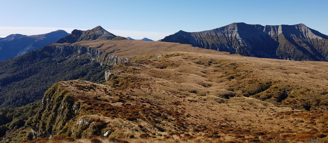
The towering cliffs of the 1000 and 100 Acre Plateau are like nothing else I’ve seen in New Zealand – an ancient sea bed, which was eroded and uplifted over millions of years to create this magical landscape.
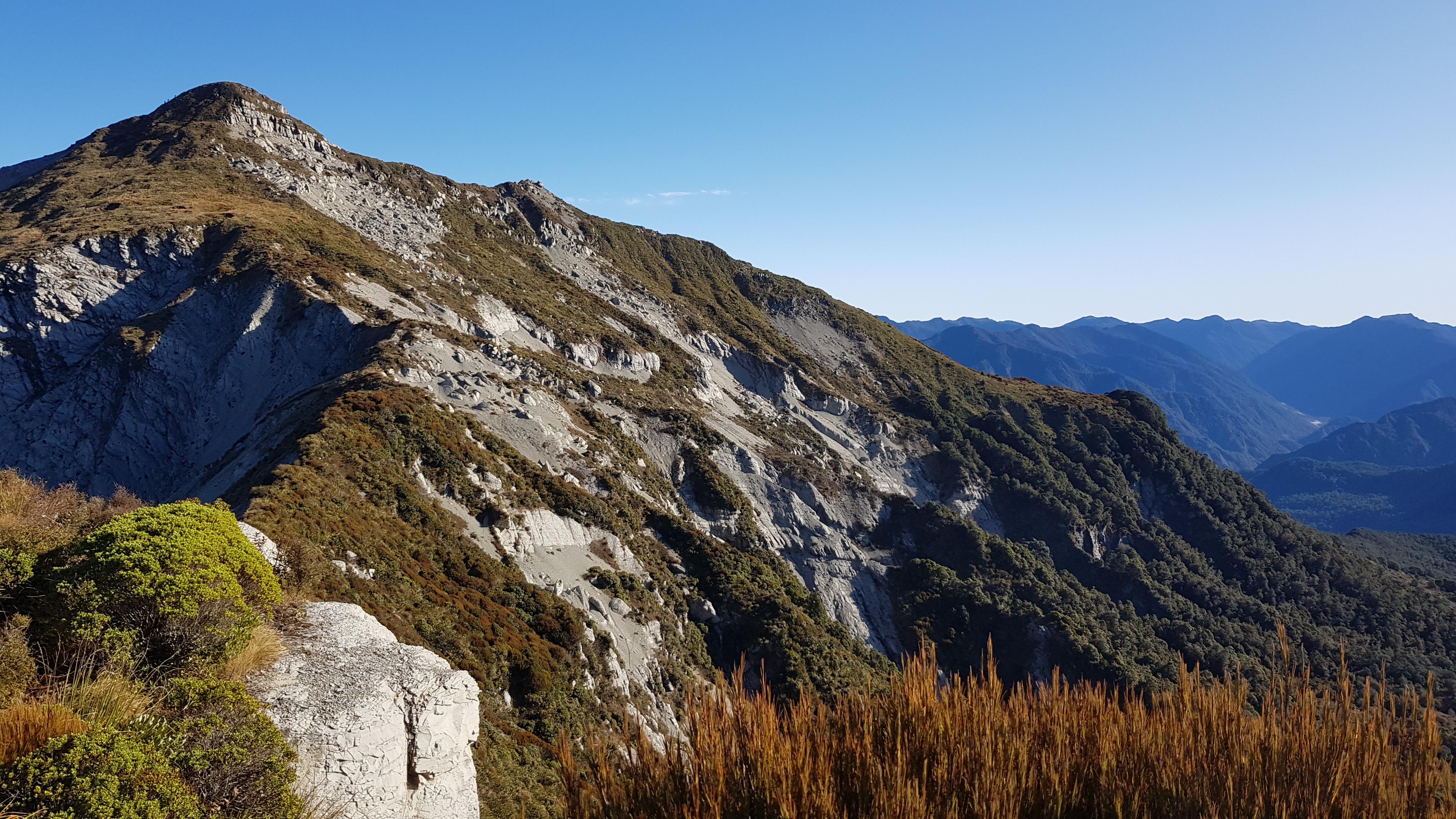
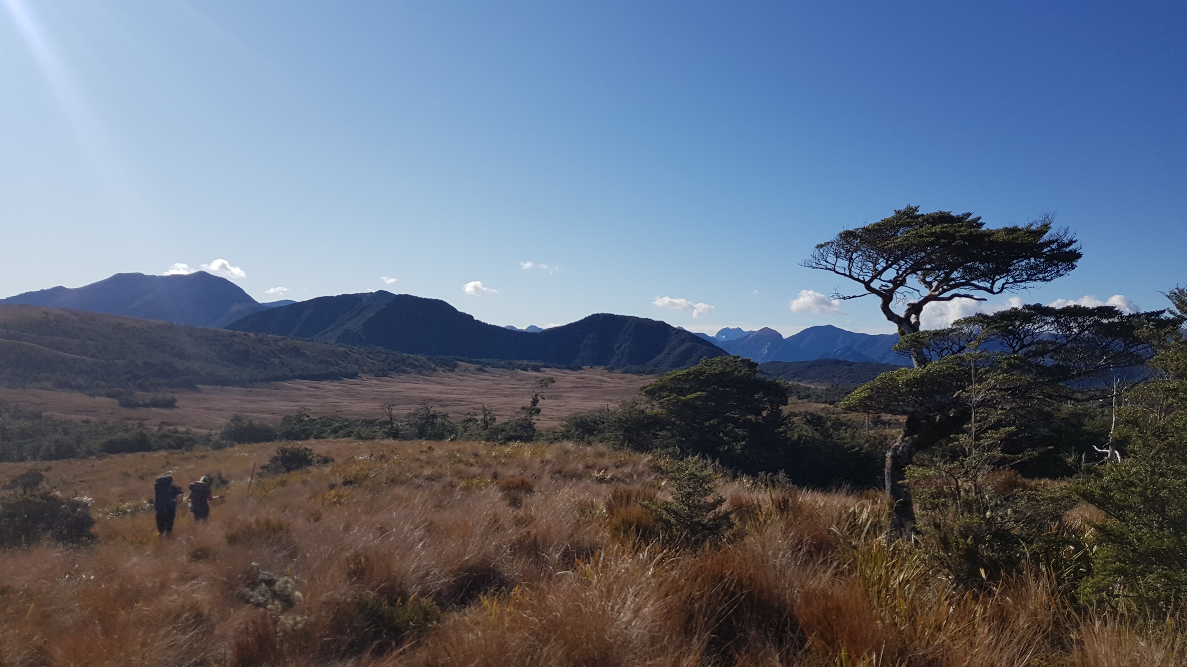
It took us roughly 1.5 hours to reach the Needle (1438m) from Larrikin hut, with a few photo and chat breaks. We had a break on the peak for something to eat and to take in the views. Mount Owen was identifiable in the distance and to our east was the Matiri River and to the West the Mohikinui South branch. Knowing we had walked roughly on a parallel with the Old Ghost Road we looked for any landmarks we might recognise. Further west, we could see the sea.


100 Acre plateau
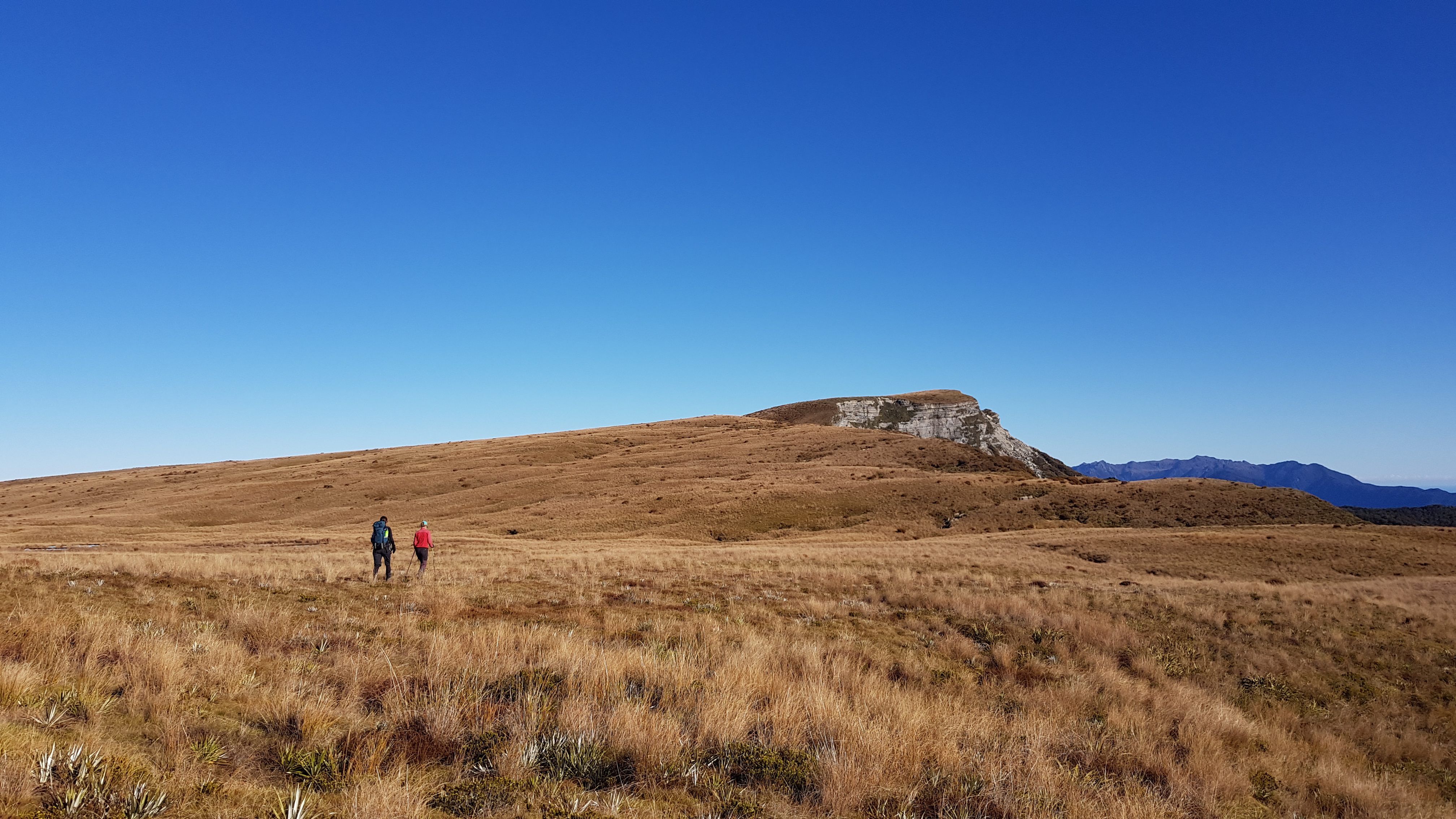
Stretching out to the southwest of the Needle is the 100 Acre Plateau, otherwise known as the ‘Devil’s Dining Table’. The undulating limestone landscape is dotted with sinkholes, tarns and small caves. We were heading across to Mt Misery, the high point a couple of kilometres away.
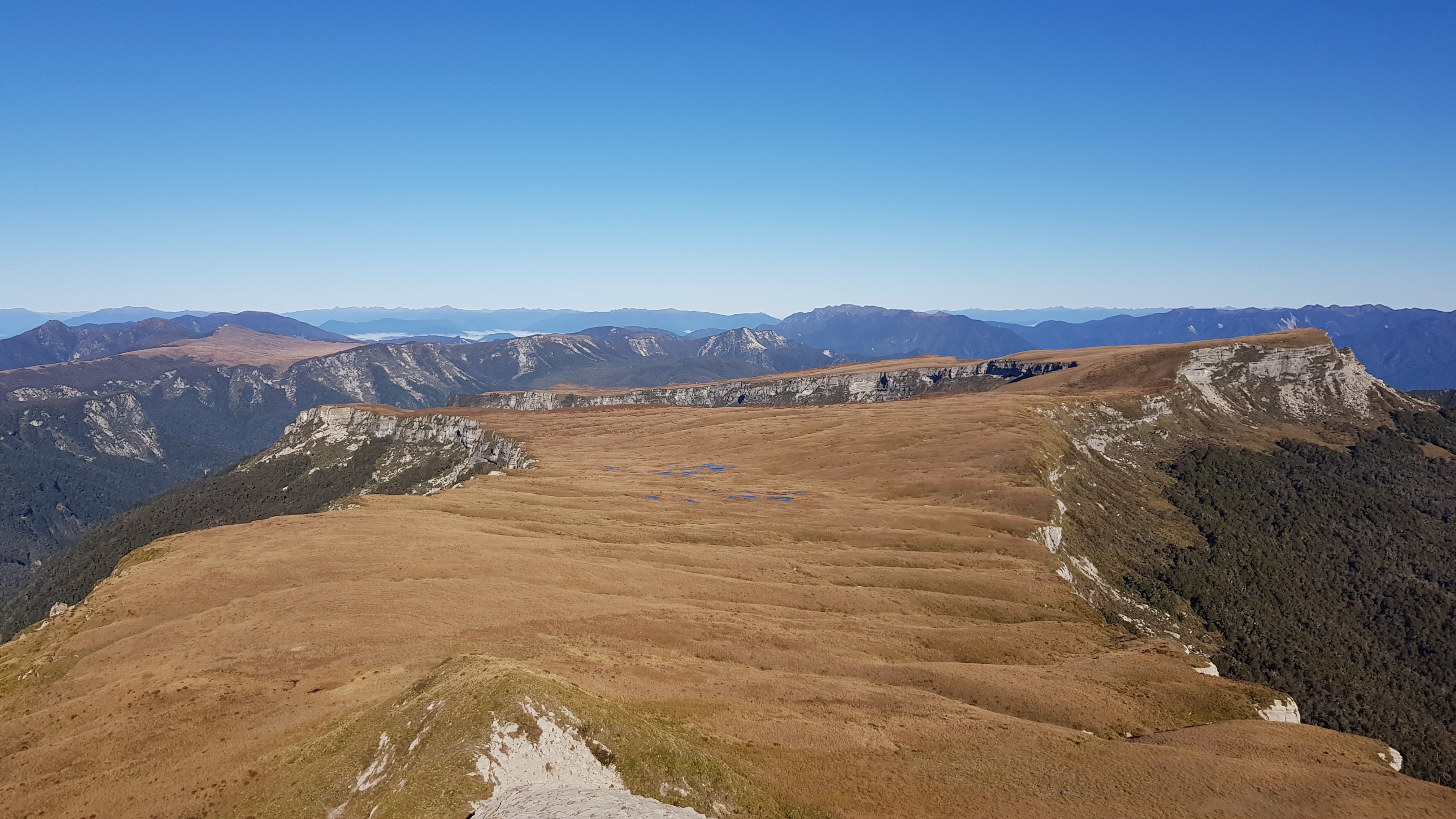
Dropping off the Needle at around midday we ambled our way across the plateau. Apparently in summer this golden plateau comes alive with the colours of all the alpine flowers. There’s a good excuse to come back.
On the plateau, we picked our own routes through crevasses, watched for holes underfoot and peered into caves. In the sheltered spots and dips, there were beautiful gardens with alpine bushes and flowers growing. We even saw some baby dracophyllum trying to make it, and suspected that if they did survive, they would remain stunted to the height of their little sheltered gardens.
It took just over an hour to reach Mt Misery.


Mount Misery
Looking up and down the rim of the plateau from Mount Misery put an entirely different perspective on the landscape. We were glad it was such a fine day – it would be a shame to miss it. We stopped for a long lunch on the clifftop overlooking the Mohikinui, in the long grass out of the wind.


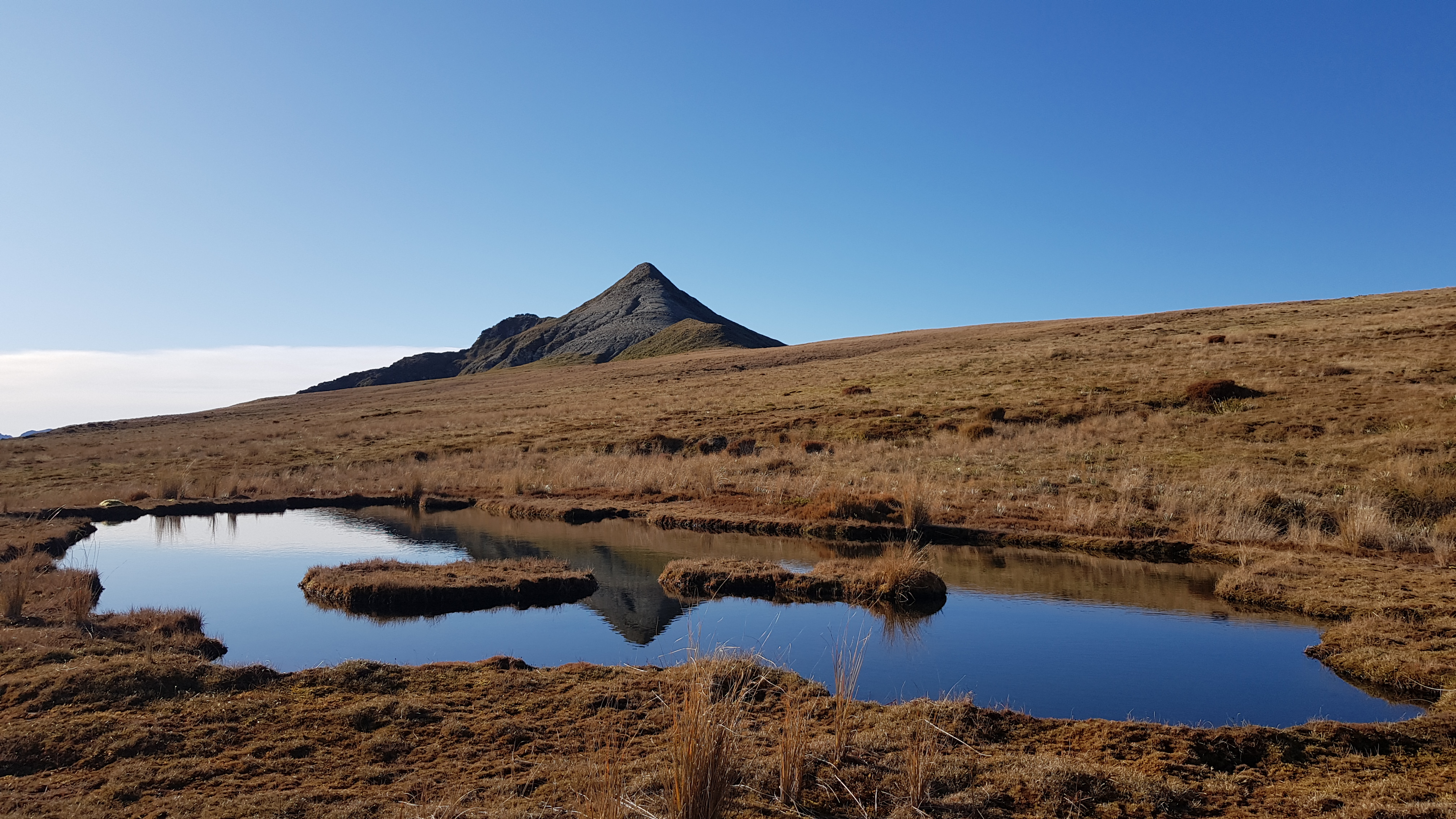
Around 2 pm we made our way down and back across to the tarns on the plateau. We dropped 100m or so down the steeper-than-it-appeared descent, fighting our way through the slippery garden, to the mid-level plateau. Once on the flat, we crossed the stream to the tarns. We picked up a couple of cairn and a rough trail led us back to the first gully we had climbed up this morning.


Into our final part of the descent of the muddy gully, we could see the shadows creeping towards Larrikins hut. The team hurried on before me, reaching the hut in sunshine before it dipped below 100 Acre Plateau.

We reached the hut at around 3.45 pm. The other group had arrived back to the hut before us, and packed up to head off back to Poor Pete’s for the night. No doubt they would be walking in the dark on their approach to Poor Pete’s hut.
Our group spent the evening making the most of the fire, eating and chatting. I happened to go out to the toilet just at the right time to see a giant moon rise above the cliffs of the Haystack. We all began yawning and looking at our watches around 7.30 pm – and made a valiant effort to not go to bed before 8 pm.
Day 3 – Back to Lake Matiri
We left Larrikins hut at around 8 am the next morning. It was a clear morning but rain was expected later, so we kept an eye on the sky. After the rather hurried walk to Larrikins, I wanted to enjoy the walk back to Lake Matiri, so took my time and looked around at all the things I’d missed a couple of days ago. The mud was still present of course, but there were also beautiful little tarns, and bushy alpine gardens to investigate.


We dropped down to Poor Pete’s hut at about 10.30 am and took a break. An hour later we were across the 1000 Acre Plateau and heading into the forest. Travelling downhill on a rocky, tree-rooty, muddy trail has never been my forte, so I didn’t rush it. On my way down I admired the shapes of the mossy forest, looked for mushrooms, listened for birds and investigated the small things.
Mid-way back we stopped at an outlook and were rewarded with in incredible view of Lake Matiri, which had been covered in cloud on our inwards journey.
We arrived down at Lake Matiri hut at around 1.30 pm and had lunch.

Lake Matiri to the Car Park
The return journey from Lake Matiri hut to the car park was uneventful but worth a mention due to us taking the correct path and it taking only half the time of the inward journey! I didn’t check my watch, but it must have been around 2.45 pm when we arrived back at the car.
I chatted to several people about the trip before I left, and all of them said it was on their to-do list, but other trips always seemed to come first. I would recommend making the effort, but make sure it’s a fine-weather weekend! You wouldn’t want to haul yourself up to the plateau and miss the spectacular views!
Click the links below for some of my other walks in the Kahurangi:
- Tableland Circuit – Cobb Asbestos, Salisbury, Peel – overnight
- Tableland Loop – Flora, Gordons, Salisbury, Balloon, Flora – overnight
- Mt Peel from the Cobb – day walk
- Mt Arthur – day walk
- Ellis Basin Route – three days two nights
- Mt Owen Day 1, Day 2 – overnight
- Lockett Range & Mt Cobb Tops – three days two nights
- Anatoki Killdevil Pack Track – three days two nights
- Kahurangi Lighthouse