The Dew Lakes and Dun Mountain Loop
The great thing about living in Nelson is the accessibility to so many great hiking spots on your doorstep. The Dew Lakes and Dun Mountain loop starts from the Maitai dam just a 20-minute drive from the city. This awesome day walk is around 23 km and takes you through a variety of forestry, bush/scrub, beech forest and open tops. Be prepared for a great workout – it’s a decent climb up to 1143m over Little Twin and 1129m over Dun Mountain. With a 20-minute break at Dew Lakes and an hour for lunch on the mountain, it took us 7 hours for the round trip. As my hiking buddy put it.. ‘it’s an honest days’ walk’.
Getting There
The Maitai dam is just a 20-minute drive from Nelson. Follow the Maitai Valley Road from the Eastern side of town (which eventually becomes unsealed) and continue until you get to the end. The road is in great condition and you don’t need a four-wheel drive vehicle. There is plenty of parking at the end, but when you get there check the times the gates are locked. We parked a little before the reservoir car park, before the gates, just in case we didn’t get back by dusk.

Dew Lakes Dun and Mountain Loop
As it’s a loop walk you can walk it in either direction. I had walked up the Dun Mountain track in the rain to access the Richmond Ranges Alpine Crossing portion of Te Araroa Trail, last summer. With a pack loaded with 8 days’ worth of food (the crossing took 5.5 days) I remember it being a very hard, monotonous, uphill slog. We started today’s walk in the opposite direction, towards Dew Lakes. It was still very ‘uphill’ this way – you’re covering 1000m up to Little Twin, but after the initial forestry section it was really pretty and had lots of variety along the way.
Maitai Dam to Rush Pools
We started at the Maitai dam at a very leisurely 10.40 am. The track takes you over a little bridge where you get a great close-up view of the mesmerising reservoir overflow. From there it was a few kilometres up a forestry road which wasn’t difficult and wasn’t pretty.
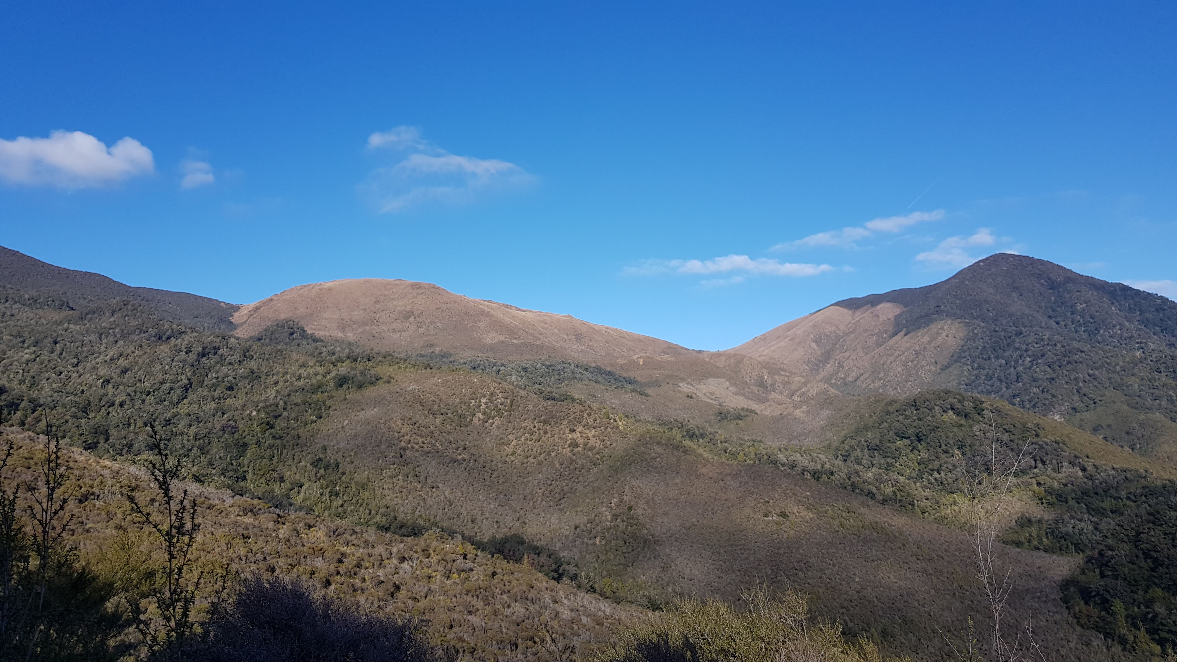
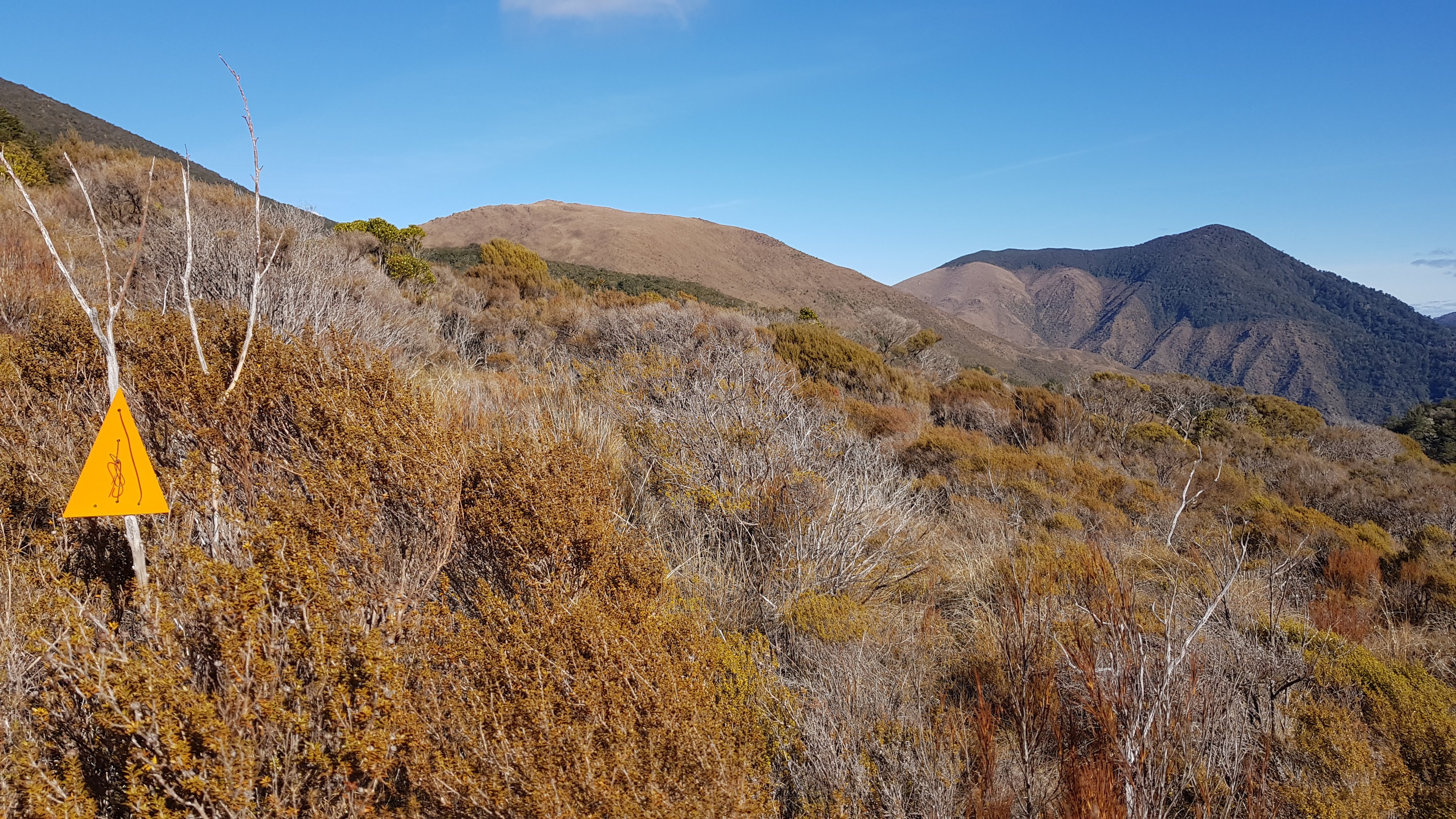
The views across to Dun Mountain more than made up for it though. It looked very far away, but the variety of scenery on the way up kept things interesting, and we really enjoyed the hike.

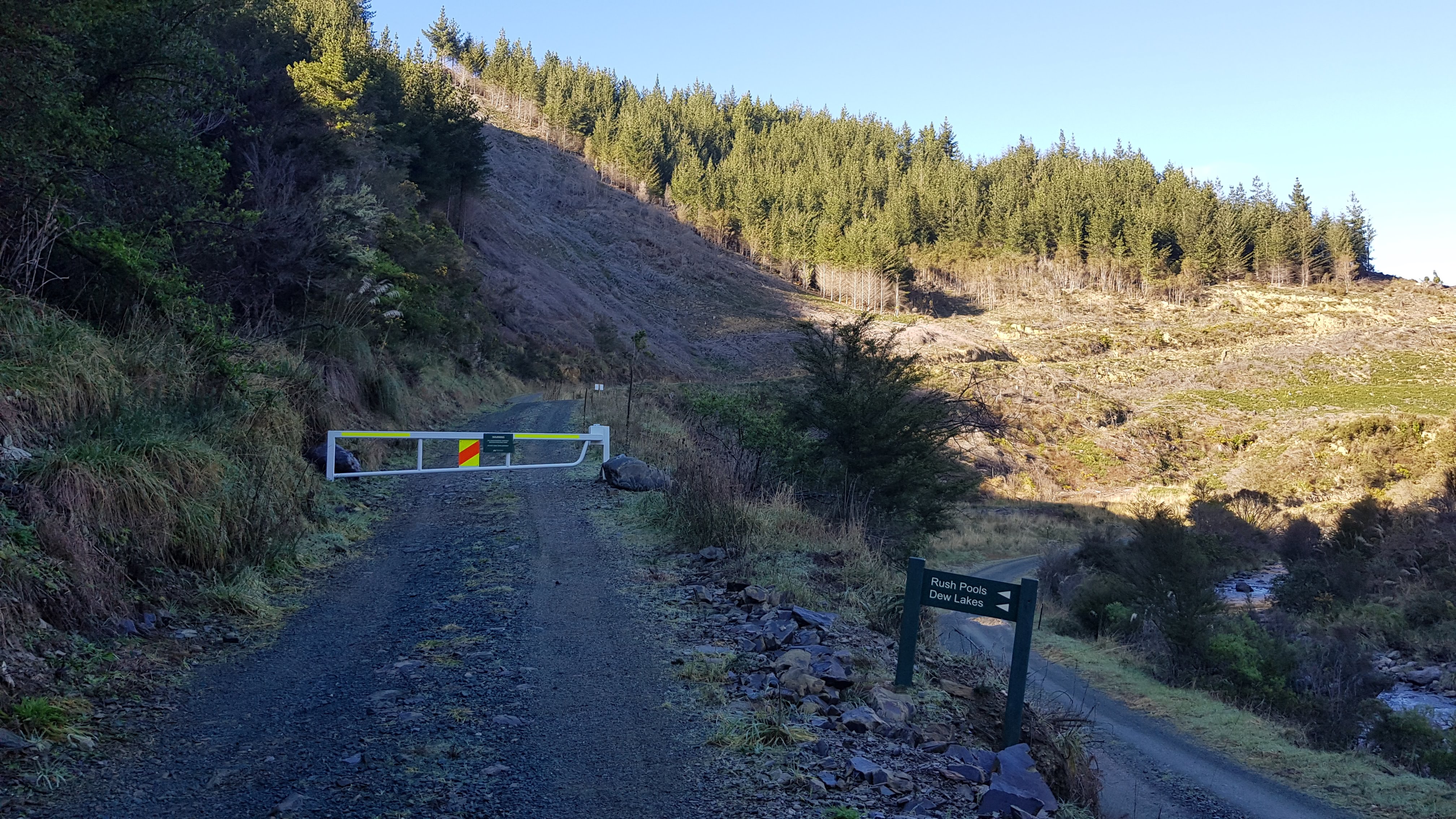
At around 10.50 pm, we came to a fork in the road and took the upper (right hand) track.


We reached the Rush Pools at 11.20 am, forty minutes from starting. The Rush Pools aren’t actually ‘pools’ any more. According to the Nelson City Council walking guide, they were a man-made pond used by early Maori in the process of quarrying Argillite to make tools. According to the Nelson Trails website, fires were lit underneath rocks to heat them, and rapid cooling with water from the ponds caused them to split and shard.
This ‘mineral belt’ in the mountains near Nelson is famous for its ancient rocks including serpentine, which 280 million years ago formed the ocean floor before New Zealand broke away from the mega-continent Gondwanaland.
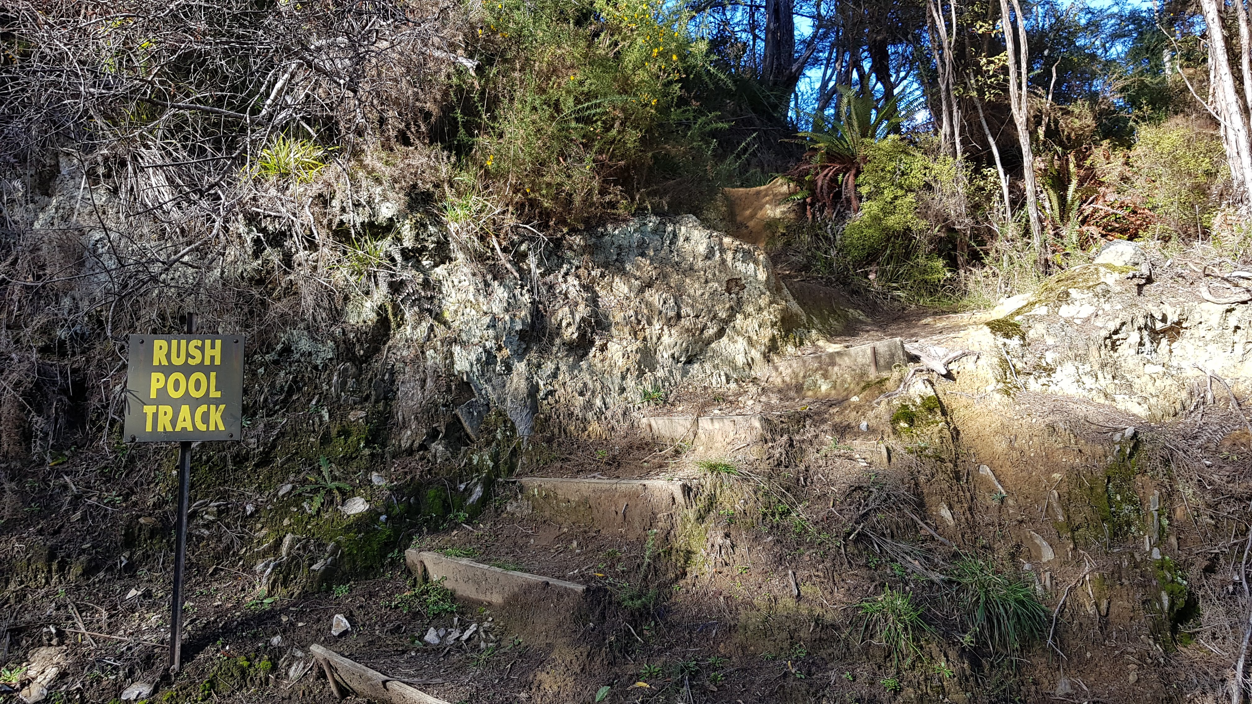
Rush Pools to Dew Lake
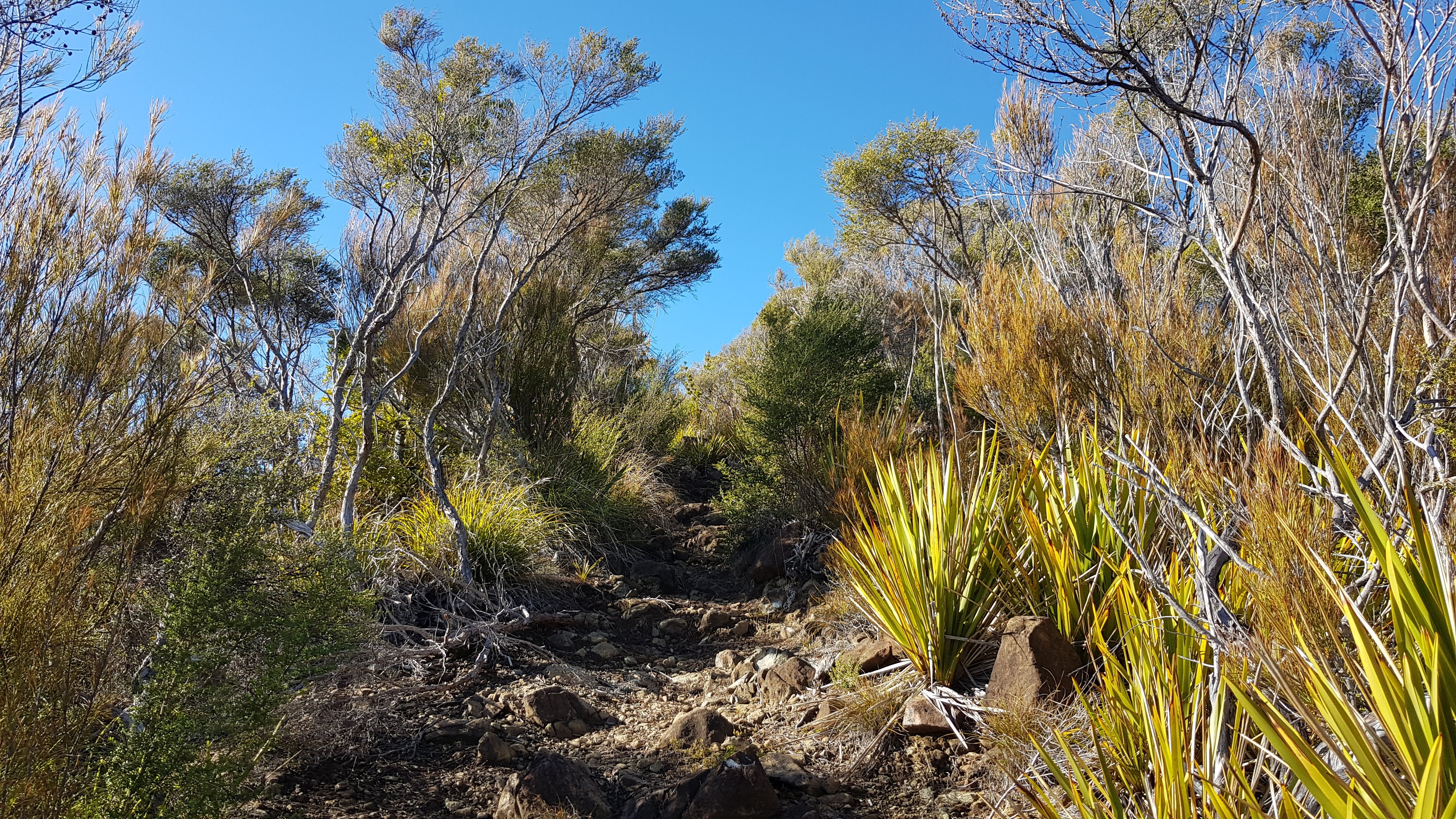
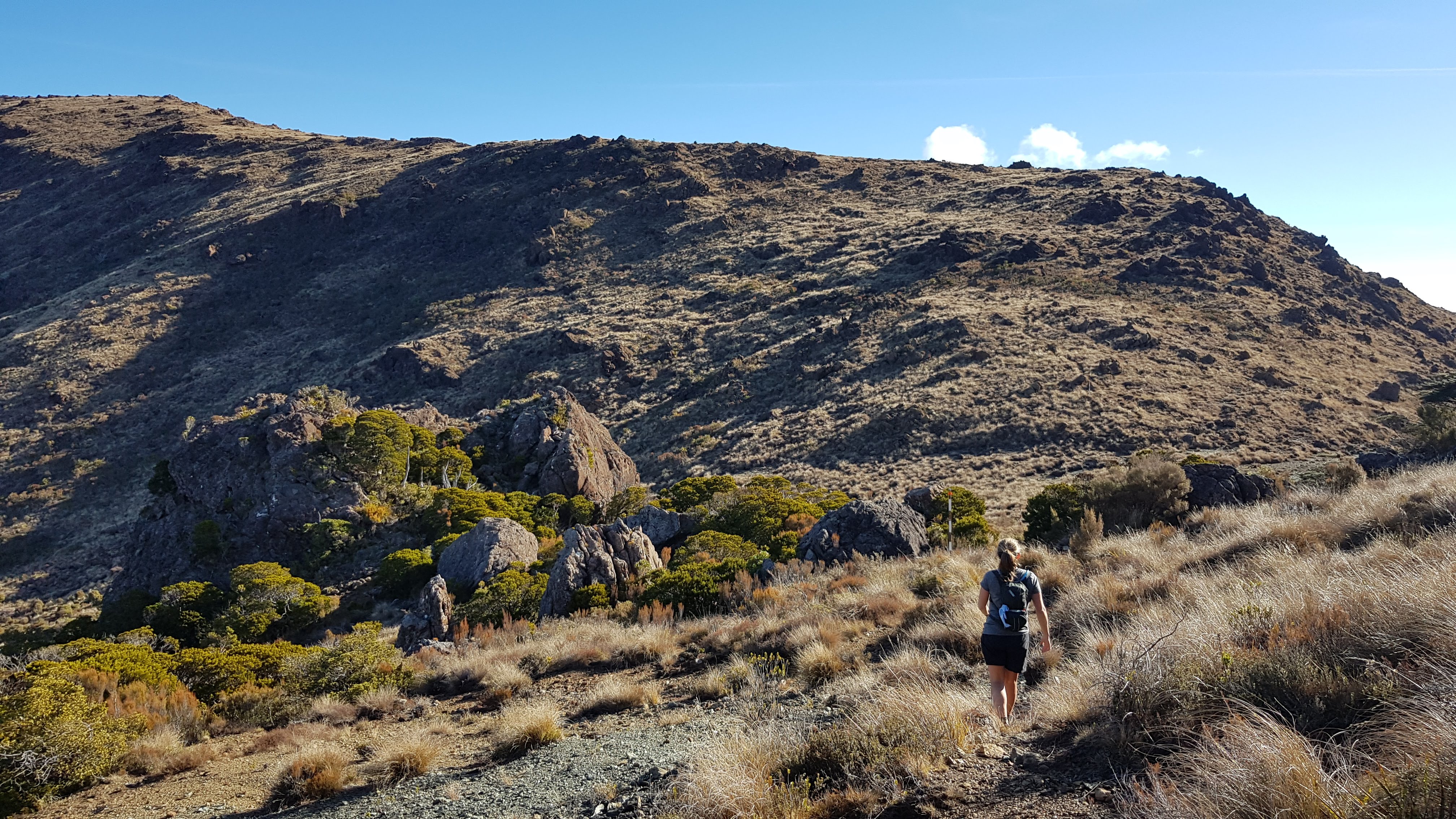
From Rush Pools, we headed up towards Dew Lakes. The trail was quite a relentless uphill and was pretty steep in parts with some nice lookouts. The track took us through a mixture of scrub/mineral belt and beech forest. I was glad I wasn’t hiking this in summer as a couple of sections of the forest were so black with sooty mould, it would have been swarming with wasps. This was probably the worst affected area I’d ever seen.


In the beech forest, we heard lots of birdsong and stopped a few times to listen. As we neared the Dew lakes it was progressively boggier underfoot, however, given that this was a mid-winter trip we were pleasantly surprised that the trail was in such good shape. We reached Dew Lakes at 12.30 pm, a two hours into the walk.
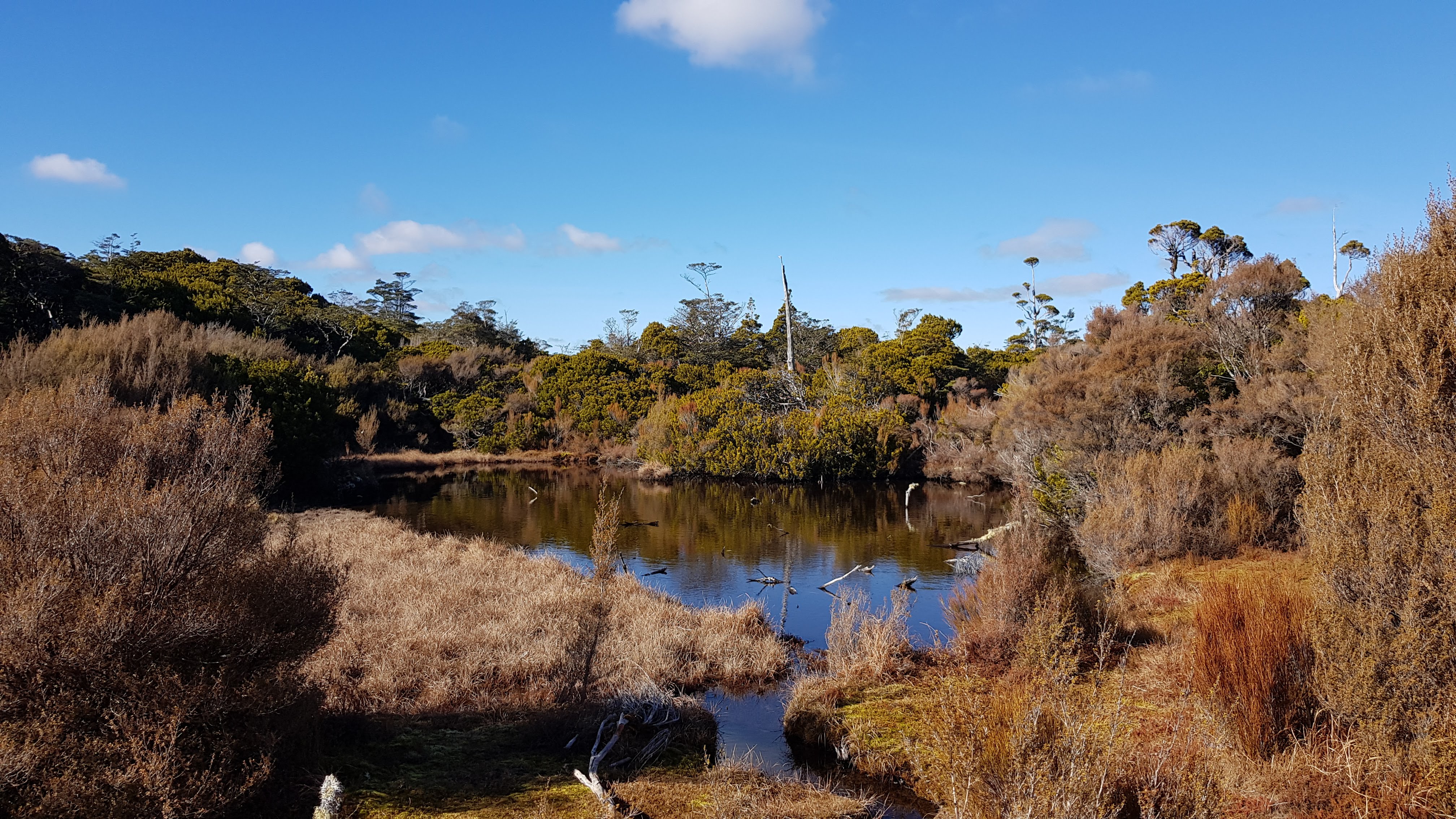
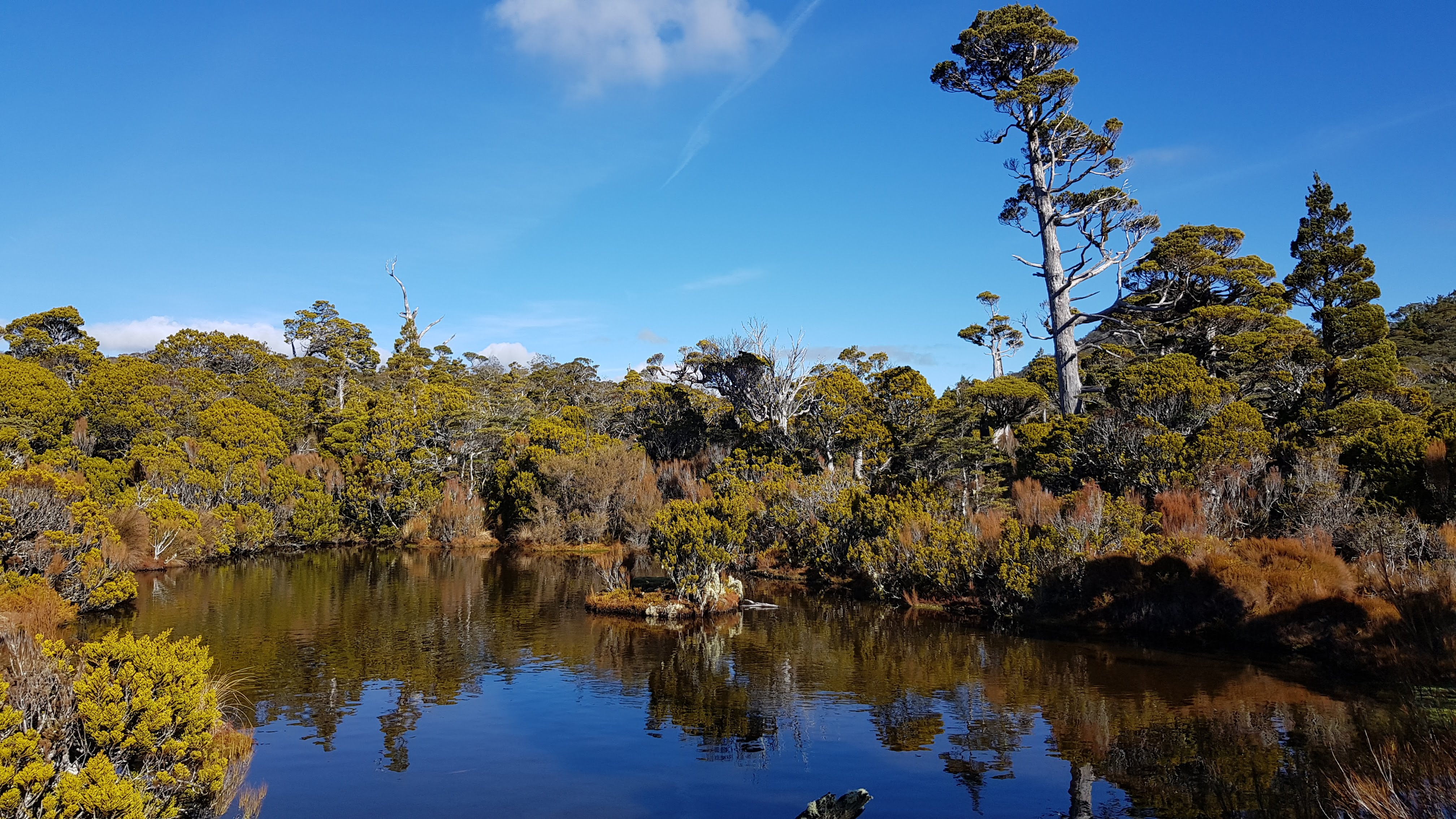
The Dew Lakes are beautiful shallow tarns surrounded by low trees and squishy moss. We had a good look around. There are a number of lakes to find if you wander around a bit and get yourself off-track. We found a beautiful sheltered spot that wasn’t too wet to sit down and enjoyed a lovely break in the sun for 10 minutes or so.

Dew Lakes to Little Twin
We got going and made a push from Dew Lakes to Little Twin (1143m). We were getting pretty hungry but wanted to save lunch for Dun Mountain. The final 400m or so up to Little twin was pretty steep, through the beautiful rocky, tree-rooty forest. We reached Little Twin at 1.30 pm.


Little Twin to Dun Mountain – Trail blazing…
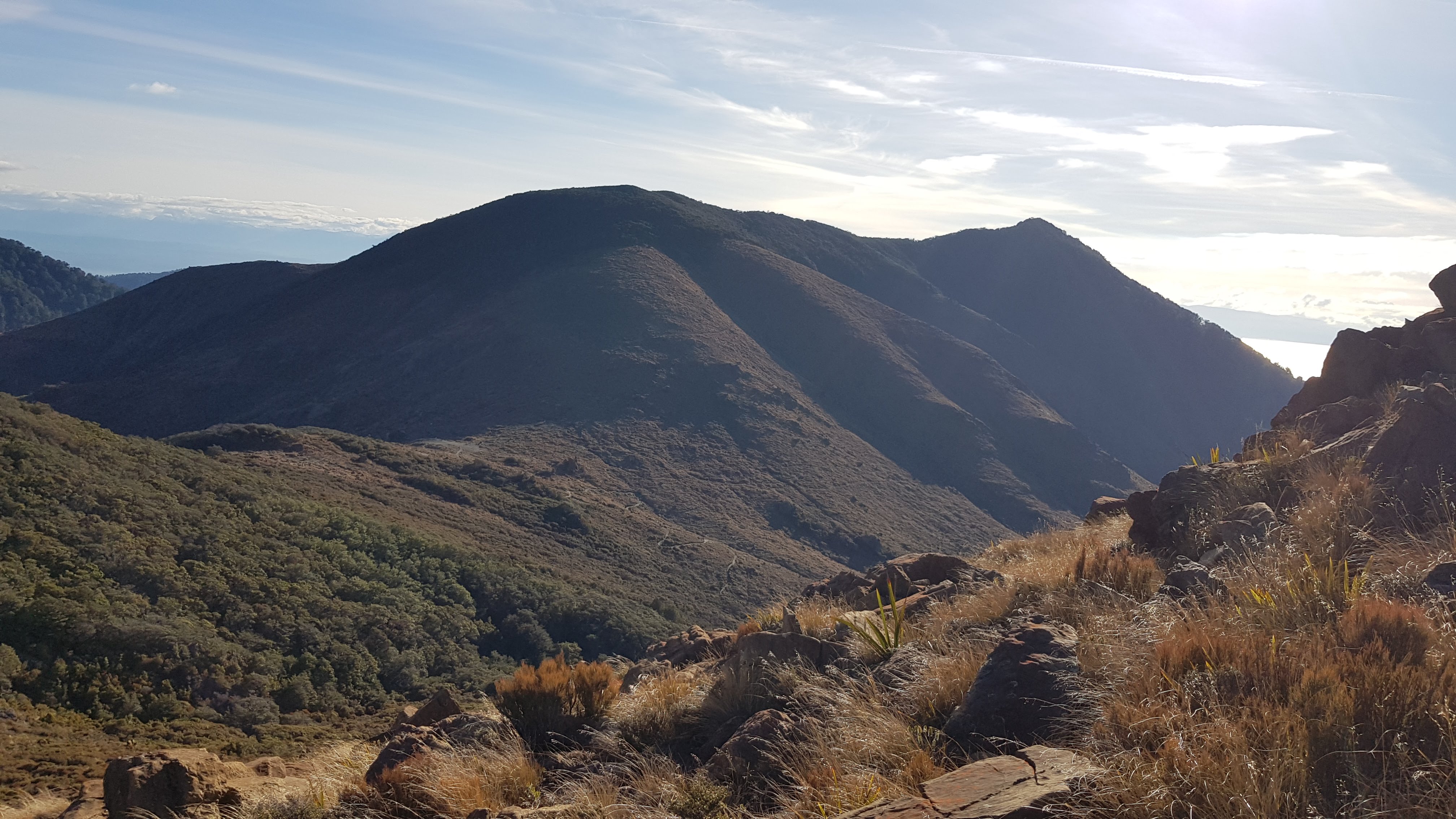
The trail was a breeze from Little Twin to Dun Mountain. It was downhill through the beech forest, then uphill onto the beautiful tussock of Dun Mountain itself.
The educational element of today’s tramp involved me learning about trail markings. We passed several trees with strange circular chunks in the trunk. I guess I had always assumed these were where branches had fallen off (or something…??) but apparently, they were likely trail ‘blazes’ i.e a trail marker of days gone by. People used to cut a slice/slash into the trees as a When I returned home I asked Wikipedia to enlighten me further.


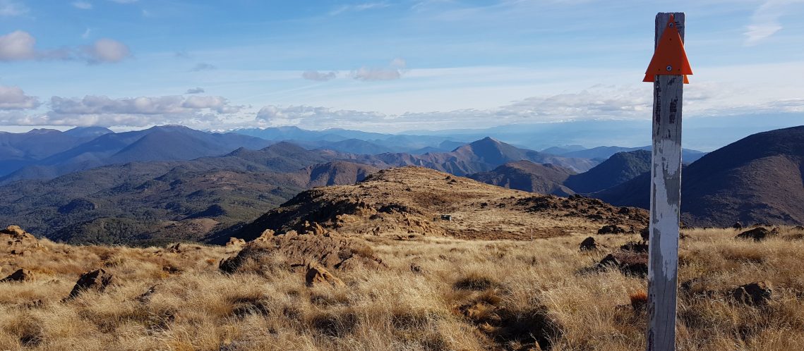
Dun Mountain
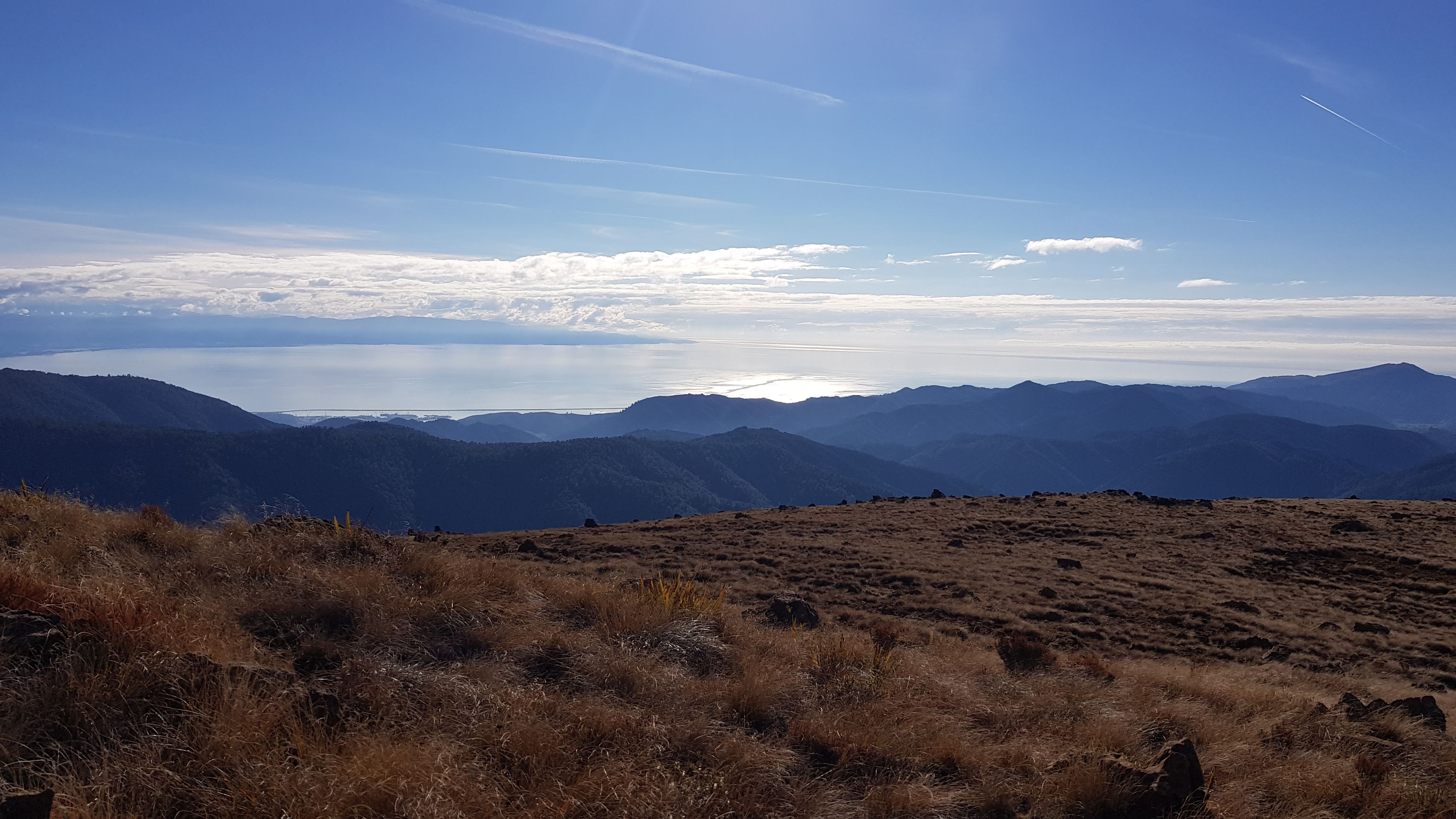
The walk up and over Dun Mountain was beautiful. There were awesome views across the Tasman in one direction and the entire Richmond Ranges in the other. It was cool to know that I was walking the ridge directly above the Pelorous Track where I’d previously walked Te Araroa Trail from Captains Creek to Middy hut, and Middy to Rocks hut.
We reached the summit of Dun Mountain at around 2 pm and enjoyed a magnificent lunch.


It started to get pretty cold, and we still had a decent hike ahead of us of around 12 km (according to Nelson Trails). We left the top at 2.50 pm and descended down to the Dun Saddle via the Dun Shelter. I popped my head around the door of the tiny shelter, which allowed me to officially ‘bag’ it for Hut Bagger NZ. It took half an hour to get down to Dun Saddle, the one place in NZ where it is impossible to get lost! 🙂


The Dun Mountain Track
From the Dun Saddle, we took the Dun Mountain Track back down to the Maitai Dam. The signage read 3.5 hours, but it took us just over 2 hours from here – around 10 km I’d guess.
The Dun Mountain track is a walking and mountain biking track. It’s probably very exciting to mountain bike, and much less exciting if you’re walking. I enjoyed it marginally more on the descent than I had when I hiked up it 9 months ago, but only because it wasn’t raining. The views were nice though.
The trail wasn’t difficult and had us following a mostly straight section for a kilometre or so before a short forested area, which was a bit wet following the gully down. Then it was out into the open again and descending the zig-zagged trail to the Maitai River.

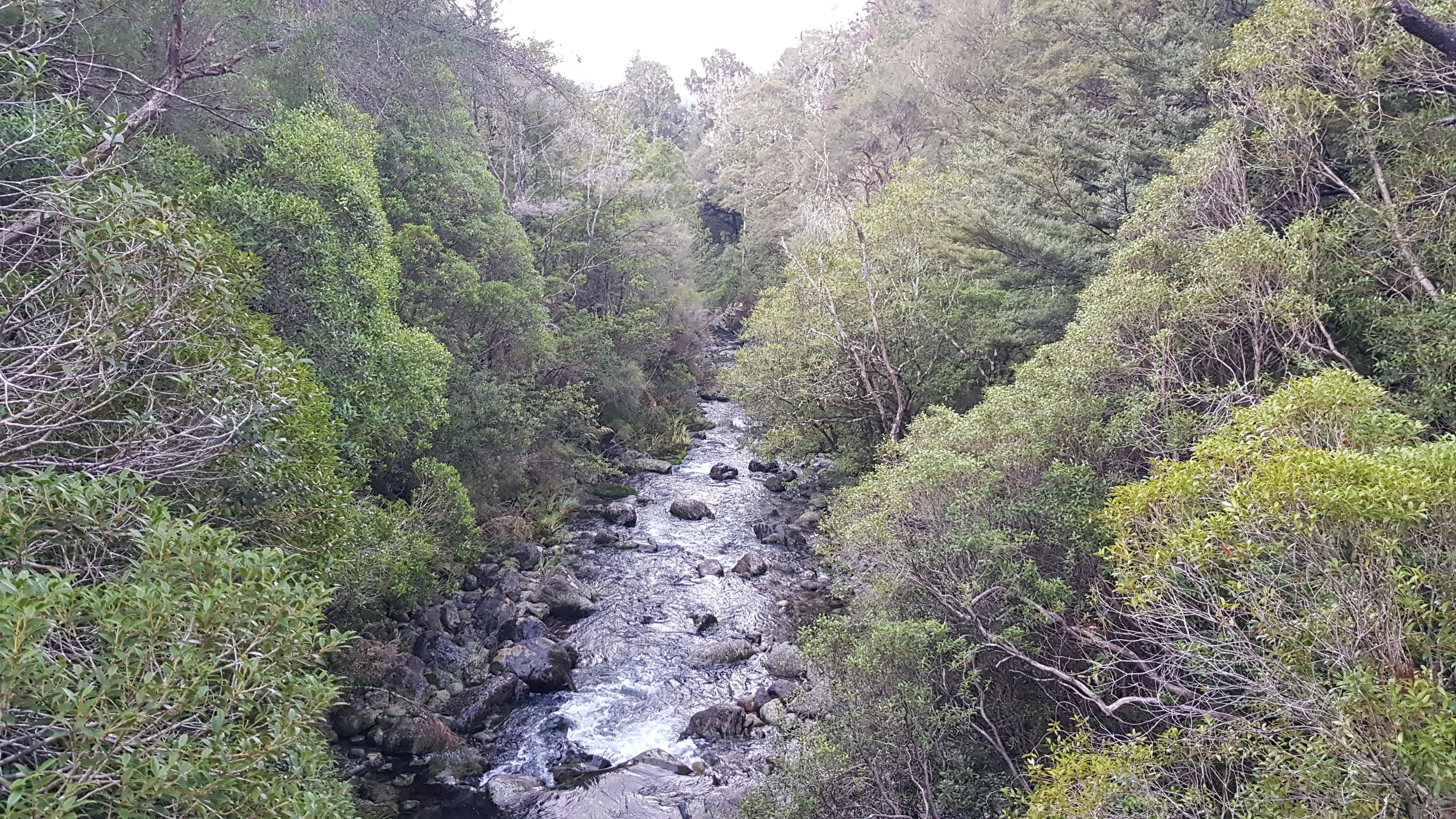

When we hit the river it was a quick 3.5 km or so back to the car. This section through the forest was as nice as I had remembered it being. We reached the car right at 5.30 pm just as it was getting dark and really cold. As usual, my fingers had gone numb, so we were grateful to be sipping a hot glass of mulled wine in the pub only 30 minutes later… wonderful!
We had a great day (7 hours including breaks and lunch). On a summer’s day, it would be cool to spend longer on top of Dun Mountain exploring, and even go over to Coppermine Saddle, Rocks hut and up to the Rocks. There are so many potential options from here – I will definitely be back.
Other walks close to Nelson: