The Puponga Hilltop Track
With its golden sandy beaches, magnificent rock stacks and arches, huge sand dunes, stunning clifftop views, and rolling farmland, the Puponga Hilltop Track should be up there on your list of easily accessible must-do-day walks.
There are lots of options for walks in the area, ranging from just an hour or so to a full day. Having had a reasonably leisurely morning, we didn’t start walking until 11.30 am and managed to cover Wharariki Beach and over half of the Hilltop Track across Puponga Farm in 4 hours with a good break for lunch. We made a loop of it and started halfway along the Wharariki Beach road and finished by walking back down along the Pillar Point Lighthouse track.
You would definitely want to make this a fair-weather trip to enjoy the best the area has to offer. This Northernmost part of New Zealand’s South Island is rugged and windswept, so dress accordingly and try to make it on a sunny day. Oh, and be prepared for the ups and downs.

Getting There Puponga Hilltop Track
The North West coast of New Zealand’s South Island is a beautiful place to spend a few days. It is a couple of hours’ drive from Nelson along the SH60 to the small town of Takaka – which is well worth a stop. From there it is a short distance to the even smaller village of Collingwood and within 30 minutes you’re at the tiny settlement of Puponga, at the start of Farewell Spit. You won’t find a lot of services up here – there are a couple of campsites and cafes and it’s probably worth calling ahead to see what’s open if, like us, you’re heading here outside of the main summer season.
Farewell Spit (Onetahua) is a huge natural sand spit shaped like the beak of a Kiwi and comprised of 25 km of solid land and a further 5 km of sandspit. You can’t travel up the spit unless you join an official tour, as it is an important habitat for wetland birds. The inner Southern/Golden Bay side of the spit is also commonly (and sadly) known for being an area where numerous mass whale strandings occur.
If you’re not sure what walks you might manage in a day, check out the DOC website for the tracks. Find further information on Farewell Spit and the surrounding area in the DOC brochure.
Walking to Wharariki Beach
We parked the car halfway along Wharariki Beach road in a tiny car park opposite the Pillar Point lighthouse track. This meant we started our day with a 2.5 km road walk, but when it was this glorious we really didn’t mind. We didn’t meet much traffic at all on this mid-winter day, but in the summer the road would be really busy.

We started walking at 11.40 am and by midday, we were at the main car park for Wharariki Beach. There are some toilets here, a campsite and a little cafe (open in summer). As we arrived we were greeted by a huge peacock! There are a couple of walking options from here. You can go up and over to the right, straight to Wharariki Beach which is about 1 km or 20 minutes walk away.
Puponga Farm Track
We wanted a longer loop, so headed straight on a couple of km down the Puponga Farm Track and around the Dune Lake.


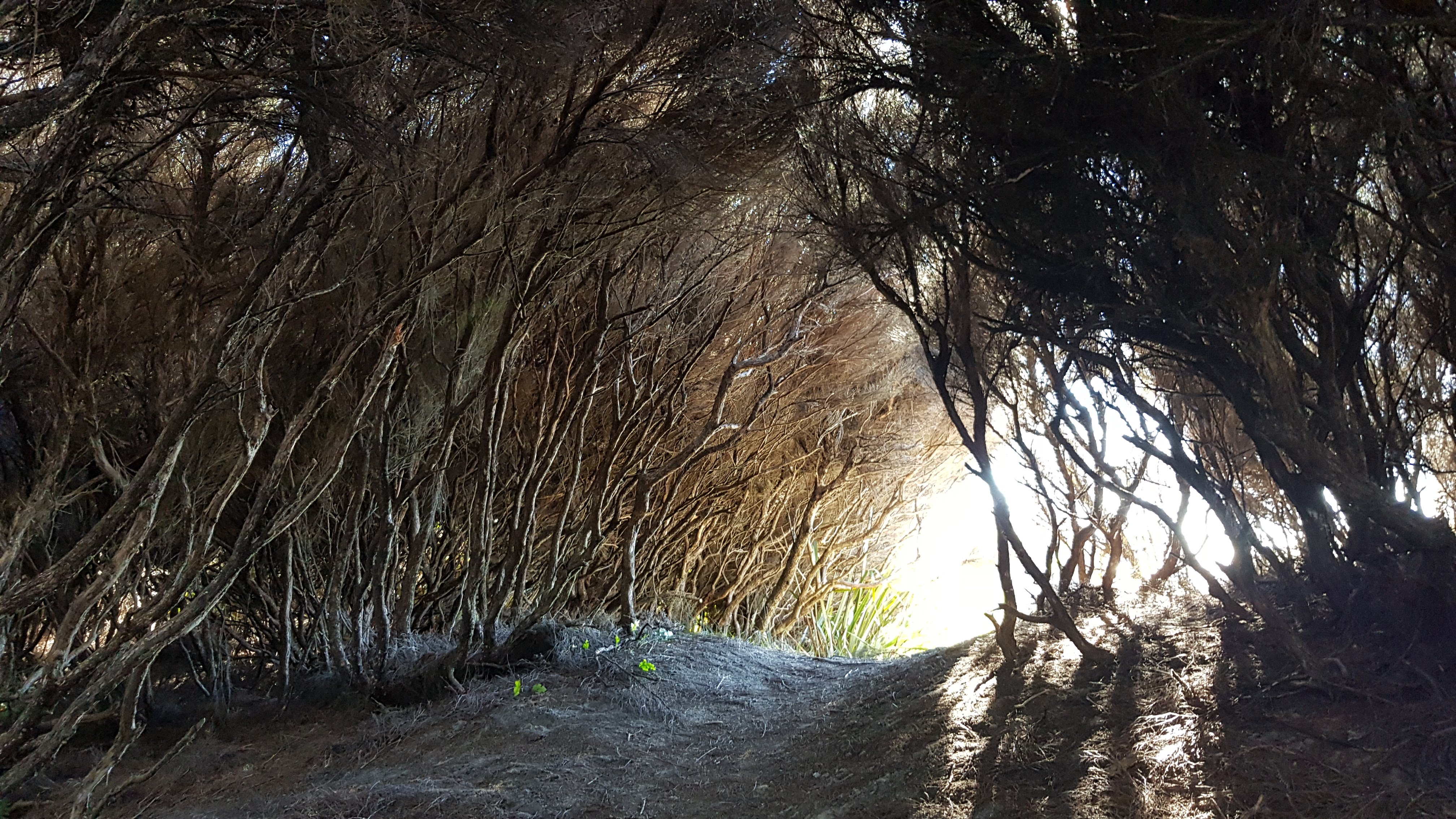
After a couple of km the track to Wharariki Beach veered off to the right just past the small Nikau Lake, where we got some great views of the farmland and headlands to the West. We headed to the beach along the marked track through the trees. If you wanted to continue, the walking/mountain bike track heads off on the Green Hills route – a longer loop of around 10 km.

Whararaki Beach Puponga Hilltop Track
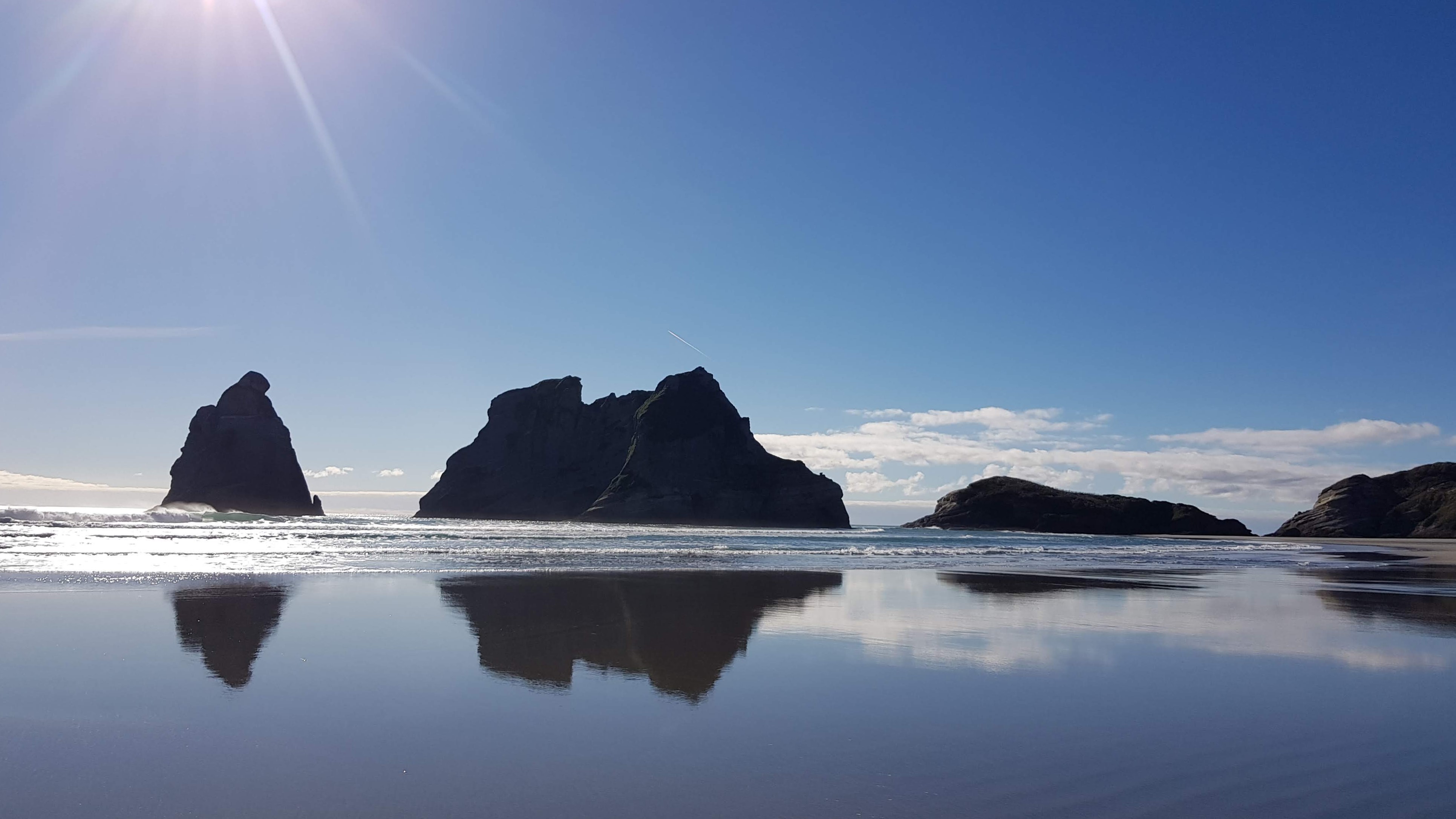
The farm track tantalised us with a glimpse of what was to come, but it’s only when you are right at the beach that you realise just how stunning this part of the world is. I have been lucky enough to travel the length and breadth of New Zealand several times, and Wharariki Beach stands out as one of the most beautiful and is one of my favourite places.
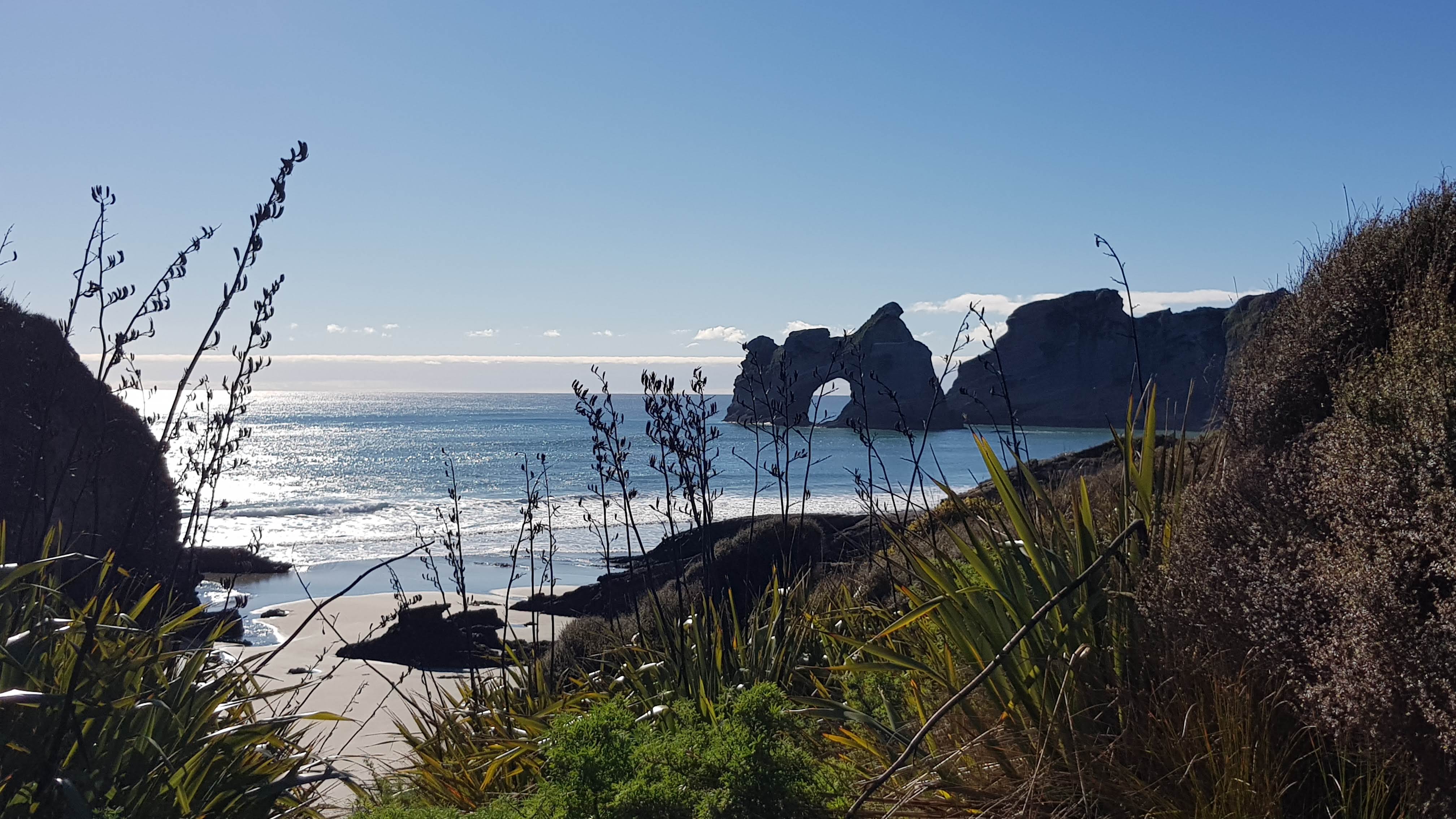
Rather by luck than planning, I have only been to Wharariki Beach on low tide. This is definitely the best way to explore the long sandy beach and wander around the rock stacks and caves. If you’re lucky, you may even see some seals basking on the rocks.

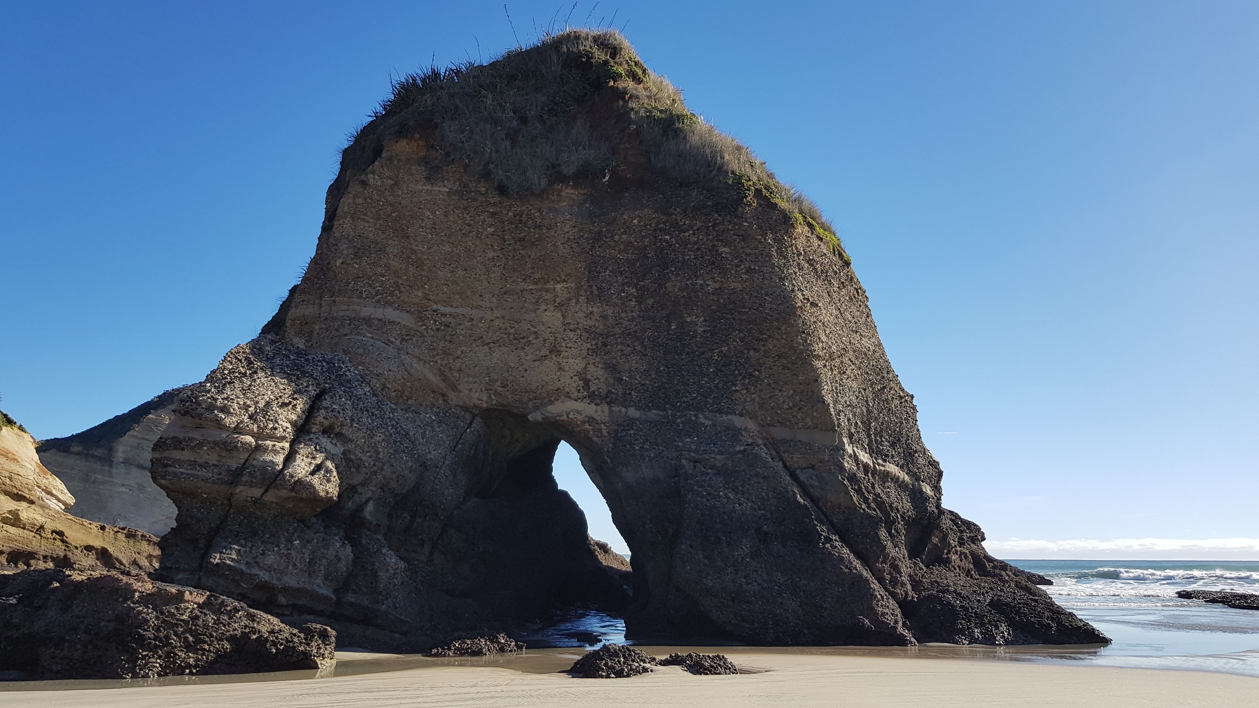

When we hit the beach, we turned right and headed East along the beach. We spent a good hour or so slowly wandering amongst the rocks. We followed the tide line out as far as we could opposite the Archway islands, and found some seals.
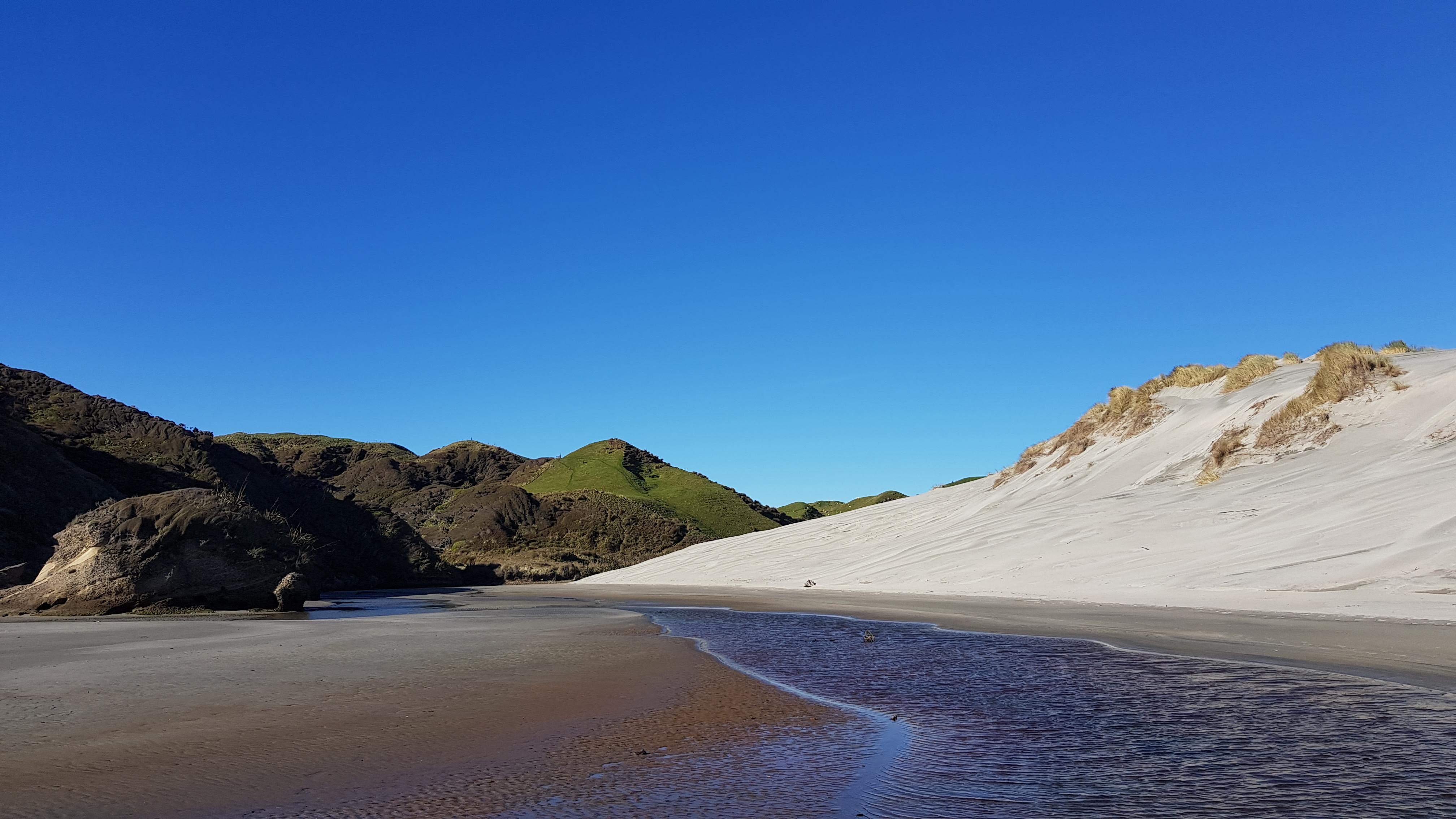
At the Eastern end of the beach, we headed over to the giant sand dunes and saw the Wharariki Beach track heading inland back to the car park. We continued on and arrived at a little stream carving its way around the dunes. Following the stream, we eventually saw a little path on its opposite bank which takes you to the start of the Puponga Hilltop Track. The stream was pretty shallow, but we took our shoes and socks off to wade across. Having left the Wharariki road end at midday, we arrived at the Hilltop track at 1.15 pm.
Puponga Hilltop Track
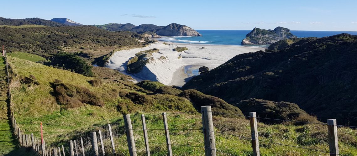
The Puponga Hilltop Track starts with a rather steep little uphill just beyond the little river. Although the trail crosses private land (and a working farm), the landowners have worked with DOC to provide a track across it.

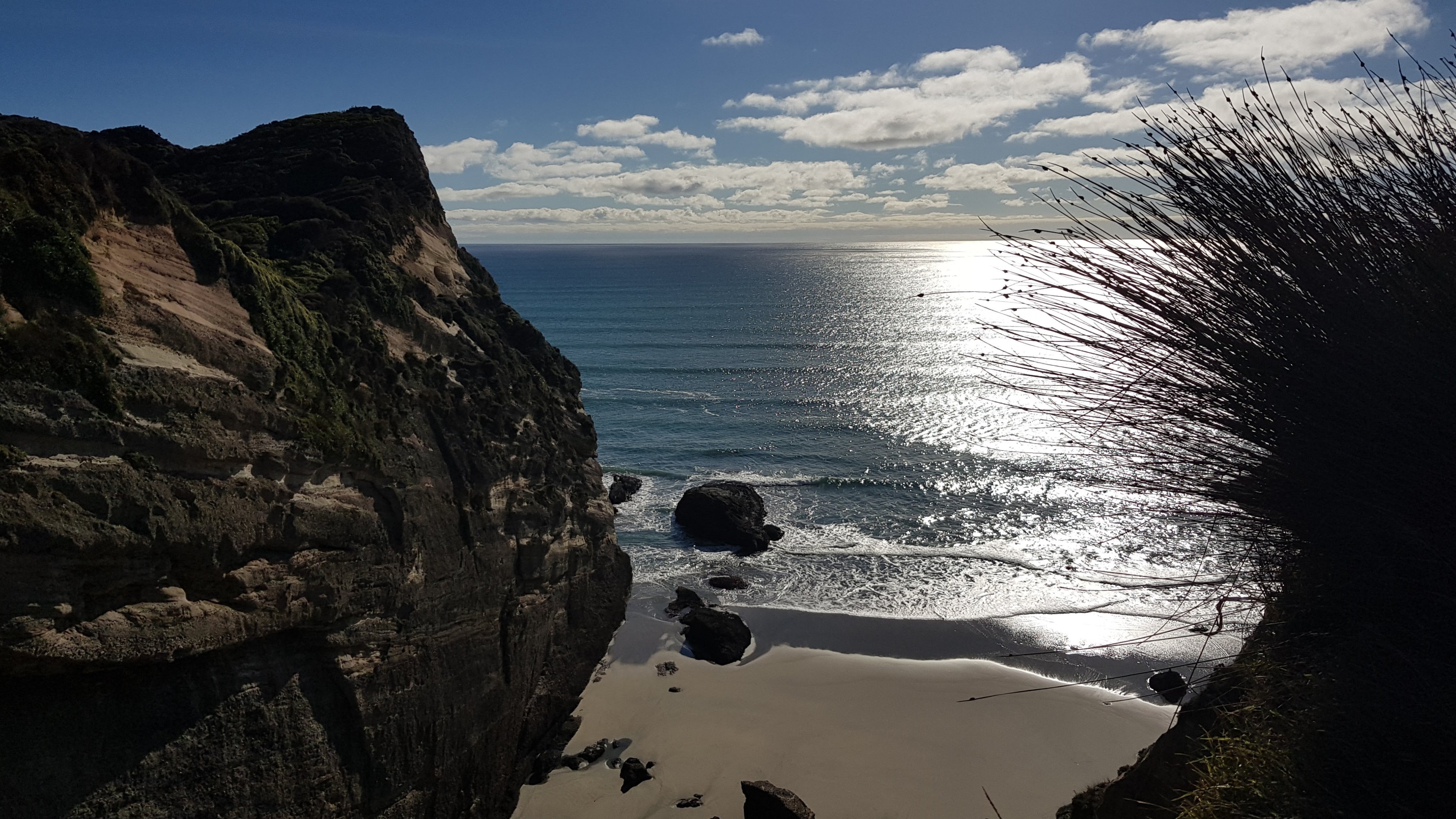
The views from the top of the first little hill were amazing, and as we left Wharariki Beach we kept turning back for another look.

The track was full of ups and downs as we crossed the farmland keeping close to the large sea cliffs. Every now and again we got glimpses of the beach below.
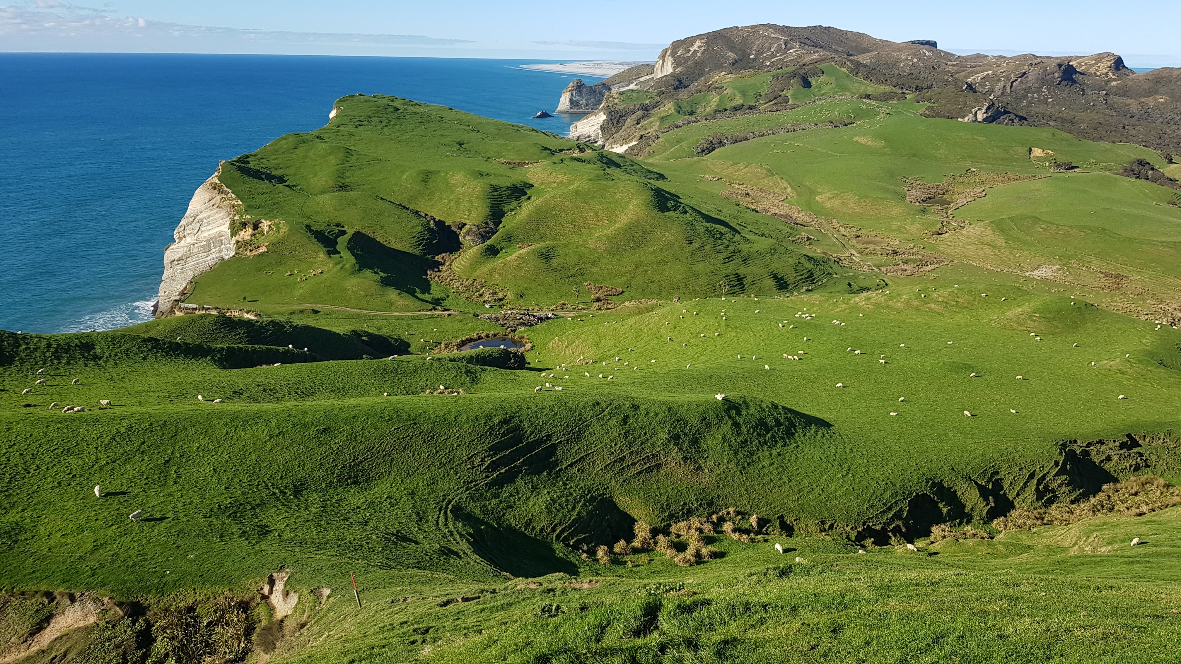
The clifftop walk was absolutely stunning. Ahead of us in the distance, we could even start to see Farewell Spit. It was a very exposed track and there are some very steep ups and downs. It reminded me of being on the UK South West Coast Path.
We walked until 2 pm when we reached Cape Farewell.

Cape Farewell to Pillar Point Lighthouse
Cape Farewell is the most Northerly point on the South Island of New Zealand. You can drive almost all the way to it, so we saw a few more people here. The cliffs are fenced off but there is a nice boarded section and a handy lunch spot i.e. an area just a little bit sheltered from the wind. We enjoyed a magnificent lunch and lazed in the winter sun for almost an hour.


After 10 minutes or so the track headed inland a little. The stunted trees gave us an idea of the predominant wind direction!


As we continued on, the land changed around us, and we were into an area of dry, rocky outcrops. We met the Pillar Point Lighthouse track and plodded up the stony walking/mountain bike track to the top.

The lighthouse was pretty tiny and rather less spectacular than I’d have hoped, but the views continued to be magnificent! We continued on for another 10 minutes or so towards Puponga and were treated to an incredible view of the Eastern end of the track – which I will come back to do another time. Pillar Point Lighthouse to Puponga.
It’s amazing to see Farewell Spit from such a high elevation and it really gives you an idea of how huge it is!


The Pillar Point Lighthouse Track to Wharariki Road
We turned back and headed back to the car. It was only 1.5 km down the fairly unremarkable Pillar Point Lighthouse track. It had taken us about 1.5 hours from Cape Farewell to the lighthouse and back to Wharariki Road, with ample time for detours and photo stops.
We could have easily walked the whole of the hilltop track in a day, had we not started late and were it not for the mid-winter daylight hours. I will definitely come back to walk the stretch from Puponga to Pillar Point, and no doubt do the whole thing again in its entirety. It’s definitely going to become a favourite.
Click on the links below in red to check out some other walks in the Tasman Region:
- Kahurangi Lighthouse – multiday tramp
- Harwoods Hole – short walk
- Moa Park Track to Porter Rock – day walk
- Takaka Hill Walkway – short walk
- Abel Tasman Southern Loop – multiday
- Abel Tasman Northern Loop – multiday
- Tablelands Circuit – (Asbestos, Salisbury, Lake Peel) multiday tramp
- Tablelands Loop – (Mt Arthur, Gordons, Balloon, Flora) multiday tramp
Thanks for that great description! We will do exactly same walk tomorrow. Whole hike is too long in combination with the beach as low tide at Wharariki Beach is too late currently (2:49pm). But the part you did is manageable. If weather is good we will do second part of hilltop walk on Sunday.