Te Araroa Trail – the day I took that wrong turn!
I had an amazing night’s sleep last night. Nature has overtaken me now, and I go to bed well before it’s dark. Generally I’m in bed before/around 8pm but it’s still light until 9 and not properly dark until 10pm.
Weirdly though this morning I was pretty exhausted – probably due to the two dinners I ate last night 🙂 I was on the trail by 7am. The track started with another ascent, and after an hour or so the path split.

I checked the trail notes and the Guthook Te Araroa hiker app. There were a couple of options:
- Dry weather route – down through a little river valley, a shorter route
- Wet weather route – the ‘up and over’ path, longer route
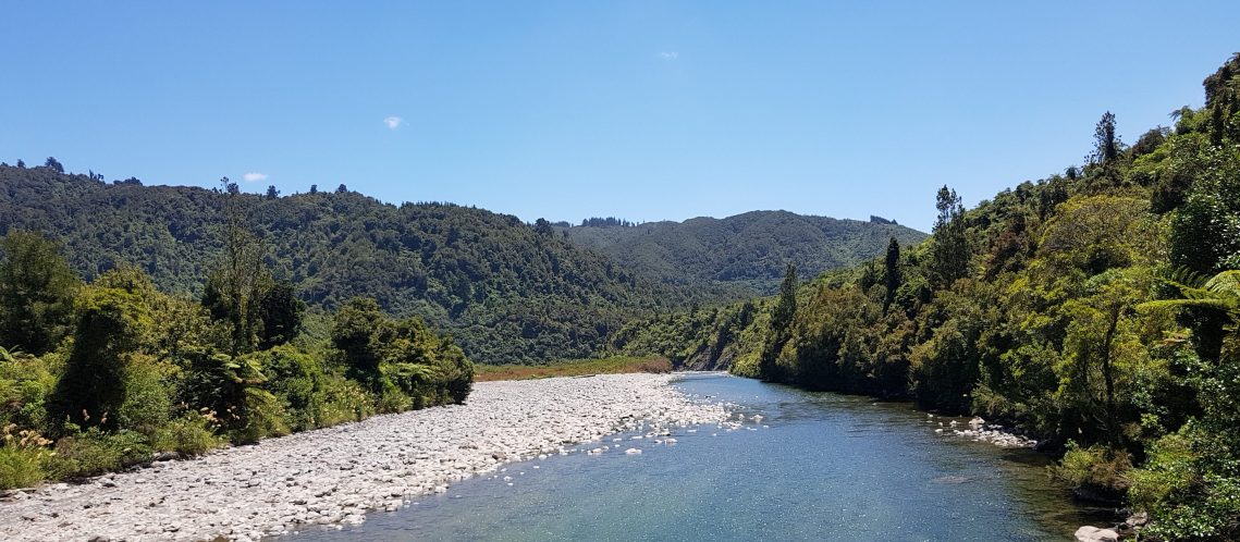
The trail notes, gave directions for both routes. I fancied the look of the dry weather route (the river trail) thinking it would be a lovely river walk along the lines of the beauties we’d experienced in Northland.
But even though I checked it on the Te Araroa Guthook app, I completely FAILED to notice and/or read all the comments about why the dry weather river route should NOT be taken (….. clang).
Ignore DoC at your peril!
As well as not reading any comments on Guthook about the river track, I also completely ignored DoC. They strongly suggested i.e. indicated with 3 orange markers (2 more than usual) that trampers take the ‘up and over’ route (not the river route).
My bad decision-making got even worse….!! In addition to the above, I stepped over DOC’s low bundle of sticks indicating a ‘blocking’ of the river route. The justification in my head was that we’d had weeks of dry weather so I thought the markers must only be for wet conditions. This was a huge mistake!
Saddle Creek
I descended and reached the little stream Saddle Creek, which was a nasty run-off-gully with sharp stones and the detritus of the prior year’s worth of bad weather. I fell on the slippery stones a couple of times and tore a shoe.
After about 20 minutes an absolutely enormous fallen tree blocked the path. Nothing unusual about that (apart from it’s enormity) so I made my way slowly through and over it and decided that this was maybe the reason DoC didn’t want people walking there.
I picked up the DOC markers again after the tree – all good, but the trail was ugly. There were lots of huge boulders, stones, gravel and it was really badly marked. I grumbled to myself…”wet feet for such a sh*tty stream”. By this time I was a quarter of the way in and in my mind, committed.
I have to admit, this was when the alarm bells started ringing, but I didn’t want to retrace my steps all the way back over the rocky river, and walk back up over the fallen tree and and up the hill again. It had taken me hours to get here.

Several kilometres later the path started to climb, so I knew I must be close to joining up with the original path again.
Landslide
With about 500m to go, I came upon an absolutely ENORMOUS, deep landslide. My heart sank. I saw the path go up the left side of it extremely close to the edge and tentatively made my way up, trying not to look down to the gaping hole in the earth to my right. Then the track finished.
I took stock & looked at the map. Ah! so that’s what a landslide looks like on a Topo map… hmmm (triple clang).
I cursed myself for being so stupid, and ignoring all those obvious signs!! The map and Te Araroa gpx file of the route indicated the trail went up and over the landslide, so I looked as far up and out over the gaping hole as I dared. That path wasn’t there any more.
Looking at the contour lines on the map I knew I was only about 60 metres from the upper path straight up through the forest. It took 2 hours for me to climb out and reach it.
Bush Bashing
The New Zealand forest is a strange beast, and nothing like European ones. This one was thick with supplejack, an awful thick long swingy vine, which grows into tangled, dense, matted walls. The other major plant life was kie kie – bushes of long thick, flexible leafy stems.
In addition I was on a very very steep slope with huge fallen trees all around me. I needed a machete or a flame thrower to get through this lot. What I didn’t need was a large pack on my back catching everything I went through, or the fallen trees, making progress very difficult.
It was almost dark amongst the foliage, despite it being a gloriously sunny day. It was super hot, and super steep. I was climbing through and over, then crawling under this hideous forest, not able to see what was ahead or above. The good thing was I had time on my side, I had food, water and it was only 10.30am. I dread to think how awful it would have been to get into this predicament at 5pm.
Thankfully my phone gps was fantastic, so I knew exactly where I was and that I only had to climb around 60m to get to the upper path. I tried so many options to get out, but the thick foliage prevented me each time. I very slowly headed towards any lighter patch of forest, then again, then again….
Relief
Finally; dirty, sweaty, swearing and heart pounding, I got to the upper track. I had a sit down and break and recover myself a bit… What a COMPLETE IDIOT.
Otaki Forks
After that the day was lovely. I came across a beautiful swing bridge and saw a family picnicking below at a beautiful spot below. We got talking and it turns out they were from the New Forest in the UK where I’m from.
I felt much better for sharing my morning’s experience with them. The path led to the beautiful recreational area of Otaki Forks, where lots of people were picnicking. It all felt a bit surreal that an hour earlier I had been in be in such strife!

I enjoyed lunch with a Kiwi family at Parawai Lodge hut and continued to Otaki Forks campground. I had a wash, sewed my ripped shoes and lazed about until dinner time. A DoC guy came along for a chat and I mentioned my morning’s adventure. He promised to tell DoC to get better signage (for stupid people like me) and I promised I will endeavour to always take their advice.
Comments in Guthook app
Days later, I was recounting my story to some friends, they told me about the comments in the Guthook Te Araroa Hiker app for this particular section. When I went back to read it properly I was astounded that I had missed it the first time around – it had strongly (and rather obviously) advised against using the track I took, for all the reasons I had just discovered.
To conclude with my learnings from this morning:
- Carefully read, and read again all resources at your disposal
- Always take DoC advice – they know more than you 😉
- Learn to read a topo map properly and look ahead at features of the entire route – however short the route
- If it doesn’t seem right, it probably isn’t. I should have retraced my steps before the fallen tree
- Remain calm and level-headed in a sticky situation