
Peak Hill Track
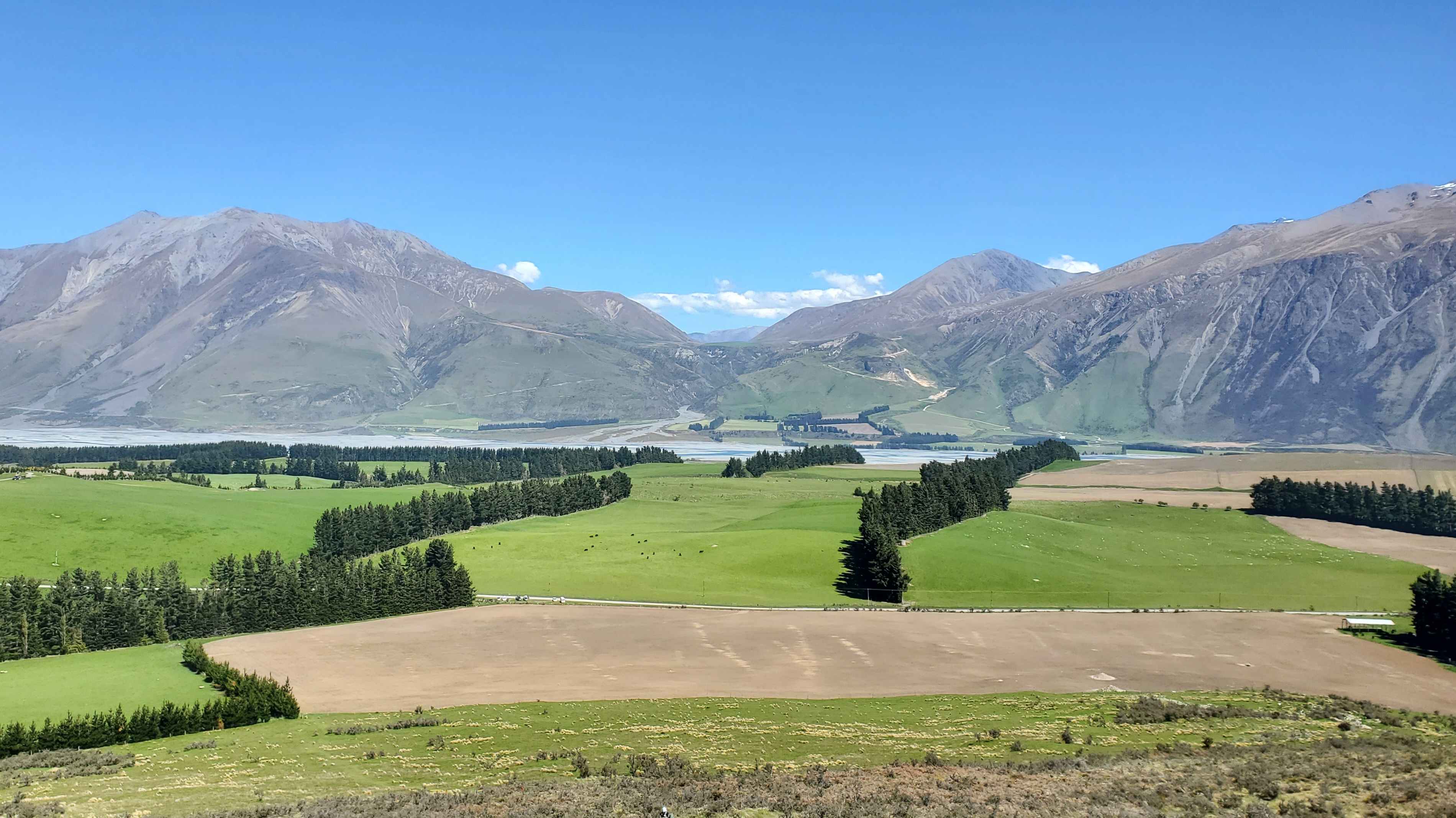
The Peak Hill Track (1240m) at Lake Coleridge in Canterbury is a stunning half-day walk with a 650m climb and superb views across Lake Coleridge, Rakaia River the Southern Alps and Canterbury Plains. It is a popular walk, but don’t take it lightly.
DOC rate Peak Hill as an Expert route and estimate a 2-hour trip to the summit and 3-4 hours return. Expect it to take that time if you don’t have a good level of fitness and aren’t used to steep uneven tracks. The first part of the track up to the ridge was steep, gravelly and slippery in parts on the dry spring day when I walked. You’ll need shoes with good grip and if your balance isn’t great, a walking pole for the return journey.
Much of the upper track is along a very exposed, windy ridge. There was hardly a breeze at the car park, but up on the mountain, it was blowing a gale and freezing. Be prepared and take plenty of water, sunscreen and warm/windproof layers. Don’t head up there in bad weather.

Timing
I was on a fairly sporty mission and was using this walk for exercise. Judging by the people I overtook going up, the 2 hours DOC time to the summit was realistic for non-trampers. Check out the DOC website for further details.
– DOC return time: 3-4 hours
– My return time: 2 hours 20 mins (incl. a wander round at the top)
– My time up: 1 hour 5 mins
– My time down: 50 mins

Getting There Peak Hill
The Coleridge Road takes you towards Lake Coleridge from close to the Rakaia Gorge. I turned off Coleridge Road at Homestead Road onto Algidus Road and parked at the busy car park – a grassy flat at the start of the track.
Note there were no toilets at the car park or along the Peak Hill track (Nov ’23). Like many others, I had to duck into the trees to pee. If you find yourself in this situation please put any used tissues or wet wipes in a bag and take it out with you.
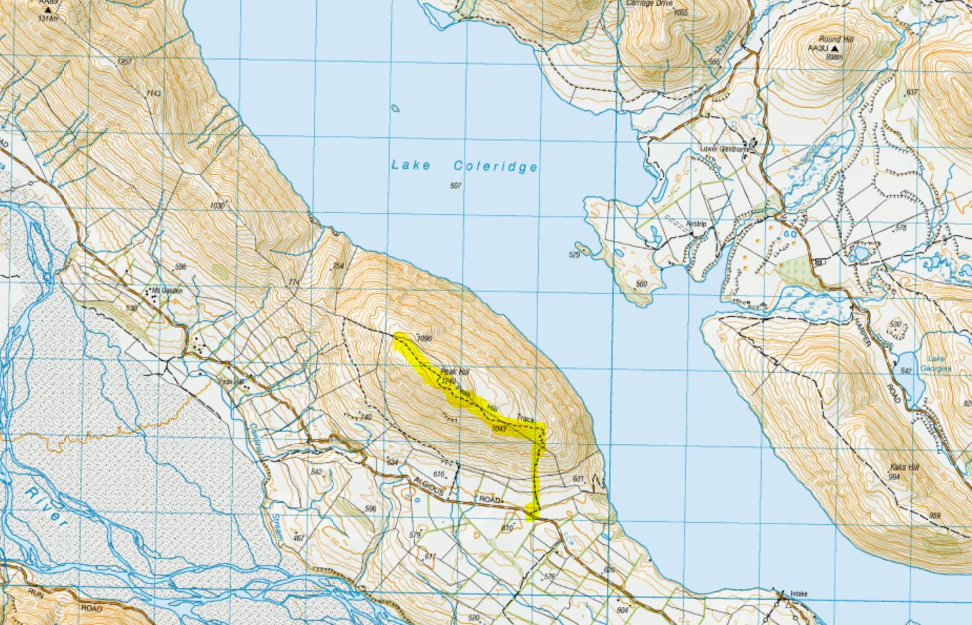
Towards Peak Hill
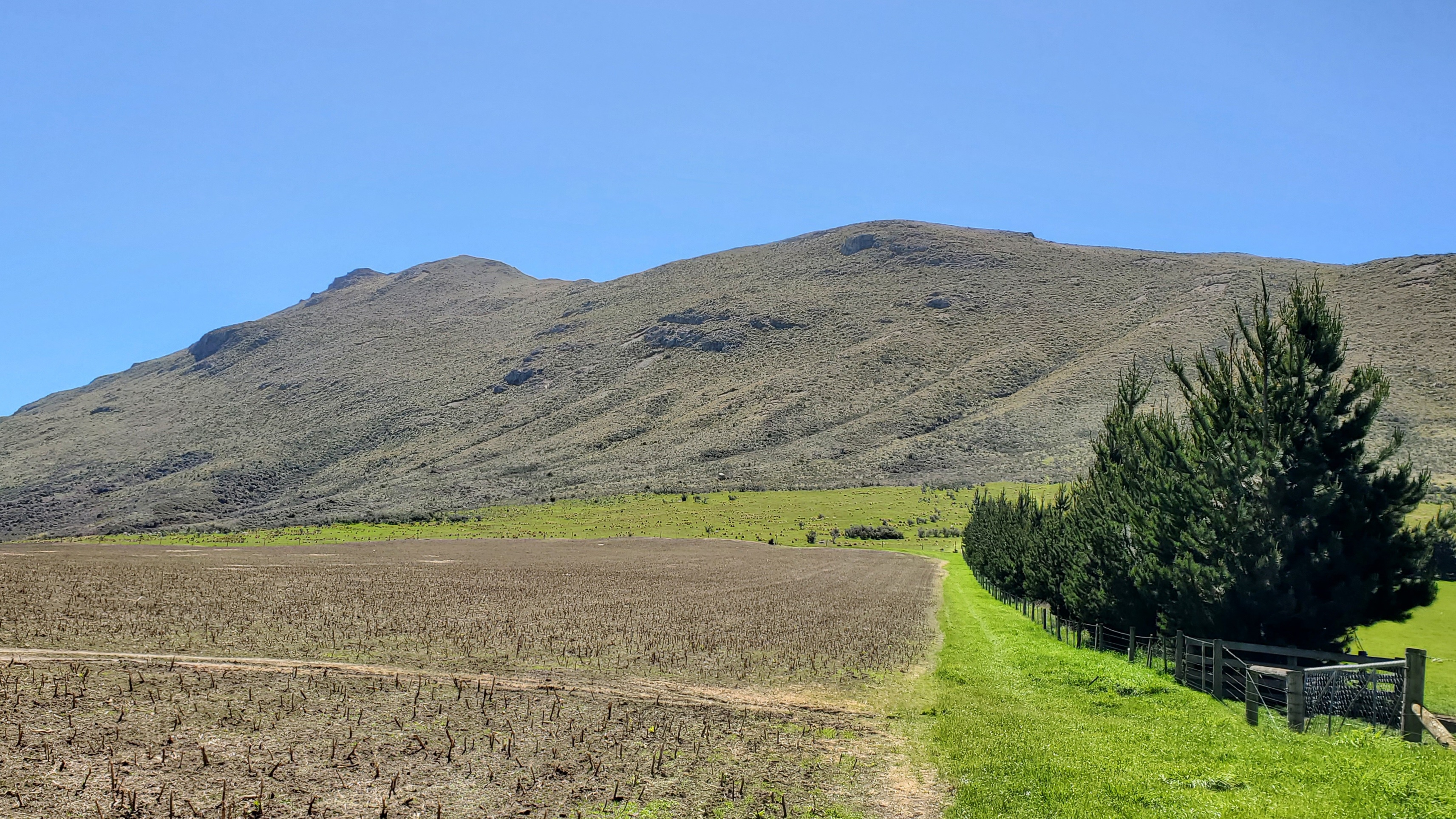
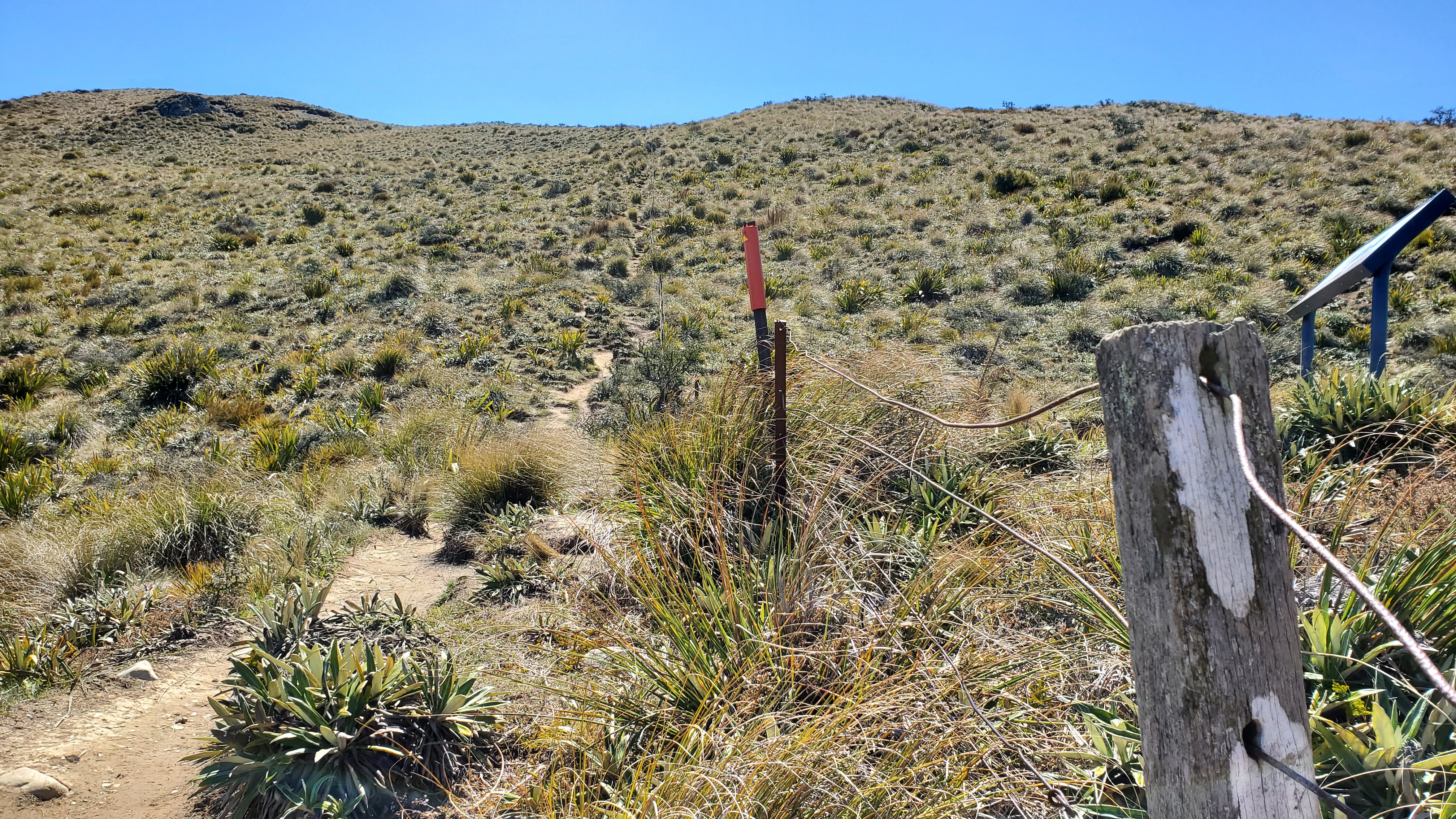
There was a board at the car park with information and map of the Peak Hill Conservation Area. The track began across a stile and headed right around the edge of a large paddock. Five minutes later I arrived at the second stile at the top of the paddock.
Enjoy the gentle gradient of the first five minutes – beyond the second stile and the grassy slopes it gets pretty steep. A couple of minutes later I was at a third stile with a large orange marker and signage beyond indicating I was in the Peak Hill Conservation Area.
Peak Hill Conservation Area
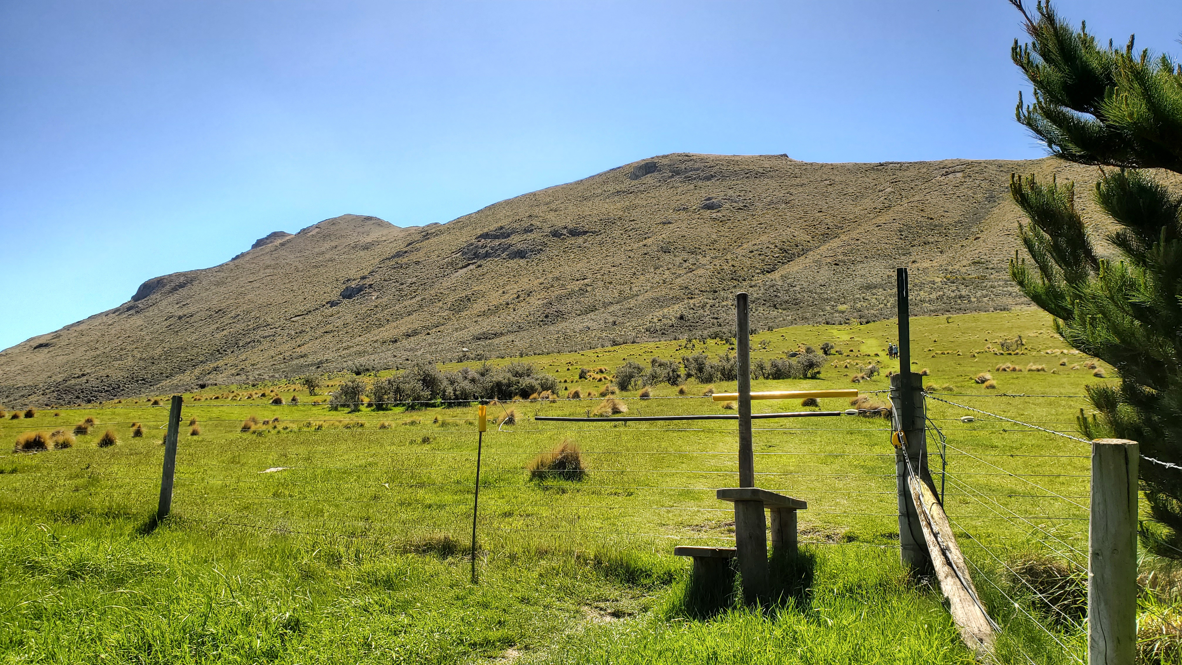
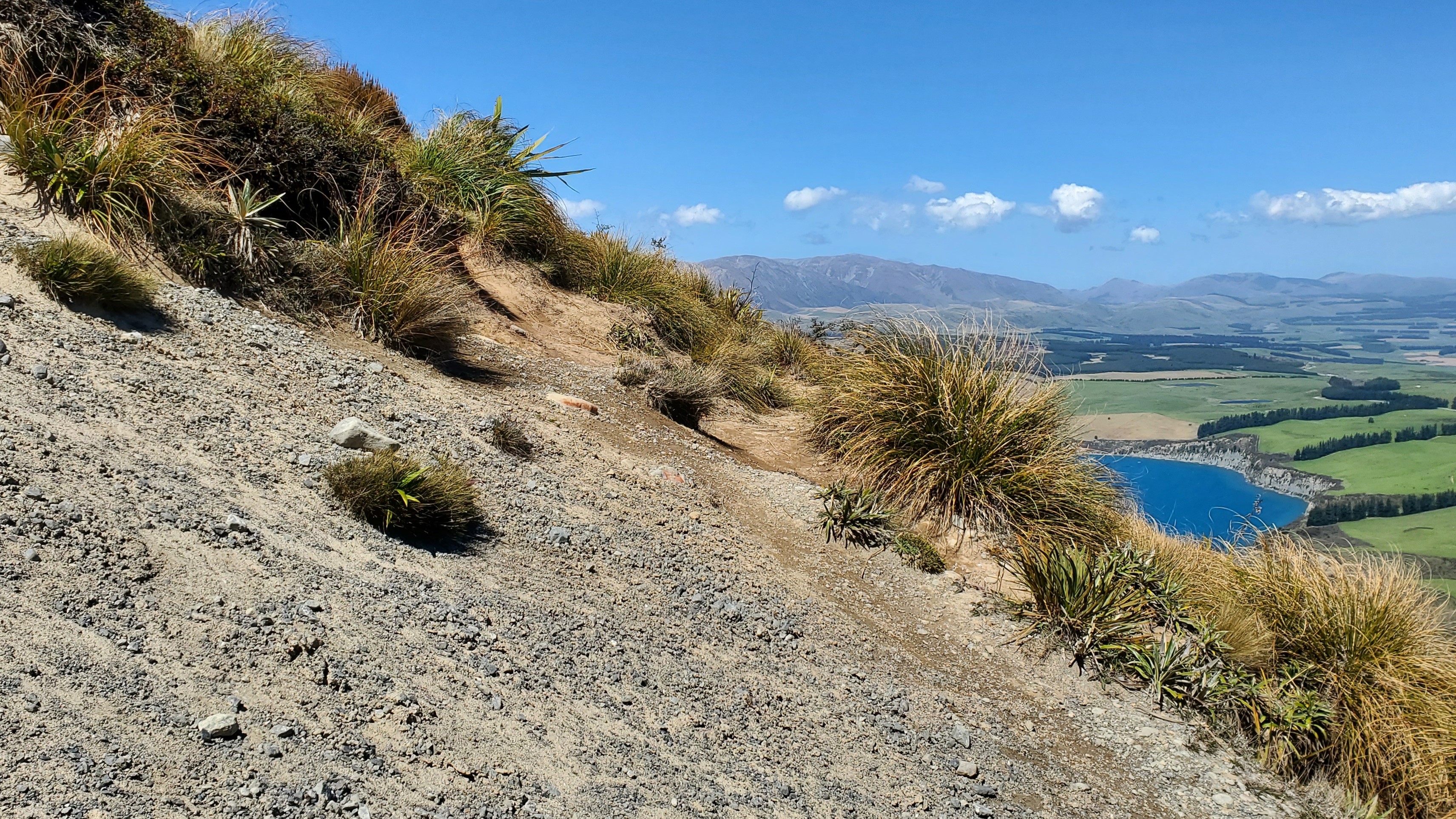
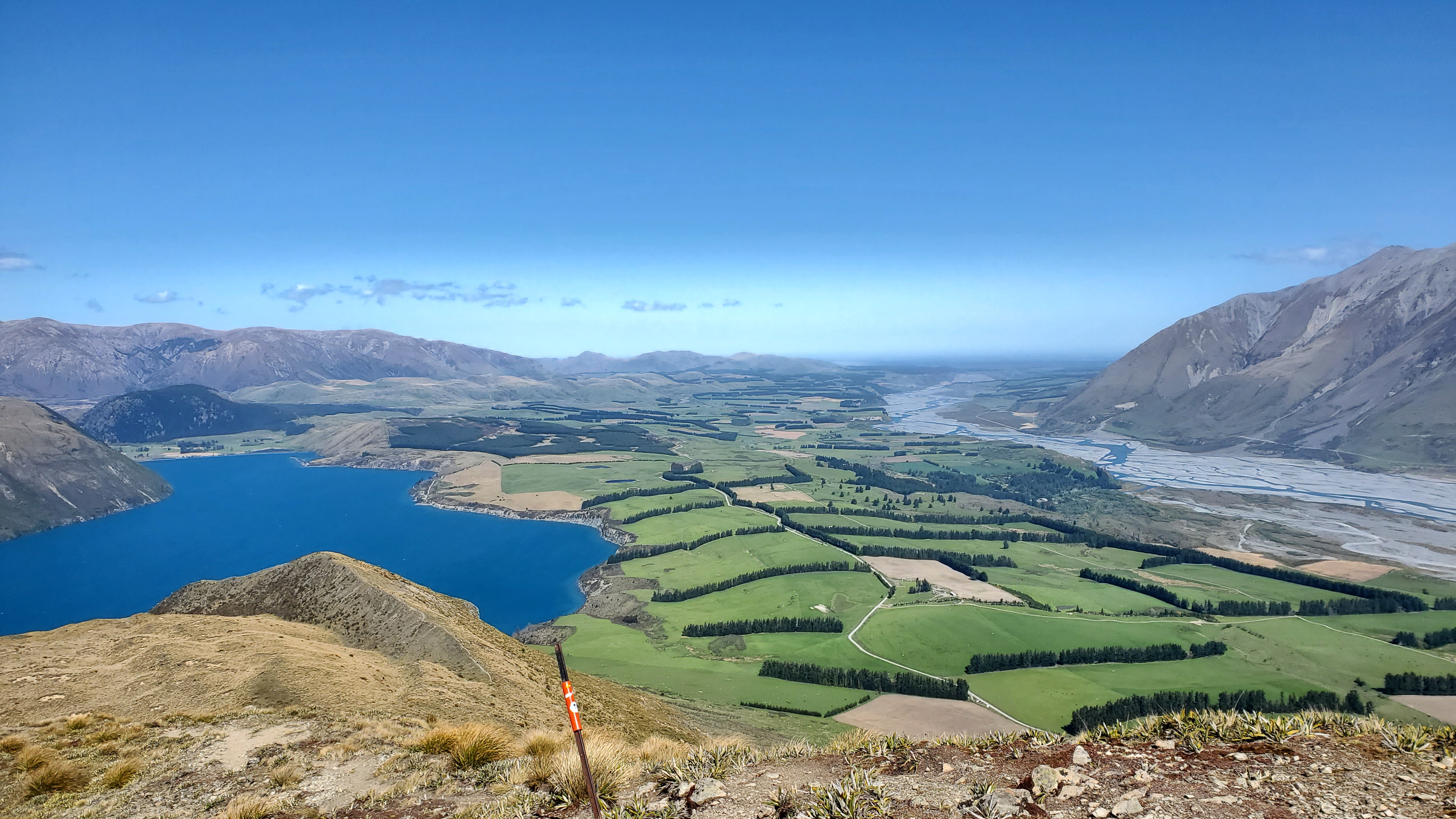
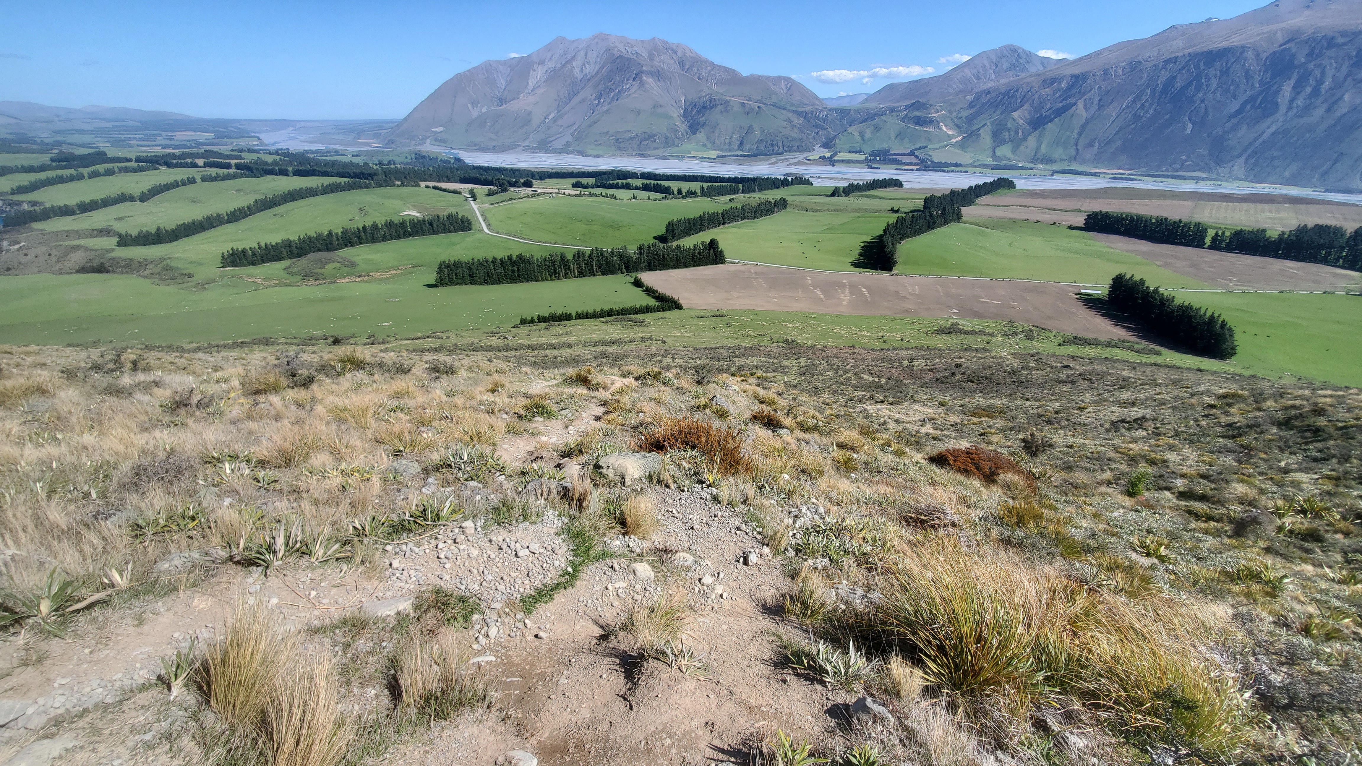
The Peak Hill track was well-trodden and easy to follow up through the scrub. I gained height pretty quickly up the steep, zigzagged track and paused a few times to take in the views of Lake Coleridge, the Canterbury plains and the Rakaia River.
In some places the track was eroded quite badly, slippery and gravelly.
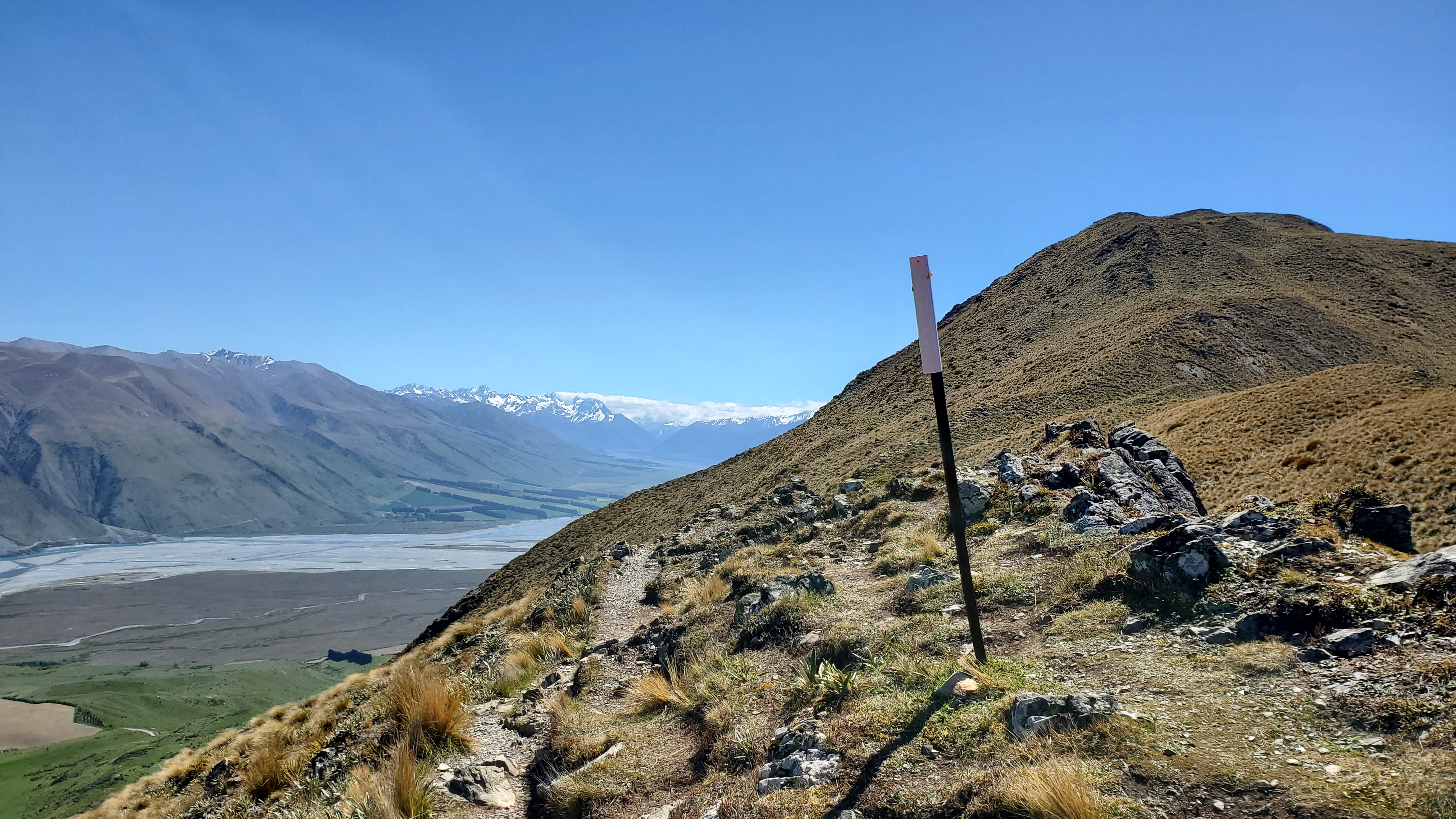
Across the Rakaia, I could see several large fans/debris from past slips off the mountains and wondered which one we’d encountered on Te Araroa six years ago. I remembered it well. A giant fresh landslide meant we walked an additional 20 Kms up Double Hill Road to Glenrock that day.

At 2.40 pm, twenty-five minutes from the car park, I reached a fence line and information board. A great excuse for a rest. From here it was another ten minutes up to the ridge of Peak Hill at around 940m. There is still another 300m to climb from here!
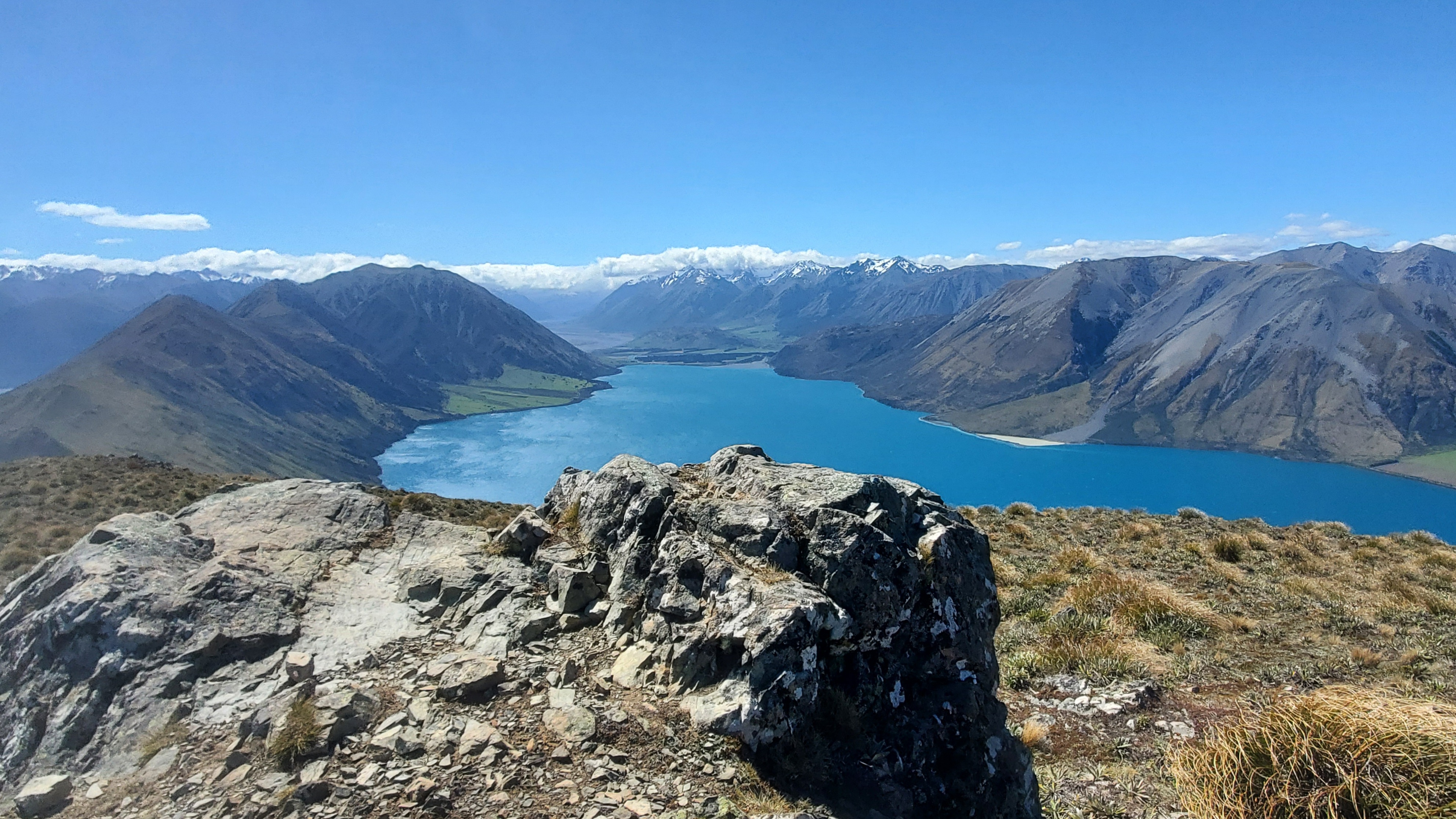
Peak Hill – Along the Ridge
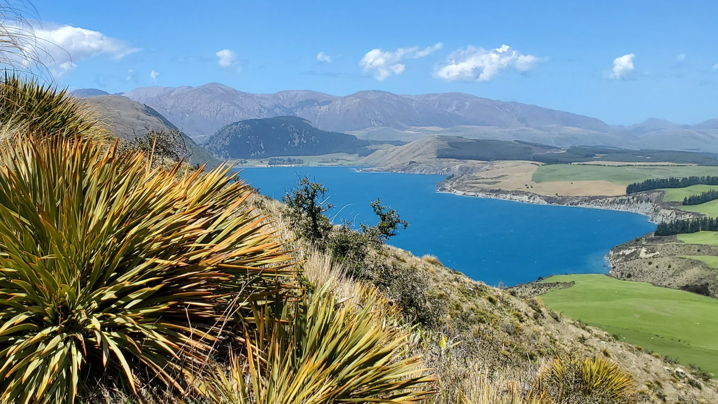
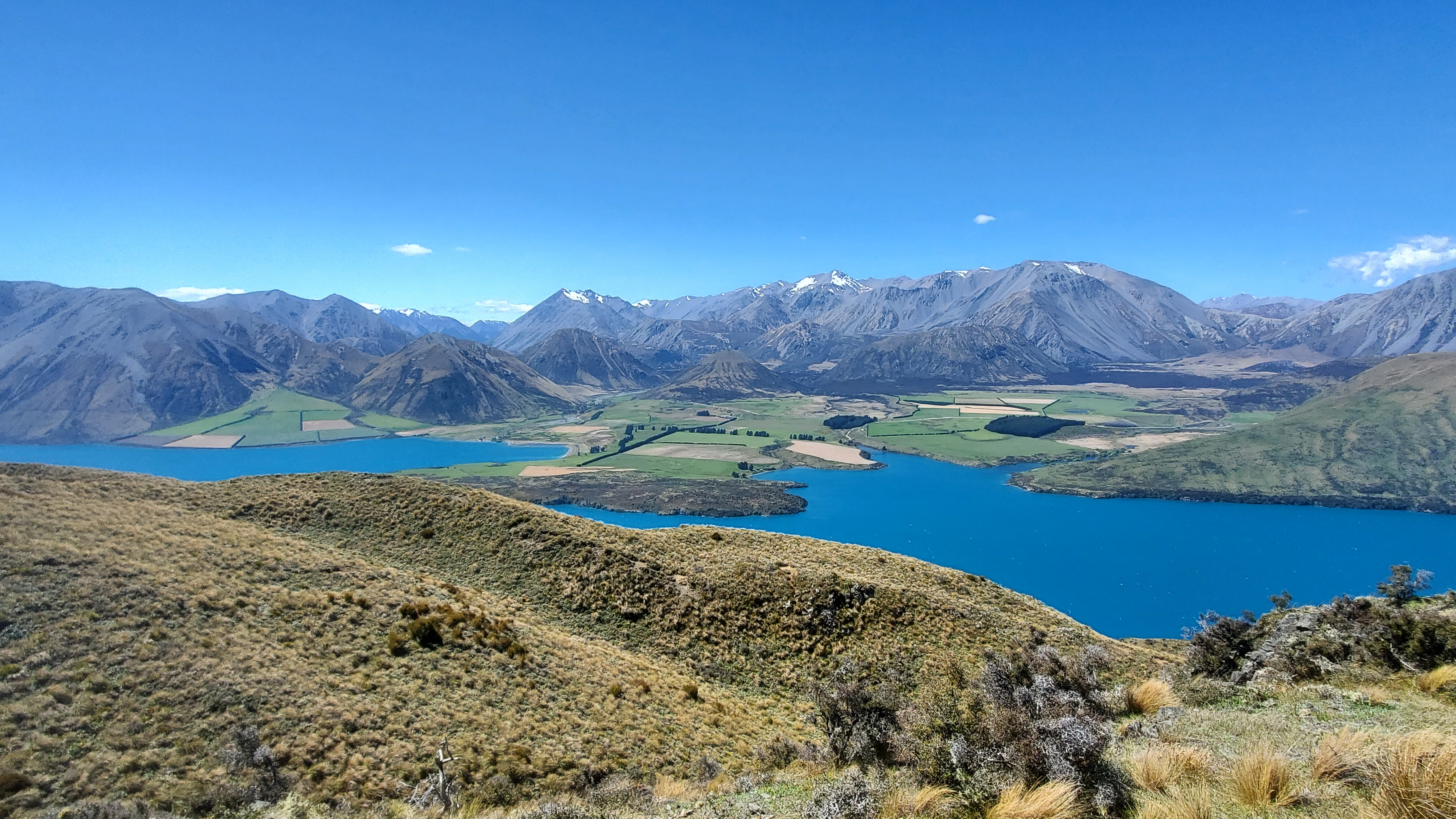
As soon as I got onto the ridge I was slammed by a strong, cold wind. I donned my buff and warm top. The walk up and along the ridge was wonderful. Lake Coleridge shone bright blue to my right, the Rakaia to my left and the ridge stretched along in front.
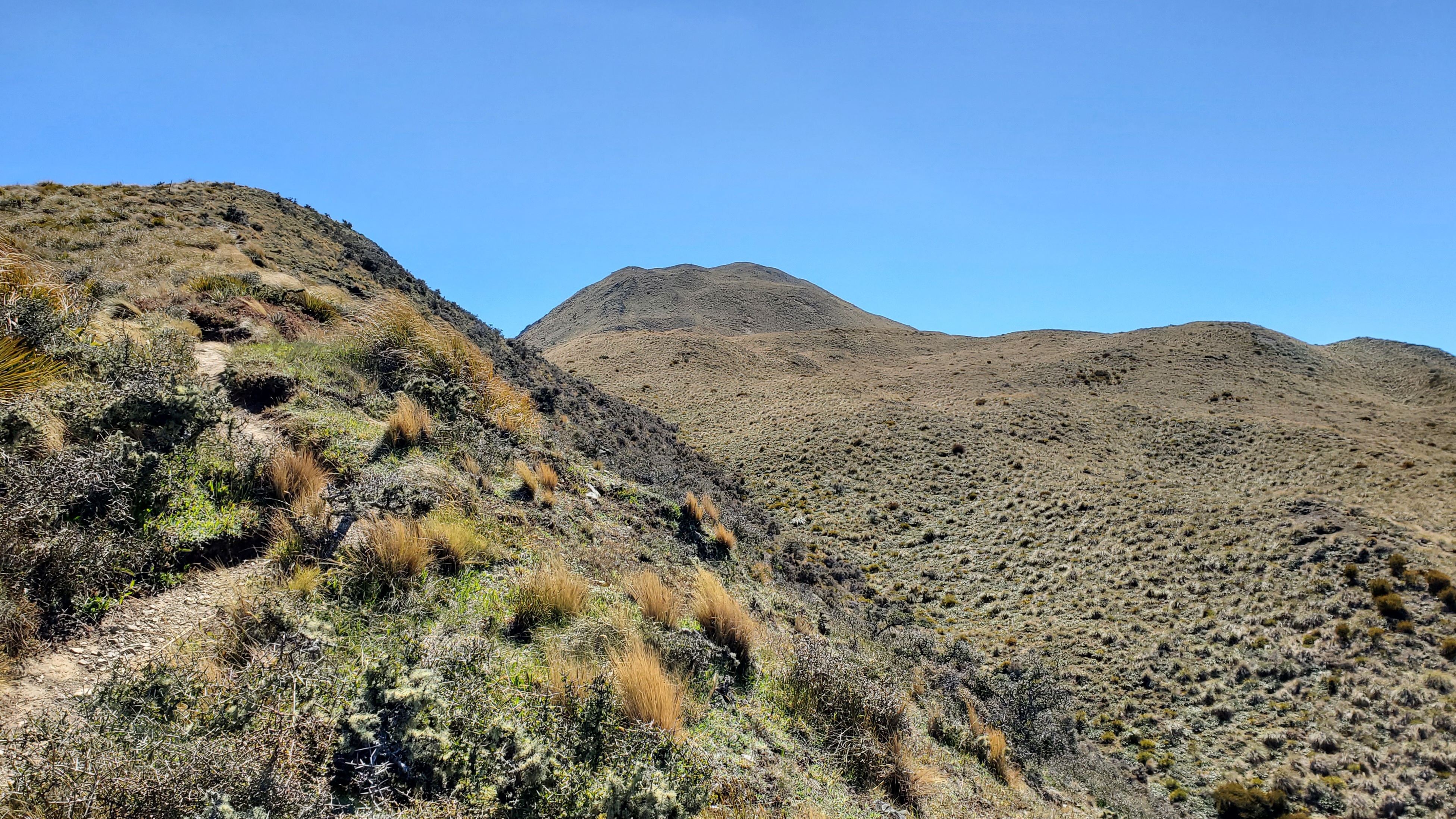
Past Pt 1043 there was a dip before the final 200m climb to the top.
Peak Hill
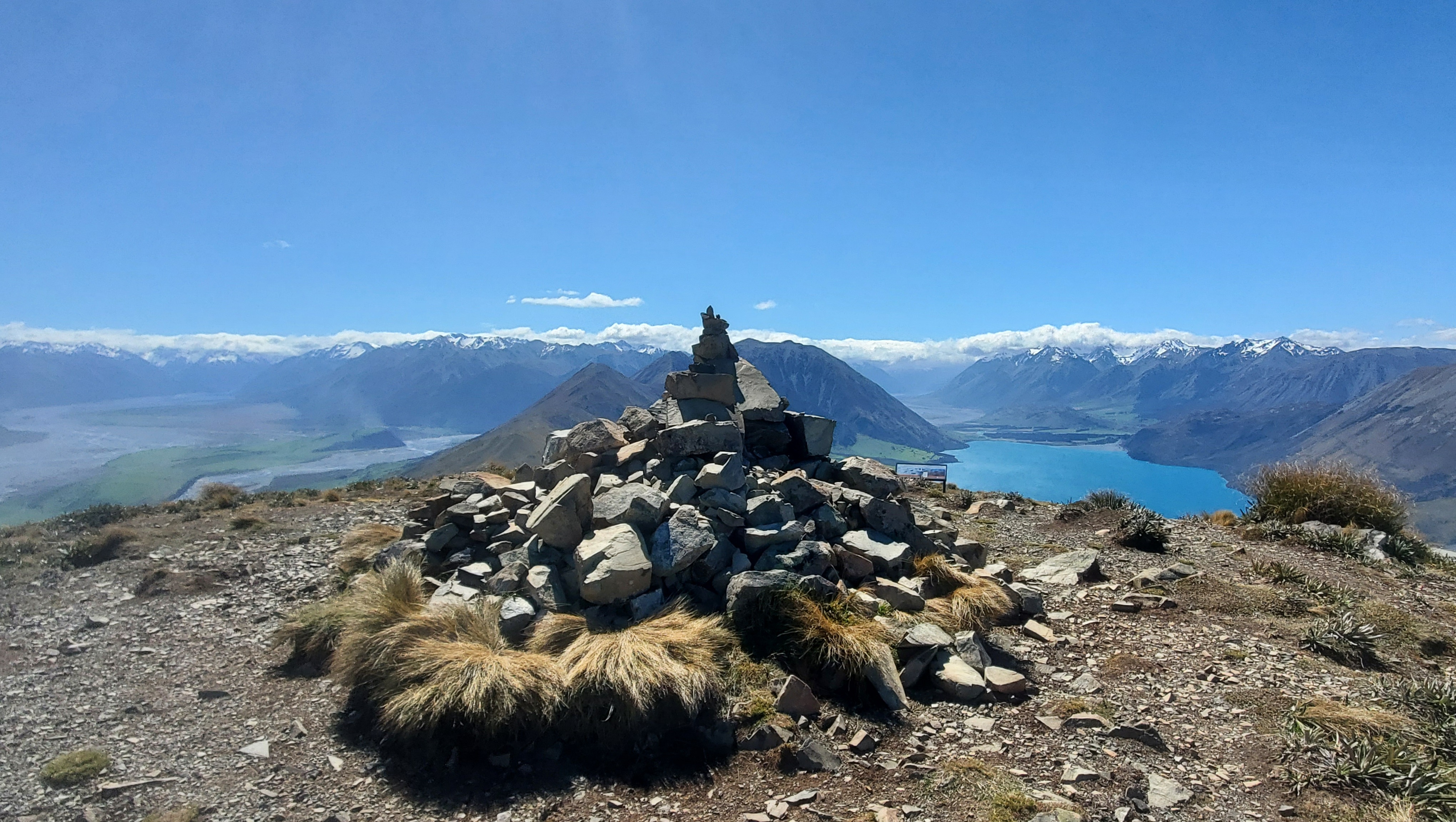
I reached the large cairn at the top of Peak Hill at 3.20 pm an hour and five minutes after setting off. Ahead, a couple were nestled into a dip enjoying their lunch in the sun and a respite from the blustery conditions. When I stopped moving it was freezing! I regretted the decision not to bring my gloves and put my jacket on, careful not to let it go. In this wind, it would have taken off like a rocket!
Find this helpful?
I write about my adventures to give you a personal view of the outdoors and inspire your own trips. Enjoy them? If you’d like to help me with my site costs, click here to make a donation. Thanks — it’s much appreciated!
The views from the top were incredible, looking straight up the lake towards Mt Oakden and up the Wilberforce River and to the left, the Mathias and Rakaia Rivers. Cloud covered the Southern Alps/Kā Tiritiri o te Moana and it was raining on the West Coast.
I remembered walking down the Harper River on Te Araroa to the Trustpower Campsite at the western end of Lake Coleridge and being so relieved to get a lift from a trail angel into Methven that night. That day, we’d seen great swirls of dust being whipped up by the wind along the braided rivers. Today too, spirals of dust clouds tumbled along the braided river banks in the distance.


Over Peak Hill
The topo map of Peak Hill indicated the track continued straight over the summit before descending the southwestern flank and coming out on Algidus Road about a kilometre from the car park. I headed down as far as the 1100m contour on a barely discernible track and had a wander along to the southwestern side to a bluffy overlook before heading back up to the cairn. I wanted to return the same way to get more of the wonderful lake views.
Back to the Car
I headed down from the summit at 3.45 pm with the wind behind me, which made things a lot more pleasant.

Coming down from below the ridge to the stile some of the eroded, slippery sections were proving difficult for some walkers, who were taking nice and slow. I was back at the car by 4.35 pm.
Click the links below for more walks in Canterbury, or use Search from the main menu bar.
- Mt Somers Track – overnight
- Peel Forest Park – short walks
- Mt Guy and Lake Clearwater – day walk
- Mt Sunday and Mt Potts – day walks
- St James Walkway, Lewis Pass – 4 days 3 nights
- Lewis Tops Lucretia Biv, Nina – 3 days 2 nights
- Hope, Doubtful, Nina Rivers Loop – 4 days 3 nights
- Woolshed Hill, Arthur’s Pass – half-day walk
- Bealy Spur, Arthur’s Pass – half-day walk
- Casey Binser Loop, Arthur’s Pass – 5 days 4 nights
Great review, wish I read it before I went – didn’t realise it was challenging and slippery. Slipped and fractured my ankle on the way done, needed to be winched off by Westpac Rescue Helicopter and can’t walk for 6-8 weeks after surgery. Will always wear tramping shoes now, if I have the courage to get back to it!
Hi Melissa, oh no!! Best wishes for a speedy recovery – I hope you get back up there one day!