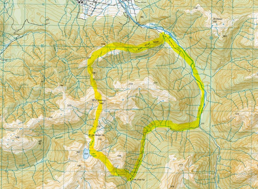
Lake Morgan Cone Creek
The Lake Morgan Cone Creek loop is a beautiful and challenging three-day tramp on the West Coast. Climbing the steep Brian O’Lyn Route to Mt O’Shanessy (1,462m), before dropping down to Lake Morgan Hut on day one. Then, across to Cone Creek Hut on day two, and following Cone Creek and the Haupiri River out on day three. There’s plenty of elevation, route finding, bush bashing and river travel, so it’s one for experienced trampers. Days two and three took us longer than expected, and it was well worth the effort. You’re rewarded with spectacular views, a rugged variety of country, and constantly changing vegetation along the way.
We walked the Lake Morgan Cone Creek loop in April 2025 over a long weekend with a good weather window – you wouldn’t want it any other way! We got our intel from the Remote Huts website, and this Wilderness mag article, among others. You’ll need permission from the Gloriavale community to access their land and park at the Haupiri River.
Timings:
Day 1: Brian O’Lyn Route to Lake Morgan Hut
Remote Huts time: 6-8h
Wilderness time: 8h
Our time: 7h 15m
Day 2: Lake Morgan Hut to Cone Creek Hut
Remote Huts time: 3-5h
Wilderness time: 5h
Our time: 5h 10m
Day 3: Cone Creek Hut to Haupiri Car Park
Remote Huts time: 5-6h
Wilderness time: 7.5 h
Our time: 8h
Day 1 Brian O’Lyn Route to Lake Morgan Hut
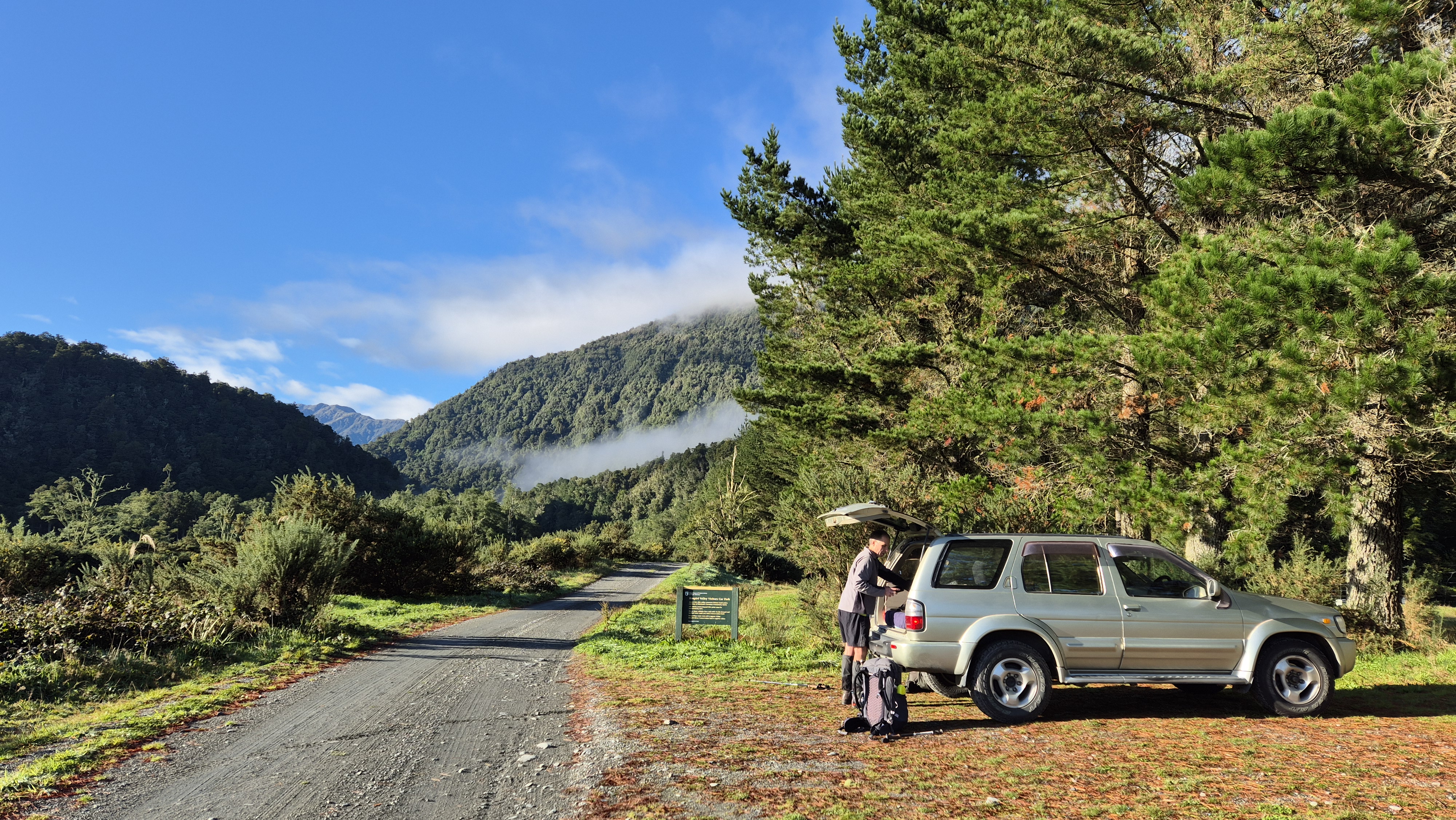
Since we were coming from opposite directions, the day began with an early rendezvous at Dobson, along SH7 in the Grey Valley, where I left my car. Rich drove us to Lake Haupiri via Nelson Creek. I’d only been down this way once before and had forgotten how stunning the lake view was, looking across to the mountains. On this calm, clear morning, it was breathtaking.
I’d called ahead to Gloriavale to ask permission to park at the Haupiri River for access to the Brian O’Lyn Route. As requested, we drove into the settlement to sign the visitors’ book, then continued the short distance to the car park at the river. As we sorted our gear, I gently fended off the inquisitive honey bees who took a keen interest in our packs.

Brian O’Lyn Route
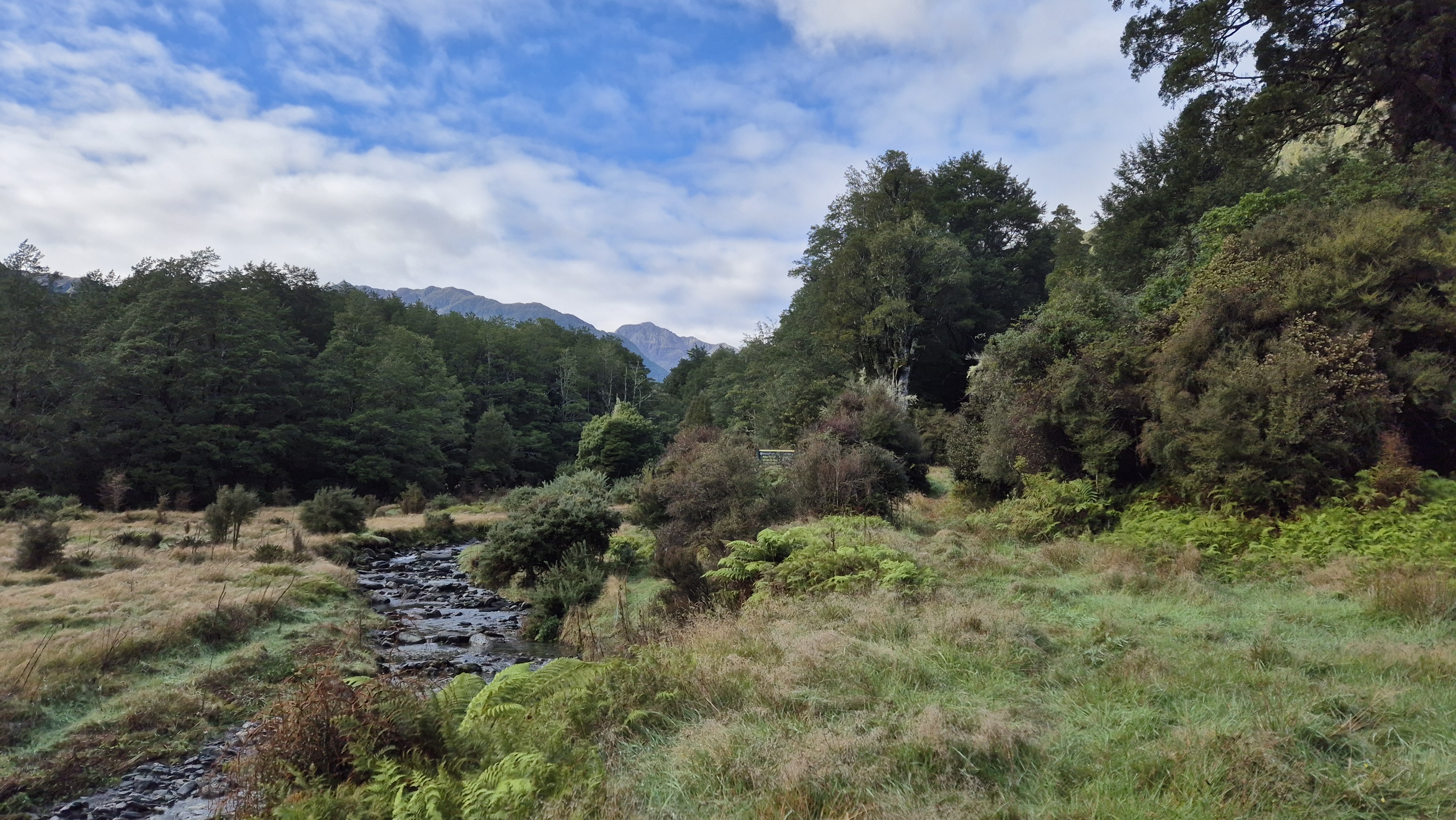
We set off at 9.20 am, following a 4WD track alongside the Haupiri River for the first 2 kilometres. The sun was out, warming our backs, and it felt good to be moving. The track was wet underfoot, with big puddles stretching one wheel rut to the next, and it was wet boots almost immediately.
Just above O’Shanessy Creek, we spotted the DOC sign marking the start of the Brian O’Lyn Route. We filled up our water from the creek, and at 9.50 am, we began the climb. The route wasn’t particularly well defined, and there was a fair bit of hunt-the-marker from the start. The ground was steep and still wet from yesterday’s rain, and there was plenty of hands-on scrambling.
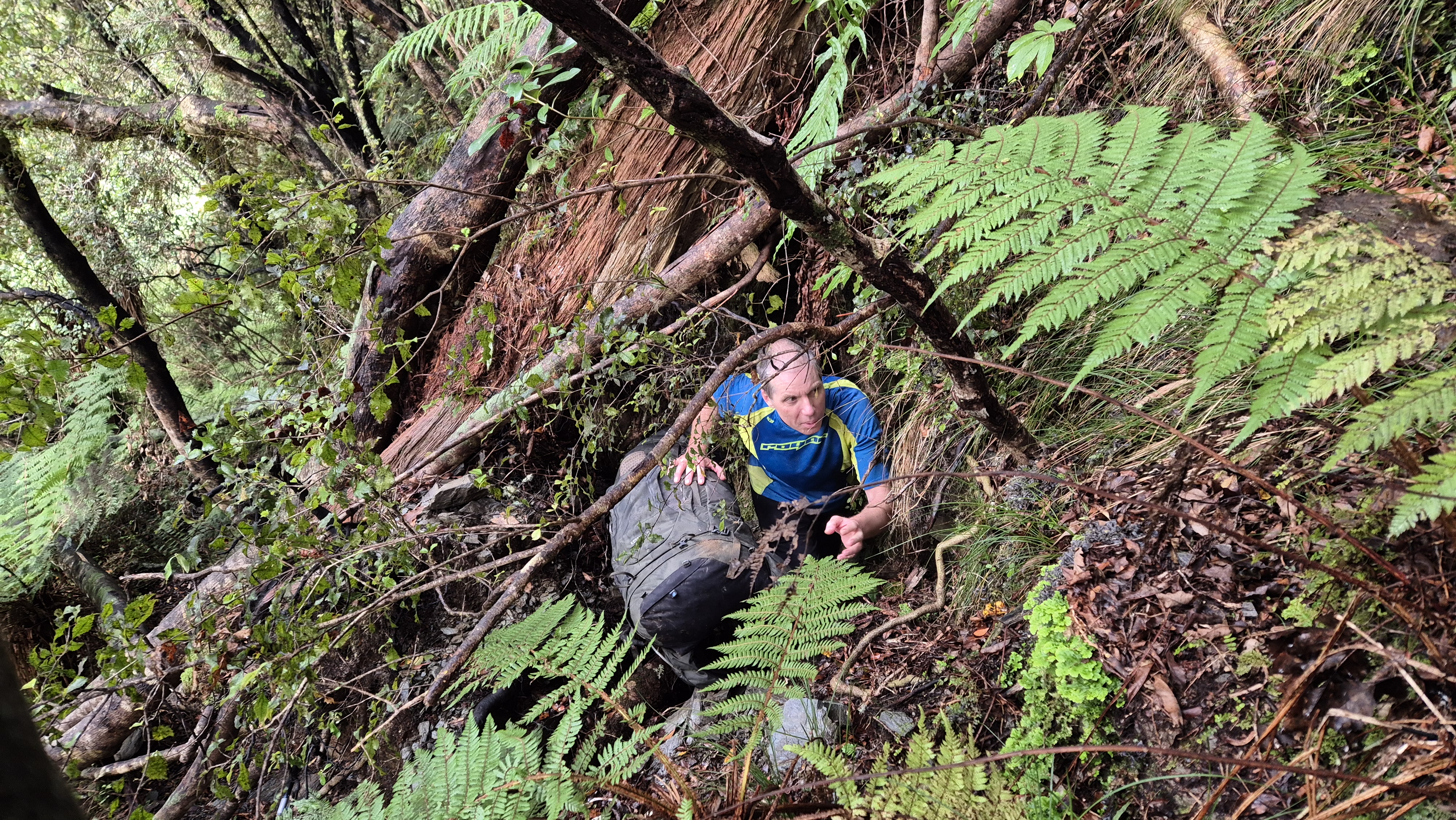
At 10.20 am, we came to a large fallen tree, awkwardly wedged across our path. It was a dirty, packs-off scrabble to squeeze behind it. The markers didn’t get any easier to follow after that, and we were grateful for the odd scrap of pink flagging tape in the trees. We spotted some bright strands of orange coral fungi glistening in the undergrowth, and as we paused to admire them, a posse of fantails turned up, flitting and chattering around us.
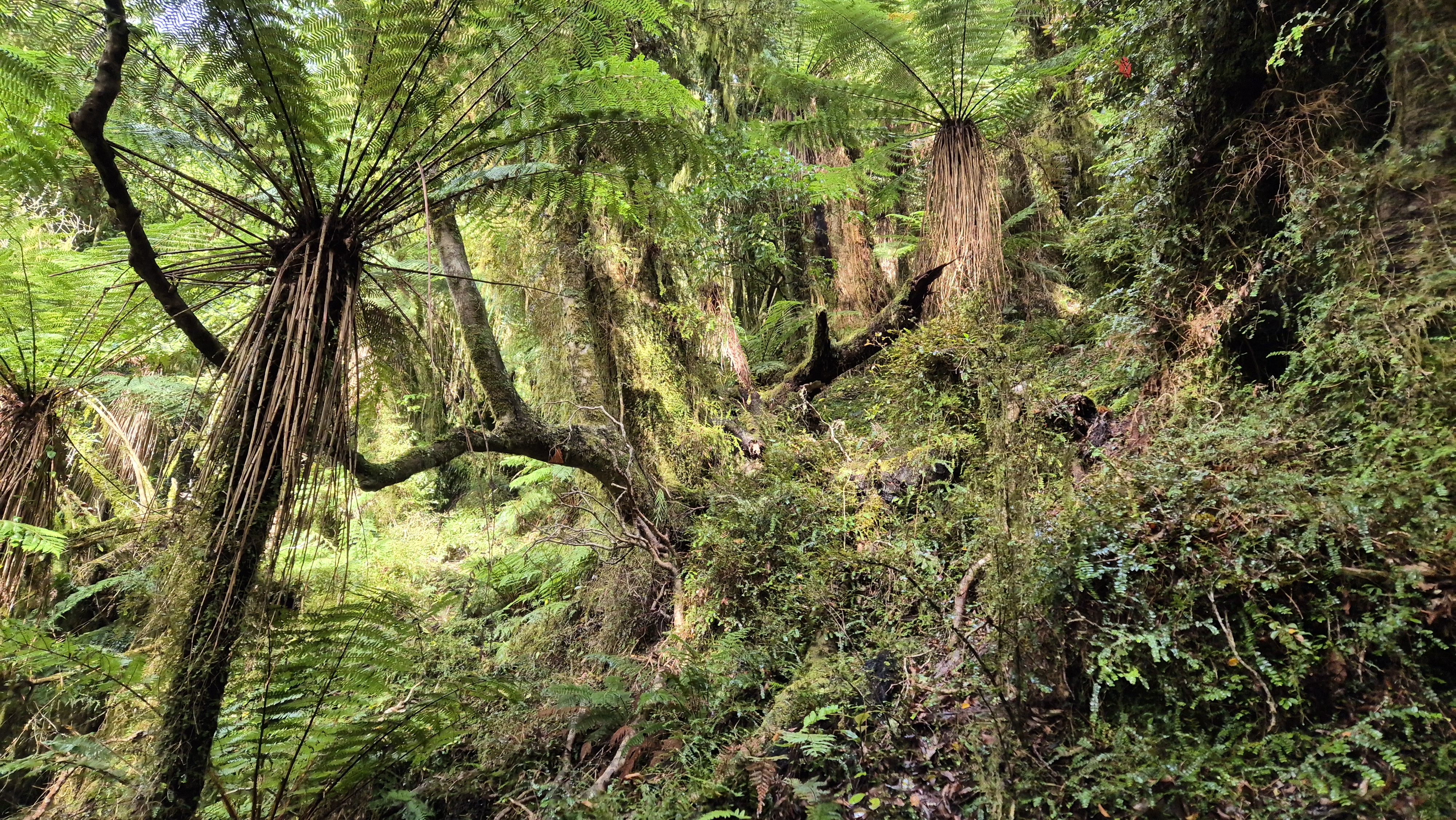
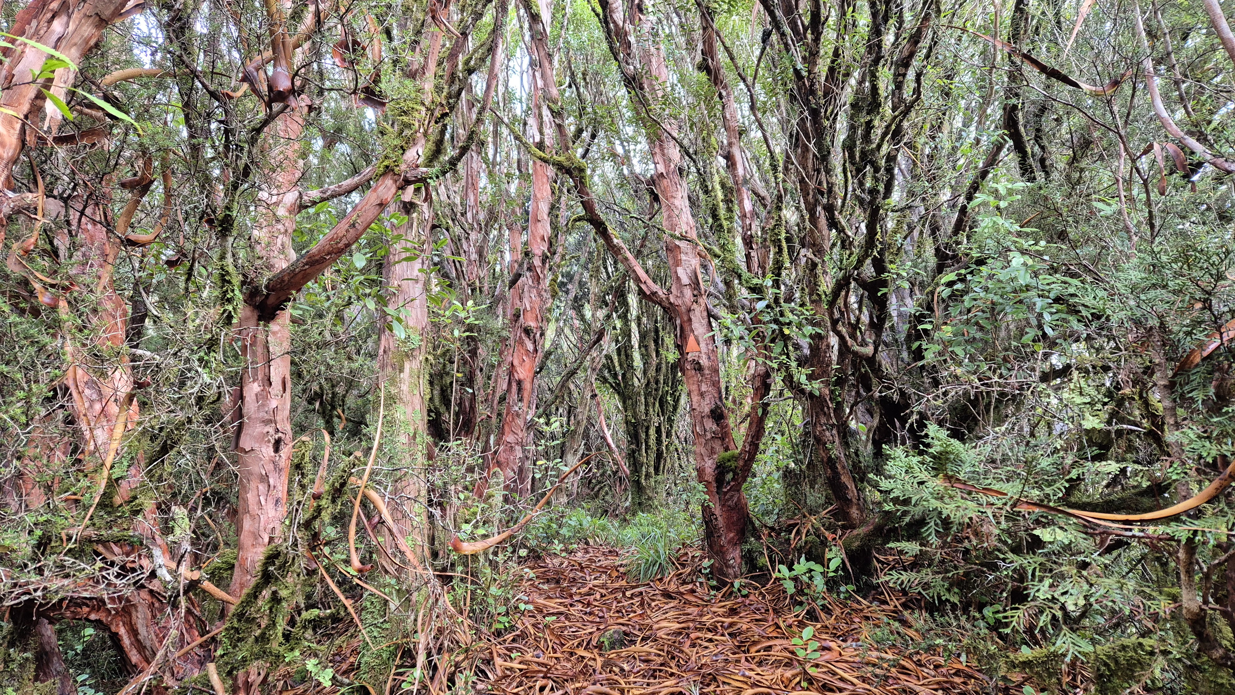
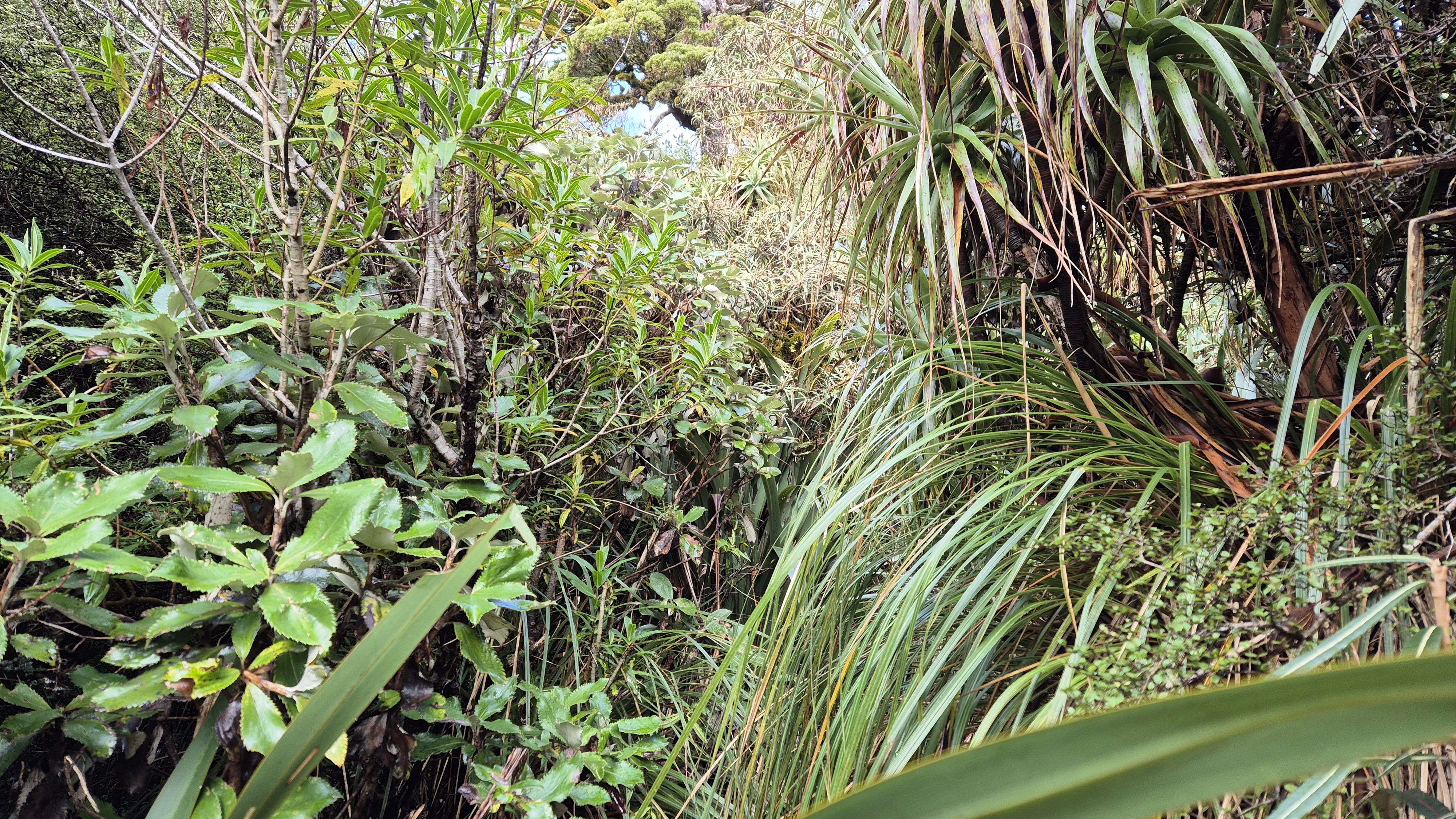
By 10.50 am, about an hour into the climb at around 640m, the gradient began to ease off. The birdlife here was fantastic. We hit the first patch of dracophyllum around 11.20 am, and from 800m the route flattened out a little. I hadn’t seen the mix of flaxes, leathery-leaved trees, dracophyllum and cedar before – it gave the route a unique character.

Views from Brian O’Lyn
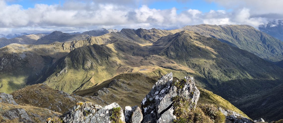
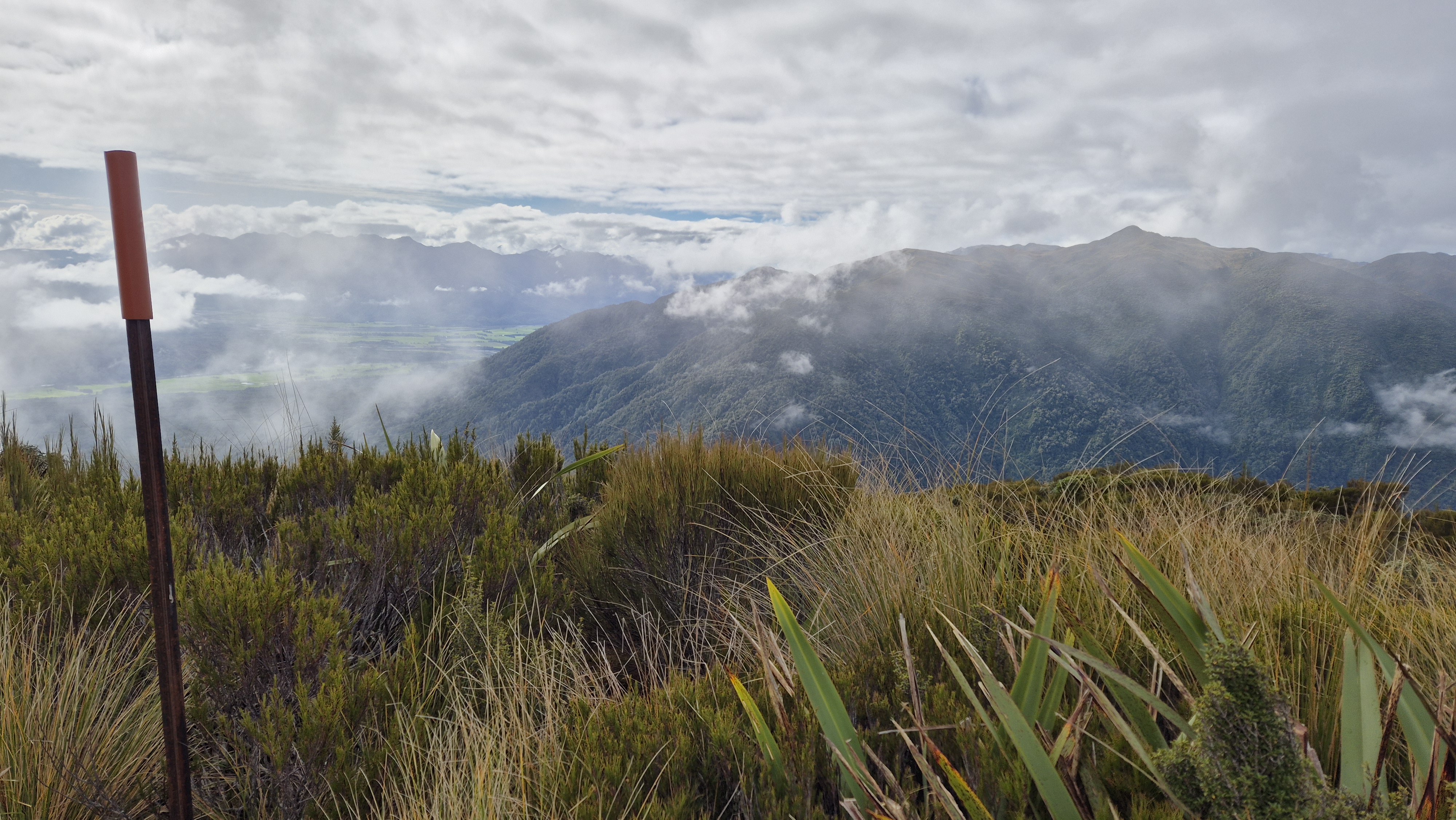
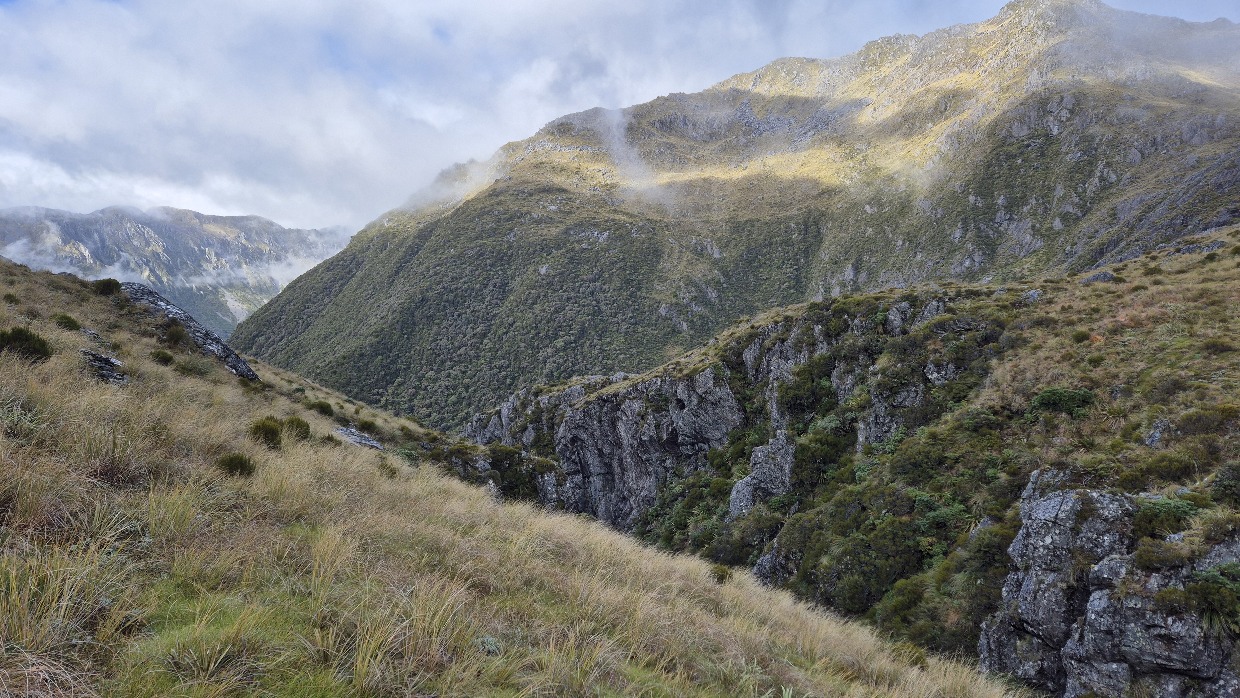
At 11.45 am, at around 920 metres, we got our first proper view of the mountains surrounding us. Minutes later, we were back into a dense overgrown section of trees, flaxes and bushes following a faint ground trail. Then a wet bash through long grasses. In places, the forest was unlike anything I’d come across before. We reached a marker pole at 12.10 pm, around 1,020 m out in the tussock – a good spot for a quick bite to eat. We put our warm layers on as a stiff breeze was blowing. The views up here were magnificent, looking across to the surrounding mountains and way down to the Haupiri River below.


On the Tops
By 12.30 pm, we were moving again. We headed straight up, keeping to the edge of the ridge with a basin on our left, and picked up a faint, rough trail. The higher we climbed, the more the landscape opened up, with sweeping views back over Lake Haupiri and Gloriavale.
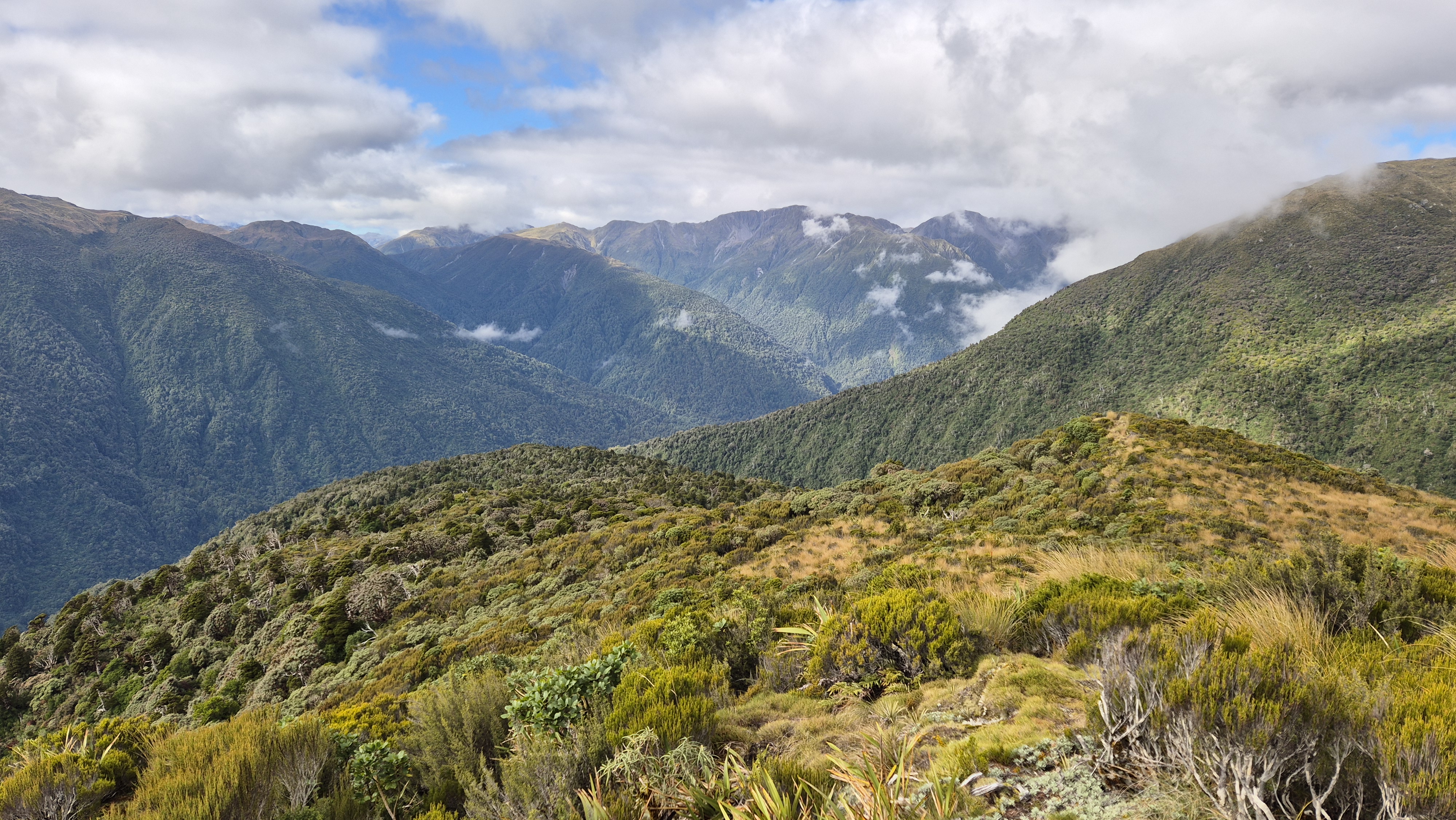

We sidled a little to the left but ended up climbing back up to the ridge as it proved easier travel. At pt 1218, we stopped to soak in the views – it was stunning! A few scattered tarns dotted the basin below us, shimmering in the afternoon light. We headed towards the saddle leading up to Mt Shanessy and began to sidle, keeping high above the tarns. The tussocks were tall, and the ground lumpy and full of holes. It took us longer than I’d expected to cross to the saddle. As we got closer, the tussock colours shifted from golden to russet-red.

Towards Pt 1196
We reached the pole at the bottom of the saddle by 1.40 pm and found a faint track. It had taken us about an hour to cross the tops. At 2 pm, we stopped for a well-deserved lunch with some epic views. The clouds were rolling in, and Mt O’Shanessy was starting to disappear, so we hurriedly finished up and moved on. It seemed like we still had a long way to go.
At 2.25 pm, we set off again. The route took us over a narrow ridge and down into another dip, mostly following a trodden path but occasionally finding our own way. About 15 minutes later, we passed a tarn nestled on the saddle.

Mt O’Shanessy
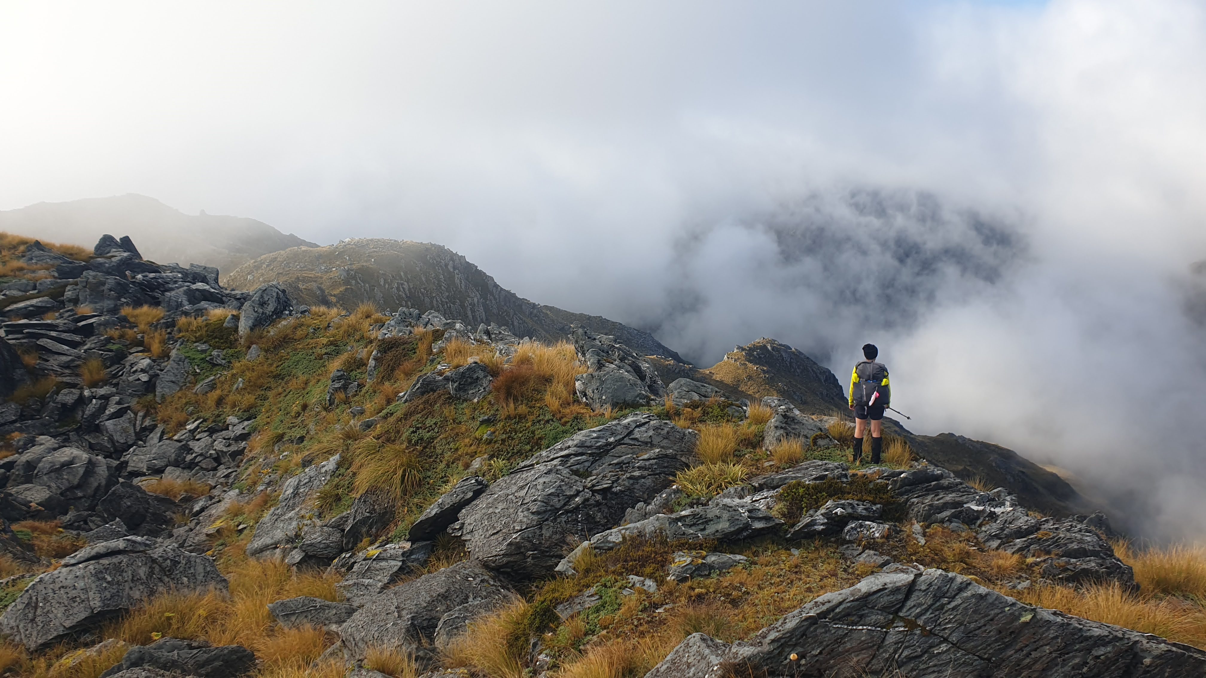
The climb up Mt O’Shannessy looked worse from a distance than it actually was. Still, by this point we’d climbed over 1,000m, and my legs were feeling pretty tired. It wasn’t technically difficult, but I felt I was moving fairly slowly. To my surprise, the route was poled. We followed the ridge that curved up to the left, occasionally following a ground trail. I was glad each time we reached a pole, a good excuse for a quick breather.
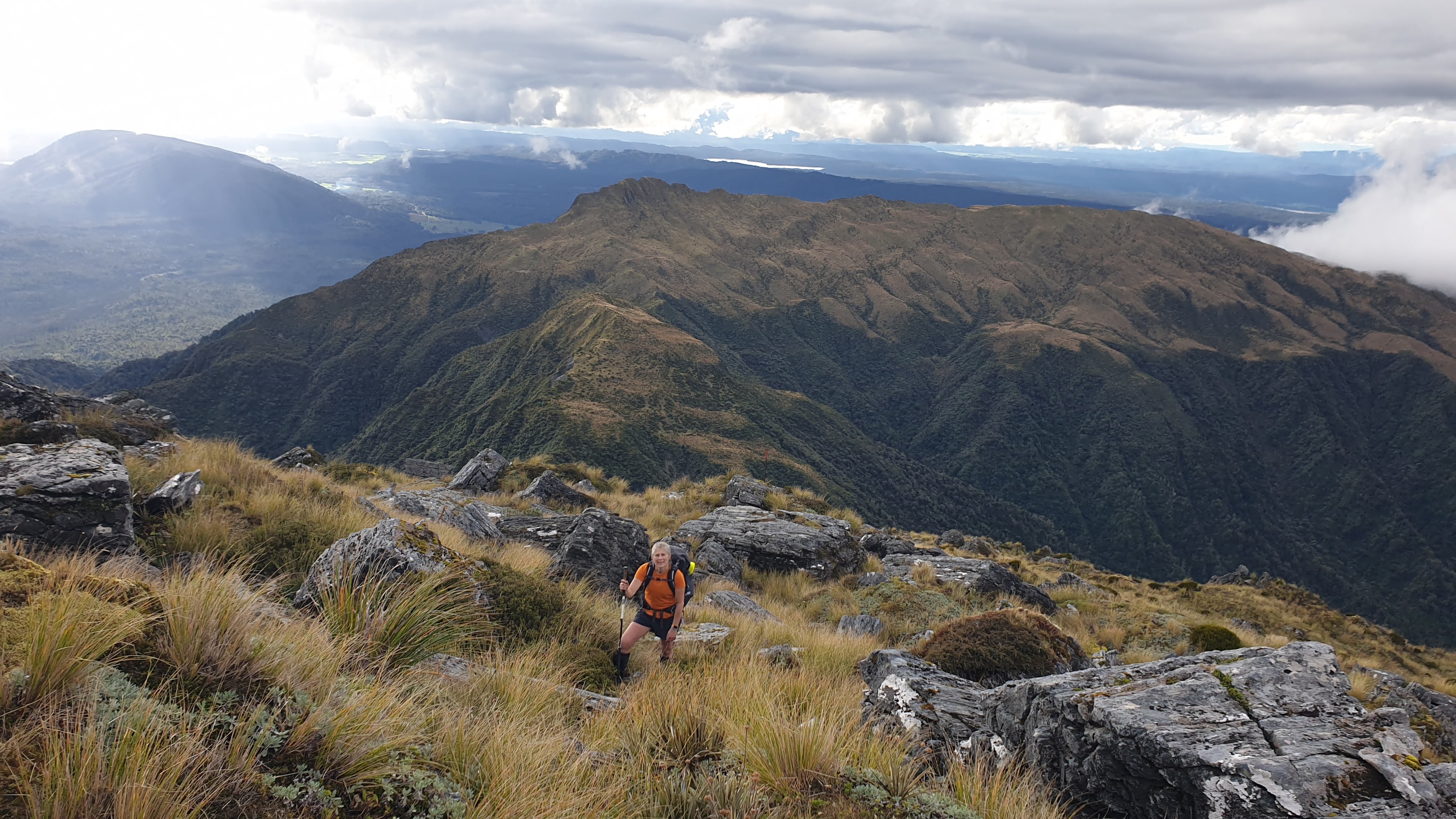
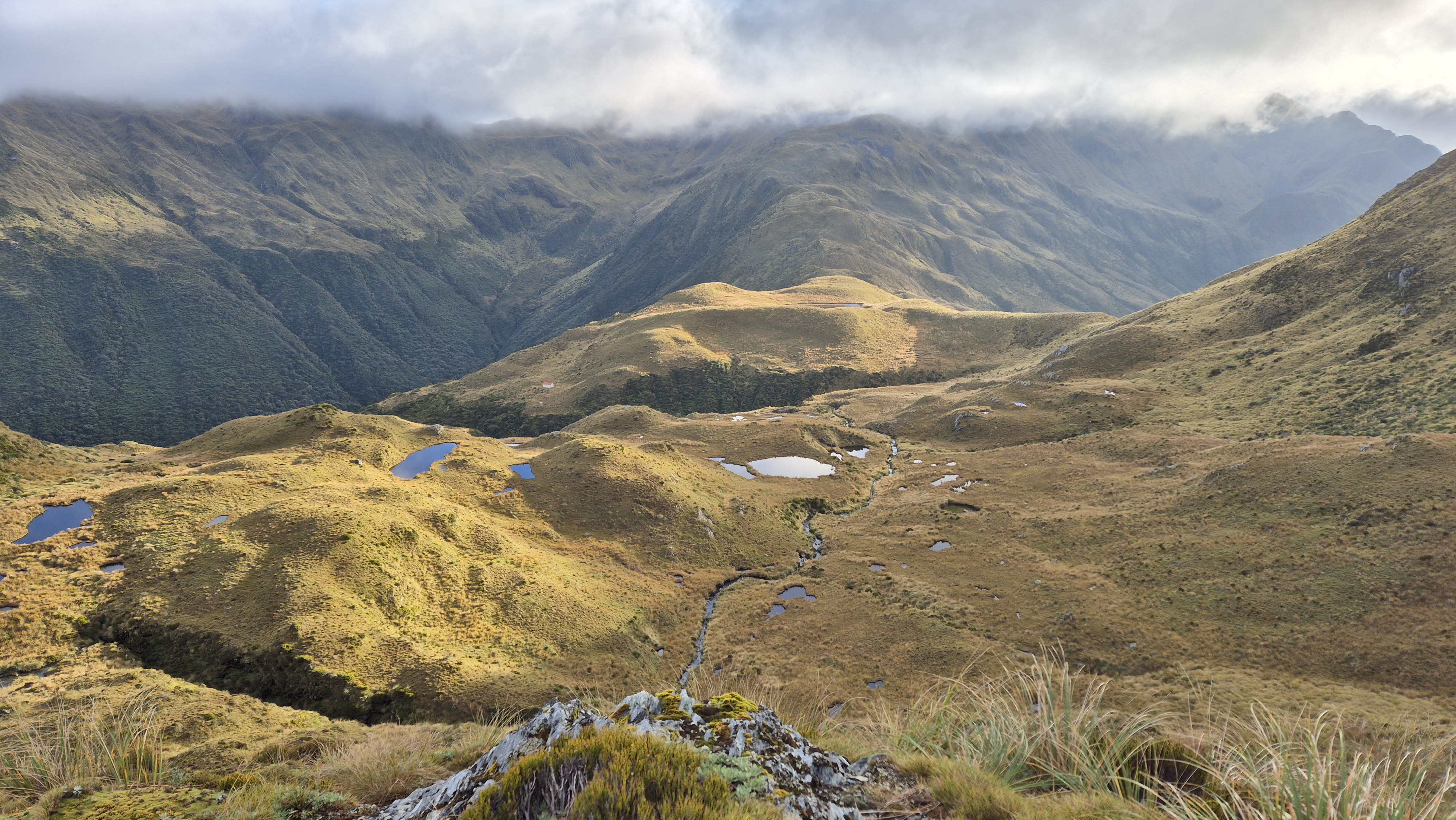
The higher we climbed, the better the views got. The sun came out again, which was a real boost, and lit up the surrounding mountains. As we gained height, the poles became sparse, and we found our way across the open ground. It got rockier near the top, but nothing too difficult. We hit a high point around 1,400m at 3.20 pm and, through a gap in the rocks, finally caught sight of Lake Morgan and Lake Morgan hut a speck in the distance far below. The ridge leading down towards it was incredible. We continued up a couple of false peaks to the summit.


To Lake Morgan Hut
We reached the top of Mt O’Shanessy at 3.45 pm. From there, the poled descent started very steeply – a grassy drop down to the left of the ridge. From there, we picked our way through the rock and tussock and a little further down, veered over to the right side of the ridge, where we continued down towards the hut.

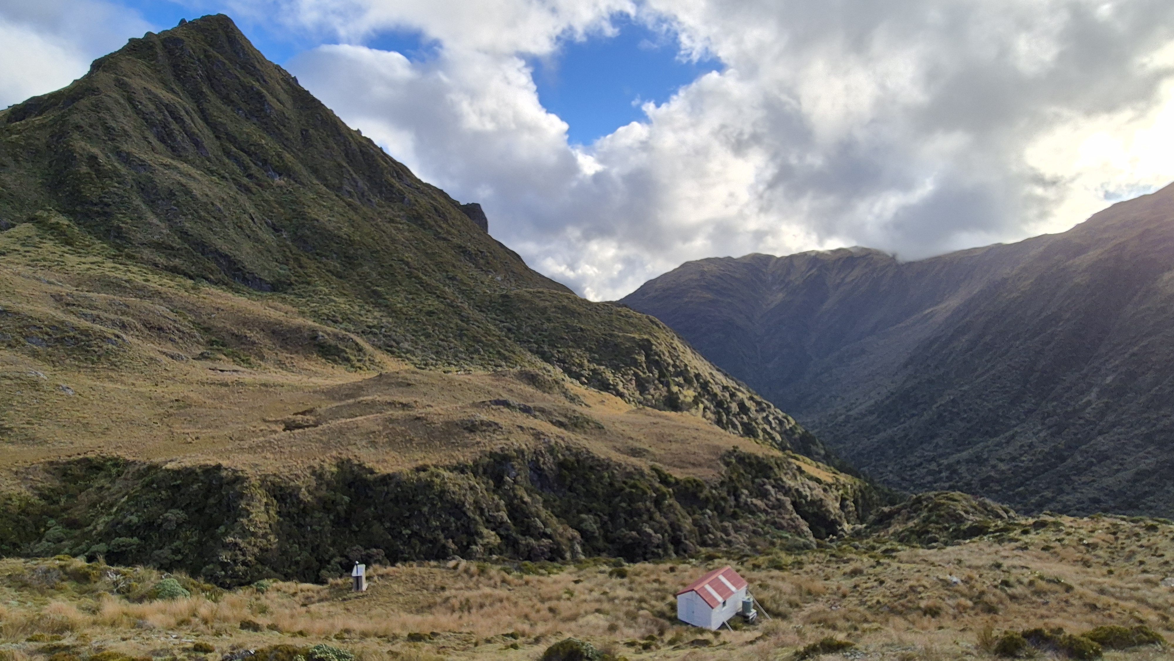
Eventually, we reached something that resembled flat ground, with a few tarns scattered around in the basin. A scrap of orange tape led us towards the hut, followed by a pole. We arrived at the hut at 4.35 pm.

The six-bed Lake Morgan hut was in great condition. Check out more information on Remote Huts. We wandered around outside to check out the shiny new toilet and admired the incredible views out over the basin. Once inside, a hot soup was the priority, with a perusal of the hut book. Lake Morgan hut doesn’t get too many visitors, aside from a few groups from Gloriavale. Dinner followed, and a round of Yahtzee, with a Twix, and some treacle pudding! What a treat!
I discovered my head torch had broken, a total fail on my part for not checking it before I left, but thankfully, there were candles and we were in bed by 8 pm. The temperature dropped sharply in the evening, so I ended up sleeping in my hat and gloves.
Day 2 Lake Morgan Hut to Cone Creek Hut
Remote Huts Time: 3h -4.5h
Wilderness: 5h
Our time: 5h 10m
Towards Lake Morgan
We woke at 6 am. Neither of us had slept very well, and we weren’t sure why, especially as we’d double-mattressed last night. It was a cold/wet boot trip to the loo, with cold air swirling outside. After a fairly leisurely breakfast, we pulled on yesterday’s still-damp, sweaty clothes. Then it was raincoats on, and we left at 7.40 am expecting plenty of wet tussock.
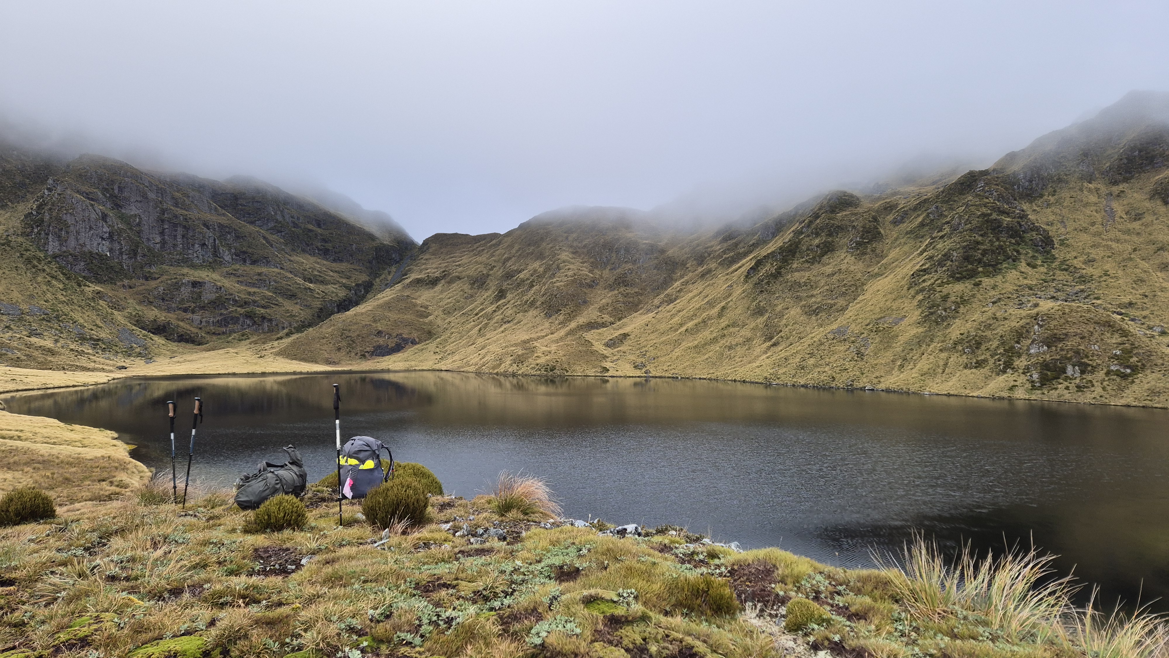
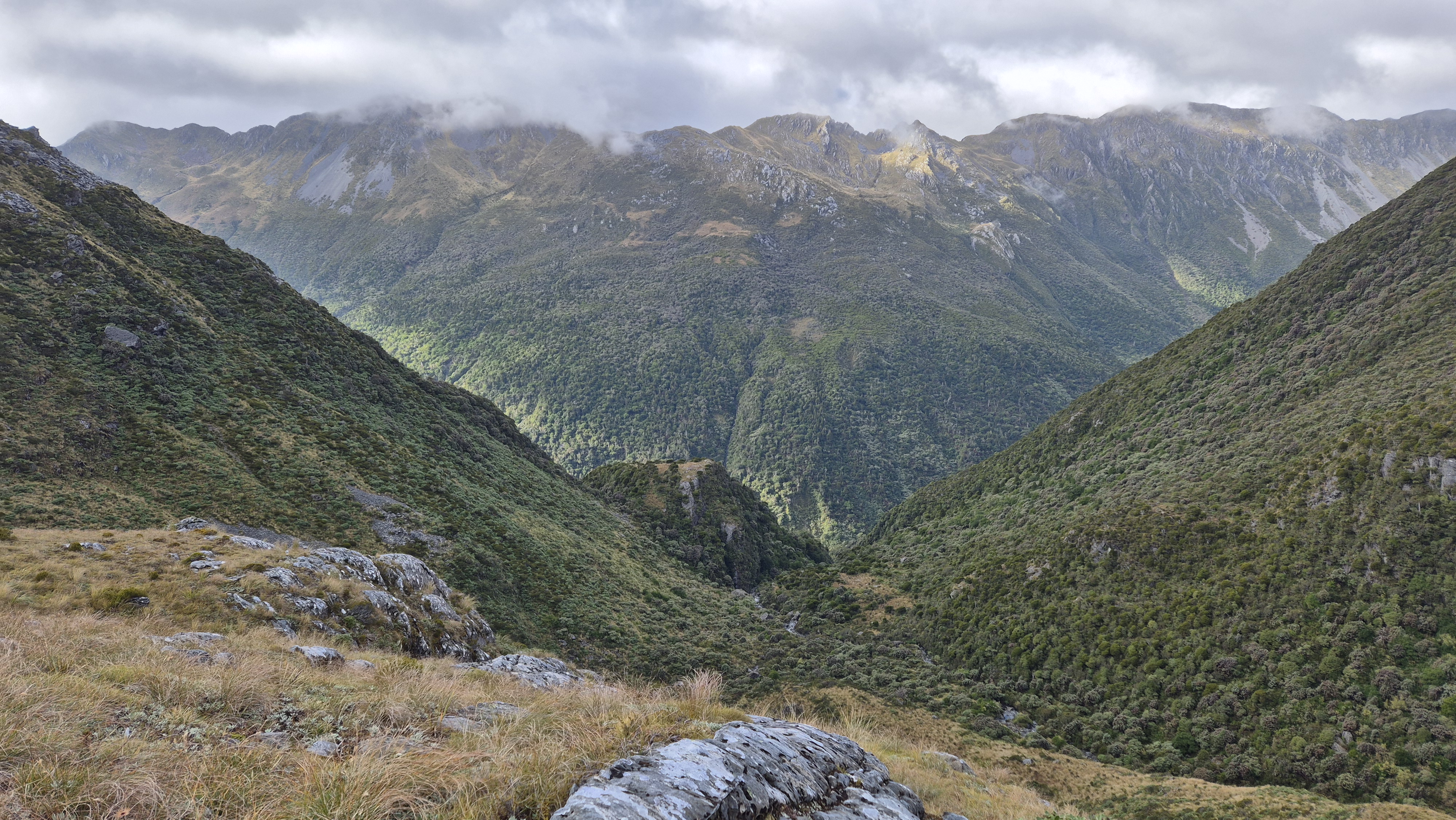
We climbed gently towards Lake Morgan, passing several small tarns along the way. It would be a beautiful place to camp in summer, but this morning it was soggy underfoot and misty around the tops. At 8 am, we stopped to check the map and debated again where to head up to the ridge for the crossing to Cone Creek. (Most of today’s travel was unmarked). We considered heading up to pt 1343 but decided against it, opting to walk up to the lake for a look and go over from there. Aiming for the left of the bumpy terrain ahead of us, we climbed up towards the lake.
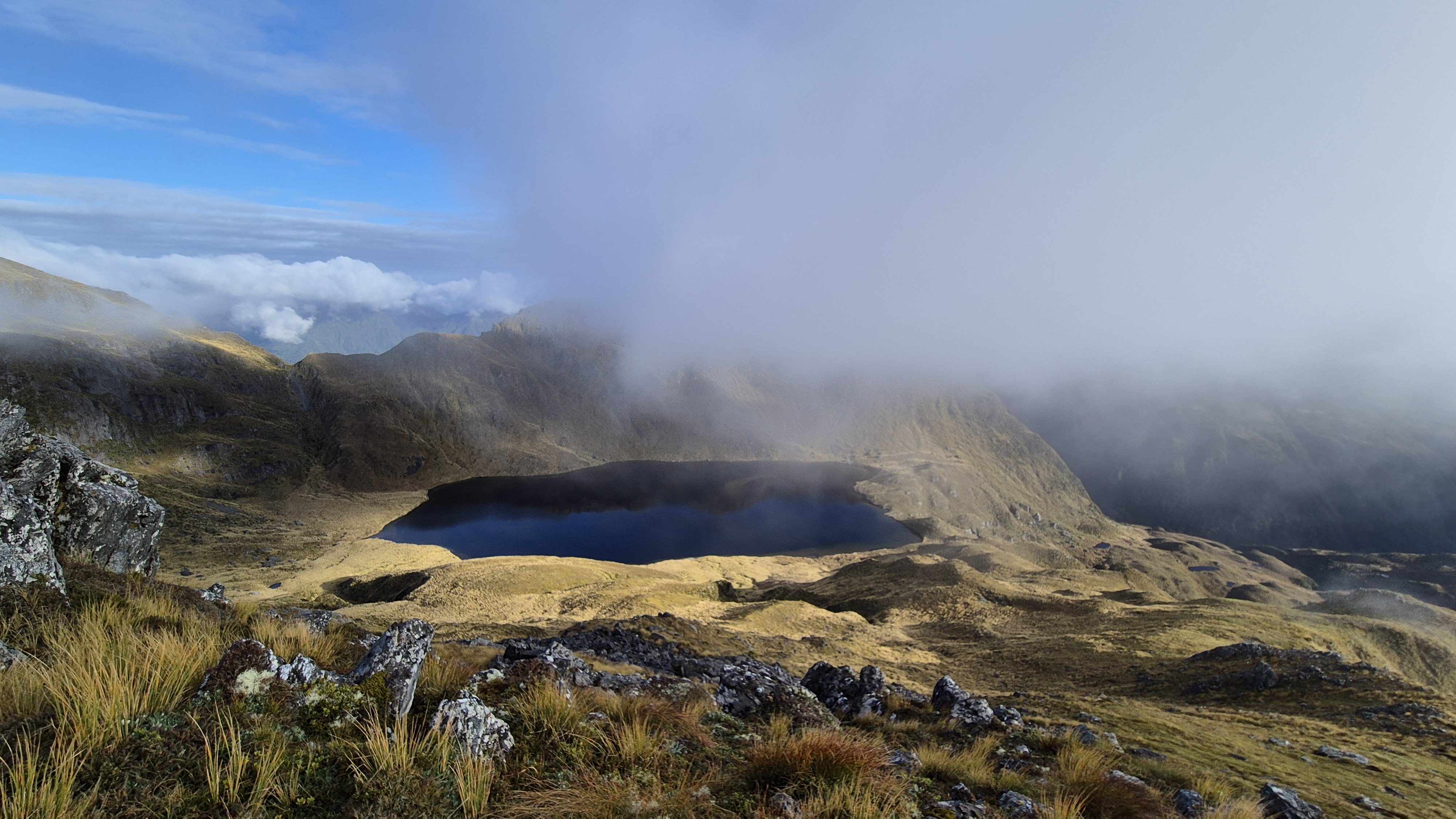
We arrived at the lake around 8.30 am, almost an hour after leaving the hut. We took a break to soak in the surroundings. The lake was bigger than I’d expected, with dramatic cliffs rising to the south, although low cloud meant we couldn’t quite get the full picture. Still, it was stunning. We dropped our packs and wandered up to a high point behind us to get a better view over the tarns and Lake Morgan hut, which was now bathed in morning sun. Looking back across to the long ridge we’d come down from Mt O’Shanessy yesterday. The mountain had its head firmly in the clouds again, and it seemed like a long way off.
Above Lake Morgan
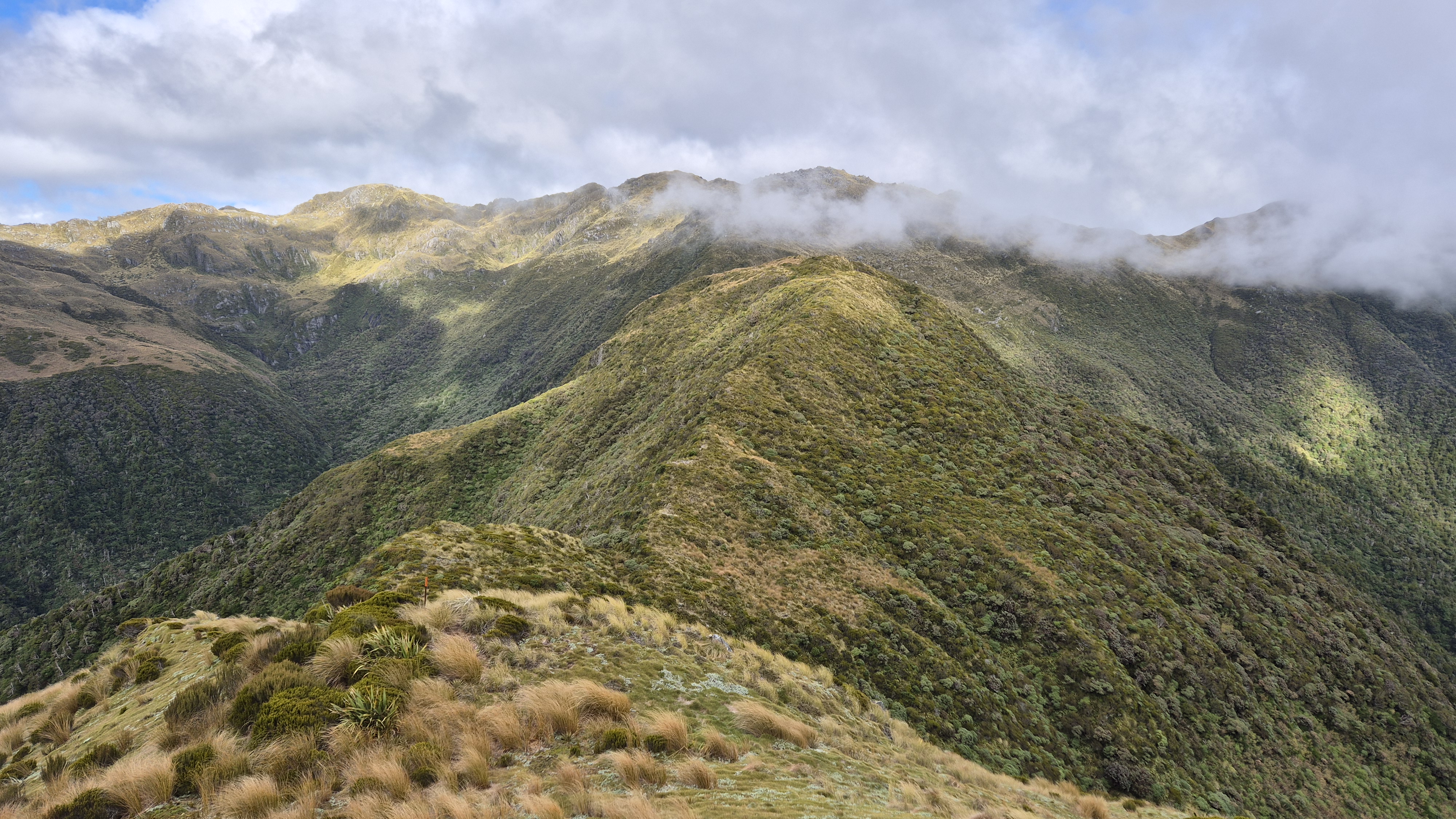
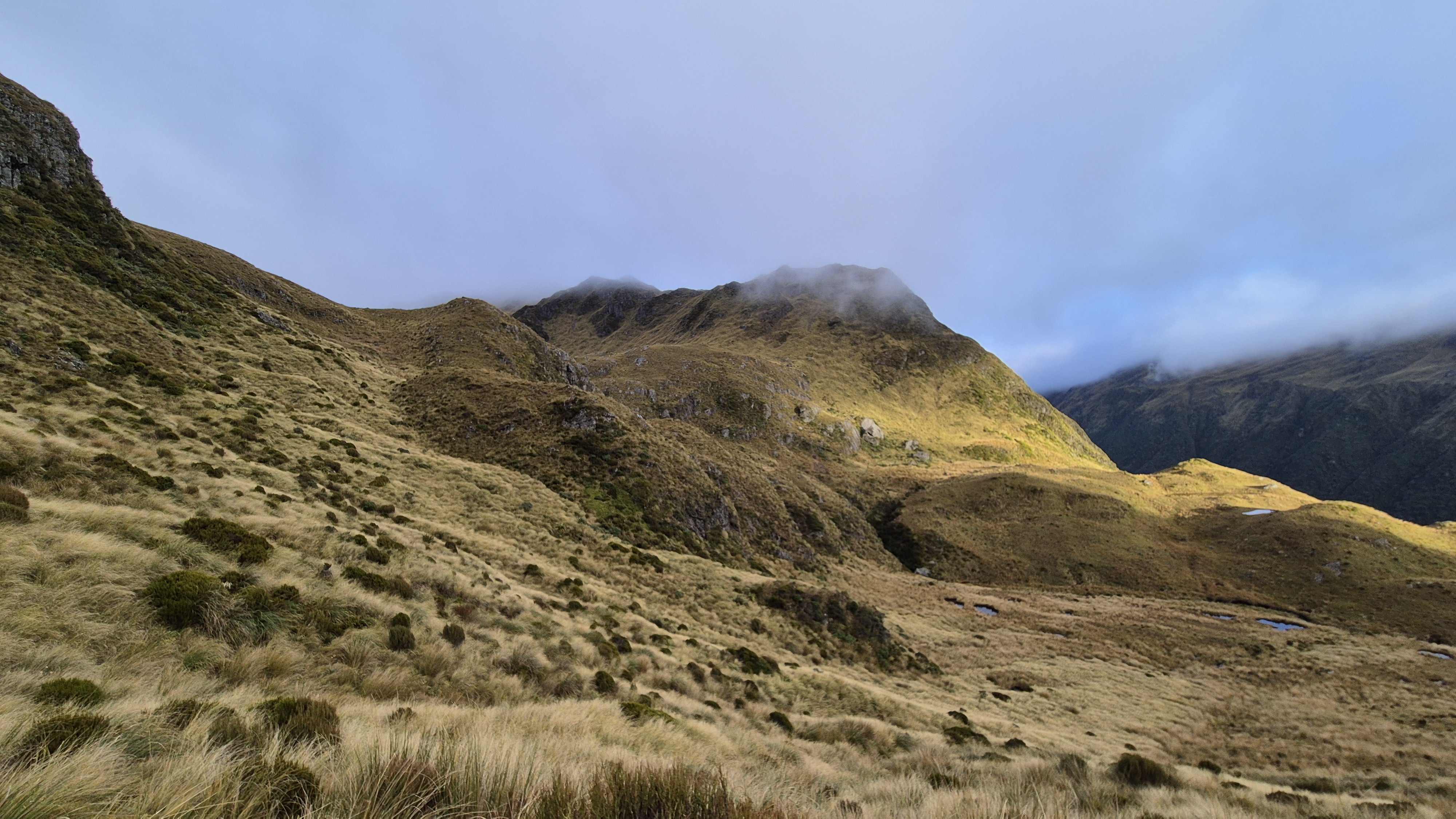
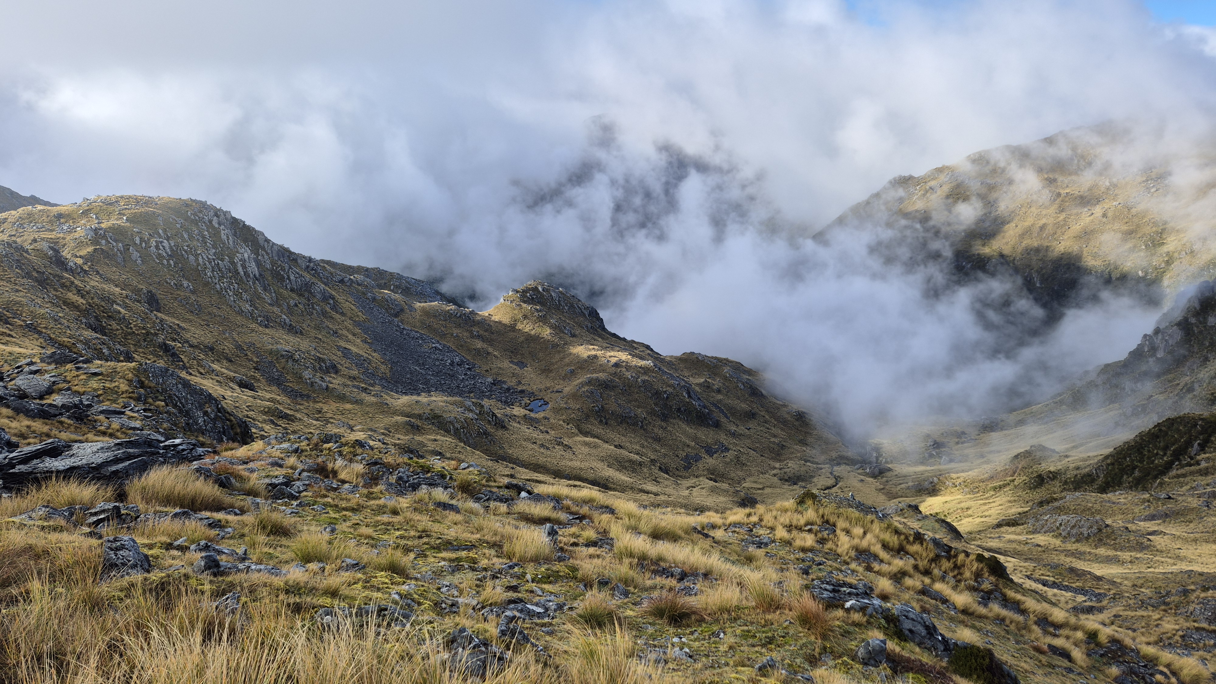
At 8.45 am, we left Lake Morgan, heading over towards Cone Creek and slowly climbed up to a low point on the ridge. When we reached it, we were treated to great views straight down to a tributary of the Haupiri River. We checked the map and continued climbing. Heading up to around the 1,420 m contour to look over the spur we’d planned to drop off, into the basin above Cone Creek.

We stopped halfway up to put on our thermals and hats back on – the wind had picked up and it was getting colder. At the top, it was cloudy and freezing! We had a short break and studied the map for a while, catching occasional glimpses of the basin below through gaps in the cloud, trying to get a visual on where to drop off the spur.
Into the Basin
Thankfully, we’d both plotted a couple of coordinates from the Remote Huts website onto our topo maps. We were aiming for a spot on the spur at around 1,380m where we’d begin our descent into the basin. Rich had also marked a few more points: one around 1,150 m above the gorge and another at 1,100m. I marked waypoints as we headed down.
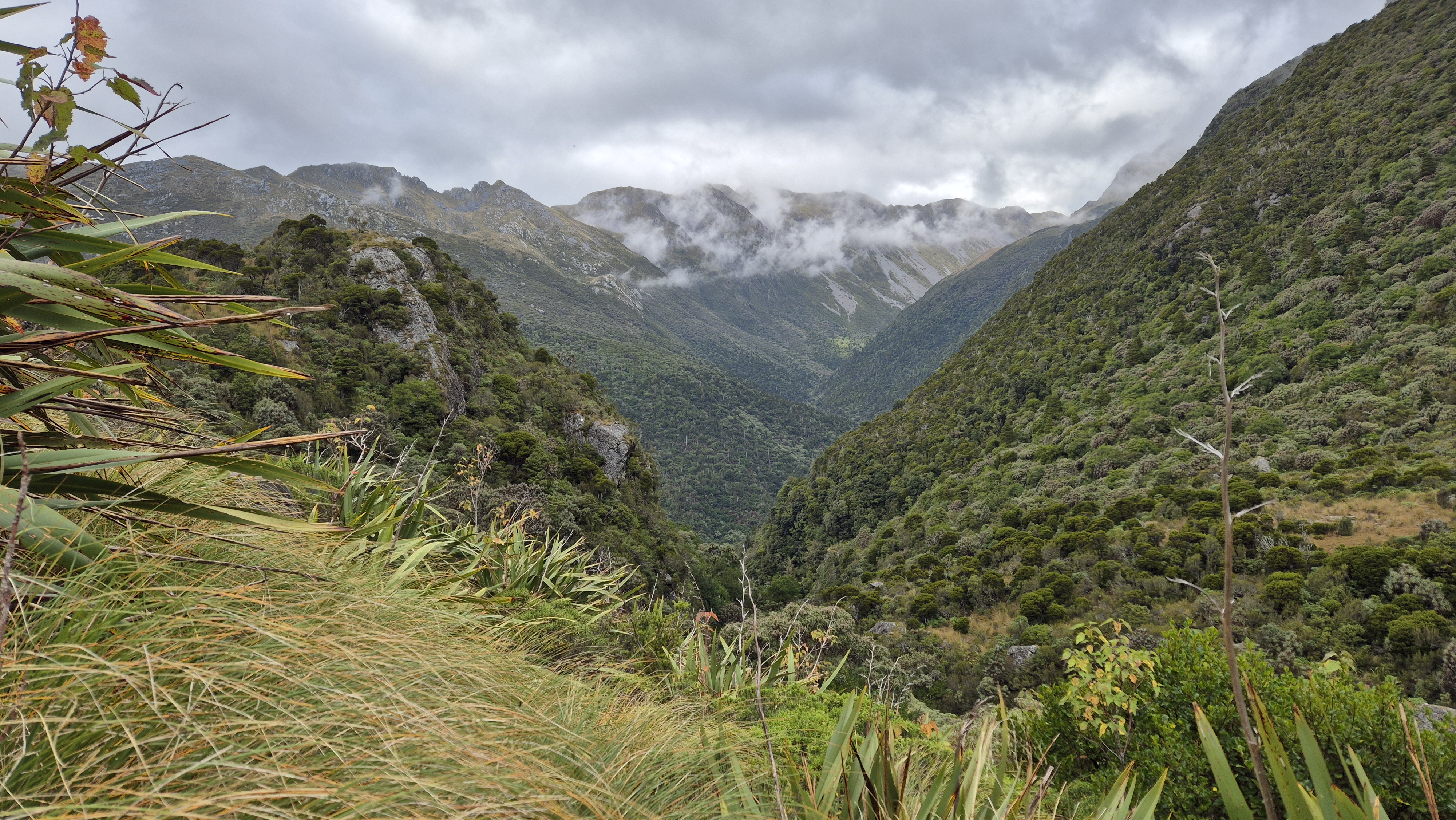
It became clear as we headed down out of the cloud that we were aiming for the left of the gorge below, which we’d glimpsed through a tiny gap in the clouds a couple of times. At around 1380m, we dropped into the basin, sticking mostly to tussock and crossing the odd patch of rock. The terrain was lumpy, with some bluffy sections and a few water channels to navigate, but the views when we got them were stunning.


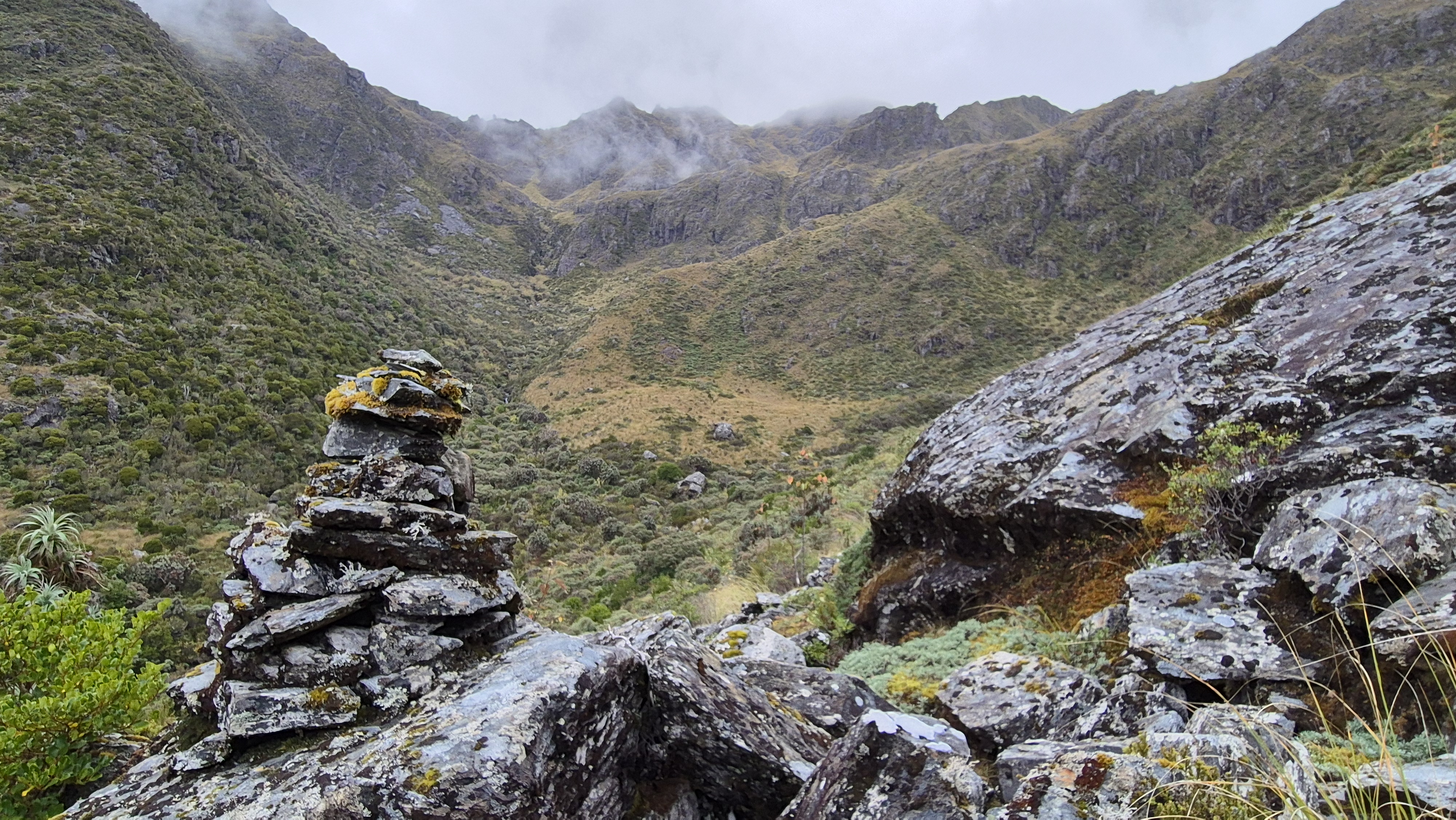
By 10.15 am, we’d reached the true left of the gorge at around and began sidling around it. A lone kea squawked overhead. We climbed over the hump to our left, which turned out to be a bit too high, then dropped steeply down the other side, clinging to bushes until we picked up a line of tussock towards the bush below. At 10.45 am, we reached the end of the tussock. A giant boulder stood topped with a cairn, and just beyond it, we spotted a permolat marker tied to a tree. It had taken three hours from the hut to the bush line.
Into the Bush
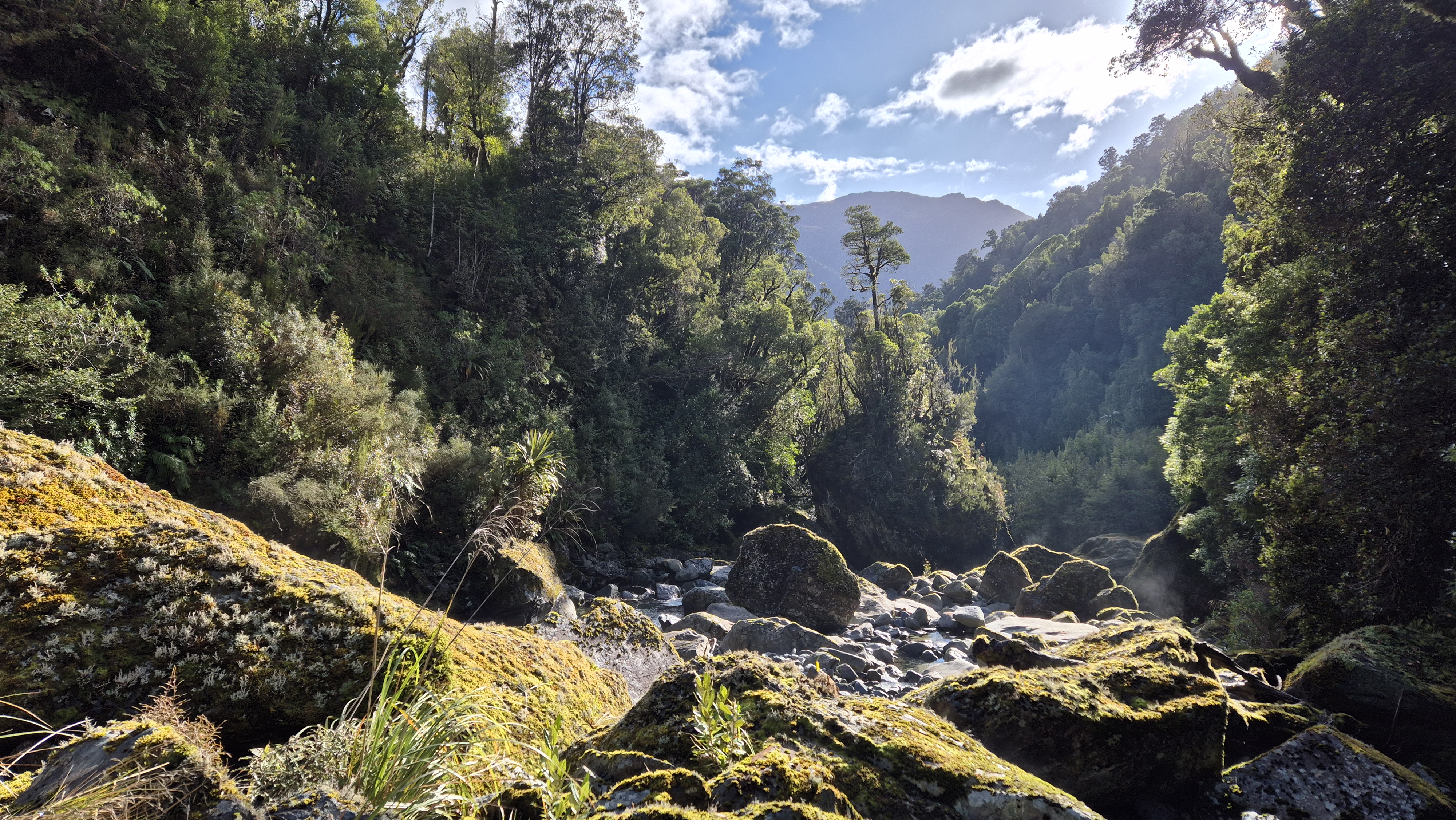
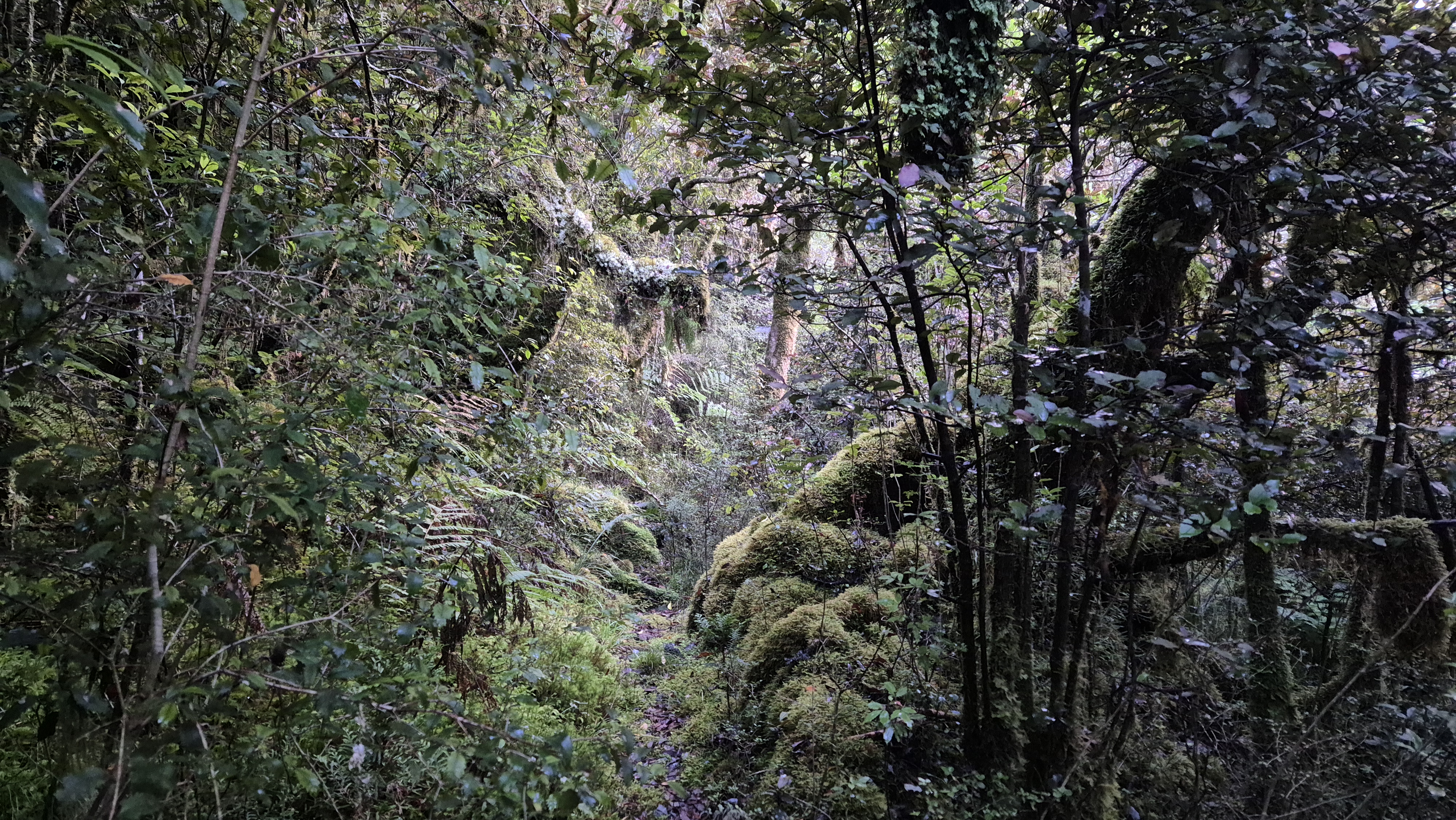
We took a 20-minute break at the bush edge and enjoyed the rest. Rich was getting a bit of a queasy stomach feeling, so we got some electrolytes into him and got going again at 11.05 am. The track led us into the bush, where we crossed a beautiful little stream. From there, the route was rough and overgrown with huge flaxes, thick foliage and bushes that hid all sorts of ground hazards. Thankfully, the odd bit of flagging tape kept us going in the right direction, and we found the occasional cairn.
The section of marked track on the map above Cone Creek turned out to be a mossy corridor of boulders, stunningly beautiful. I was concentrating so much I didn’t think to take many photos. Everything in this ankle-breaking stretch was green and wet. Every step (slide) was painfully slow. I kept at least three points of contact most of the way and did a fair amount of bum sliding. The final stretch was a slippery, muddy slide of dracophyllum leaves.


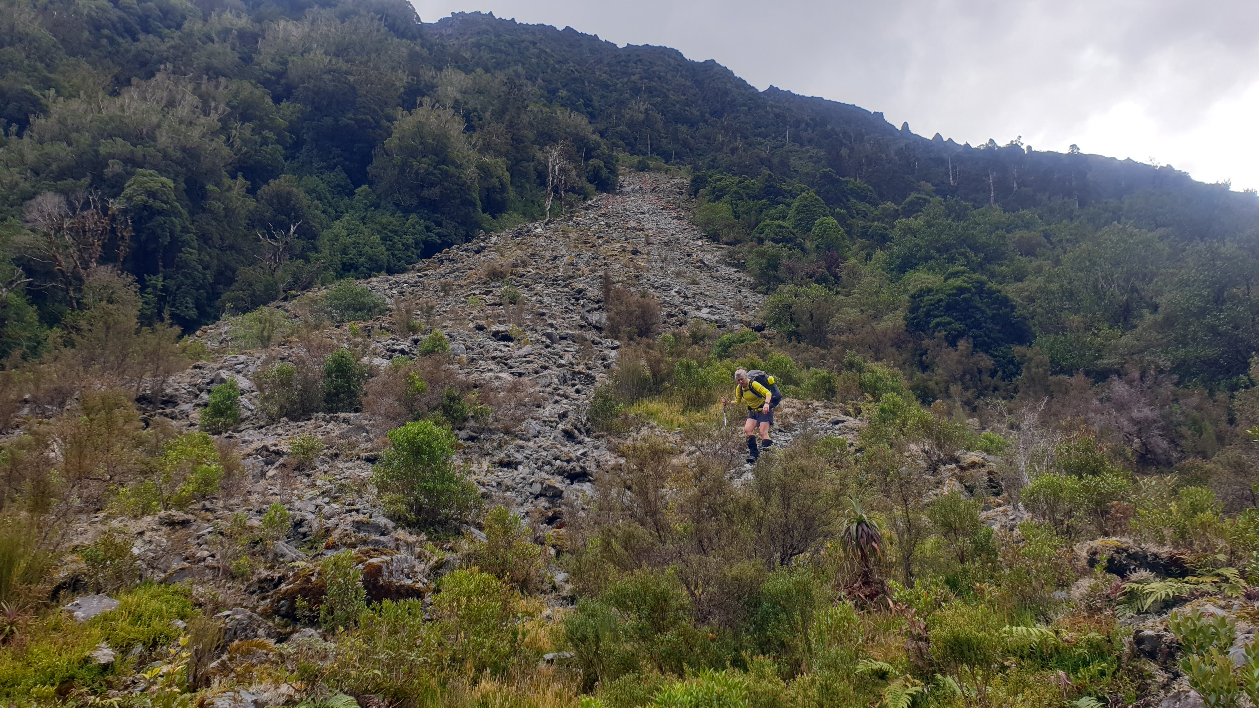
The Scree Slope
We popped out into the open around 11.50 am and began scrambling over boulders that led towards the huge scree slope we’d read about. It was steep and intimidating! A line of four cairns marked the way down towards where we dropped into it, and we could just make out another cairn near the right-hand bend way below.
I took care not to walk directly above Rich, in case I dislodged anything. As we walked across, everything shifted underfoot and moved everything else with it, from the loose stones to rock slabs. I found it extremely unnerving, especially partway down, looking back up to see the looming wall of rock debris above.

We aimed for the more solid-looking left side and slowly got down to the bend. There, it became more stable, and I felt I could move a bit more confidently. Latterly, we crossed to the right, before descending the middle towards a permolat marker at the bottom. I felt quite out of my comfort zone most of the way. At the bottom, we gave each other a congratulatory high five and looked back up. From the bottom, it didn’t look quite so bad.

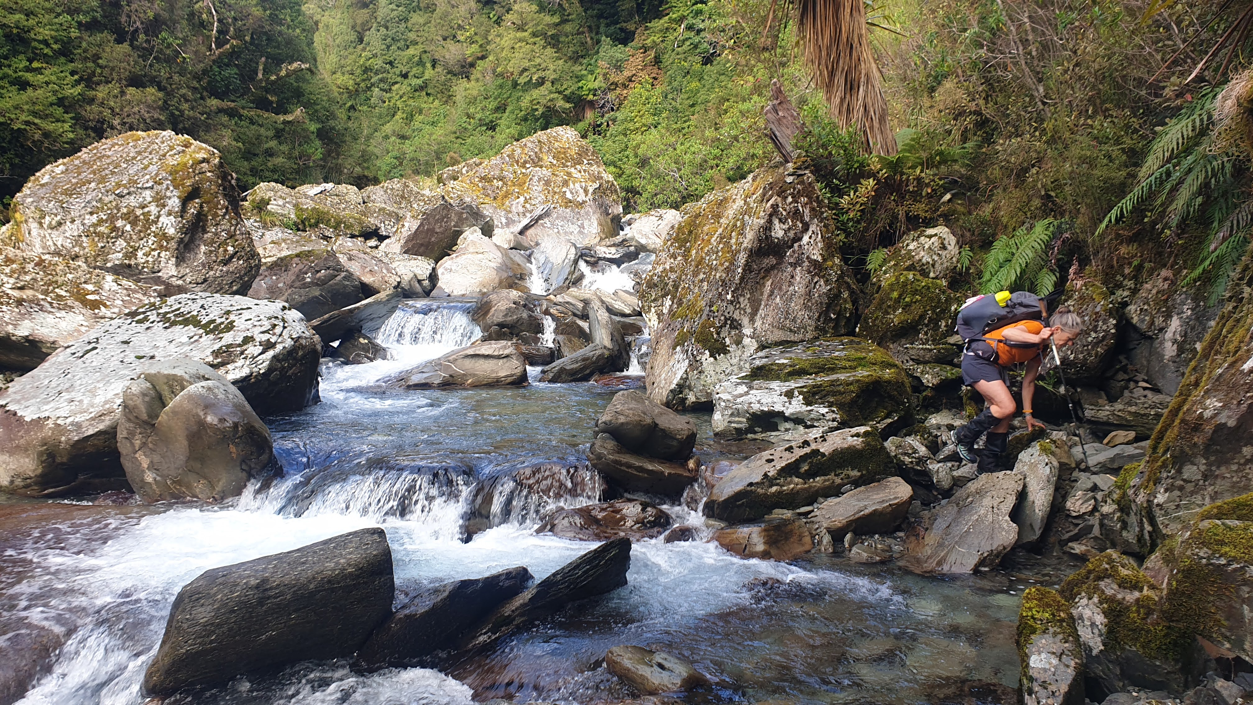
Cone Creek Hut
We followed the permolat markers into the bush and soon came to a small side stream that required a muddy, slippery bumslide down to cross, before arriving at the 6-bed Cone Creek hut. It was 12.50 pm. It had taken me an hour to inch my way down the scree, and we’d made it in 5 hours 10 minutes from Lake Morgan Hut.
By now, Rich had a full-blown dodgy stomach predicament, so we changed our afternoon plans. Our original idea had been to head down Cone Creek and possibly continue to Elizabeth Hut if we were making good time. The backup plan was to camp at the Haupiri River confluence. We knew it would be pretty slow going; we’d read 3 to 4 hours to reach the confluence, even though it only looked like about 5 km on the map.

The thought of a rough, slow section ending with a potential cold night camping along the river somewhere wasn’t ideal, so we made the call to stay put. An afternoon of rest and reading with a proper toilet nearby seemed a much better option. We made a soup, lazed around with books, and took it easy. Check out the Remote Huts Website for more details about Cone Creek Hut.
Day 3 Cone Creek Hut to Haupiri Car Park
Remote Huts time: 5-6h
Wilderness time: 7.5 h
Our time: 8 hr
We woke up at 5 am after an amazing night’s sleep. I’d put in my earplugs when the possums began to creep around outside. Thankfully, Rich was feeling better this morning. We left Cone Creek Hut at around 7.25 am. The journey down Cone Creek to the Haupiri River was even slower than we’d anticipated. Remote Huts suggested it could take fit, experienced trampers around 5–6 hours to reach the road end. Even though we’d generally put ourselves into those categories, it took 8 hours. Much of the track was rough and overgrown, wet, slippery, and slow going, and at times, we backtracked to find the best route. There was plenty of river walking, and I’m not the fastest when it comes to clambering over slippery boulders. We were glad we’d given ourselves the day and hadn’t tried to push through yesterday afternoon.
From Cone Creek Hut
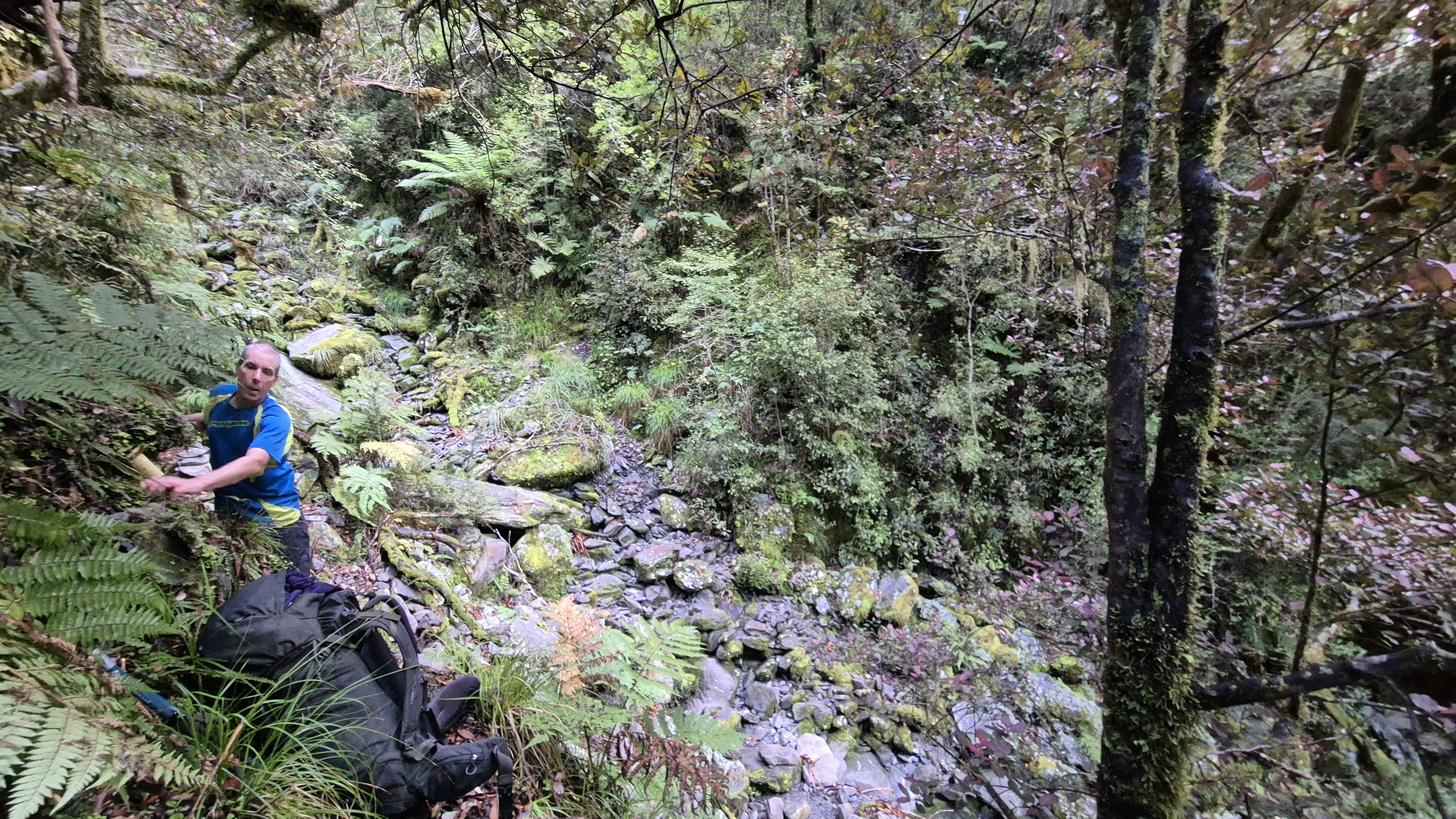
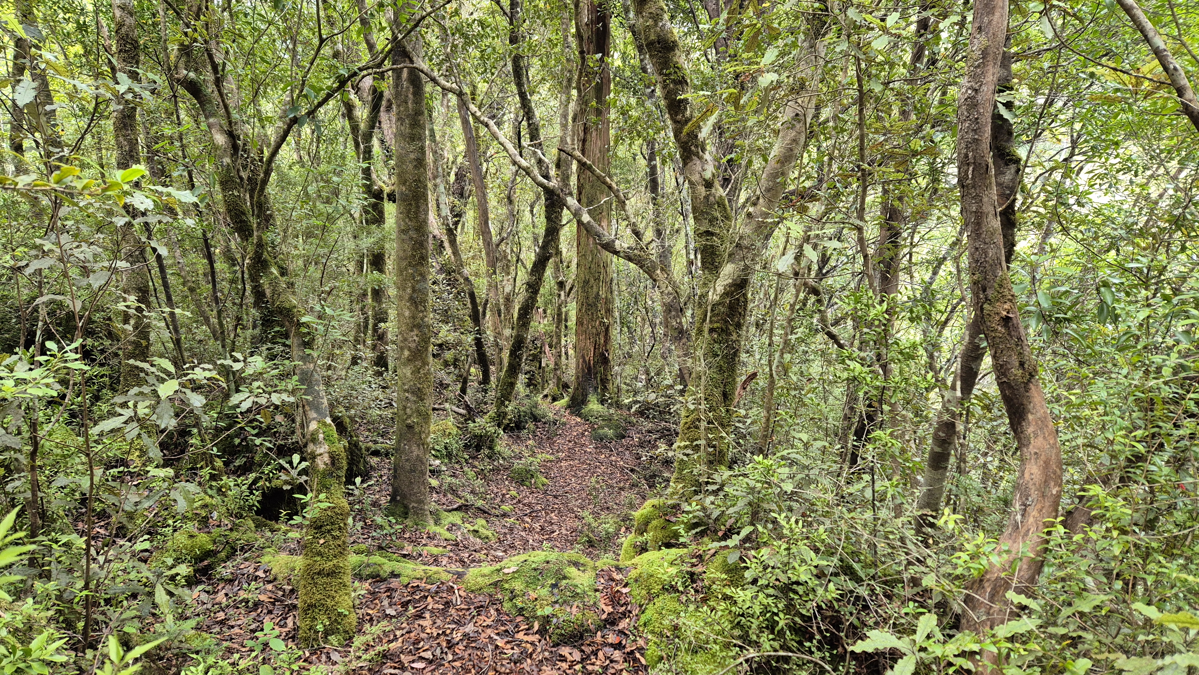
After crossing back over the stream and picking our way across the lower flank of yesterday’s giant scree slope, we found the track downstream. A permolat marker pointed the way into the bush, on what seemed initially and surprisingly, a fairly well-trodden trail. The ground was narrow and slippery in places, but easy enough to follow. About 15 minutes in, we were already taking off the layers.
We travelled above the true left of Cone Creek. It was pleasant walking through the quiet, damp forest. After about half an hour at a significant side creek, there was a tricky drop-off to negotiate, too steep to risk with packs on. We used some cord we’d had in our packs, looping it around small trees to create handholds. At least the climb out had decent roots and branches to grab onto. We’d probably only travelled about a kilometre in the first hour.

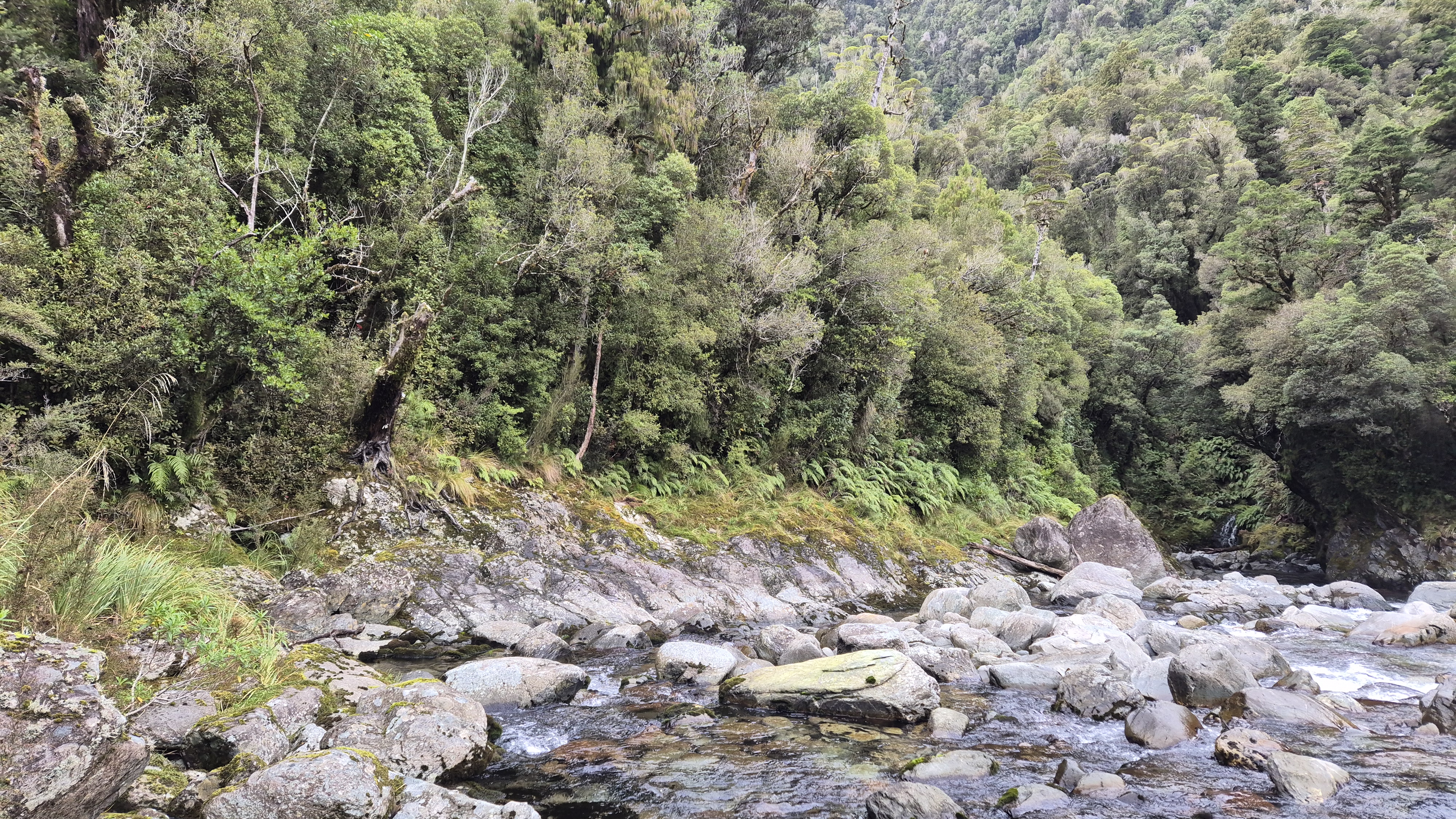
Along Cone Creek
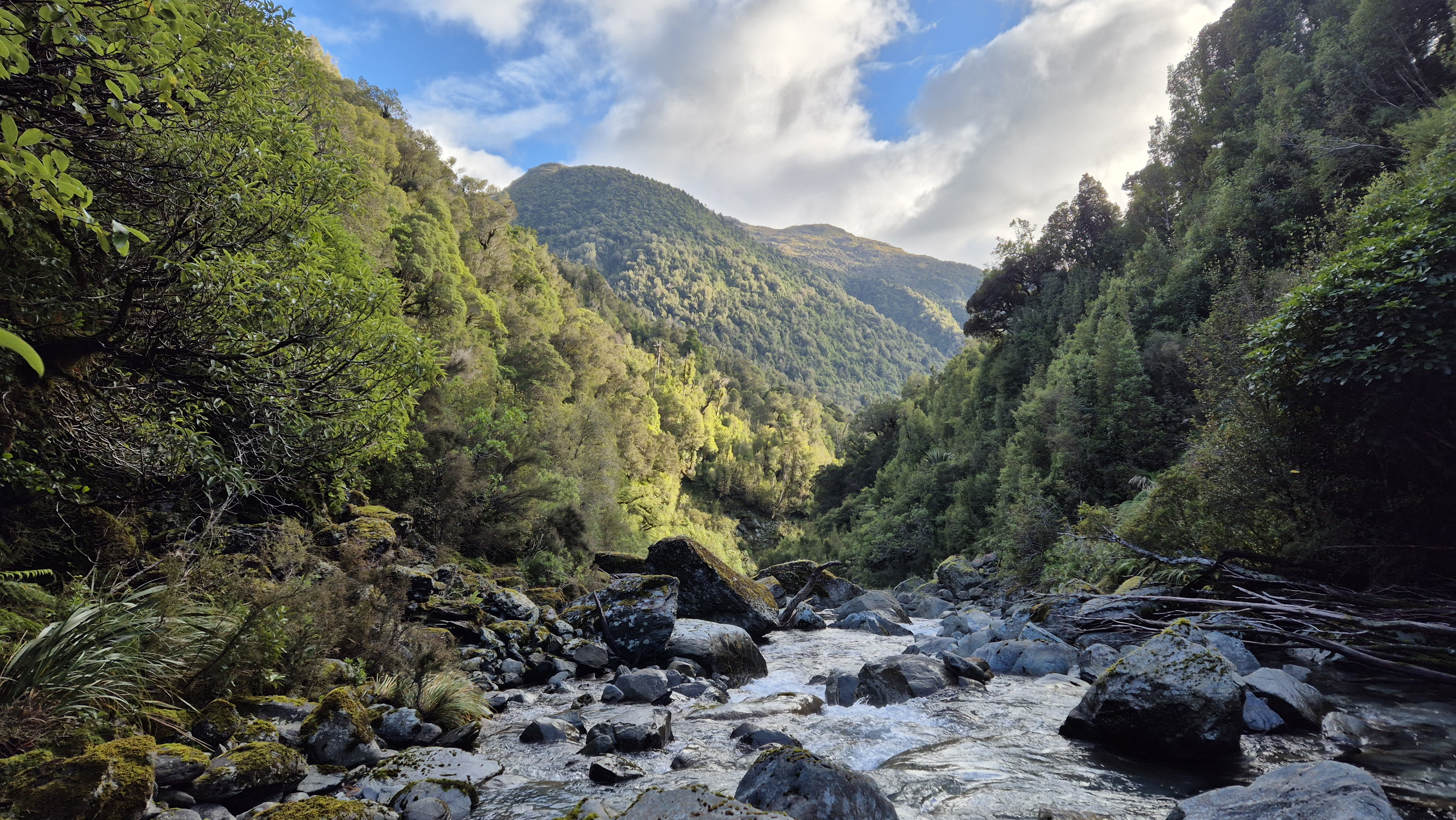
By 9.10 am, we met Cone Creek just over 1.5 km downstream from the hut. We clambered along the river boulders, finding our way down towards the sunlight, and a giant slab of a boulder at the bend. We found the odd cairn along the way. Some sections of the river were pretty swift with deeper pools, and we crossed where necessary, taking our time and ending up back on the true left.
At 10 am, we spotted a tiny piece of permolat indicating where a track went back into the bush, and built a cairn to make it more obvious. The track headed straight up a cliff, with a solid-looking rope attached. Rich went first, we used the rope to haul my pack up, then I scrambled up.
We spent most of the next stretch in the forest with eyes down, admiring all the different coloured mushrooms – what a treat! Spotting plenty of the bright blue werewere-kōkako (Entoloma hochstetteri), the stunning little mushroom that features on the New Zealand $50 note. Turns out it was prime mushroom country; we must have seen at least 30 along the way. Every few steps, there was something new popping out of the leaf litter. Another highlight was hearing a kākā somewhere overhead, its unmistakable call echoing through the bush.

By 10.50 am, we were making a slow, slippery descent back down to the river – a good spot to stop for a proper break. This marked the start of the longer river section on the topo. We’d probably covered about 2.5 km from Cone Creek Hut in three and a half hours and were still only halfway to the Haupiri confluence. With all day ahead of us, we chalked up the Remote Huts timing as aspirational and enjoyed the break. Amazingly, there wasn’t a single sandfly, and we happily basked in the sun until we got back on the move again at 11.25 am.
The Unmarked River Section
Although enjoyable, I was just as slow in the river again on this stretch as we made our way downstream and around the river bend. The valley gradually opened up around us. An hour later, at around 12.35 pm, we crossed to the true right to avoid a rocky cliff, and were bashing through the undergrowth for a look at what lay ahead around a narrow bend, when we noticed a piece of permolat on the rocky bank opposite, which we’d crossed to avoid.

After retreating, we crossed back to the true left and, twenty minutes later, scrambled up the rocky bank. Not only did this give us a great view back upstream, but it also led to the best part of the track yet. Early on, we walked between walls of blue mushrooms – a magical little section. Later, it looked like someone had been in and recently tidied up some of the track. At 1.50 pm, we arrived at the Haupiri River (around 6.5 hours from leaving Cone Creek hut).

Haupiri River Confluence
We’d read about the hot pool near the confluence and had a bit of back-and-forth about where they were. We could smell it, so we knew we were close – but after a very half-arsed search, we decided we couldn’t be bothered and saved it for a future trip to Elizabeth Hut. Instead, we settled in for a break. If you’re keen to find the pools, check out more details on the NZ Hot Pools website.

Haupiri River
We heaved ourselves up at 2.15 pm and followed the track through the bush, heading down the Haupiri River. Within five minutes, we were bashing through head-high grasses, picking our way along animal trails on the grassy river terraces. It made a nice change to be out in the open.

About an hour later, we spotted orange flagging tape leading back into the bush on the true left. From there, we followed a poled 4WD track with some gigantic puddles. At 3.55 pm, we popped out at the bottom of the Brian O’Lyn route and, looking up at it from this angle, realised just how steep it was!

By 4.30 pm, we were back at the car, eight hours from Cone Creek Hut, grazed, filthy, and absolutely stoked. Rich handed me a zero beer he’d stashed as we reflected on our unforgettable three days; never has a slightly warm can tasted so good. The Lake Morgan Cone Creek loop had been a proper West Coast adventure. Steep, rough, slow and beautiful – sometimes hard work, but with big rewards. One for experienced trampers, and well worth the effort.

Click the links below for more walks on the West Coast
Buckland Peaks, Westport – overnight
Inland Pack Track – overnight
Mt Watson Route to Ces Clarke Hut, Paparoas – overnight
Robinson Christabel Circuit – 5 days, 4 nights
Wheel Creek Hut – overnight
Point Elizabeth Walkway, Greymouth – half-day walk
Camp Creek to Mt Alexander, nr Lake Brunner – 3 days, 2 nights
Cedar Flat and Adventure biv – overnight
Roberts Point Track Franz Josef – day walk
Alex Knob Track, Franz Josef – day walk
Okarito Coastal Track and Three Mile – half-day walk
Stafford Bay Route, Jackson’s Bay – day walk
Always great information and photos, Jules. I look forward to your blog. Lotsa thanks 🙂