
Buckland Peaks
You have to make the most of the ‘good weather weekends’ during a New Zealand Winter. Even though the days are short, we are spoilt for mountain tramping adventures near Nelson. We made the trip up to the Buckland Peaks, at the Northern tip of the Paparoa Range (behind Westport) over the ‘shortest day’ weekend. We camped on the tops and spent a few hours on the second day exploring the peaks; a grassy undulating wonderland of rockfalls, giant boulders, and tarns. It was one of those trips which leaves you feeling like you just enjoyed a week-long break, not just a weekender.

For more information, check out the DOC information on Buckland Peaks.
Getting There Buckland Peaks
I was ready on time for a change – no last-minute faffing or anything (!) and we left Nelson at 8 am. Heading South on the SH6 towards Murchison and the West Coast, we stopped in at the legendary Wakefield bakery. It’s a shame we always pass it so soon after breakfast, because for some reason I have a thing about not allowing myself to have a pie immediately after breakfast, and the pies look amazing. But on this occasion, I allowed myself a mini (two-bites) savoury mince meat pie. Packed with meat, and just the right amount of rich dark gravy. the pastry was delicious. We also got a huge cheese and bacon double-scroll (finished by Inangahua) and a raisin and custard danish which we managed to save for the afternoon.
The journey itself was a steady three-hour drive through a foggy Buller gorge. We turned left into Bucklands Peak Road four-wheel drive track just shortly before the SH6 becomes the 67, about six km before Westport. There were already four vehicles in the car park – not surprising given it was 11 am.
That Four-Wheel Drive Track
One of my work colleagues had mentioned that he hadn’t walked Buckland Peaks yet because it began with a slightly tedious hour-long walk down a mostly very straight four-wheel drive track. He was absolutely right, but the sun had come out, and we were glad that the right of way (through someone’s private property) existed at all. It gave us a good look at what our weekend was shaping up to be. We were heading up to just beyond the tussock tops poking up above the forest to the centre-right.

Westport had received a deluge of rain for most of the week, so in the dips of the undulating track, there were some very large, very boggy puddles to cross. An hour later at midday, we were at the bottom of the Buckland Peaks track.
Buckland Peaks Track
The Buckland Peaks Track is a solid climb taking you from around 300m elevation to around 1160m. If like us, you want to bag the hut, then you then have to drop down about 100m into a basin, then back up to the tops again. We camped at the 1175m high point.
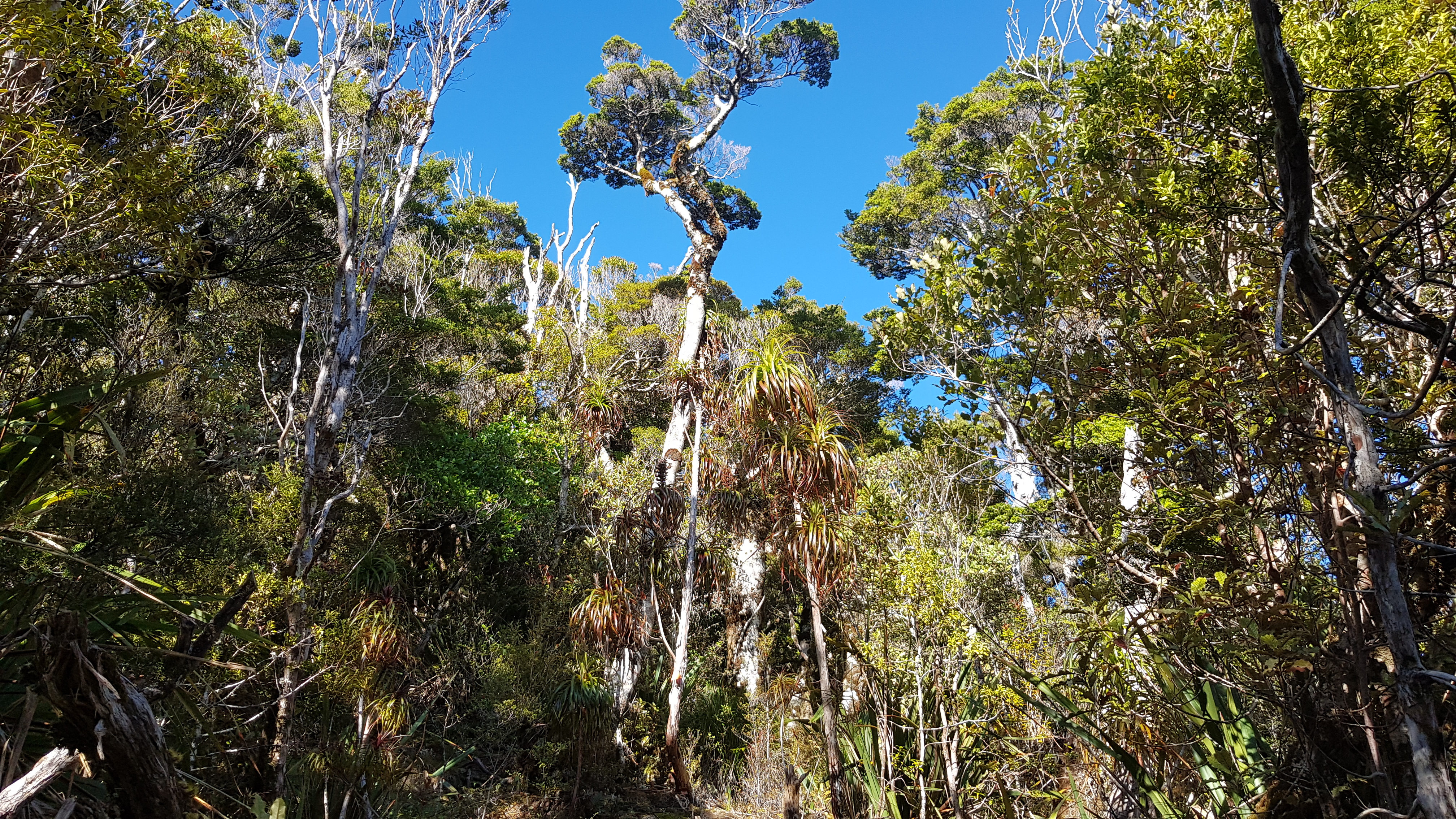
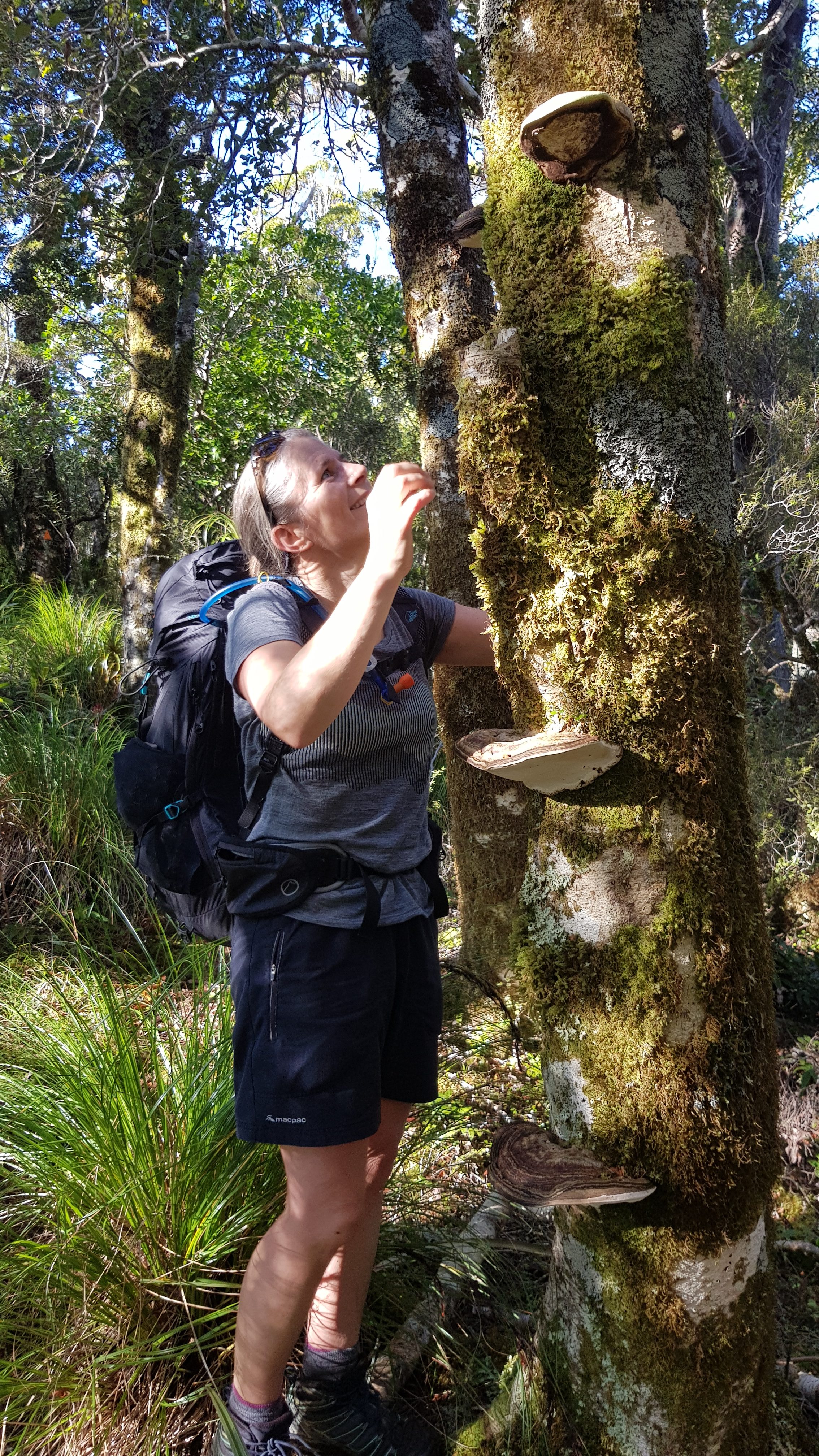
The track began as a bit of a slippery, boggy climb through lots of tall grasses and manuka. It developed from there into a climb-of-many-zones with lots of variety in the canopy and on the ground. Sadly due to my still extremely limited knowledge of New Zealand flora, which I’m rather embarrassed about, I don’t recognise most of the trees except beech forest, and my favourite: The Lancewood – “two trees for the price of one” – an amazing tree which is a silly slip of a thing which has no branches, and spindly helicopter-blade leaves off the main trunk for years… until it becomes an actual tree. Then there’s the Dracophllym which is perfect from the beginning and has leaves which look like grass, which curl to shape into lovely little spheres.
The track was fairly straightforward, easy to follow and wasn’t too steep. It followed a ridgeline all the way up, so wasn’t too wet either. There was a bit of treefall half way, but nothing serious.

Halfway House
Half way was marked by a small, flat clearing and a wooden sign nailed to a tree. We must have reached it at about 1.30 pm. As we were coming up to half way we had just overtaken a group of people, and another group were taking advantage of the clearing to sit and have their lunch.
We (and everyone else) wondered what the sleeping arrangements would be like at the hut. As usual, we carried our tent and let the groups know that we planned to camp on the tops, but Buckland Peaks hut was only a six-bedder and we had just overtaken around 8 people…
We were pretty hungry, but we didn’t want to get into one of those awkward overtaking-catchup-overtaking scenarios, so we carried on up.
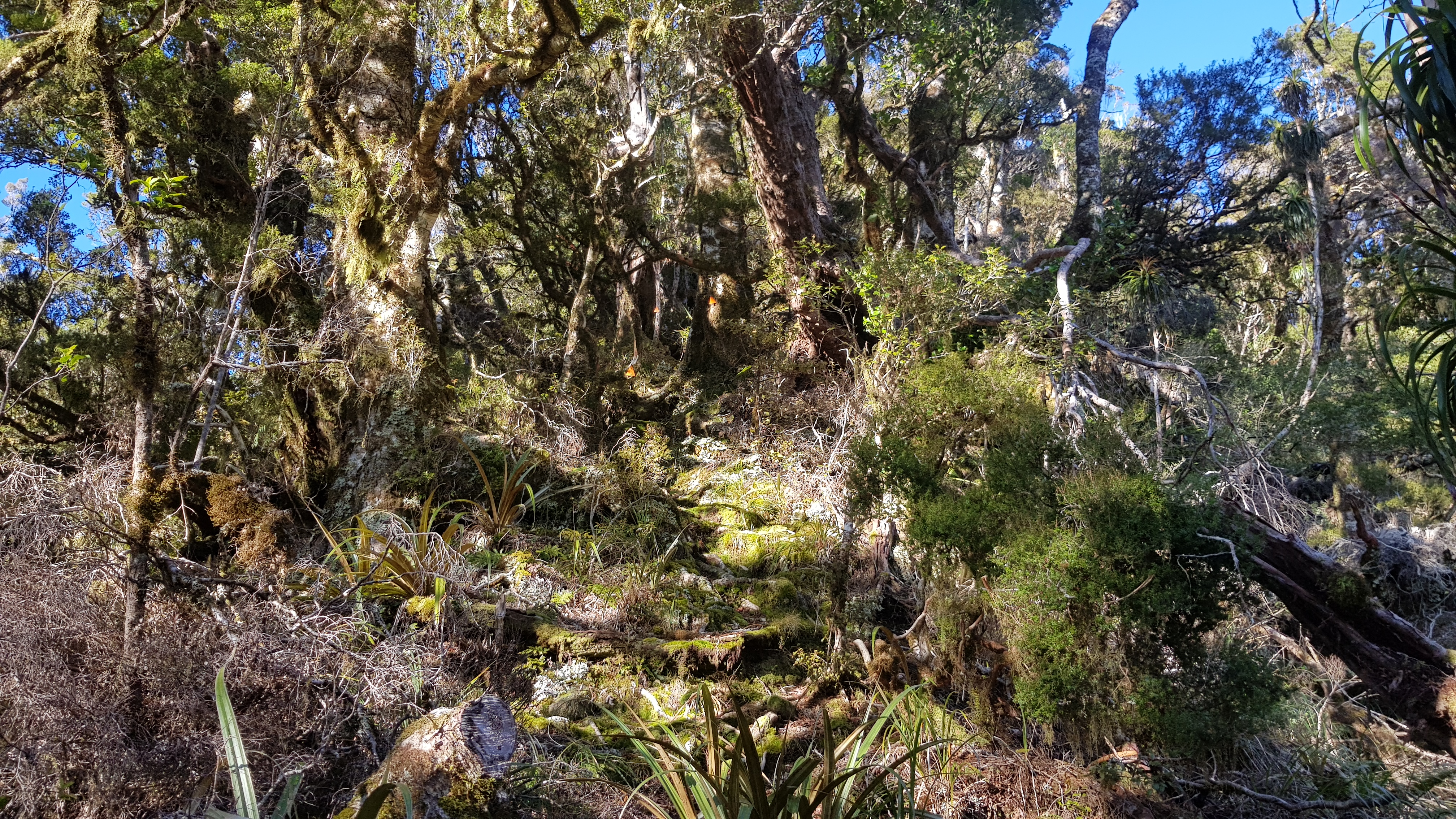
The second half of the climb was steeper and mostly through beautiful beech forest. Not long after half way there was a particularly lovely section of goblin forest.

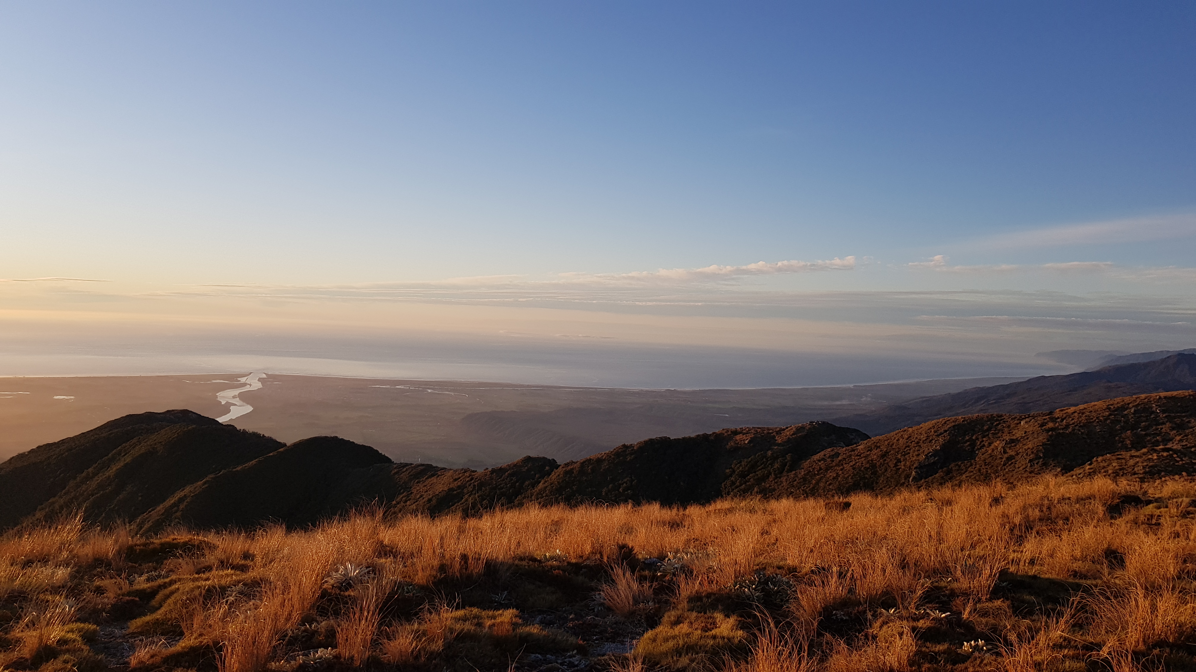
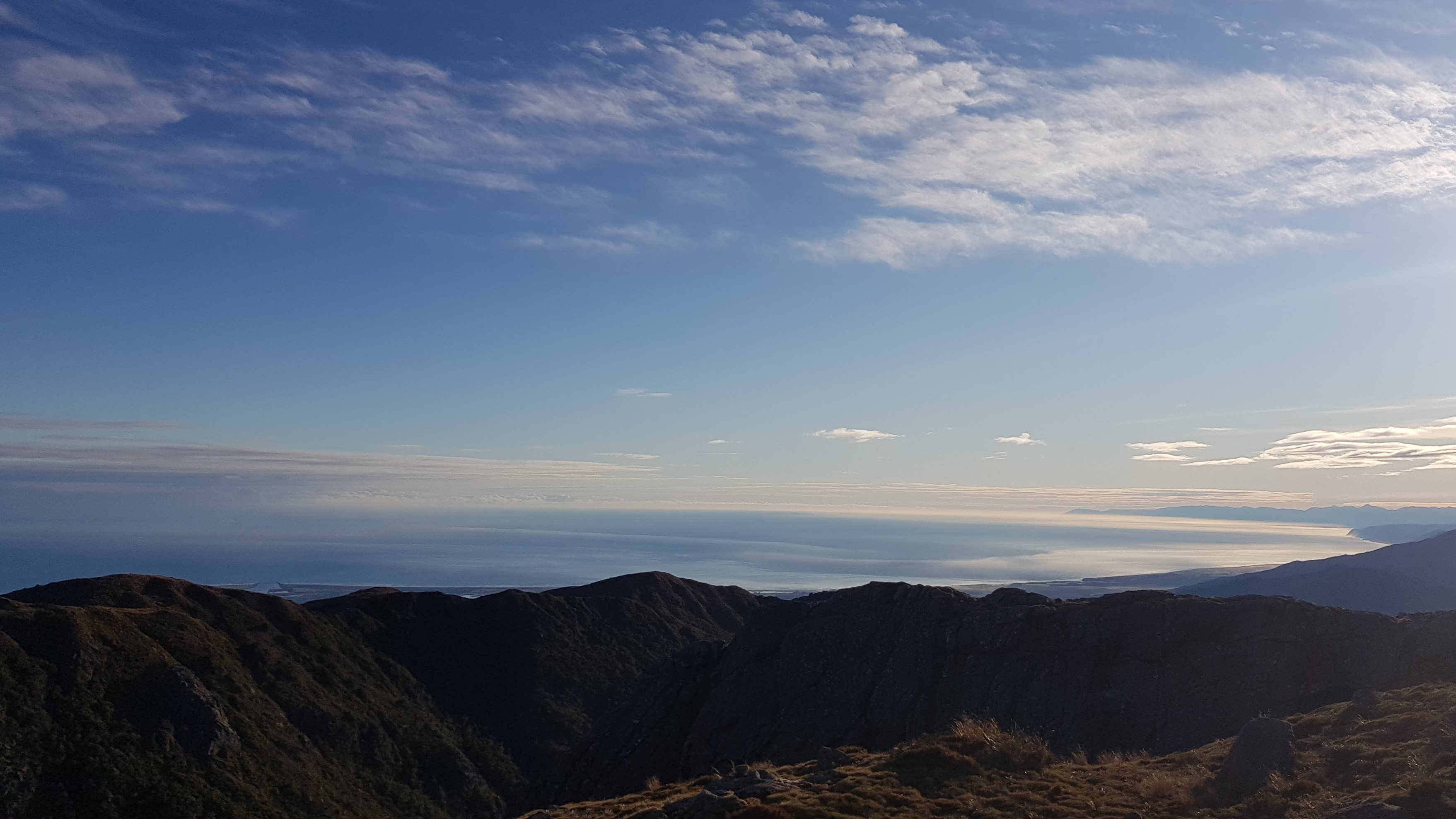
We came out of the treeline at 2.30pm. There wasn’t a cloud in the sky, and the views down the coast were incredible.


As we came out of the tree line we chatted with a very nice local gentleman who advised us of a couple of good camp spots – on the knobbly ridge above and to the right of the basin where the hut was, and also up on the Buckland Peaks. We wanted to get as far up into the peaks as we could, but first, we had to bag the hut.
Buckland Peaks hut
Buckland Peak hut sits in the basin approx 100m below the track. We continued along the ridge for 20 minutes or so before dropping down to it. We reached the hut around 3.30 pm, and luckily there was a little sun left at the picnic table. The 6-bed hut had mattresses but no fireplace. It was spotlessly clean. The chap we passed had also just fixed the tap on the water tank, so we filled up our vessels for an overnight stay on the tops, and went on our way again.

We were back up onto the ridge by 4 pm, having followed a water pipe behind the hut which led to an alternative way up. We missed a section of the ridgeline, but we would walk back that way tomorrow.

Camping on the Tops
The sun was getting low in the sky, and we were pretty tired. We reached the high point of the ridge at 1175m just before the big dip down/up to the main section of rocky tops, and found the perfect camp spot just off the track, with all the necessary ingredients for a great night – flat, slightly sheltered, large rocks for sitting / cooking shelter and 360-degree mountain and coastal views – perfect for sunset and sunrise.
We made quick work of setting the tent up as we knew it would be getting dark in about an hour.

Once the tent was up we went exploring to the Eastern side of the ridge (around the basin the hut was sitting in). Across the basin, we saw the other groups arrive and set up their tents on the Western ridge opposite. No one was using the hut after all. The West coast delivered us a spectacular sunset and covered the mountain in a warm golden glow.

We hurried back to the tent to get dinner on before dark, then enjoyed an evening playing a few rounds of Yahtzee in the tent. When dark fell, it got a bit chilly and the wind got up considerably and buffeted the tent around a bit. It was calm again by midnight.
Day 2 – Exploring Buckland Peaks
We didn’t really see much point in getting up too early – today being the shortest day of the year. We rose at around 7.30am before the sun poked its head over the mountains. The sunrise was equally as incredible as the sunset, illuminating the foggy twists and turns of the mighty Buller River. We were both completely wrong in our assumption of where the sun would come up (given where it had set) as we didn’t account for it being quite so far North and therefore making a much smaller arc in mid-Winter.


Our enjoyment of breakfast was slightly diminished by the fact that I had forgotten to bring milk powder for the muesli. Instead, we used a sachet of ‘flat white’ coffee, which was neither brilliant nor too bad. At around 9 am we zipped the gear in the tent and headed up to the Buckland Peaks. I say up – it started with a 60m dip down then a wonderful climb of around 200m up to the main tops.


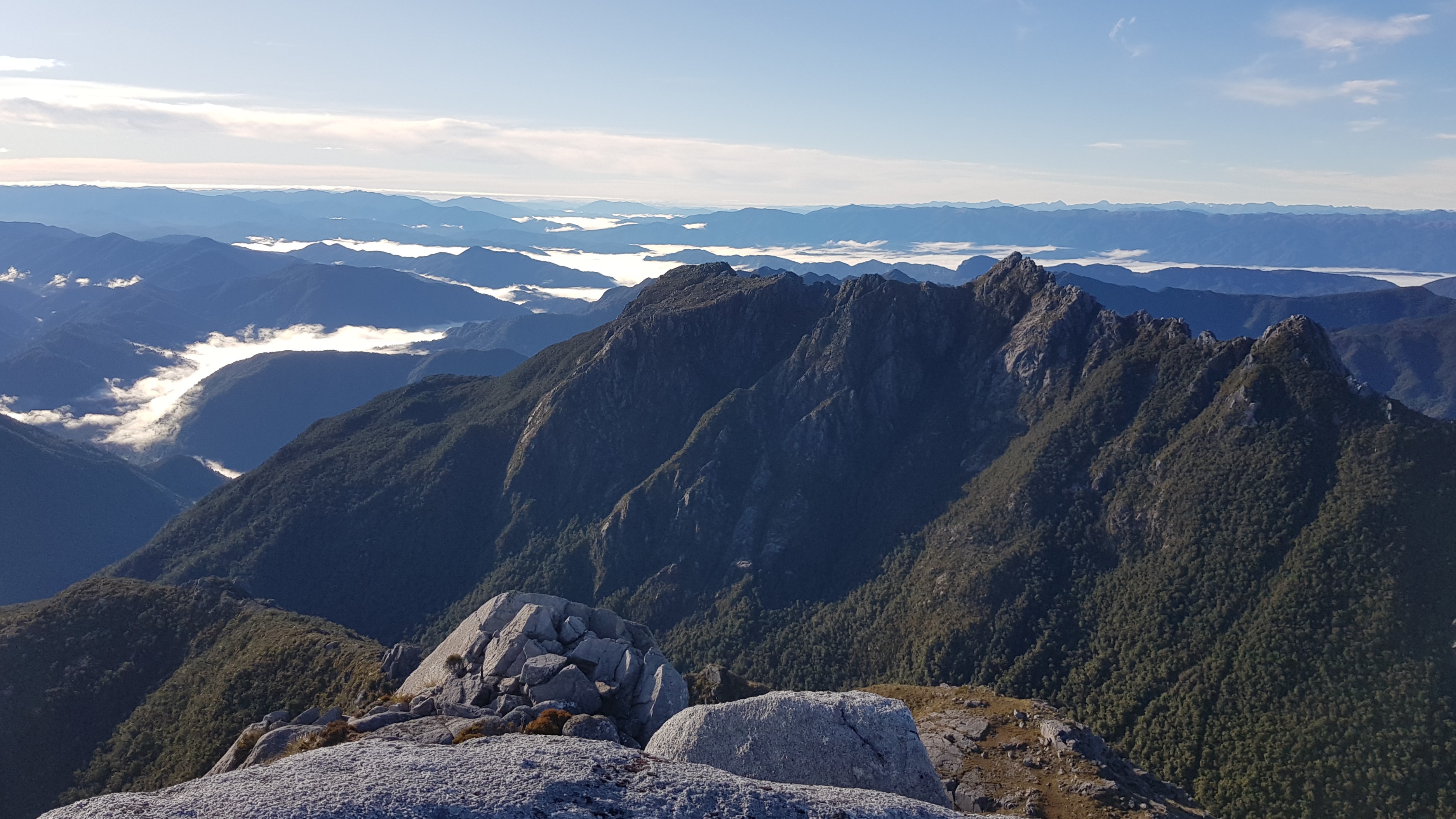
This morning’s adventure was everything I love about tramping. Sunshine, an open plateau, lots of potential for easy exploration and fantastic views. This was my first trip where I had seen the jagged and exposed Paparoa Range at height. Beyond that, we could see a few of the snow-capped peaks of the Southern Alps including Aoraki/Mount Cook (as pointed out to us by the local we passed yesterday).
We explored the tops for a few hours, peering over huge drops, marvelling at precipitous rock stacks, hopping and climbing over boulders and poking at the ice in the little tarns.


On the Plateau
As we were fairly short on time, we headed over the plateau to the high point for the views to the South, before being enticed over to the high points towards the South East which essentially joined the Buckland Peaks to the Paparoa range. There was a well-trodden trail across.


At around 10.30 am we started to slowly make our way back to the tent. On the return journey, we took the time to notice the small things; brilliant white seams of quartz in the rock, the patterns in the vetegable sheep and the number of alpine flowers around – no doubt it would be even more beautiful up here in summer when they bloom.


Heading back down
We were back at the tent by about 11.15 am. I busied myself in the kitchen as Rich packed down the tent, and we enjoyed a cup of soup in the sun before heading back across the ridgeline. We left our camp spot at around midday. I was glad we had bagged the hut yesterday – it was lovely to wander over the full length of the ridge back to the track. We had met one of the other groups just as we were leaving the tops, and we passed their camp just off the trail on the Western side of the basin. They too were exploring the tops before heading out later today.
Within about 25 minutes we were back in the forest and making the knee-testing descent back down the mountain. The midday sun filtered into the forest giving the leaves, mosses and lichens an ice-green hue – unfortunately pretty difficult to capture on my phone camera.


On the return journey, we stopped for a break at the half way point around 1.30 pm and decided between ourselves that it was probably more like the “60/40” point – the top 60% seemed much longer (coming up and down) than the bottom 40%.
Food for thought…
Later, we had a quick hello-in-passing with a party of four coming up the mountain who were on a late day walk and were hoping to reach the top. We didn’t check our watches right then, but it was around 3 pm – at least an hour had passed since we finished lunch. We also didn’t realise that we were just a minute away from the bottom of the mountain.
It was one of those times where upon reflection, we wished we’d checked our watch said everything differently. In two hours it would be nearly dark. We knew they had at least one head torch, but only one of them had a backpack. To make ourselves feel better we ascertained they would at least see the half way sign in an hour, meet the other group coming down, and know by then that they weren’t likely to make it to the top. I guess there’s a fine line between the social awkwardness of sh*tting on someone else’s adventure plans, and/or giving them more information to make an informed decision. We realised what we should have done.
The final hour back along the four-wheel drive track passed quickly, and it was nice to be in the sun again. We reached the car at 4 pm.
A Great Weekend Adventure
Buckland Peaks makes an excellent weekend away, and the three-hour drive each way from Nelson and the one-hour walk along the four-wheel drive track really wasn’t too bad at all. We were really glad we had squeezed in a few hours on the tops this morning, and in the summer there would be a lot more potential for exploring. We will remember this trip as a very special Mid-Winter adventure.
Click the links below for some of my other walks on the west coast.
Myra’s Track to Mt William, Westport – day walk
Inland Pack Track, Punakaiki – overnight
Mt Brown hut, Kaniere – overnight
Alex Knob Track, Franz Josef – day walk
Roberts Point Track, Franz Josef – day walk
Camp Creek to Mt Alexander, Brunner – overnight
Stafford Bay hut – day walk (or overnight)