Lake Rotoroa and Mt Misery
The trip to Lake Rotoroa and Mt Misery was our first adventure in a couple of months – so we made it a good one! The aim of the weekend was to kayak the length of Lake Rotoroa 14.2 Km (8.8 mi), then walk up to Mt Misery hut. The hut sits at 1550m / 5085 feet with an elevation gain of around 1100m / 3607 feet over just 2.5 Kms. We didn’t fancy hauling our tramping packs all the way up Mt Misery, so we overnighted at D’Urville hut. Saturday was a big one – with the kayak and hike up and down the mountain, and Sunday was less demanding, with the kayak back.
Getting there Lake Rotoroa and Mt Misery
Lake Rotoroa is about 1.5 hours to the South of Nelson off the SH6. Pass the 63 to St Arnaud and continue on a short distance to the turnoff at Gowanbridge. Head up the Gowan Valley for approx 12Kms to Rotoroa. There is plenty of parking at the lake, a campsite (which we didn’t visit), and a picture-perfect jetty.
Early Start
I set the alarm for 5 am. Outside the ground was thick with frost, and we made a hot breakfast to warm ourselves up. We got going at 6.30 am and stopped in at the superb Wakefield Bakery. We bought a mini savoury pie each (for now) and a bacon and cheese double scroll for later. The sun was rising in completely clear skies, and as we drove down we could see a little snow remained on the Travers range. We couldn’t have asked for a better day.
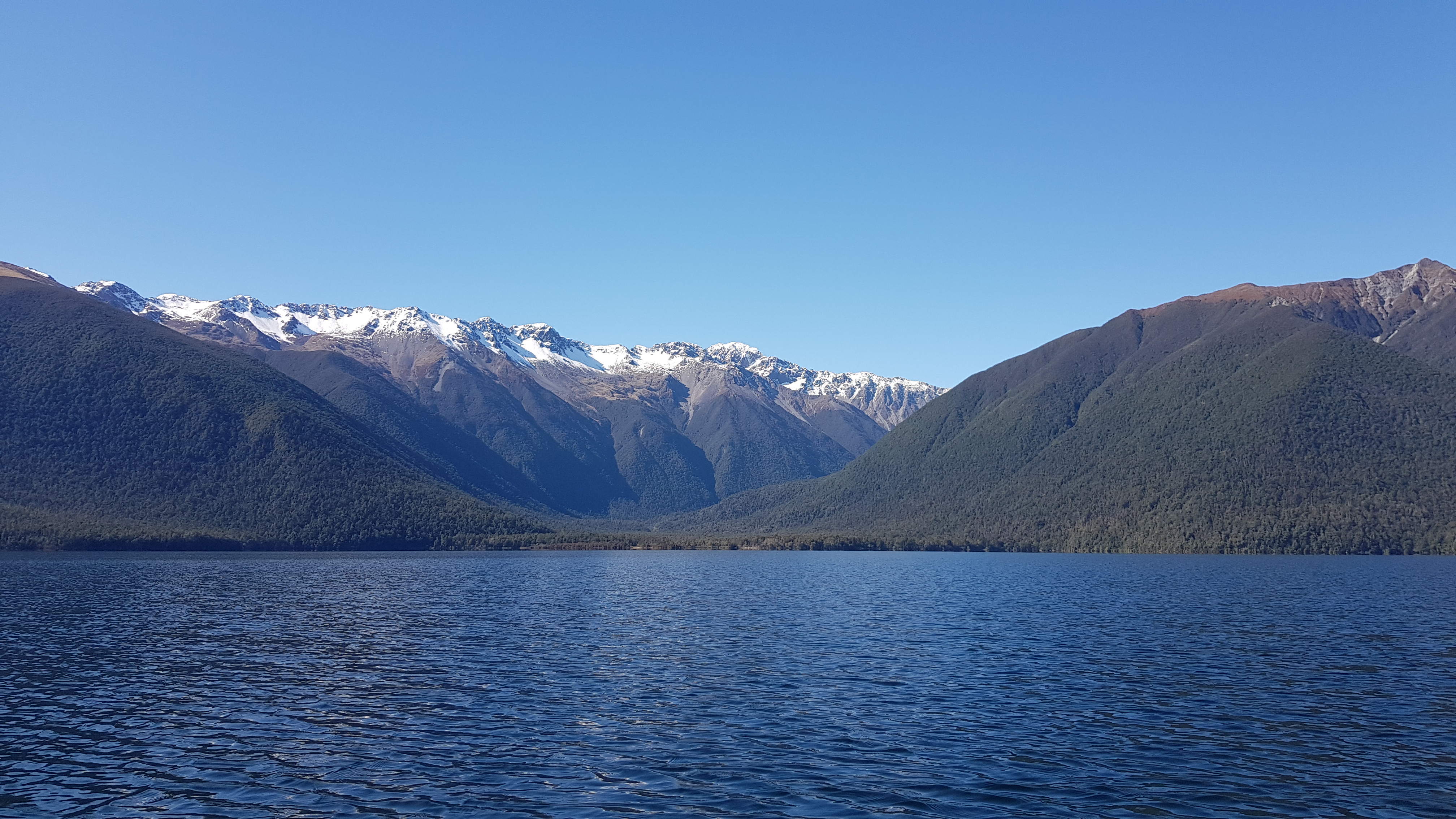
We arrived at the lake at 8 am. This was my first time to Lake Rotoroa and like it’s sister Lake Rotoiti to the East, it didn’t disappoint. The water was clear, and the views incredible. The Travers range was dusted with snow but Mt Misery to the left/West wasn’t. A couple of hardy camper vanners arrived to have their breakfast with a view, and apart from that, were the only ones there.

Lake Rotoroa
It was freezing! As we unloaded the car and loaded the kayak, our fingers became colder and slower. I walked the frosty jetty to warm up in the sun and see if I could spot any eels, but there weren’t any.
By about 8.40 am we were ready to leave. The paddle was amazing. There was hardly a ripple on the crystal clear water and from the lake bed, we could see fingers of green plants reaching up to catch the sunlight. Our fingers were numb, so every few minutes we stopped to blow on them to warn them up. After about thirty minutes they tingled back into life again.


It took us about two and a half hours to paddle 14 or so Km the length of the lake. We kept close to the Western shore and made numerous little stops to gently float over huge submerged trees and investigate little side streams and beaches.


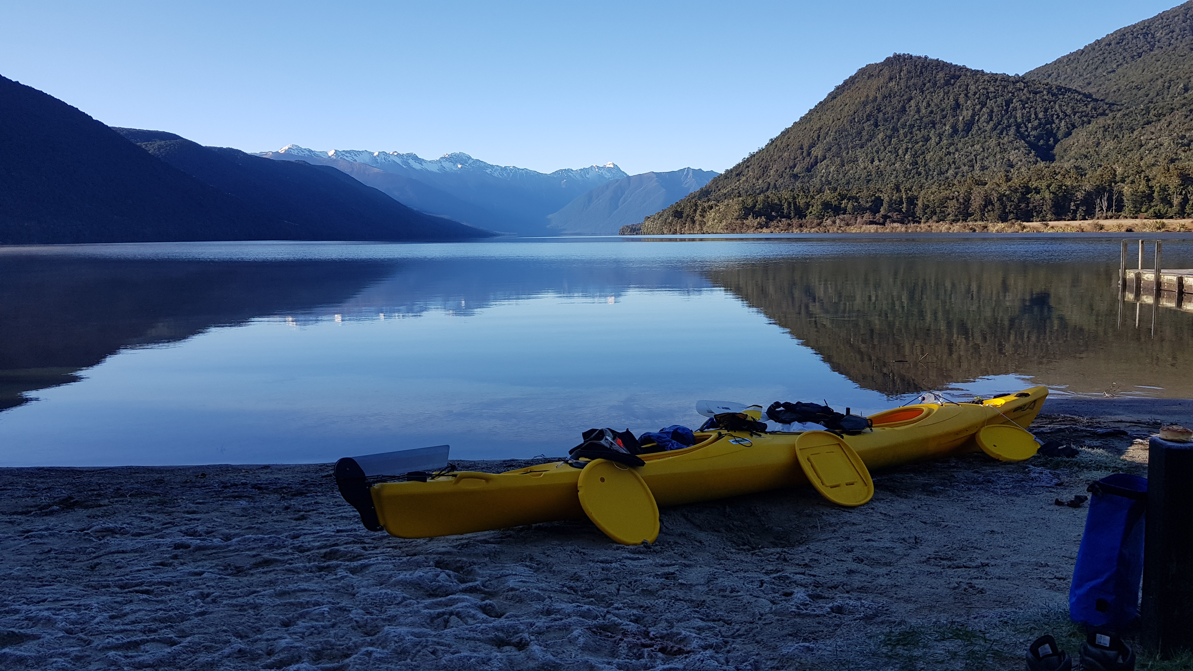
We floated onto the tiny beach by D’Urville hut at about 10.30 am.
D’Urville Hut
D’Urville hut is a ten-bed beauty. It was clean and spacious with two-level platform beds (rather than the individual bunks). There was firewood, toilet paper (!!) and the grass had just been cut. Wow! Our hut buddies (who we later met as they were coming down and we, going up Mt Misery) were two dads-with-kids who had travelled out on their boat for an adventure weekend. We threw our stuff on a couple of top bunks.
Despite breakfast and a mini savoury pie, we were pretty hungry after the paddle. We broke out the bacon and cheese scroll and wandered down to the jetty to bask in the sun. We weren’t the only ones. There were numerous eels swimming around the jetty – many of which were huge!


We had a mountain to climb, so we headed back to the kayak and paddled for ten minutes or so via the mouth of the D’Urville river around to another small jetty, at the start of the track up to Mt Misery. We dragged the kayak onto the little beach, got changed into our tramping gear and headed off.
Mt Misery Track
The track up to Mt Misery hut according to the signage, takes three hours (someone had scratched four). We started walking at around midday. It took us about two and a half hours with our day packs. The climb is roughly 1100m elevation over 2.5 Kms. It was certainly a solid climb. Thankfully, you ease into it, with the first 750m or so gently climbing around 100m to get your legs broken in for the rest of it… which was steep!
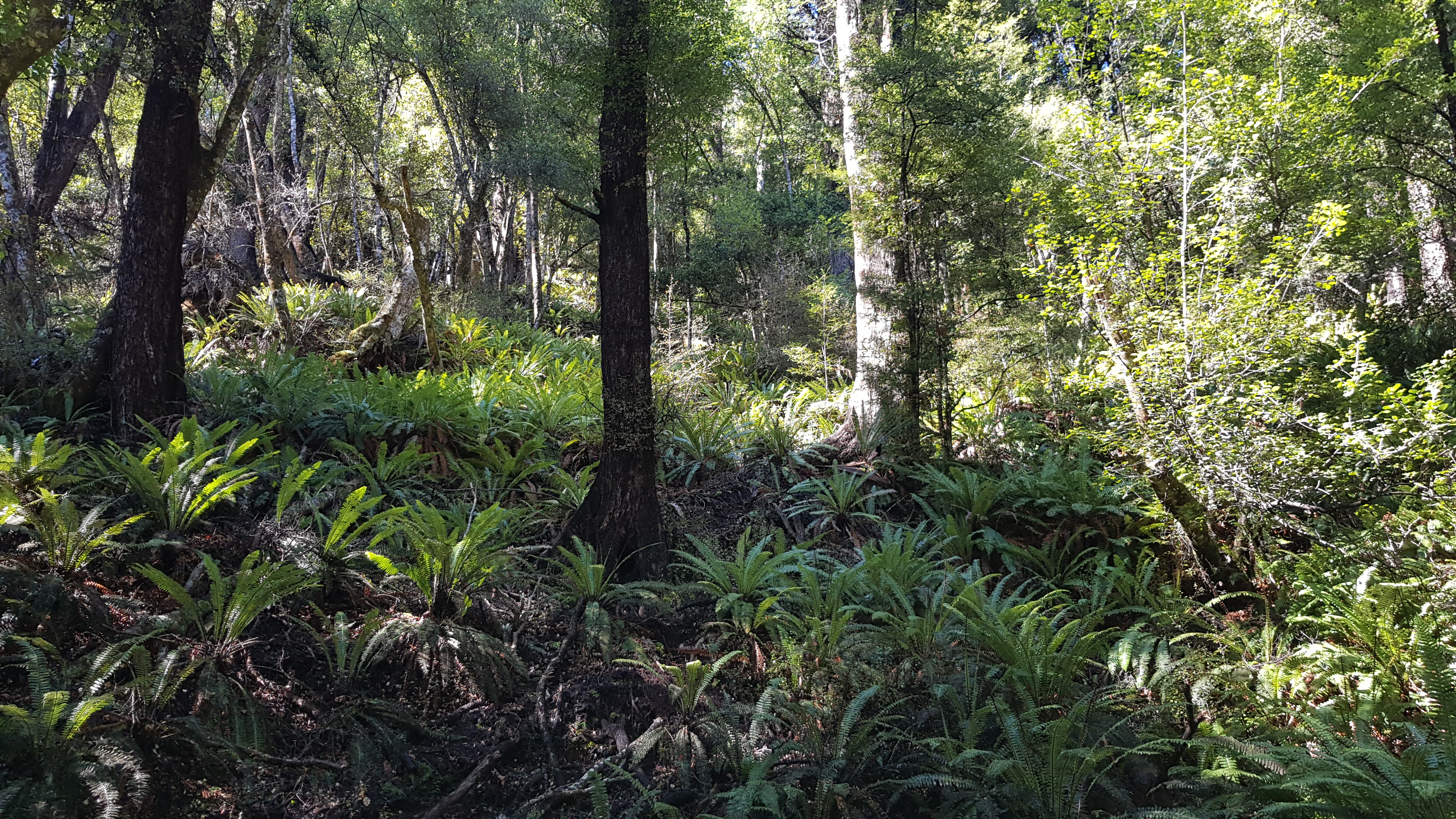
The track itself, apart from being steep, was wonderful. There was a nice variety of zones – the crown ferns, the big beech trees, the little beech trees, the trees with beards (lichen). The track was in really good shape and wasn’t very muddy. The only really slippery parts were where black sooty mould had grown over some trees and across the ground.


Usually, the small beard trees signal that you’re about to pop out onto the open tops, but in this occasion, there was a very brief respite from the climb before it entered the beech forest again. Turns out there was 200m vertical yet to climb. The ground became rockier underfoot and we knew we must be nearly there… nearly there… nearly there… We met and chatted with our hut buddies, who were on their way down.
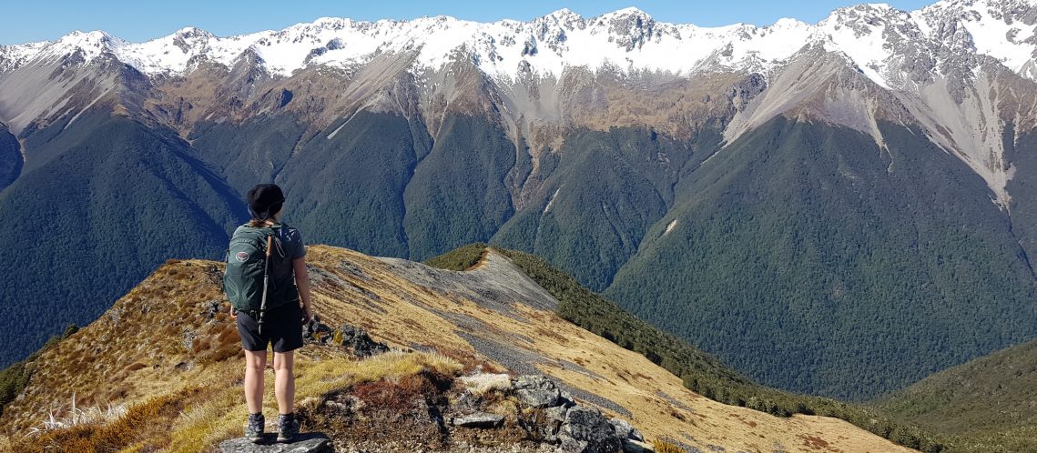
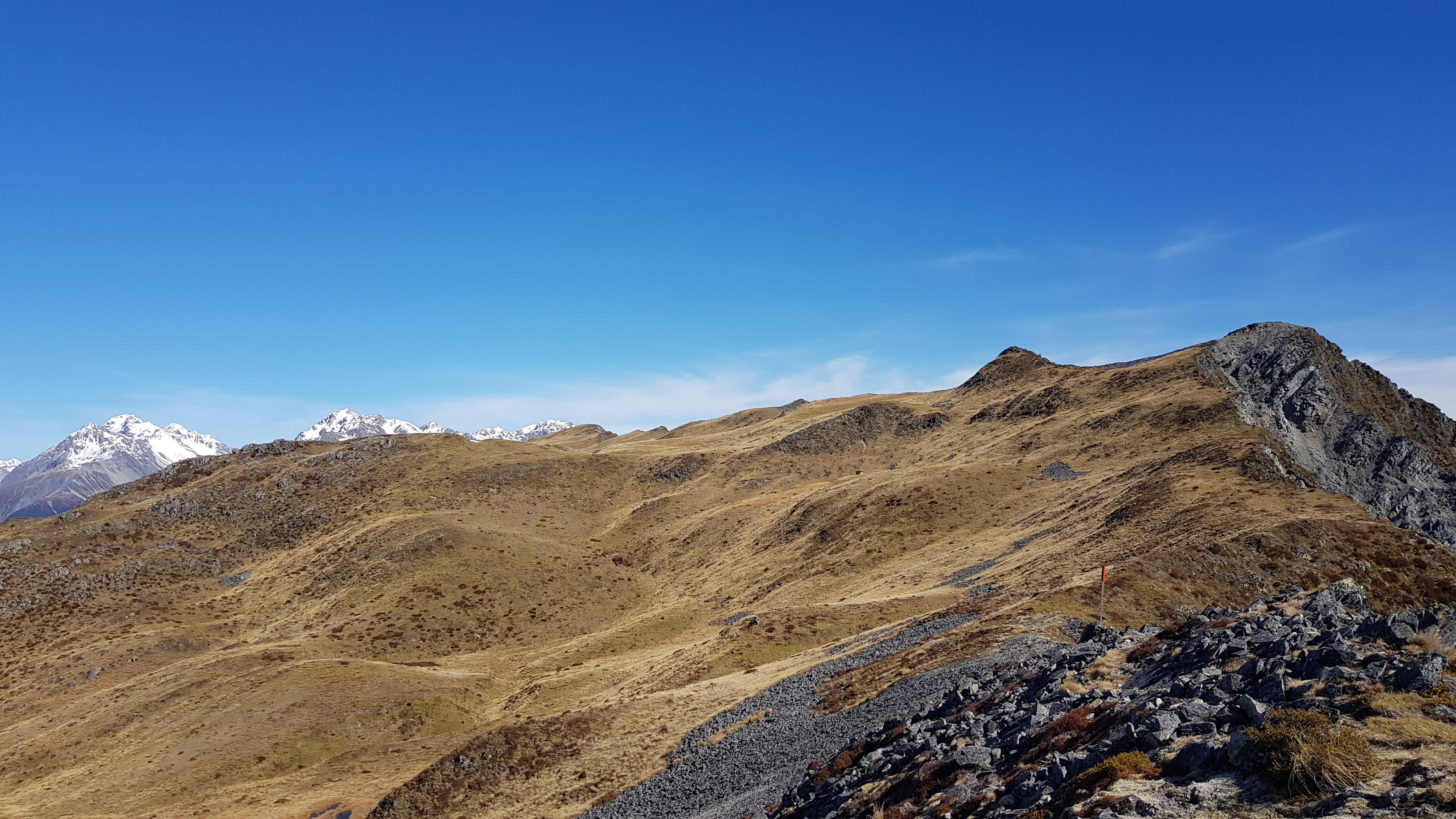
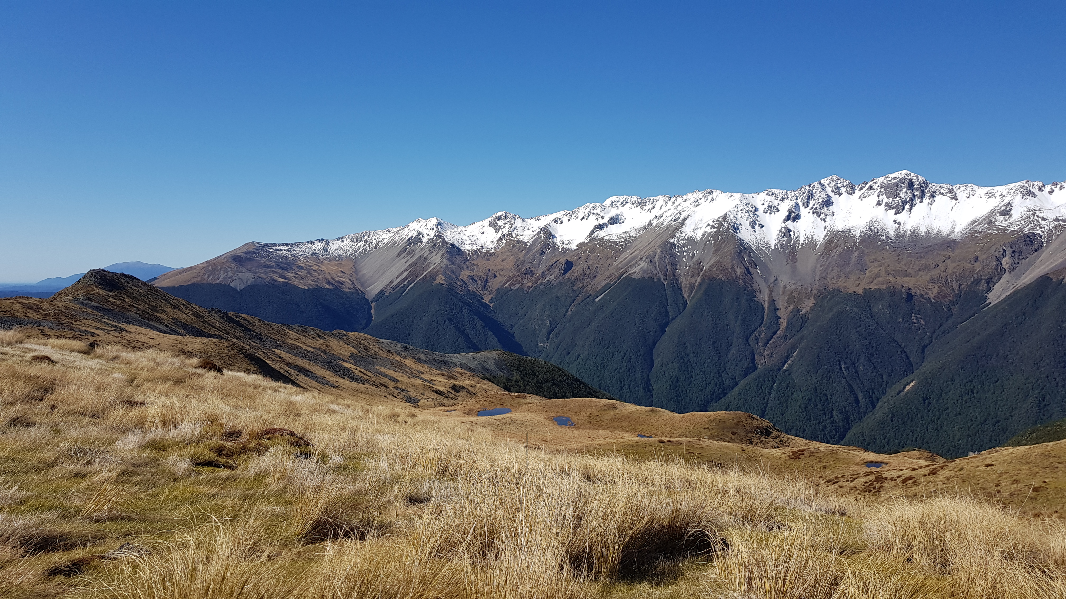
On the Tops at Mt Misery
We reached the tree line at 1400m at around 2 pm and saw that there was still a fair climb to go. The track was still great, the route was poled and the sun was warm. We had made the mistake of telling ourselves that we wouldn’t have lunch until the hut, and I was pretty hungry! But our desire to have lunch with a view was still stronger than the desire to stop so near to the top. We shared a muesli bar and carried on.


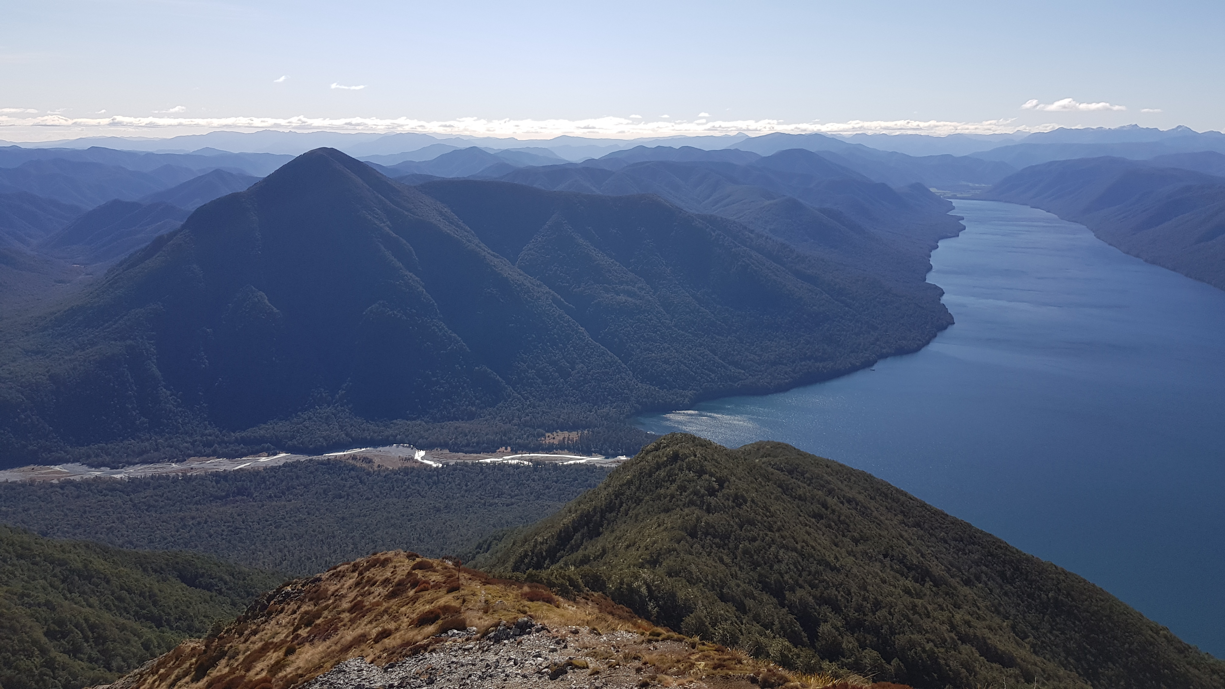
When we reached the ridge, the scenery was every bit as spectacular as we hoped it would be! We could see the length of Lake Rotoroa to the North, and the ridge stretched to Mt Windward to the South. To the East was the Travers range. Funny that it seemed so remote when I crossed the Travers Saddle on Te Araroa trail and now here I was just next door on a weekend mission. To the West was the Ella range and the Mole tops which has been on the weekend adventure list for some time now.
We marvelled at the views and spotted the hut about 600m away.


Mt Misery hut
I have seen some truly wonderful sights whilst tramping in New Zealand. None have brought me the joy and wonder I experienced upon seeing the ULTIMATE loo with a view on Mt Misery!! I have used many loos with views, loos with no door etc. but the loo on top of Mt Misery is a box, which opens to reveal a wonderful throne. BYO toilet paper of course, and a little exposed in a howling gale…

Mt Misery hut was a short distance away, and we arrived at around 2.30 pm. It is a lovely four-bedder, with no fire, next to its own little tarn. Today it had been warmed by the sun, but I imagine it would be pretty chilly to spend the night.
We found a warm spot out of the wind and ate a well-deserved lunch.

The descent
We had set ourselves a departure time of 3 pm, so we didn’t have time to explore any further or to head up to the peak above us at 1601m. We headed back to the ridge and down the track. Given that the track was in good shape, and there were plenty of trees to lean/swing on, the downhill could have been a lot worse. I was glad for my walking poles, and it would be a bit of a killer if you had dodgy knees!
We were back down at the jetty within a couple of hours. The sandflies were out in force, so we wasted no time in covering up, jumping in the kayak and heading back to the hut as quickly as we could.
We spent a lovely evening in the hut cooking dinner and chatting with the families. One of the dads was an adventure racer with some great stories and was able to give us some pointers on tracks we had in mind for future weekend adventures. By 7.15 pm we were all yawning and by 8 pm we were all asleep!
Paddling Back
In the morning the kids got a great fire going in the hut and we enjoyed a breakfast of hot-milk muesli. By 9.30 am we were all ready to leave. We were glad to have walked the mountain yesterday, as today was a little overcast with moody skies.


On the return journey, I had a nagging shoulder ache which turned into a very painful ‘I can barely raise my arm’ situation. I haven’t done much kayaking before, and yesterday’s effort hadn’t done me much good. I don’t have a “technique” so I spent the return journey attempting to develop one. My partner, who is a very patient man, spent his return journey gently coaching me and getting nagged at with my silly questions… poor bugger.
We reached the jetty at Rotoroa at around 11.45 am. I hadn’t developed a technique, especially given I could hardly raise my left arm, but the basics had sunk in. At the jetty, we were greeted by a friendly local man and his spaniel (both of whom arrived on his motorbike). Turns out he and Rich knew some people in common.
To round off a superb weekend we enjoyed a leisurely picnic lunch on the table at the Rotoroa jetty, then drove into St Arnaud for a coffee and a muffin at the Alpine Lodge.
We are already planning future missions in the immediate vicinity… Cedric, Moss Pass, and Mole Tops being top of the list 🙂