Mt Haast
Today’s mission was a day walk up Mt Haast (1587m) in the Victoria Forest Park near Springs Junction on the West Coast. If you’re a frequent traveler through the area you’ll have seen the pyramid-shaped peak of Mt Haast, unmistakeable on the skyline once it’s on your radar. The walk involves a stiff climb of almost 1000m from the car park (640m) up a marked track to the bush line, then a route to the rocky summit. The reward is stunning views across the nearby ranges, the Southern Alps / Kā Tiritiri o te Moana and the West Coast.

We walked on a clear September day when there was still a sprinkling of snow on the tops of the Victoria Ranges. DOC Rate the 5km return as an expert route. It was very exposed above the bush line. Take plenty of warm layers, and don’t head up in bad weather.
– DOC time – 6 hrs return
– Our time – 5 hrs return (including 30 mins lunch at the top)
– Up: 2 hrs 25 mins
– Down: 2 hrs 5 mins


Getting There Mt Haast
It takes about ten minutes to get to Mt Haast from Springs Junction. Drive towards Reefton on the SH7 over the Rahu Saddle. The large car park is on the left just over the bridge crossing the upper Inangahua River. It is about 30 minutes from Reefton towards Springs, about a kilometre after the Lake Stream track.
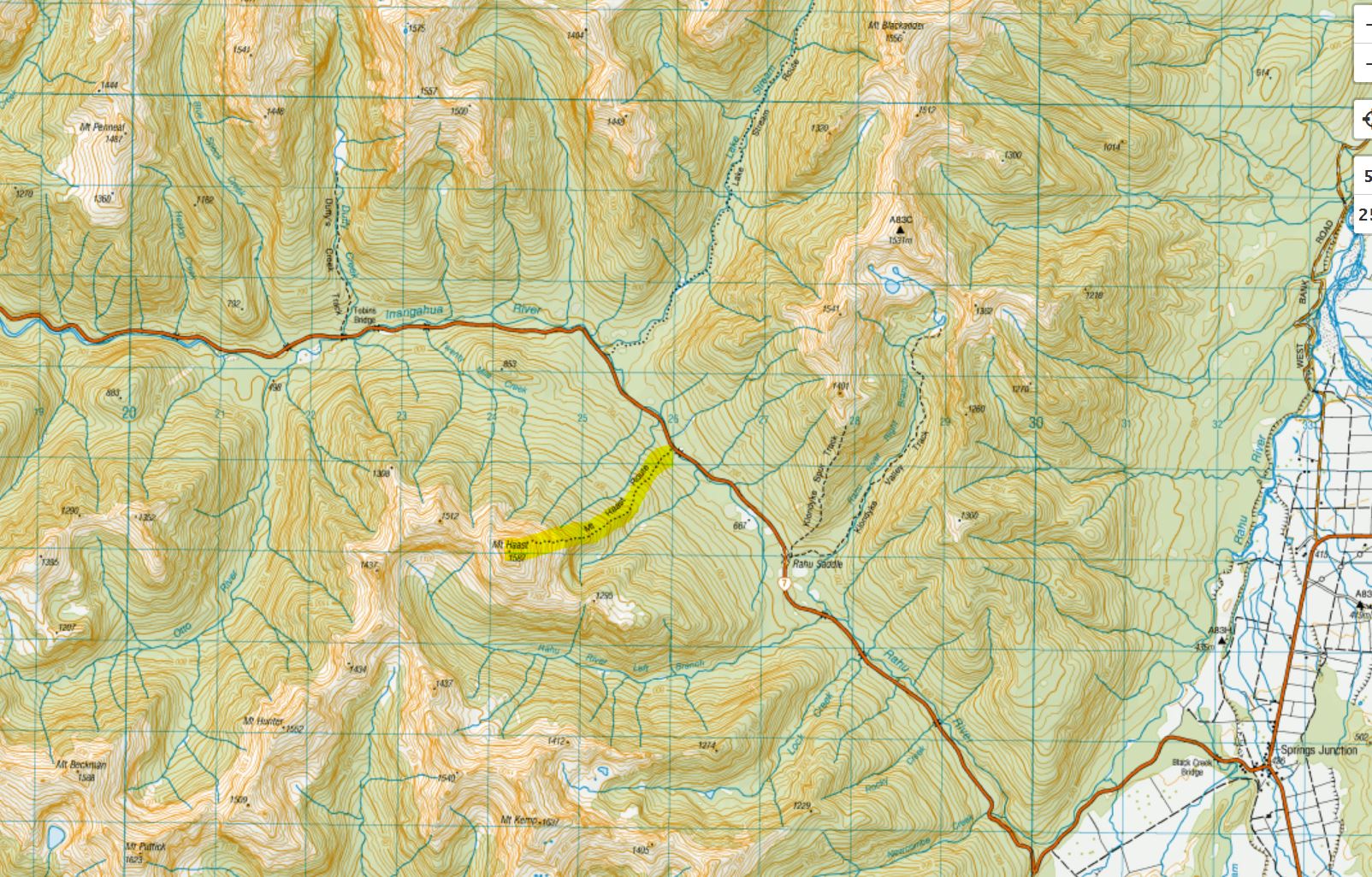
Mt Haast Route
We were the only vehicle in the car park on the Saturday we walked. There isn’t a loo, so if you need to go, Springs Junction would be your best bet. We got ourselves together and started walking at 11.25 am.
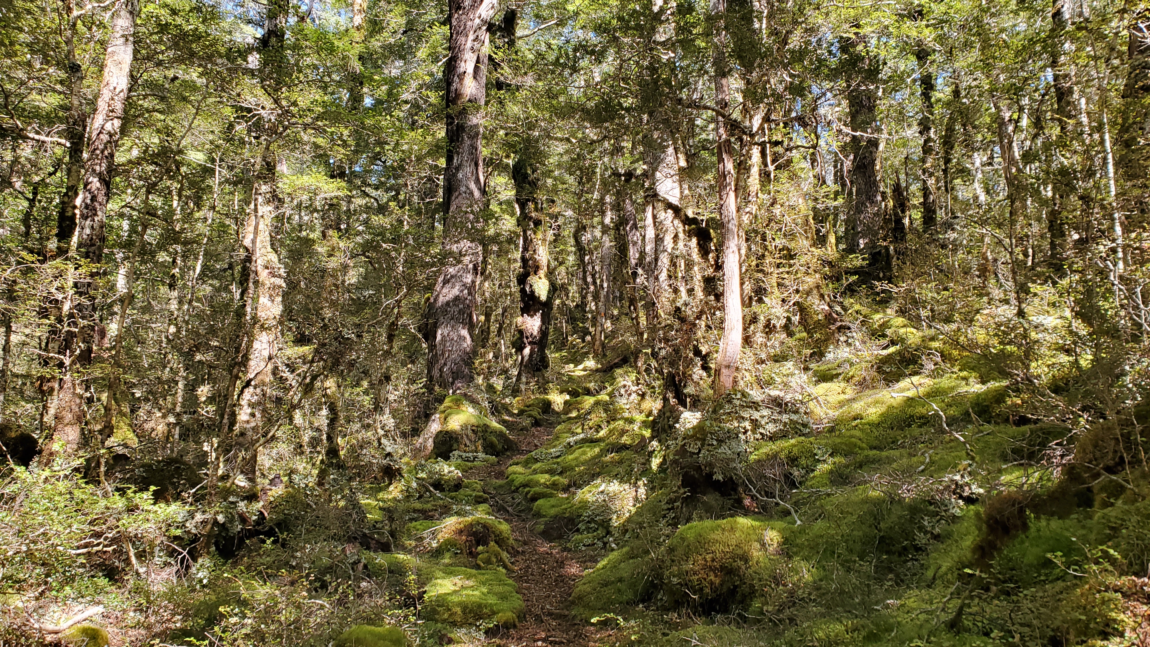
The Mt Haast route didn’t seem like a particularly well-used track. It was marked, but the track on the ground wasn’t well worn. We kept an eye out for the markers. Early on, the track was a little boggy and tree-rooty underfoot and from the start it was a steady climb. Enjoy the relative ease of the first 250m elevation over the first kilometre or so, because things got steeper around the 900m contour.
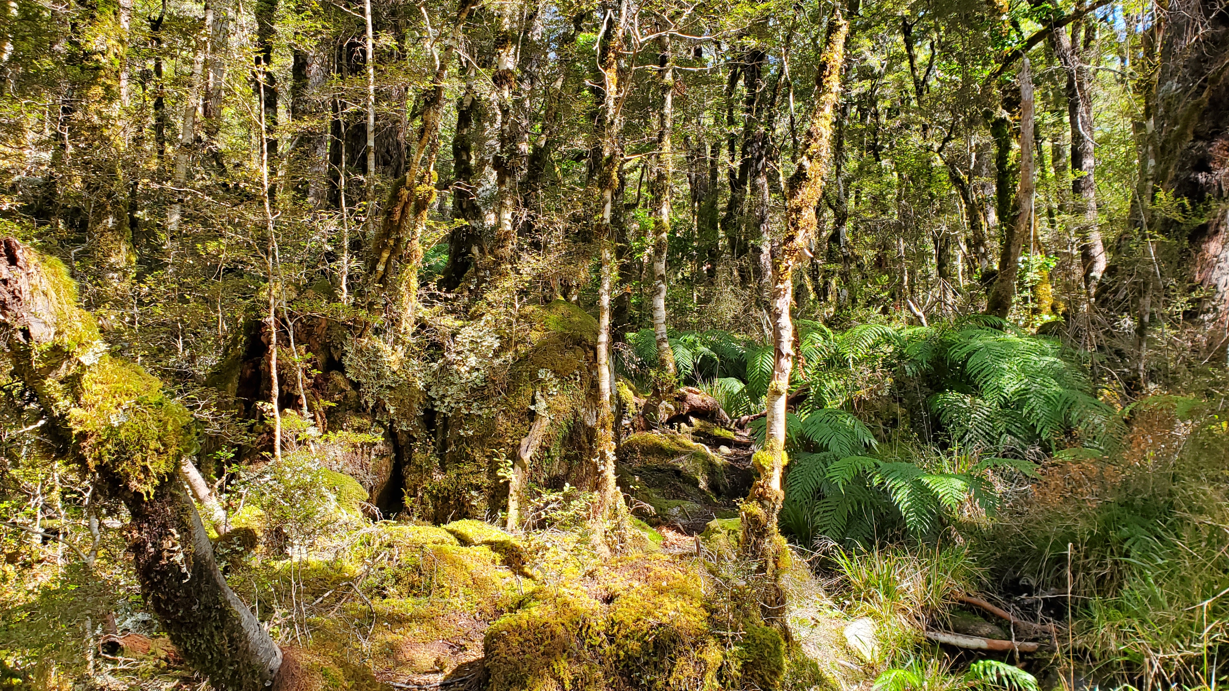

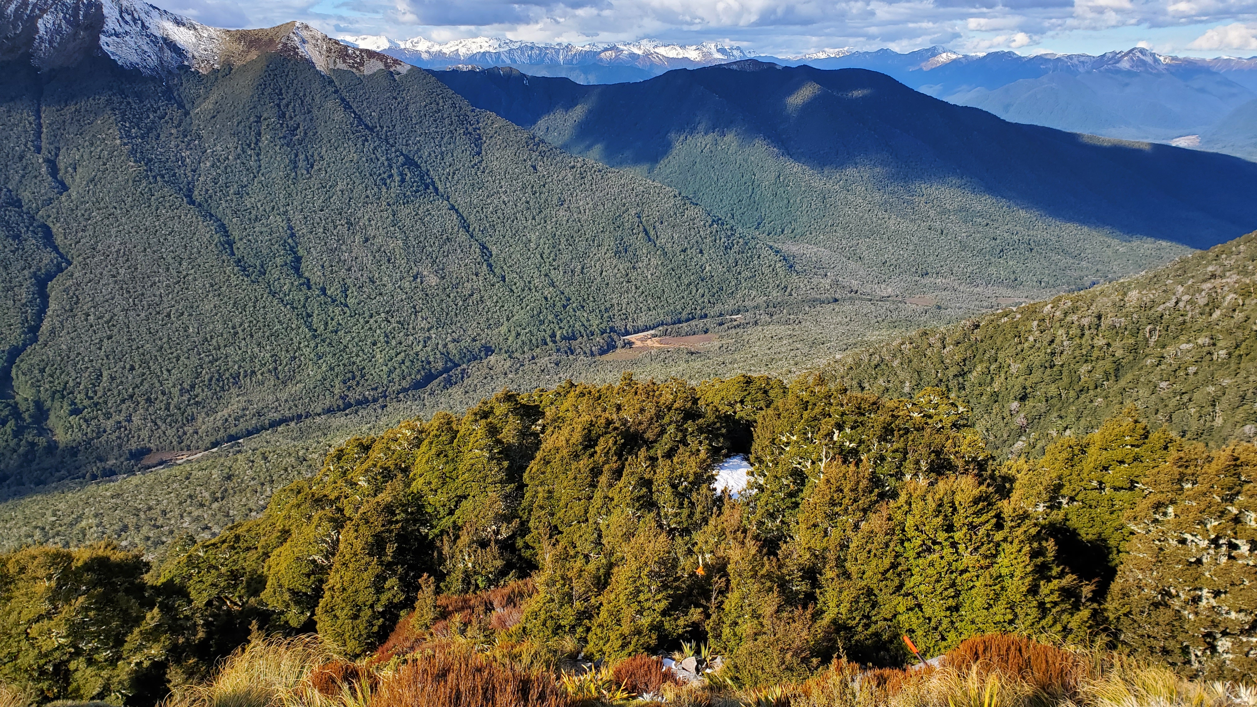
As we climbed the track became more of a pleasant carpet of beech leaves through the beautiful mossy forest. By midday, we were following an obvious ridge. After almost an hour of walking, at 12.20 pm we came to the dracophyllum zone and crunched our way through the fallen leaves and pockets of snow. Brief views tantalised us through the thinning trees.

The vegetation indicated we were close to the bush line, and ten minutes later we crossed a short open section marked with pink flagging tape. From here we got our first great views up the mountain.
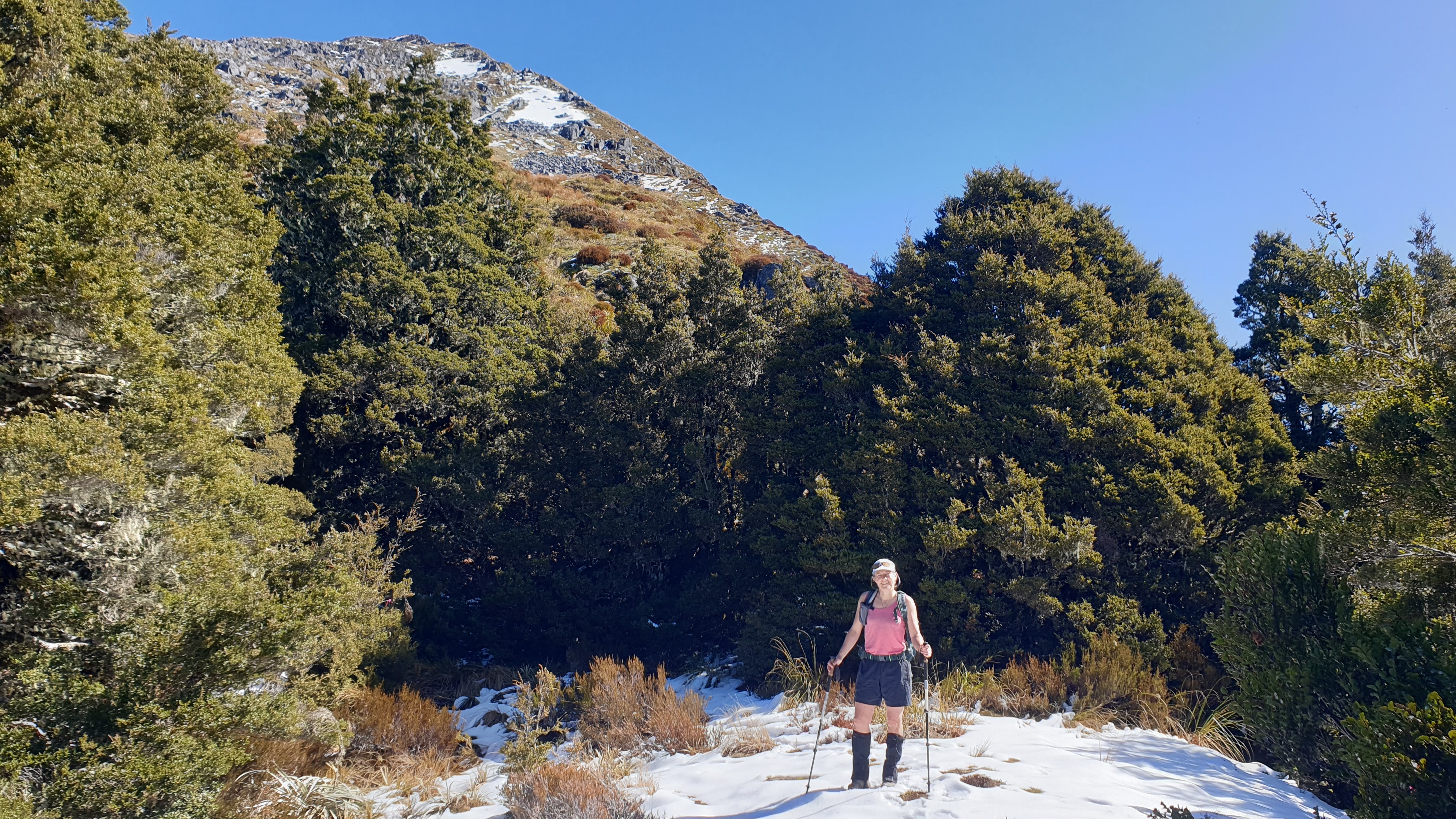
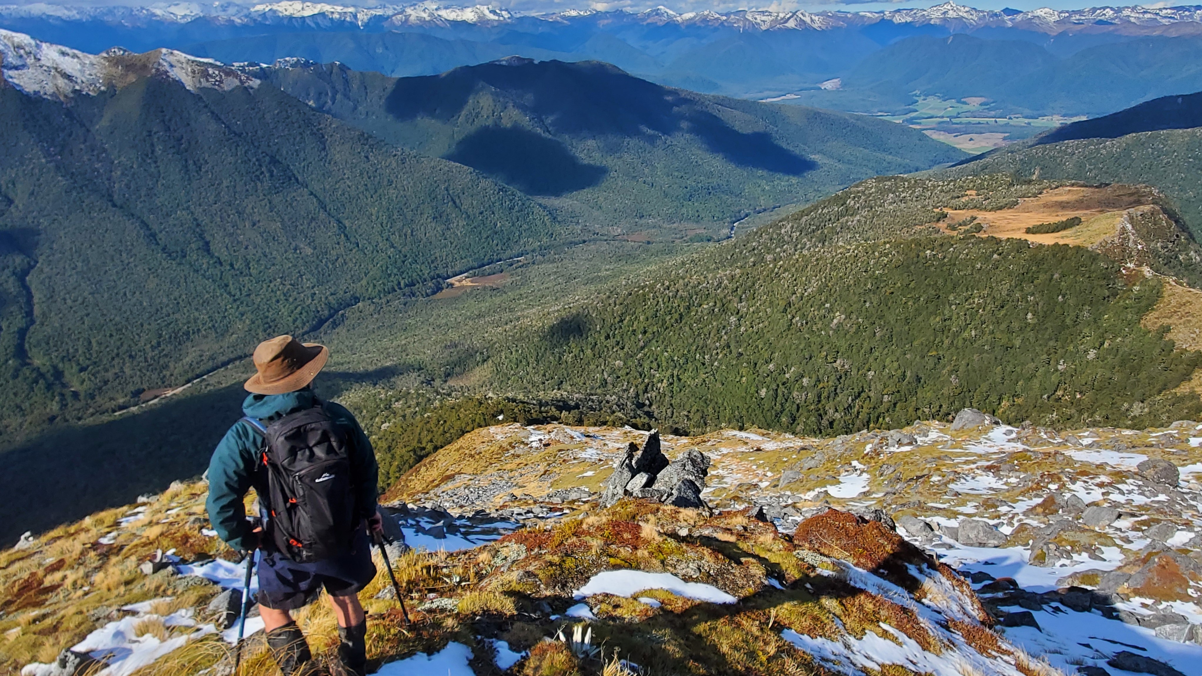
Above the Bush Line
By 12.40 pm we were out of the trees and into the tussock. We took a rest and marveled at the superb views. The climb didn’t let up and we were now above Pt 1295 down to the Southeast. There was still a decent (and steep) climb to the pyramid peak above. Marker poles indicated the route through the alpine garden.


We got stuck in and walked to the left of a scree field of boulders, alternating between walking up the slippery grass and the slippery rocks. After a larger patch of snow (and the last marker I noticed) we steered slightly right and walked up the spur.

Towards the top of the spur, it was steep and narrower and required some scrambling.

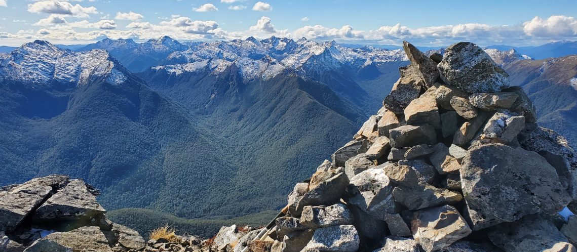
Mt Haast 1587m
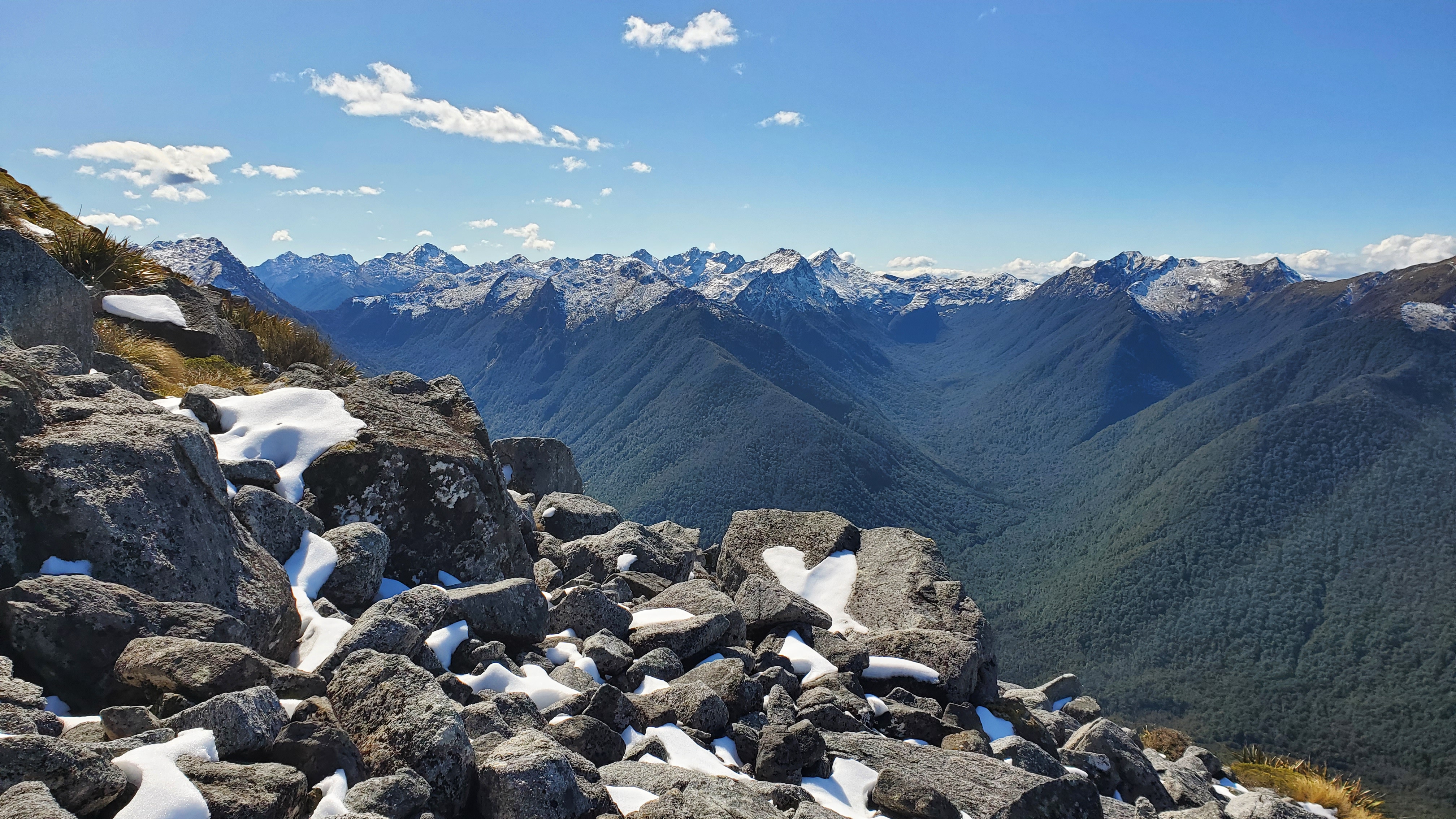
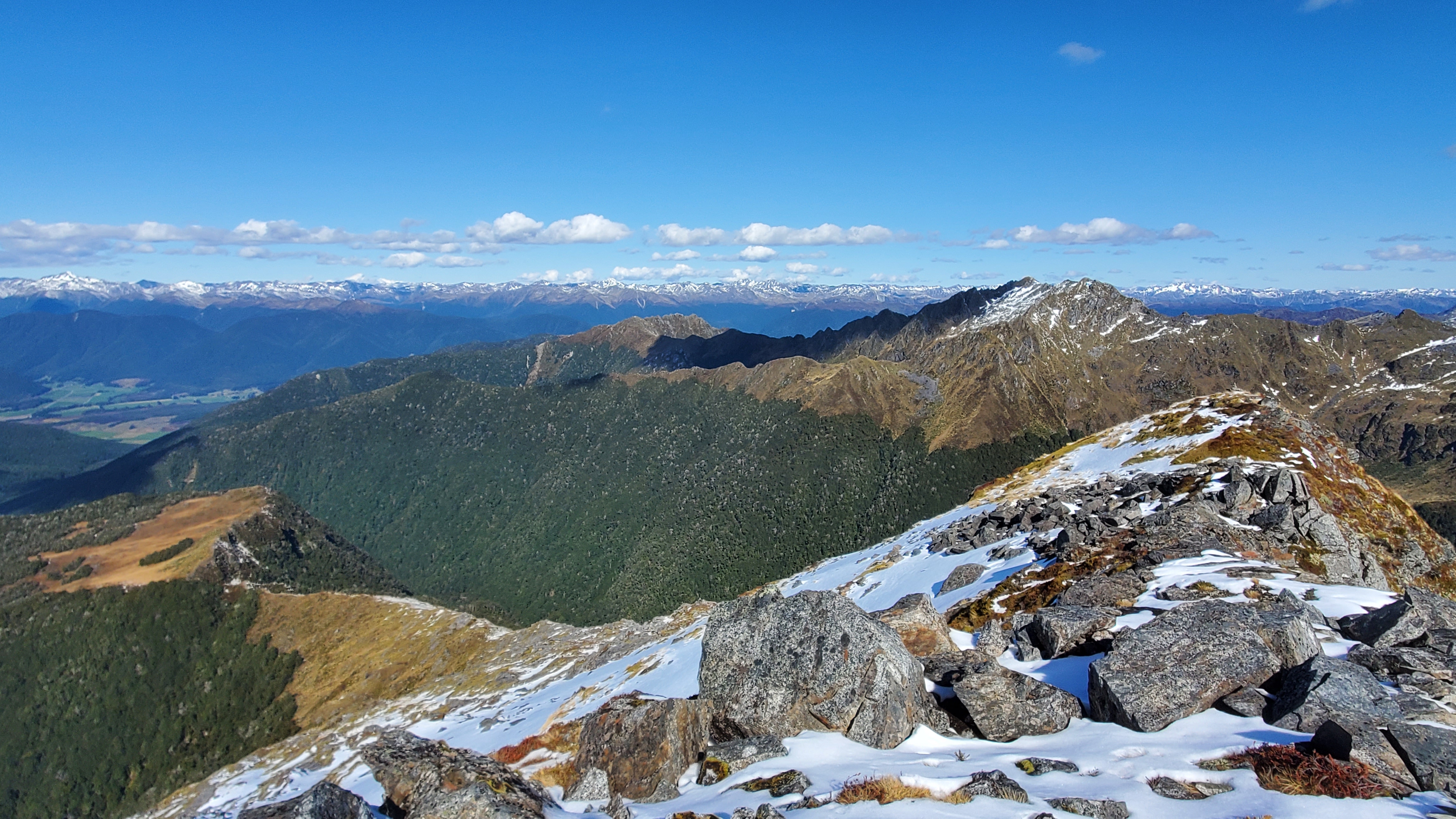
Two hours and twenty-five minutes after setting off (and just over an hour after emerging from the bush line) at 1.50 pm, we reached the large cairn at the summit of Mt Haast. The ridge of Mt Haast stretched away in a couple of directions and would be worth exploring on a longer, summer day.
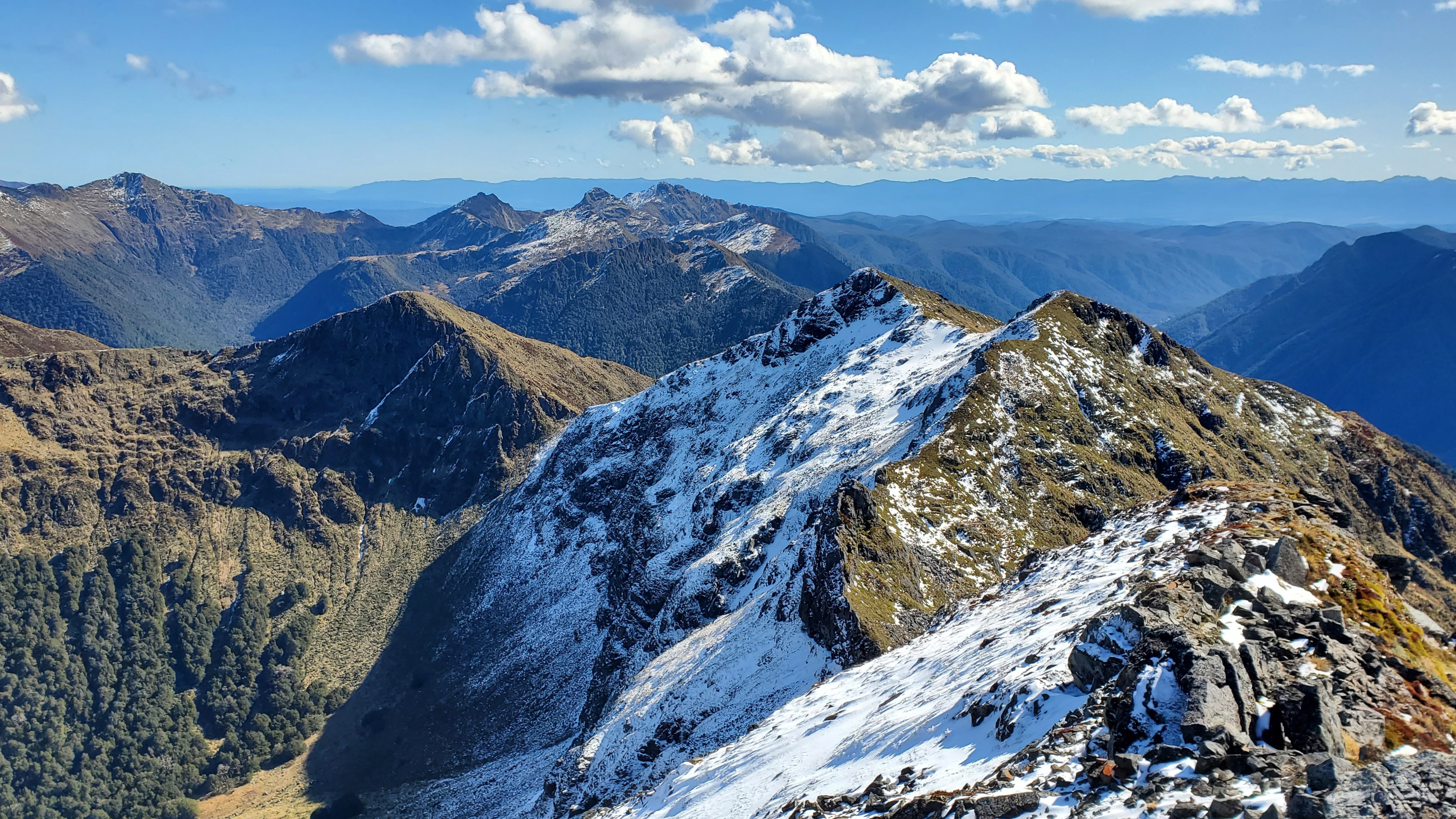
Over lunch we took in the fantastic views and a couple of tracks made it onto the future tramps list – the Lake Stream and Klondyke Spur/Valley Routes opposite. Already on the list and down to the Southeast, the Lake Cristabel tracks beckoned.

Heading Back
It was pretty fresh at the top and we were glad for our warm layers. At 2.25 pm it was time to get moving again. We headed carefully back down the spur and down the rocky sections to the tussock.
We could see the snow patch we’d crossed in the trees on our way up and headed for it. As we got closer we picked up the marker poles again and spotted a large orange triangle in the trees. After an hour at 3.25 pm, we were back in the forest and about an hour later, back at the car. A thoroughly enjoyable day.
Click the links below for some other walks in the area or use Search in the main menu bar: