
The Robinson Christabel Circuit
The Robinson Christabel Circuit is a beautiful, varied almost-loop through remote backcountry, close to Springs Junction on the West Coast. We took plenty of time and made it a five-day tramp over Christmas 2024, topped off with a spectacular day on the tops. Expect a bit of everything – mossy forests, rivers, open tops, rugged terrain, and three huts to bag for your efforts. It’s not without its challenges, however. The descent into the Christabel from the Robinson was seriously overgrown when we walked. Lake Christabel to Palmer Road was also overgrown with plenty of windfall, making it an even longer walk out. But the rewards are worth it. A memorable tramp that delivers solitude, views and a satisfying dose of adventure.
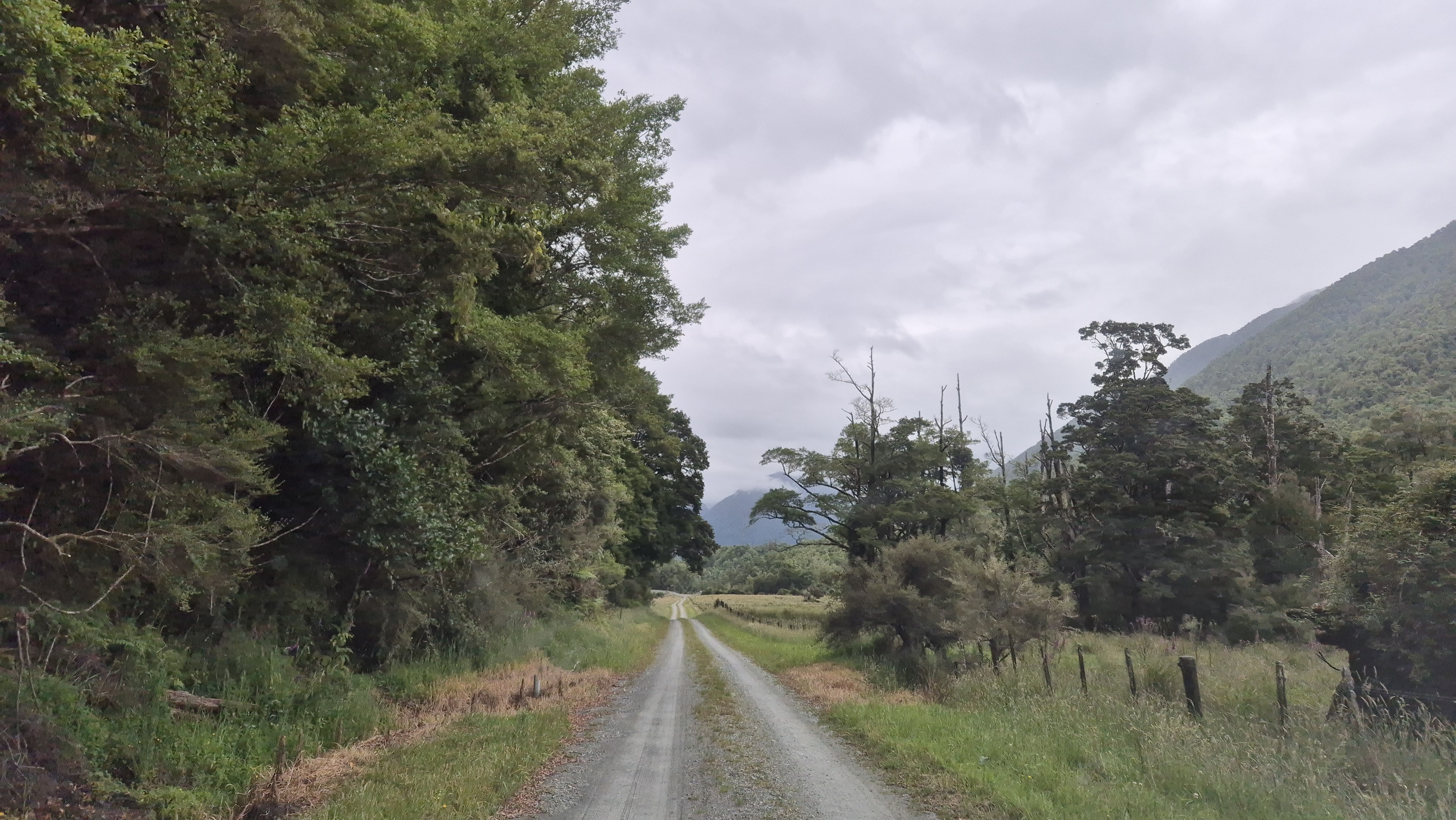
To get to the Robinson Christabel, turn off the SH7 (Springs Junction to Reefton) at Palmer Road. There’s about a 10km road stretch between the Robinson and Christabel tracks. We started walking from the Robinson River and took a bike to stash in the bushes at the Lake Christabel Track, so we could fetch the car at the end of the tramp.
DOC rates the Robinson Christabel tracks as Advanced tramping. When we walked (Dec 2024), there was a warning on their website about a slip where the track is washed away towards Mid Robinson hut. We didn’t fancy walking over it, and avoided it by crossing the (low) river. A couple of cairns marked the crossing point.
Timings
Day 1 – Robinson road end to Mid Robinson hut
DOC time: 5-8h
Our time: 5h
Day 2 – Mid Robinson hut to Top Robinson hut
DOC time: 5-8h
Our time: 4h 30 mins
Day 3 – Top Robinson hut to Lake Christabel hut
DOC time: 8h
Our time: 7h 20 mins
Day 4 – To the Tops via Rough Creek Route
Our times:
Christabel hut to the bush line: 2h 20 mins
Christabel hut to ridge to approx 1440m: 3h 30 mins
Day 5 – Lake Christabel hut to Palmer Road
DOC time: 6-7h
Our time: 7h 30 mins (+ 2h returning from the tops)

Robinson Christabel Day 1
Palmer Road to Mid Robinson Hut
DOC time: 5-8h
Our time: 5h (including 30 mins lunch)
Christmas Morning
We left Nelson at 7.15 am on Christmas Day. Even though we had our supply of festive treats, we couldn’t help but approach the Wakefield Bakery with an unreasonable glimmer of hope that it might be open. Of course, and quite rightly, they have Christmas Day off too. A few hours later, we turned off the SH7 before the Rahu Saddle, near Springs Junction, and headed down Palmer Road. At the start of the Christabel Track, we dropped off the bike for the end of the trip, when we’d need to ride back to fetch the car from the Robinson River Track. As we parked, a friendly elderly gentleman emerged from a nearby paddock where he was camping. He gave us the rundown on recent walkers, who had been through, when they’d gone in, and when they were expected back. It was heartening to know he was quietly keeping watch.
Rich stashed the bike into the bush, its hiding spot deemed suitable by our new friend, and we continued the slow drive towards the Robinson River Track, alongside the Upper Grey River. The road was in decent condition, with several rocky fords and pools to cross. (A high-clearance two-wheel drive would probably manage it ok). The car park at the road end was empty. We stretched our legs, demolished the pre-walk snacks, and got ourselves ready to go.
The Robinson River Track
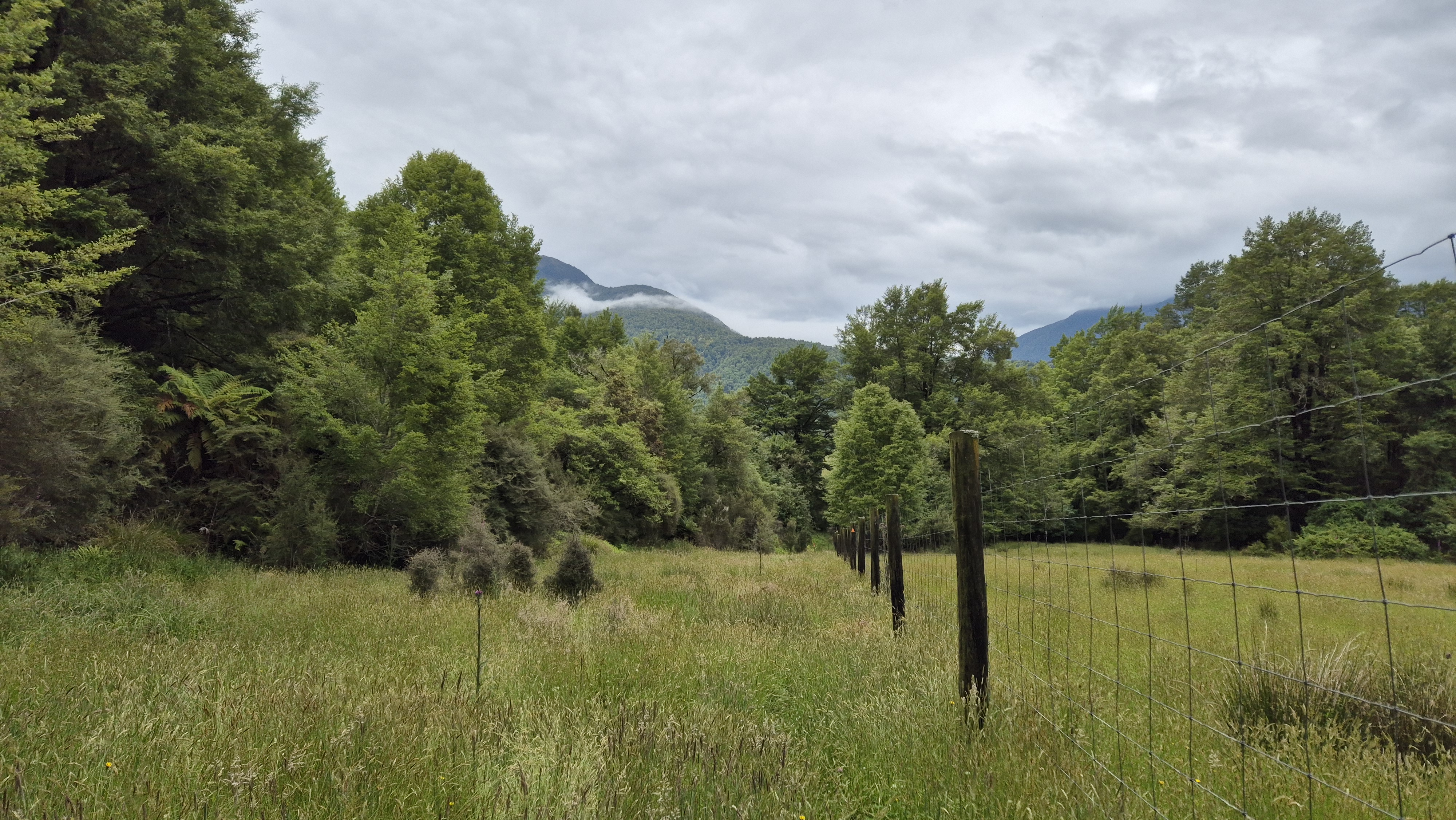
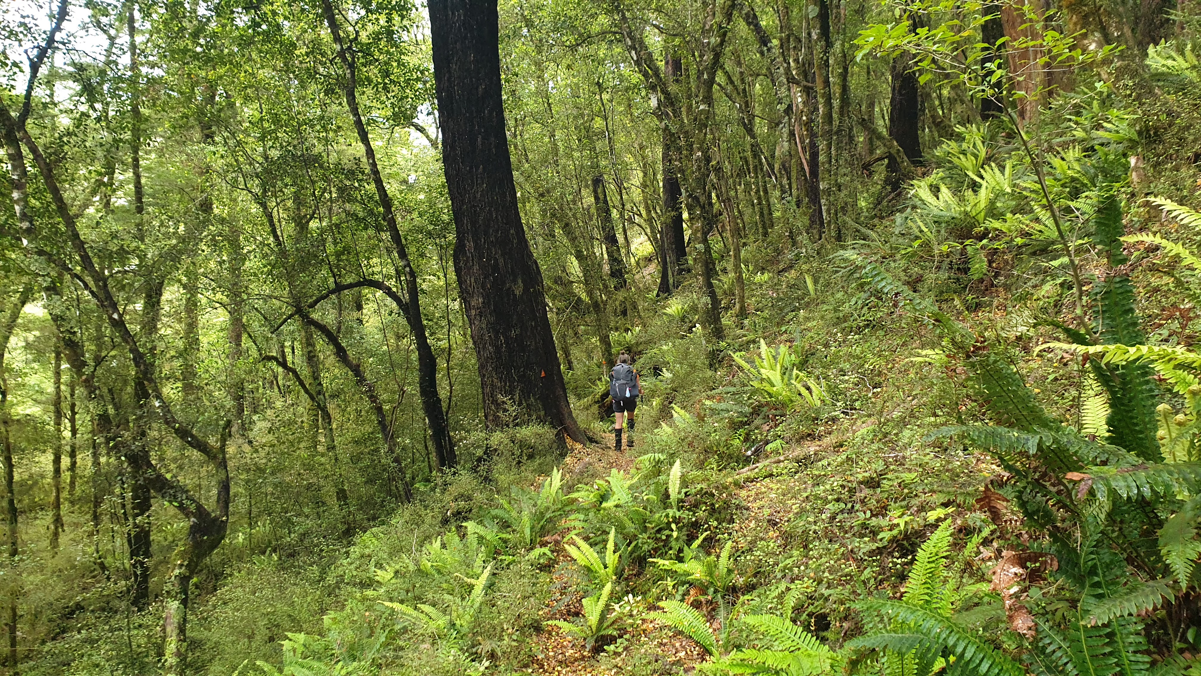
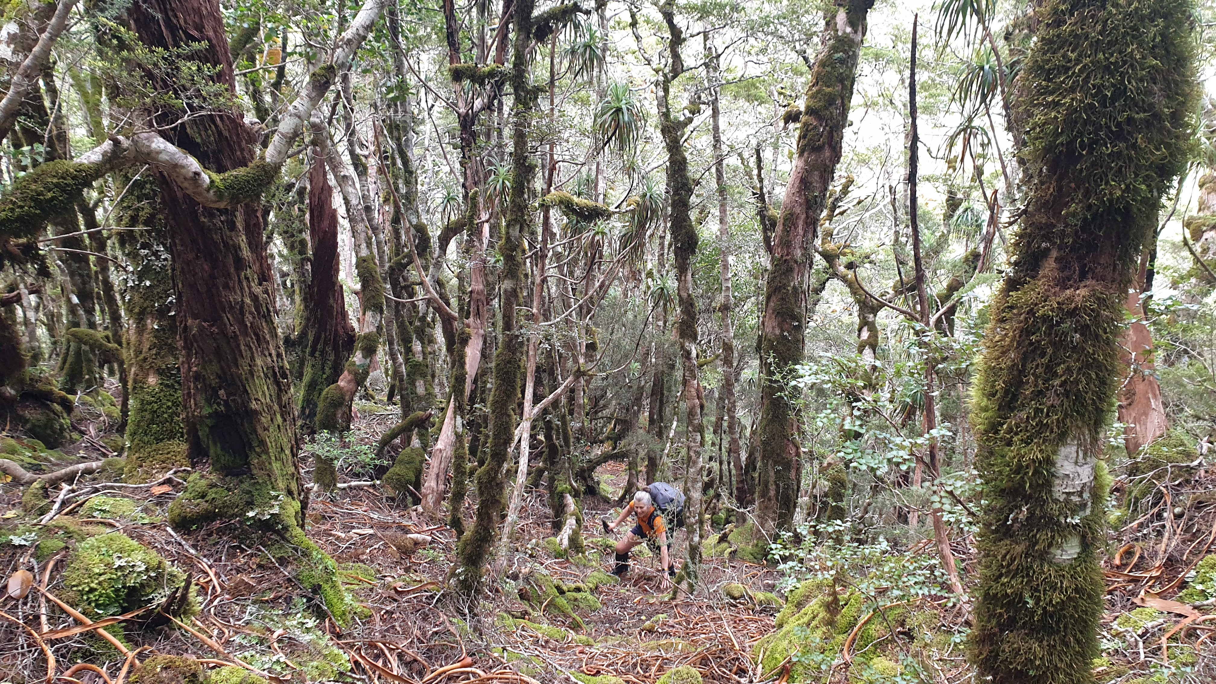
We set off at 10.45 am, beginning in the forest directly opposite the car park. The marked track quickly opened out, skirting farmland and following alongside a deer fence. The grass was thigh-high and thick with pollen, an absolute nightmare for anyone with hay fever or contact lenses (I tick both boxes). Thankfully, the drizzle earlier in the morning had kept things slightly damp, holding it at bay. Still, it wasn’t enough to stop me from breaking out in impressive hives. Angry red welts flared up on my legs. Parts of the track here were boggy in places, and if you’re trying to keep your feet dry, don’t bother; they’ll be wet for the rest of the day anyway.
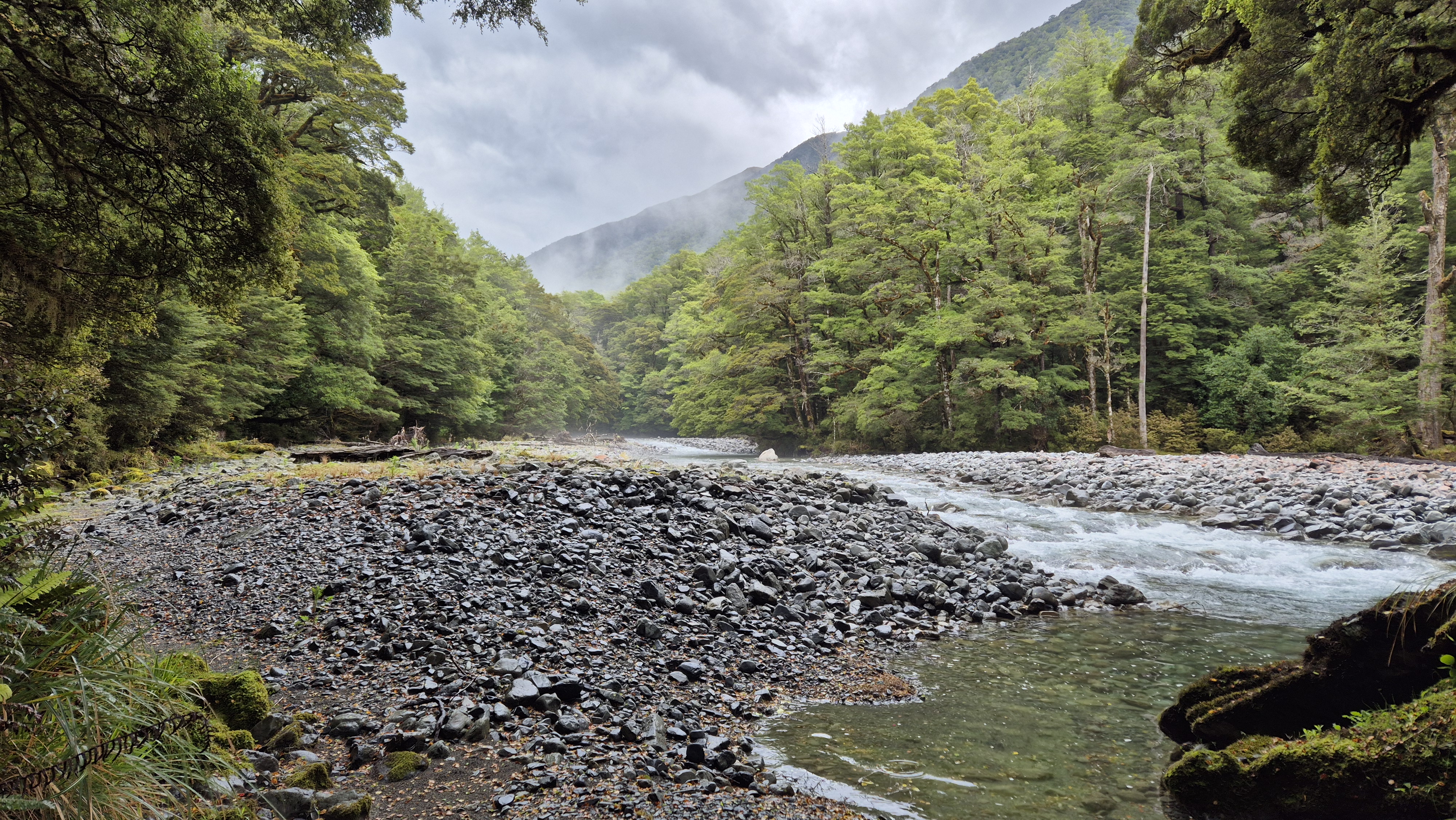
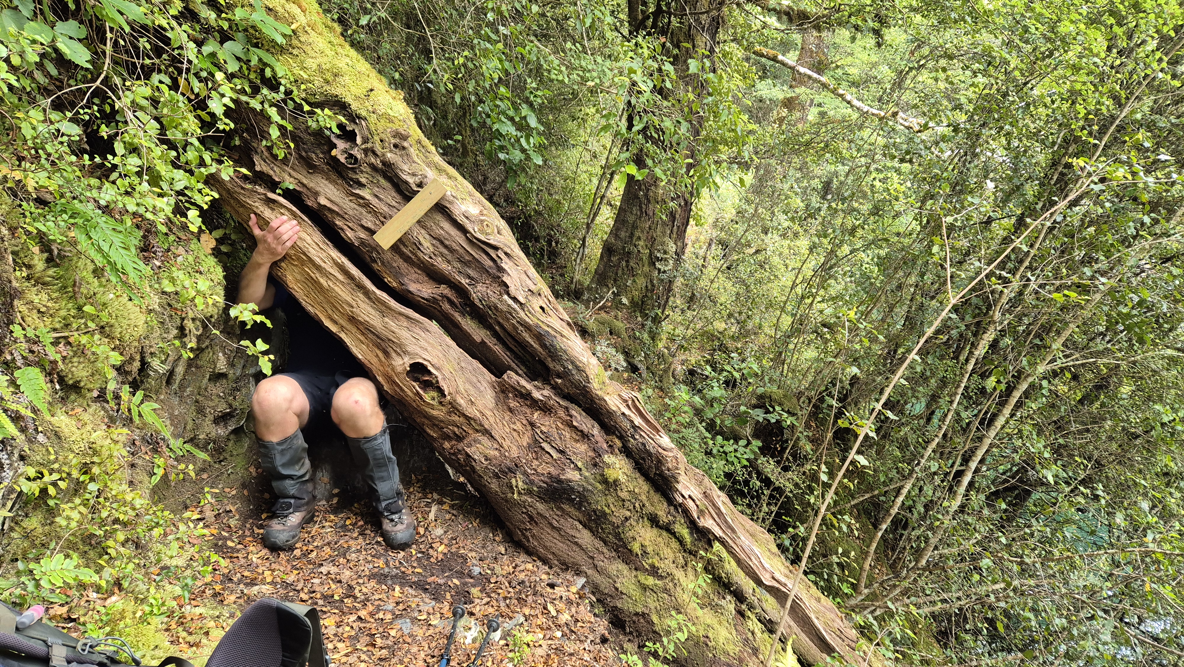
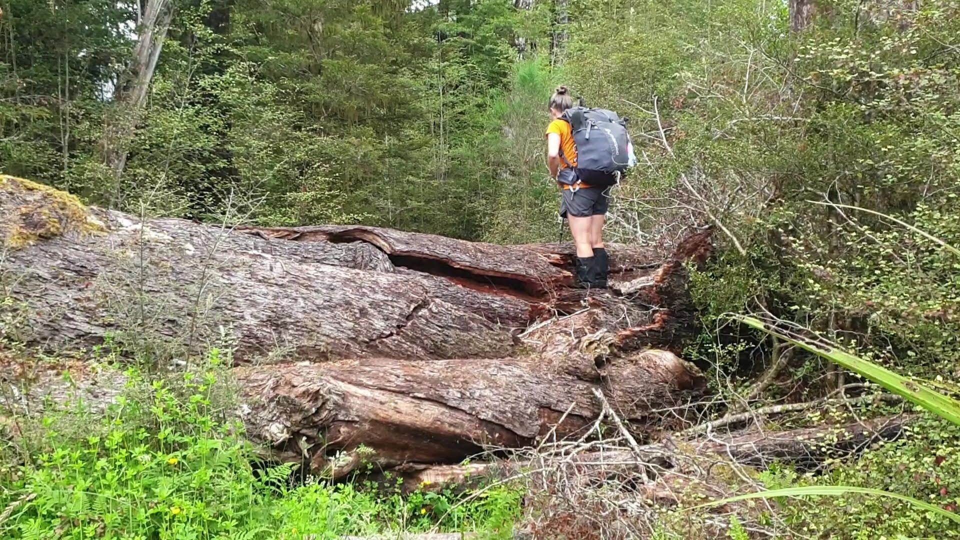
We reached the forest around 11.30 am, and not long after, came across a large fallen tree sprawled across the track. We kept left, bush-bashed a little, and picked up the track markers again after spotting a faded bit of tape tied to a bush. The path through here was boggy in parts. About 15 minutes later, we passed the Anglers signage close to the river, and followed the true right bank upstream. Not long after, we caught sight of the swing bridge in the distance. A tree had fallen down the bank just before it, making for a bit of a scramble.


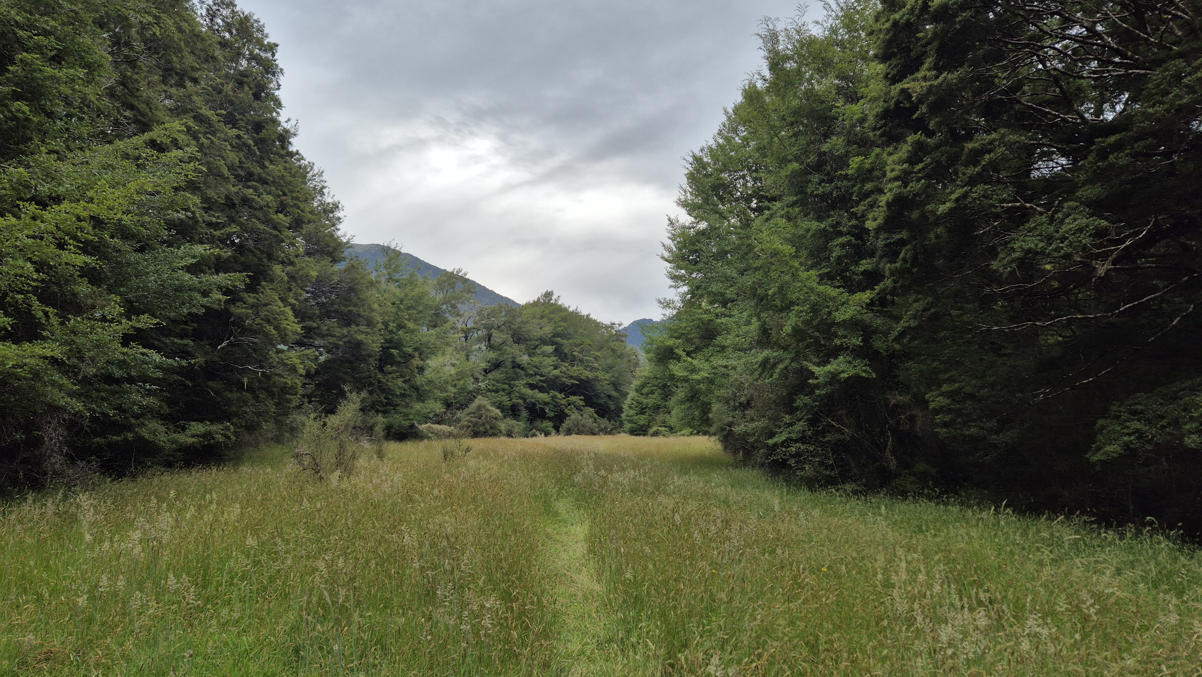
We crossed the swing bridge around 12.20 pm then firmly locked this in as a wet boot day, thanks to a side stream just beyond. From there, we followed the river flats out onto Lynches Flat, where there was evidence of pig activity. A lone marker caught our eye, on a tree in the middle of the flats.

To Mid Robinson Hut
Our lunch break came around 12.55 pm, with some enthusiastic sandflies keeping us company. Back on the move by 1.20 pm, we continued along the river flats with a lovely view upstream. Eventually, keeping on the true left, we picked up the track in the bush again. The river ran swiftly beside us. A bit further on, it was up, over, and down a steep, slippery scramble—no real track to speak of, just a hint of the way. Watch out for the ongaonga and thistles here and there.

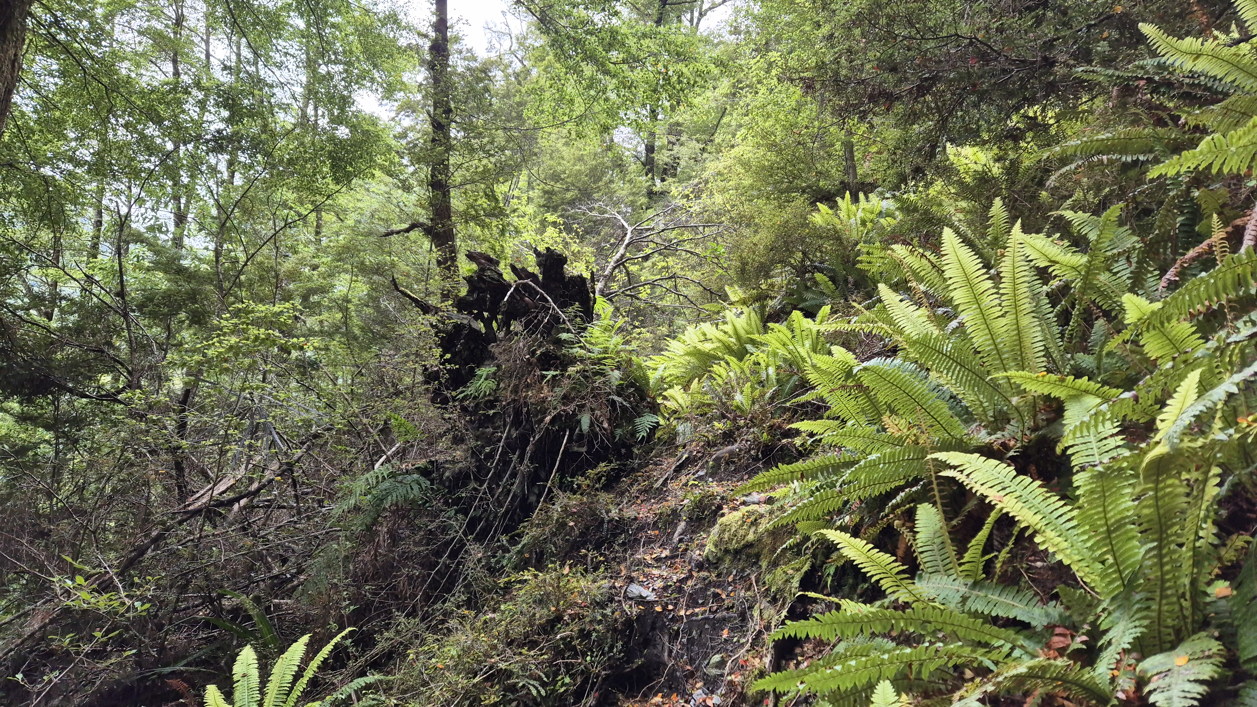
Around 3 pm, we reached the big slip we’d read about on the DOC website. Standing before it, we certainly didn’t fancy crossing it (though I later read that people do). Instead, we backtracked and scouted for a decent river crossing. A cairn marked the spot on the river bank, and with the river low, it was an easy walk to the rocky middle section, then across to the true right, cutting out the bend with the slip. We crossed back, climbed up a steep bank on the true left and rejoined the track.

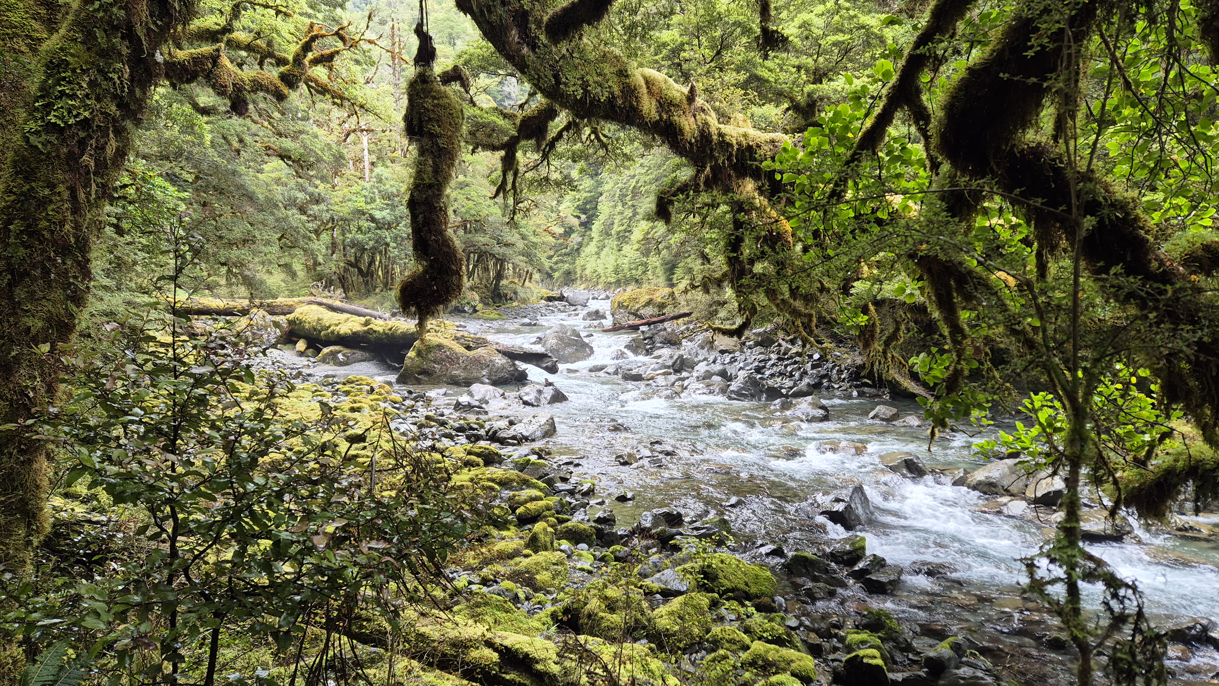
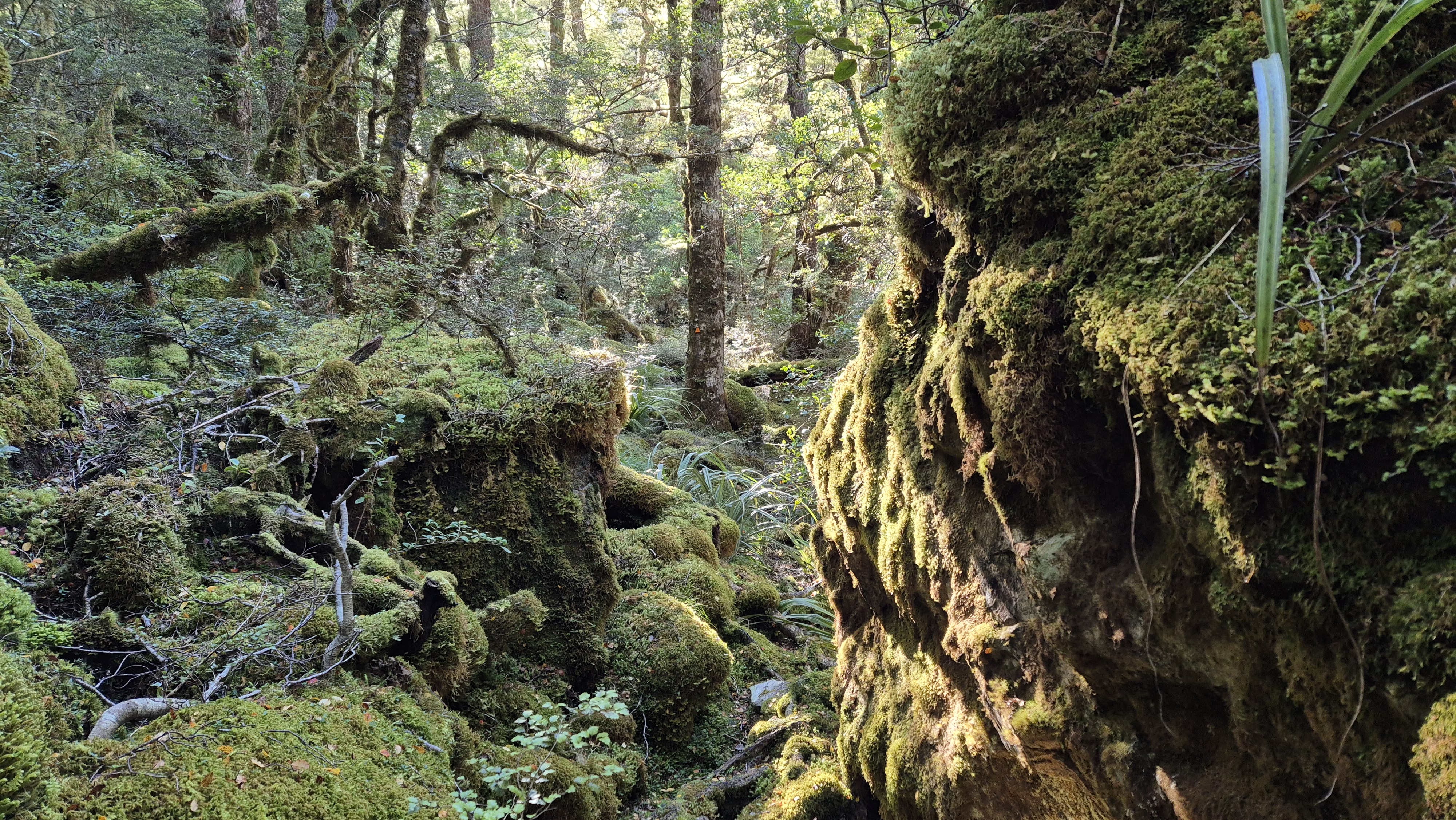
From here, the track meandered through mossy beech forest. The bridge over the river came into view around 3.40 pm, and a minute later, we arrived at the 6-bunk Mid Robinson Hut. Packs off, and socks wrung out and hung up, we eased into a quiet evening as soft rain fell lightly on the roof. Lights out came early at 8.25 pm.

Robinson Christabel Day 2
Mid Robinson Hut to Top Robinson Hut
DOC time: 5-8h
Our time: 4h 30 mins (including 15 min break)
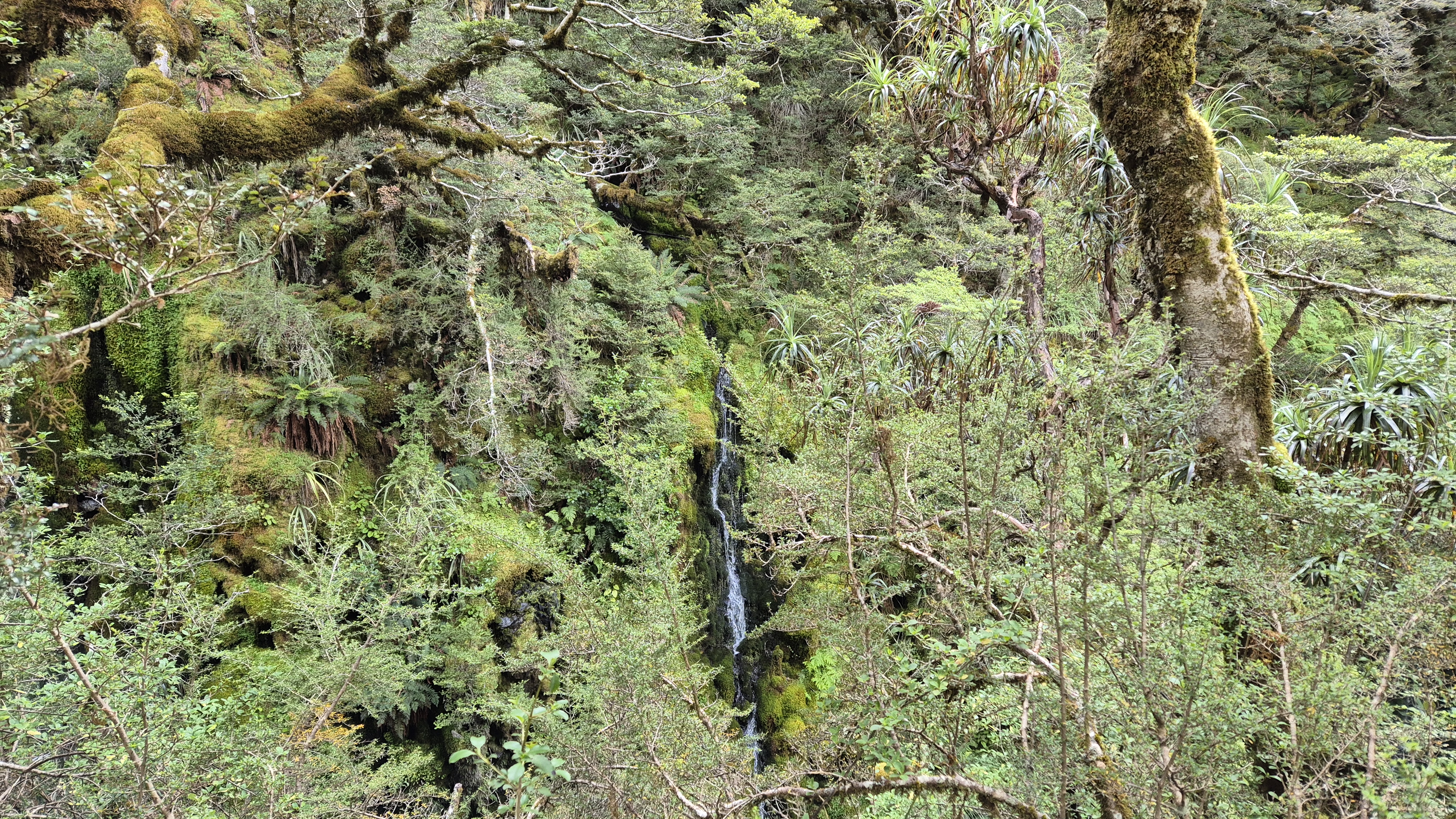
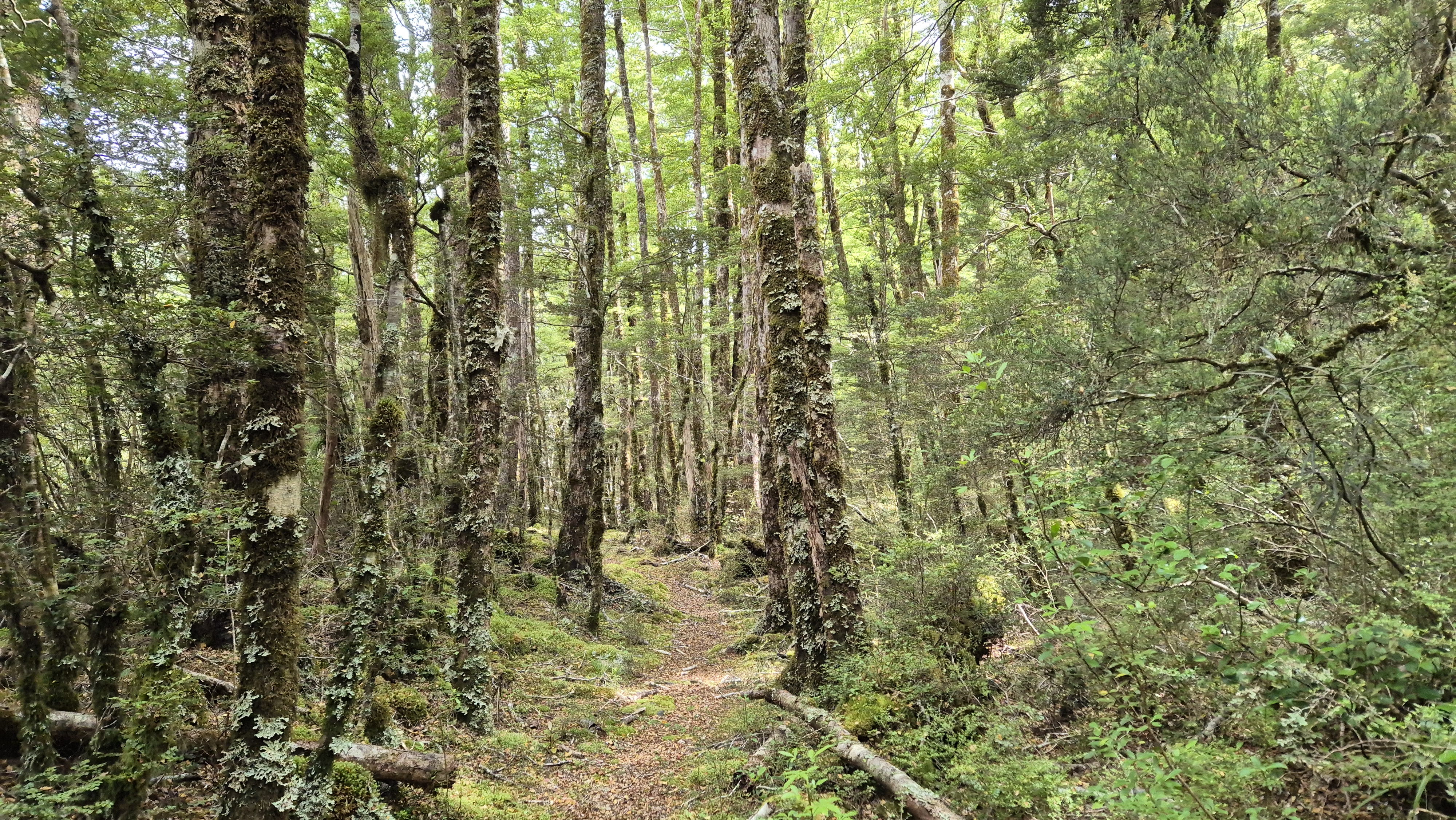
We woke at 7 am after one of the best sleeps I’ve ever had in a hut. It rained overnight, and mist clung to the mountains. It was a relaxed start to the day, with only about five hours of walking ahead, so we played a few games of Yahtzee with breakfast. We left at 9:10 am. A couple of robins flitted by as we set off, always a good sign. We crossed a side stream fairly early on, and from there, the track markers weren’t always easy to spot, which slowed us down in places. But the forest more than made up for it. Lush, quiet, and moss-covered. Everything was glistening and damp. We squelched through the occasional sloppy bog. Even if a little slow going in places, it was worth it. The birdlife along the way didn’t disappoint either, with rifleman, robins, fantails and tomtits keeping us company. We kept our eyes peeled for whio, but no luck spotting one.
A few sections involved steep, slippery descents down to the river, which added a bit of a challenge. Occasionally, wisps of mist hovered just above the river, giving the whole scene an almost magical feel. Along the way, we paused to look up to some towering giant beech trees and down to admire mushrooms growing from the mossy rock.
We crossed a significant side stream around 10.30 am. A few of the side streams along the way were sizeable – scrambling in and out was required. Crossing some of them in heavy rain wouldn’t be pleasant. About 15 minutes later, we stopped for a break at the next stream. A long, wet log in an open stretch by the river made the perfect seat. And we remembered our foam pad seats! The sun appeared and warmed us up as we enjoyed the views up to the tops.

Towards Top Robinson Hut
We left at 11:05 am, following an easy stretch through low, mossy forest. About 45 minutes in, treefall blocked the way and the markers became difficult to spot. After picking a route around it, the next section was slow going. We were soaked from pushing through overgrown trees, crown ferns, and bracken. The track was mostly clear but occasionally vague, requiring some interpretation of the marker directions. Below us, the river had picked up more force. At 1.20 pm, a three-wire bridge came into view, accessed by a ladder; however, with the river running low, it was easier to walk across instead. Beyond the river, the track had been recently cleared. An old “5 mins to the hut” sign appeared soon after, then Top Robinson Hut came into sight – a welcome stop for lunch.
Top Robinson Hut
We arrived at the 6-bed Top Robinson hut at 1:35 pm, just as the rain began to fall. Without much deliberation, we decided we definitely wouldn’t push on up and over the saddle today. Settling in, we swept the hut, then opened the hut book. DOC had been in six months earlier to work on the hut and track – great job! We counted that only 12 parties had passed through (or, at least, written in the hut book) in 2024.
We washed in the stream and changed into our dry, comfortable hut clothes. Lunch became the main meal of the day. Afterwards, I sawed some wood, more for the chance to try a bow saw than out of need, as there was already plenty of wood stacked nearby. Later, I sat quietly in the forest. A shrill, loud, unfamiliar bird call echoed through the trees, and I tried to place it. It was the same as one I’d heard up Mt Tuhua a few weeks ago. I discovered at home later that it was a long-tailed cuckoo (koekoea). A cruisy afternoon followed, spent eating and watching a movie on Rich’s phone. By the evening, the wind picked up and beech leaves blew down like snowflakes through the forest.

Robinson Christabel Day 3
Top Robinson Hut to Lake Christabel Hut
DOC time: 8h
Our time: 7h 20 mins (incl 55 mins break)
We woke at 6.30 am after a refreshing sleep. We swept the hut again – and this is weird, but try standing on the deliciously spiky mat outside the hut door as a treat for your feet! Before leaving, Rich did his good deed for the day by levelling out a hole on the track in front of the hut on the way down to the river.
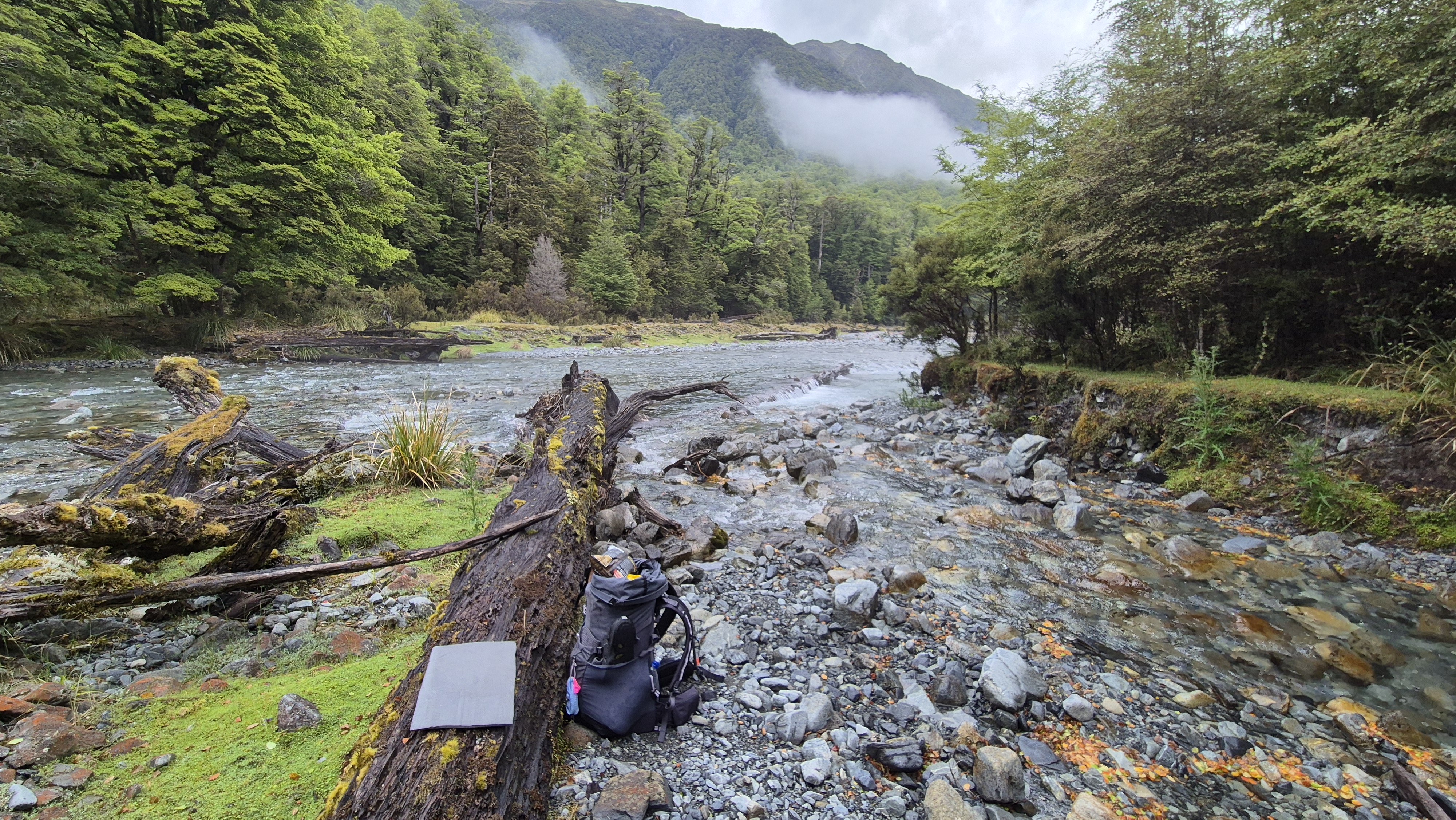
It was a breezy morning. The sun was out, and fluffy clouds scooted across the sky. Top Robinson hut sits at 730m. Today we were to climb a spur up to 1400m from the Robinson, then drop into a high saddle before heading down to Lake Christabel Hut (700m). We left at 8.50 am. The marked track had been trimmed and was in great shape. We arrived at the 3 wire bridge ten minutes later and filled up with water from the river.

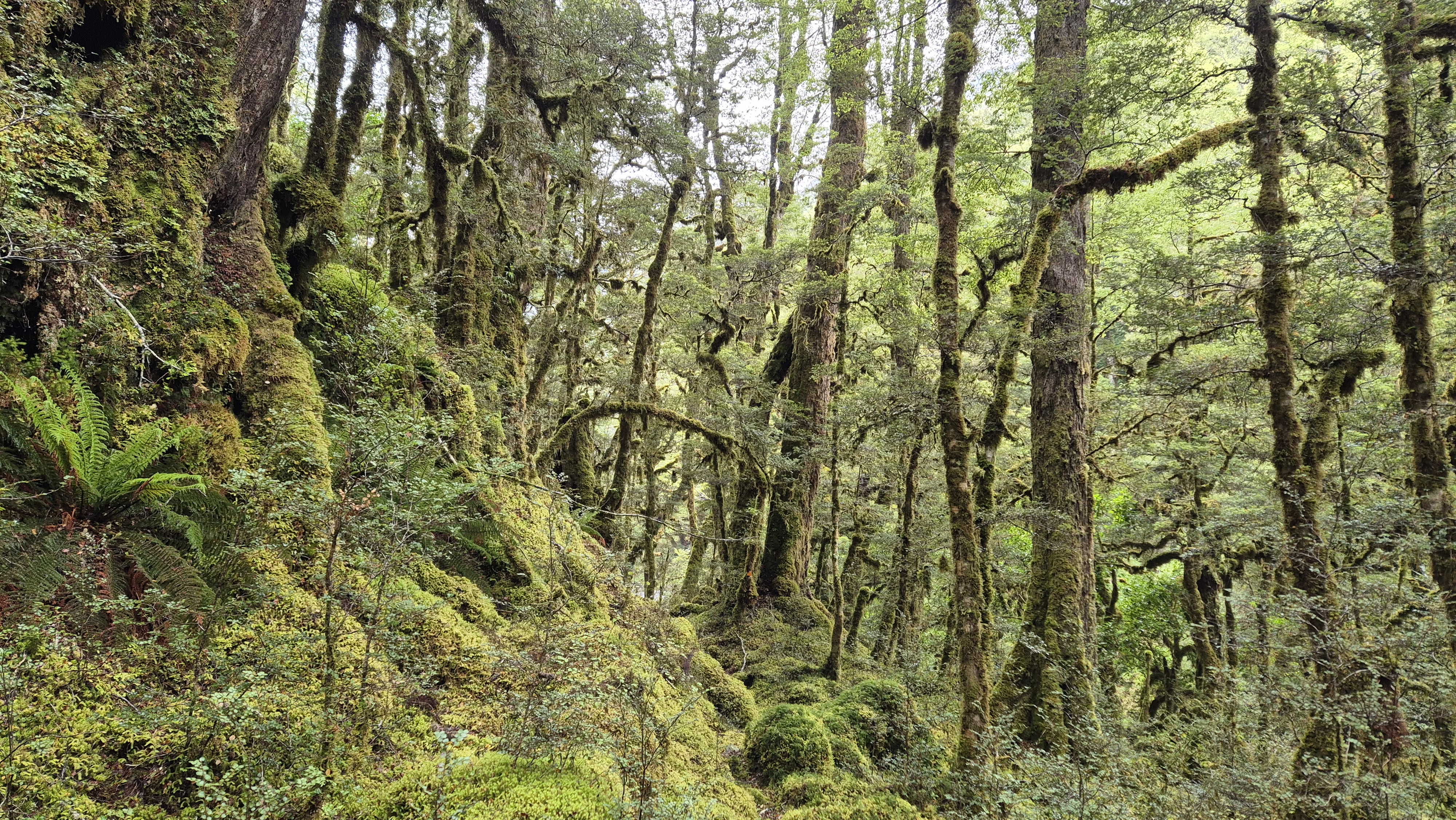
We got stuck into the climb – the easy track we’d enjoyed earlier was short-lived. The track up the hill was initially very overgrown with small beech trees. The first 100m elevation was a gentle ease into the following 400m, which was pretty steep. Within ten minutes, we were both sweating – glad the sun wasn’t too hot yet. At 9.40 am and around 900m elevation, we entered the beautiful dracophyllum zone and continued zigzagging our way up.
From the Forest
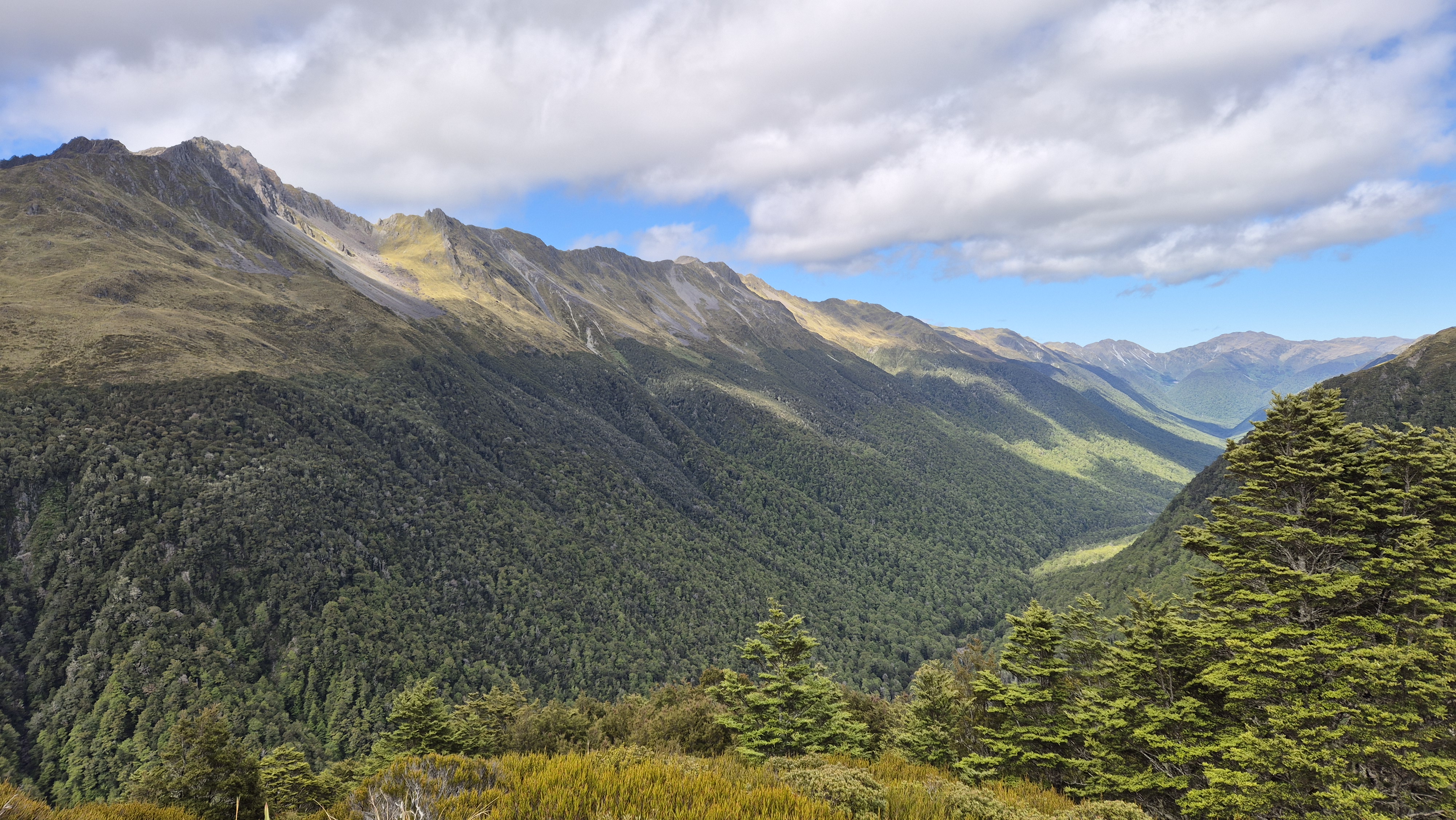
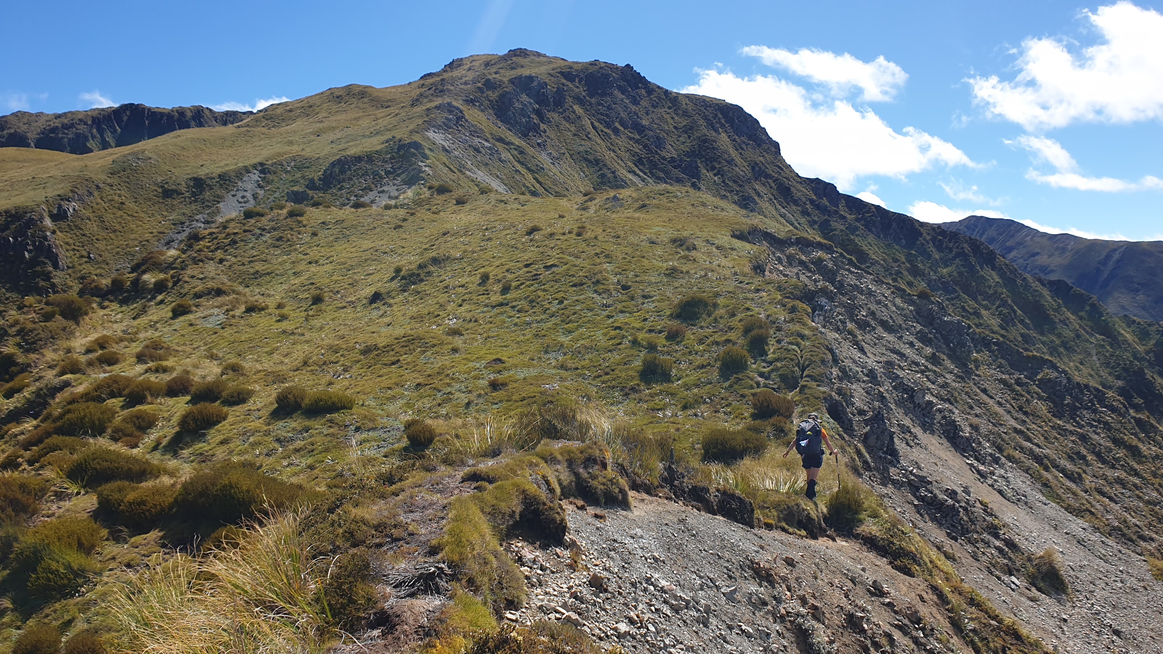
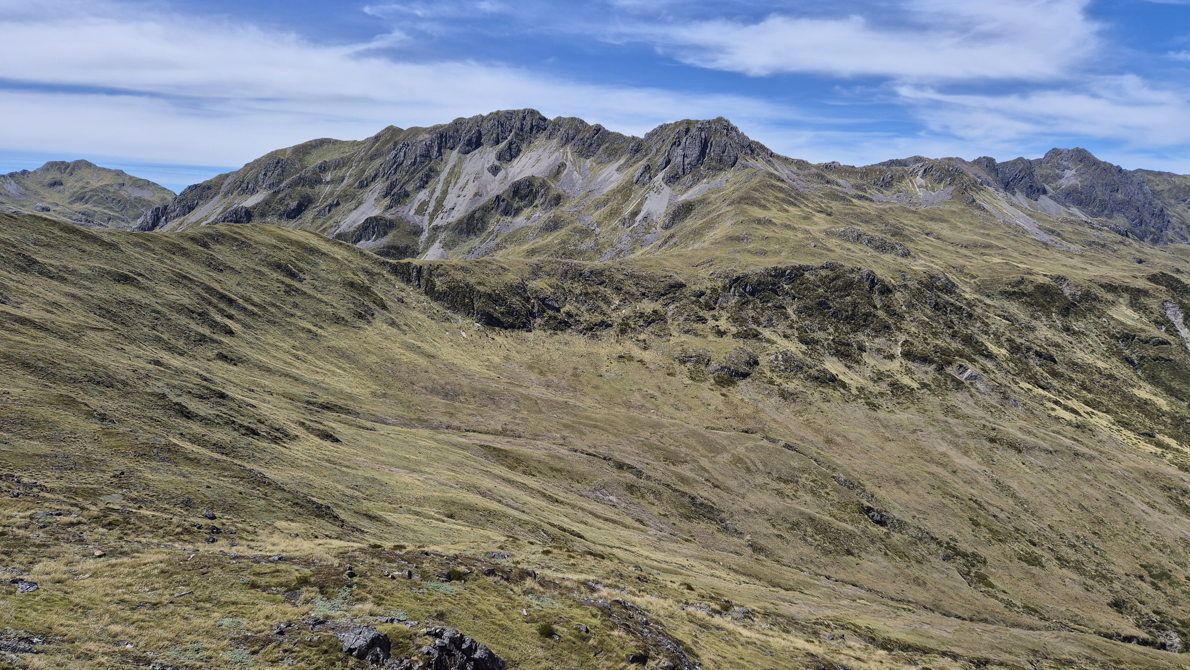
By 10.15 am, the trees were behind us and the route led into thick alpine scrub. The first pole came into view around the 1200m mark. From there, the ridge to the saddle loomed ahead, dotted with poles tracing the way up. Looking back offered sweeping views down the Robinson River and across the tops – a perfect excuse for a break to soak it all in. Mt Barron stood tall across the valley.

At 10.40 am we donned our hats and sunscreen and continued climbing towards the saddle. What looked like the top turned out to be a false peak, with more work still to go. Along the way, we spotted a few dainty orchids tucked among the rocks, which made a good excuse for a rest. We reached the high point at 1400m by 11.20 am. The views were wonderful!! Well worth the climb.

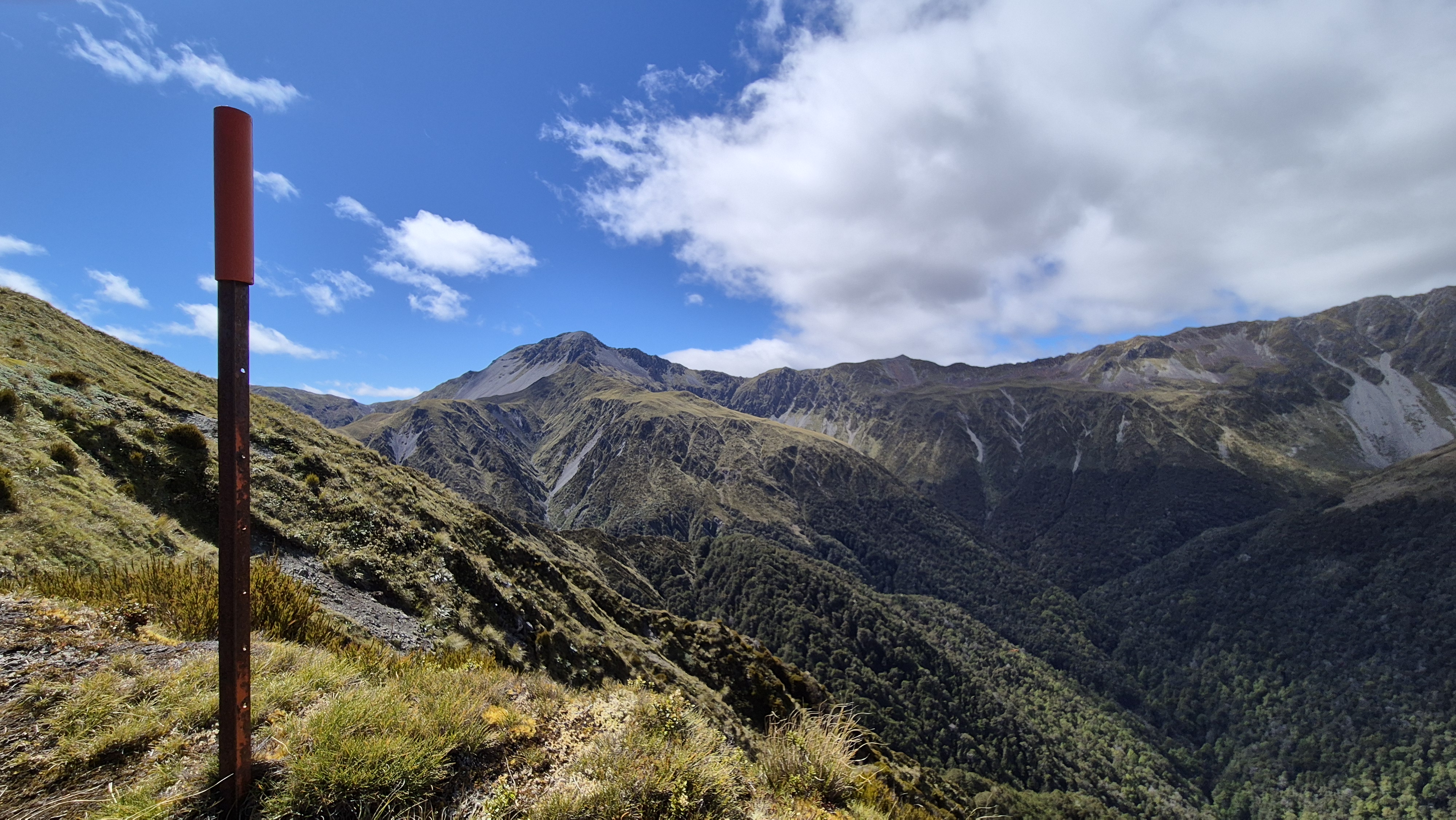
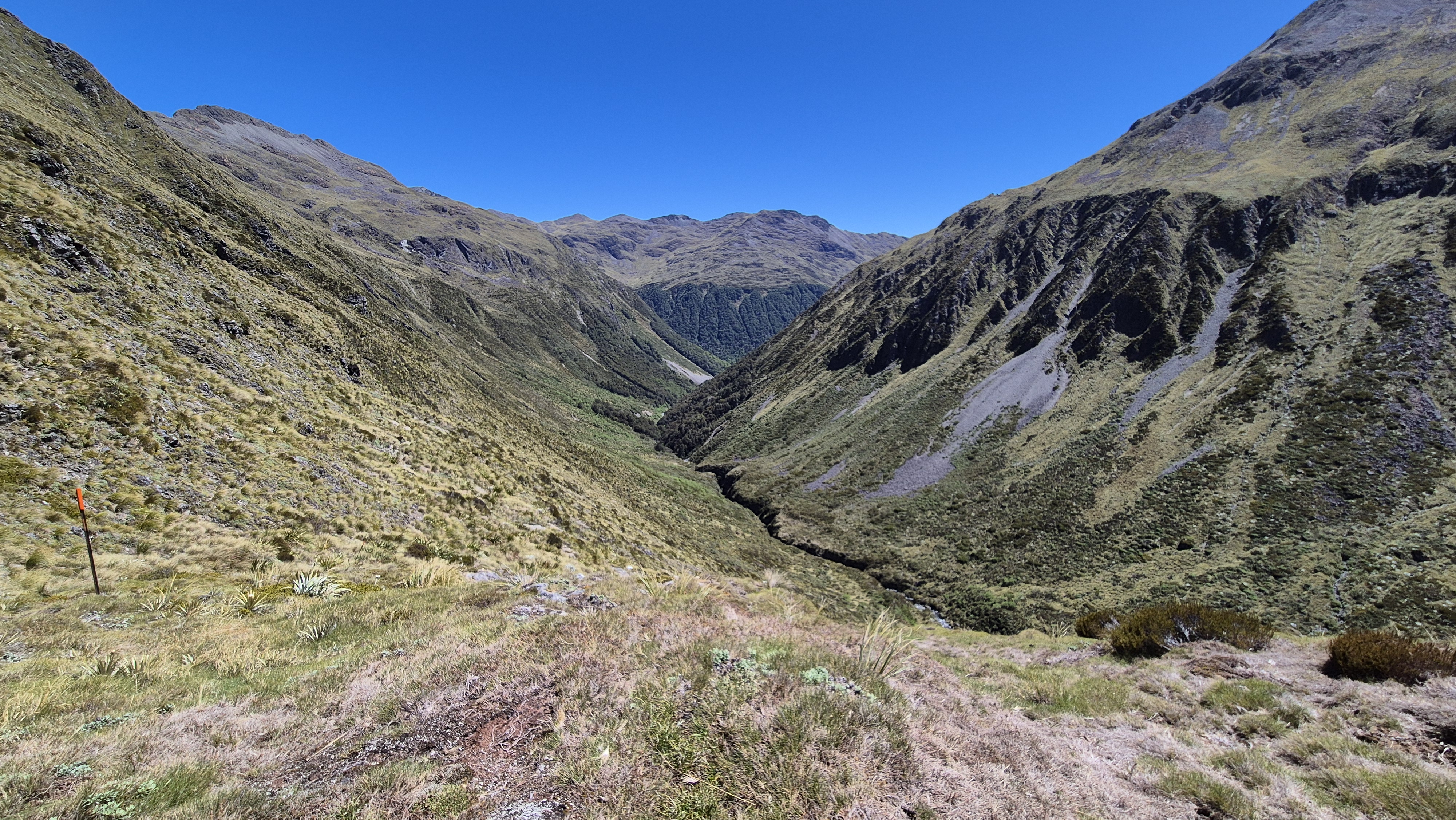
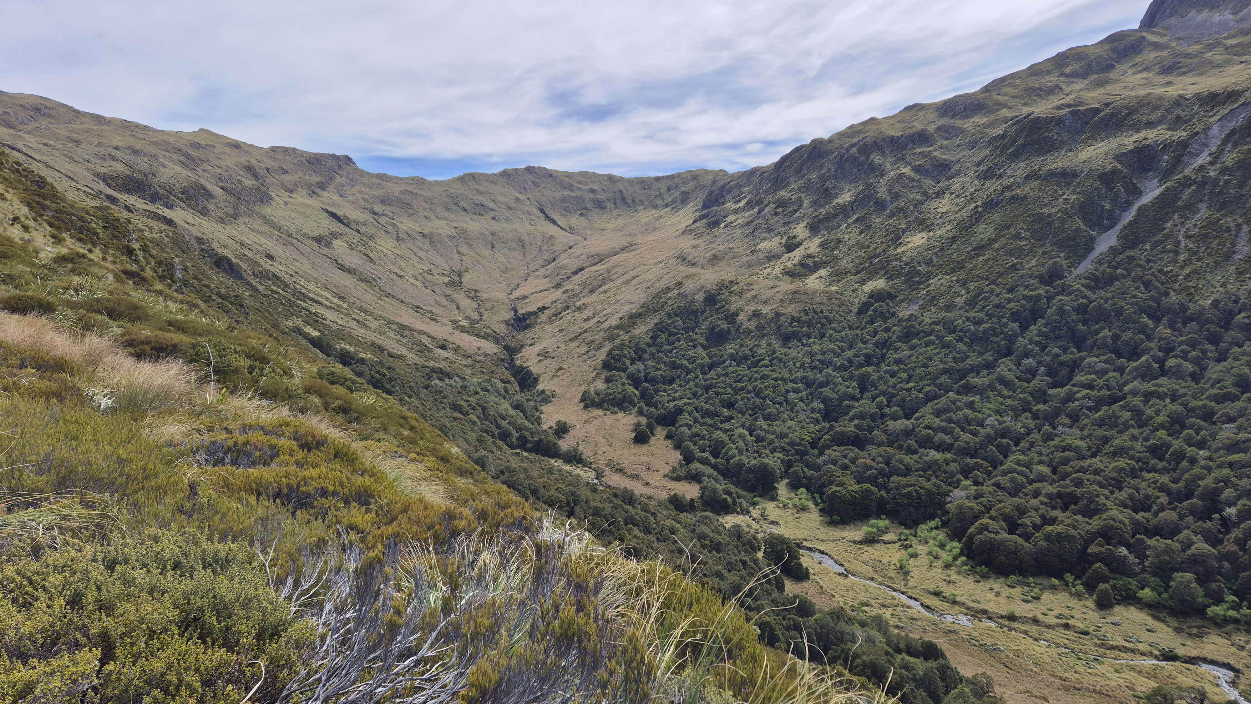
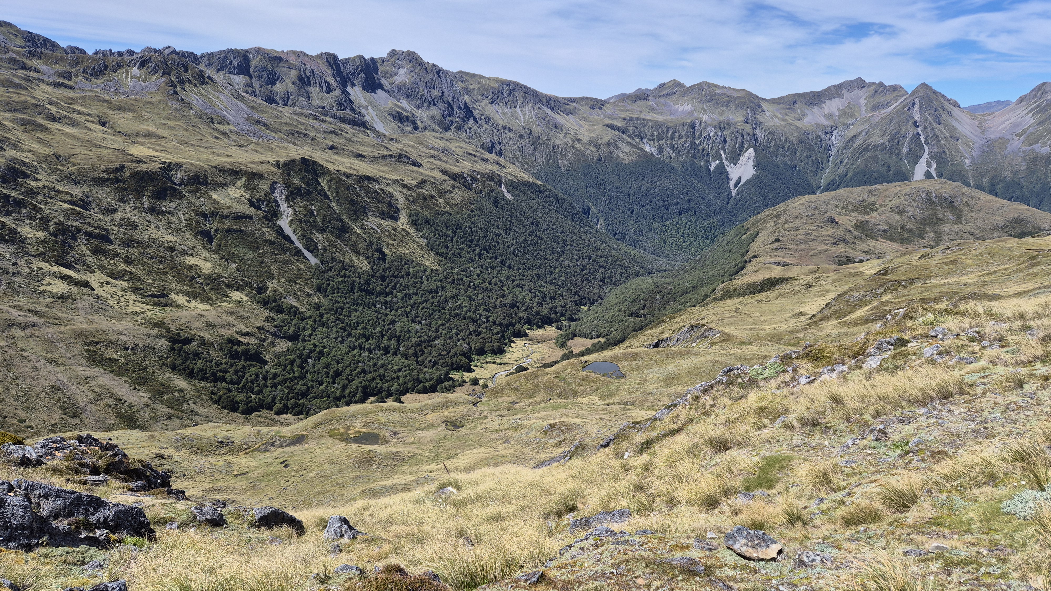
Robinson Christabel Saddle
The views from the saddle were outstanding, with a wide sweep over the Robinson to Mt Barron, and Mt Boscawen ahead. Below, a couple of tarns shimmered in the distance and the route continued with a lovely sidle beneath Pt 1526. A few small stream guts crossed the way, with water still flowing through them. The odd cairn marked a path, and the backdrop made for some great photo stops. Camping could be viable up here, though it’s pretty exposed and you’d have to pick your spot – the wind was howling through today. The first tarn we passed was already low, even in early summer. The second looked like a better option for camping nearby.

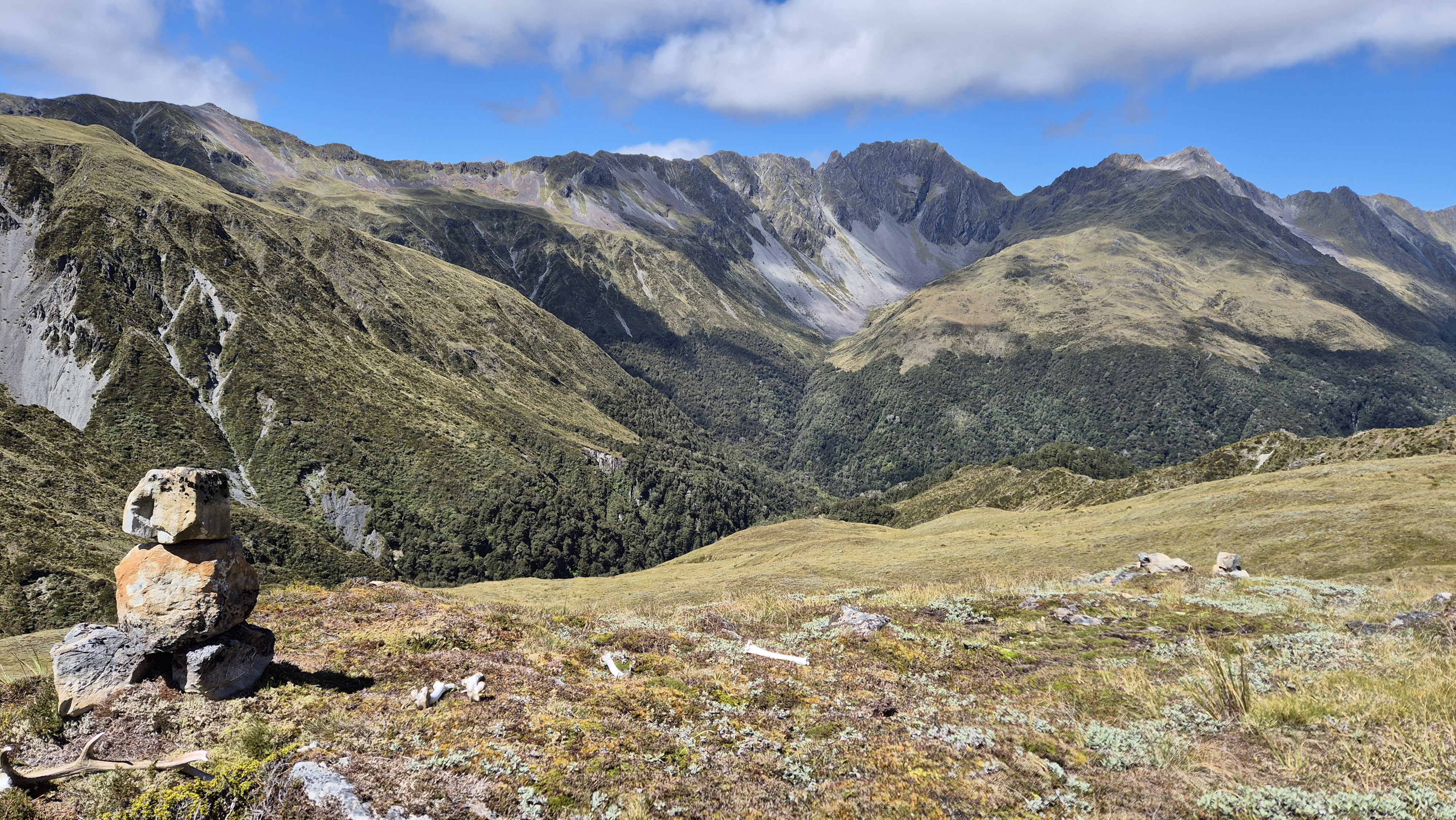
By 11.55 am, we were looking out over the next valley, the river snaking its way down. It would lead us to Lake Christabel this afternoon. From here, we looked upriver and traced a possible line up over the saddle at Pt 1452 beneath Mt Boscawen heading towards the Nina. That’s when we realised we were looking out over the Main Divide.
From the Saddle
Our descent began right on midday, sidling sometimes steeply down the valley towards the river (unnamed on the map, leading towards Lake Christabel). We thought that in winter, this area would likely be avalanche-prone. The long grass was wet underfoot, and the route wasn’t well defined. A sharp little drop part-way down required some care, and the loose rocks made for a tricky scramble. Crickets launched themselves in all directions with every step.

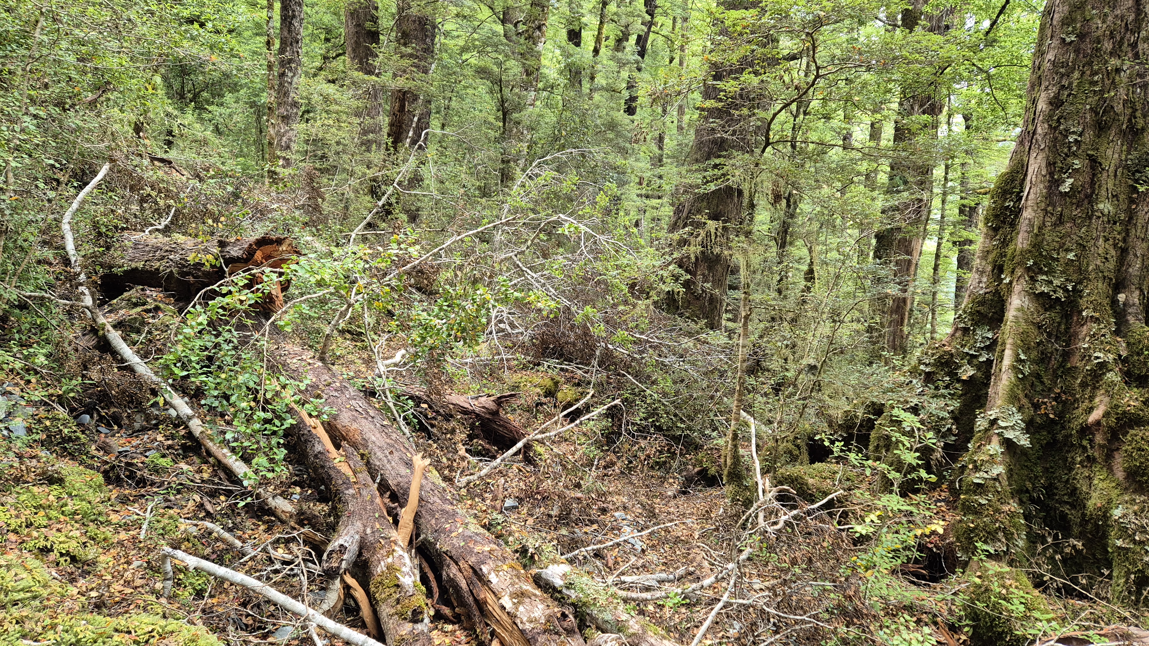
We spent the next 30 minutes pushing through overgrown vegetation, following a faint ground trail, and occasionally glimpsing hard-to-spot markers. Underfoot, hidden holes and small watercourses made the footing a bit unpredictable, so we watched each step. Thankfully, the bush was dry, and stunning. Everything was in bloom – tall red flaxes, flowering shrubs, and trees. We gratefully reached the shade of the beech forest at 1 pm, a perfect spot for lunch. It was a welcome relief after the descent and the slog through the overgrown vegetation.

After Lunch
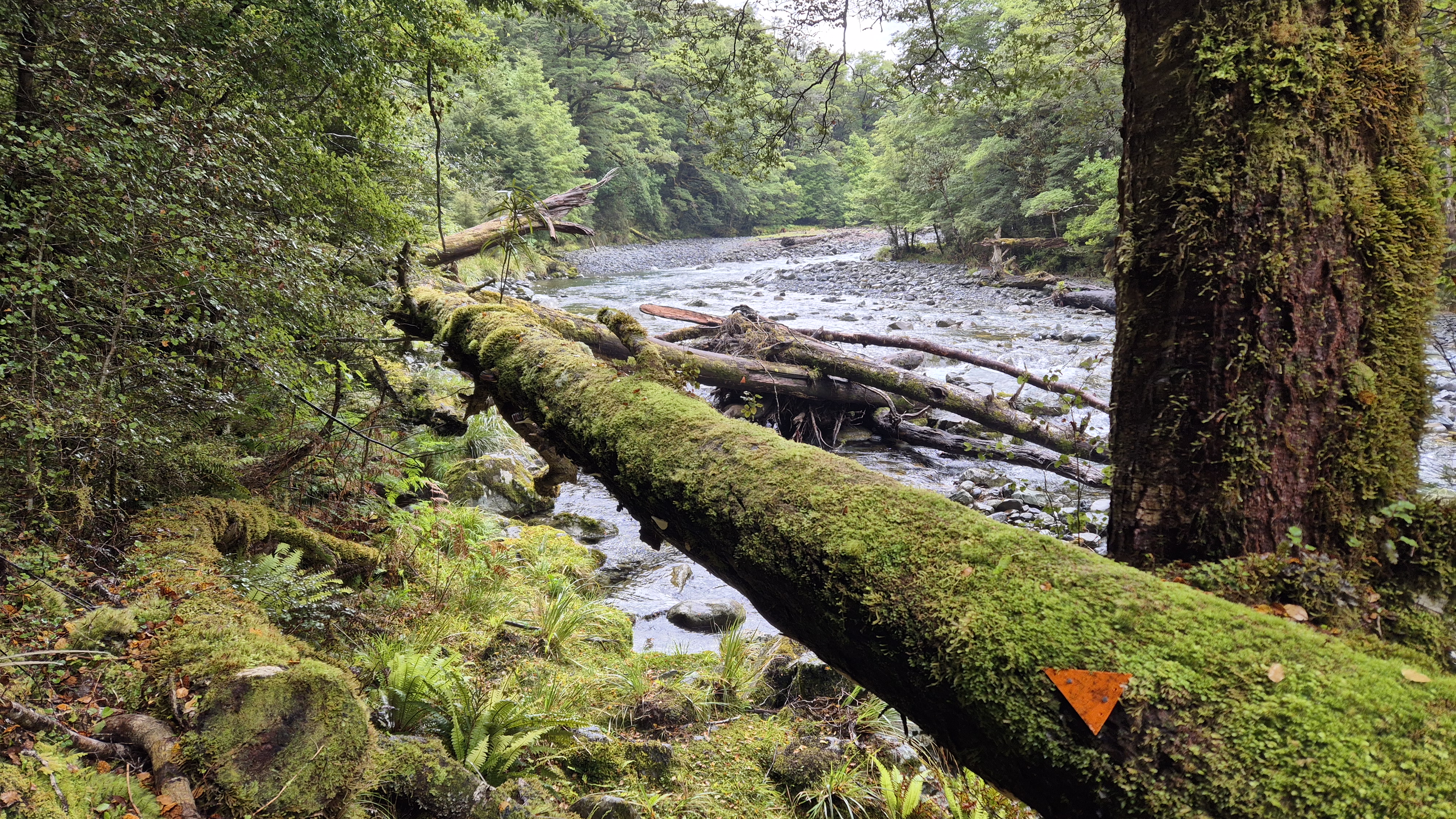
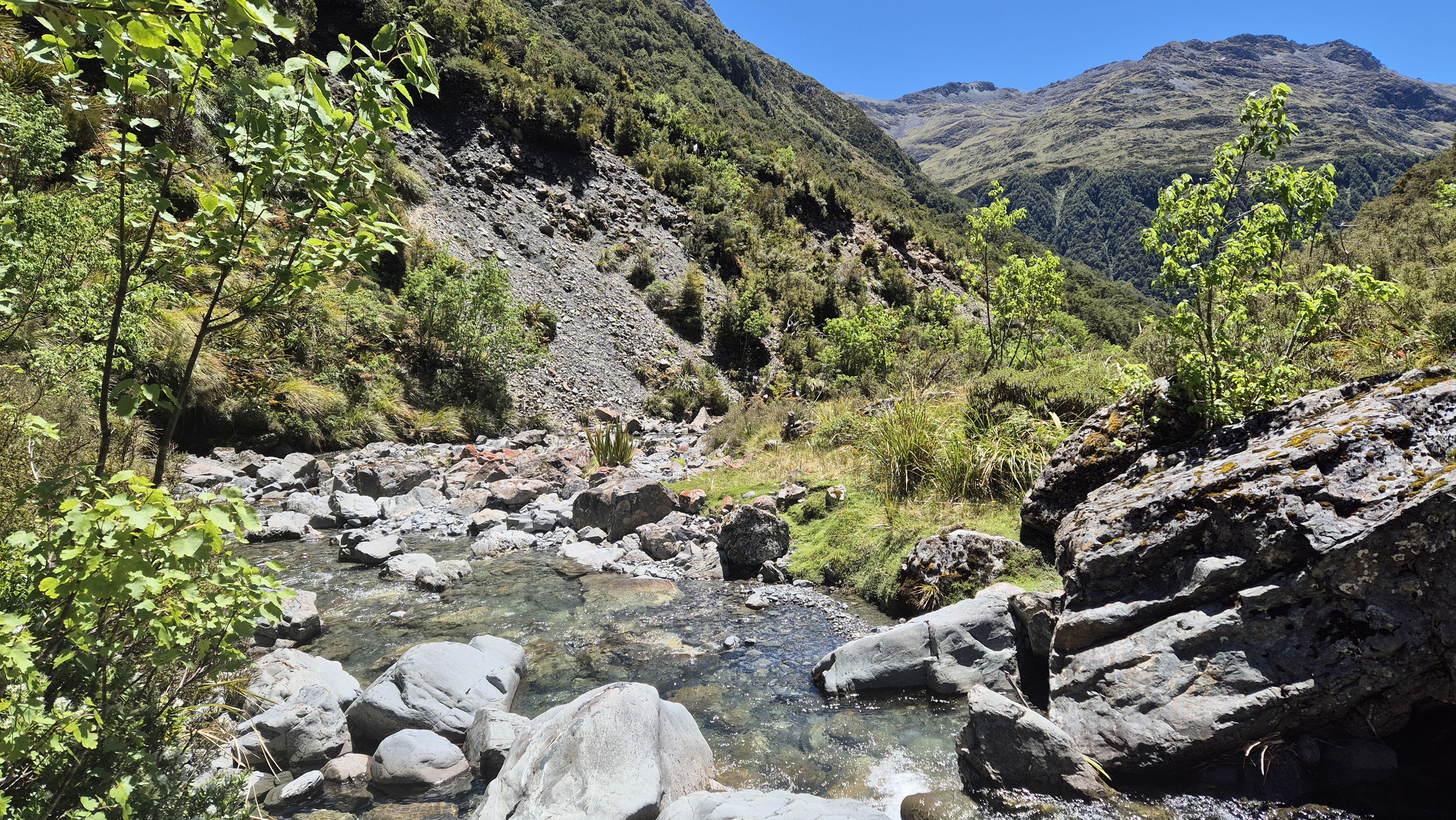
We left at 1.35 pm with around 5 km to walk to Lake Christabel hut. Soon, the track dropped steeply into a rocky, dry creek bed. We spotted cairns down and to the right and more at the bottom. Afterwards, we bypassed a slip, crossing the beautiful river near a great-looking pool. After crossing back to the true left and staying close to the river, Rich spotted a random marker. It took a bit of searching to locate the next few, but we eventually climbed up and found more, eventually finding a giant one.

Towards Lake Christabel Hut
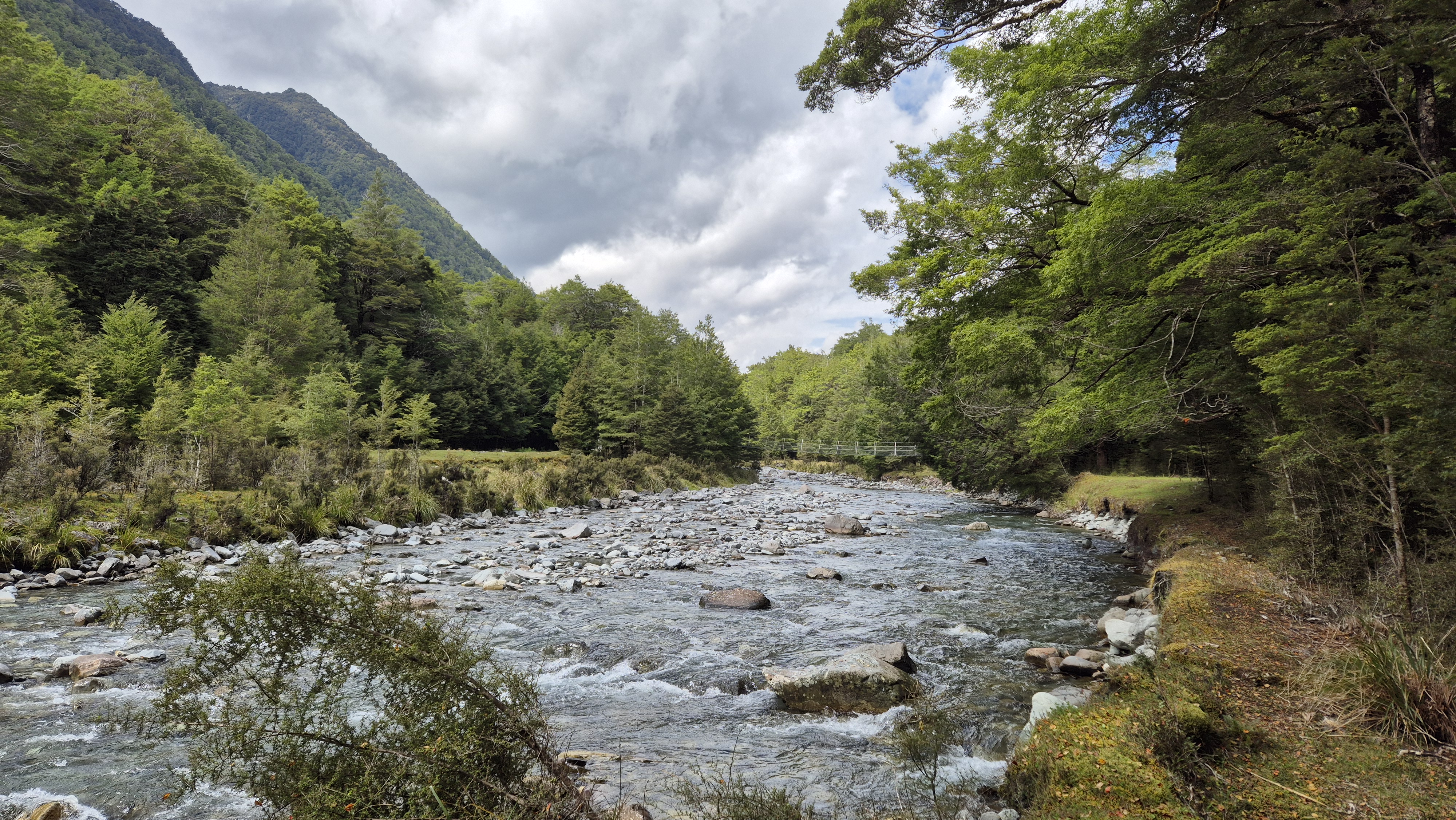
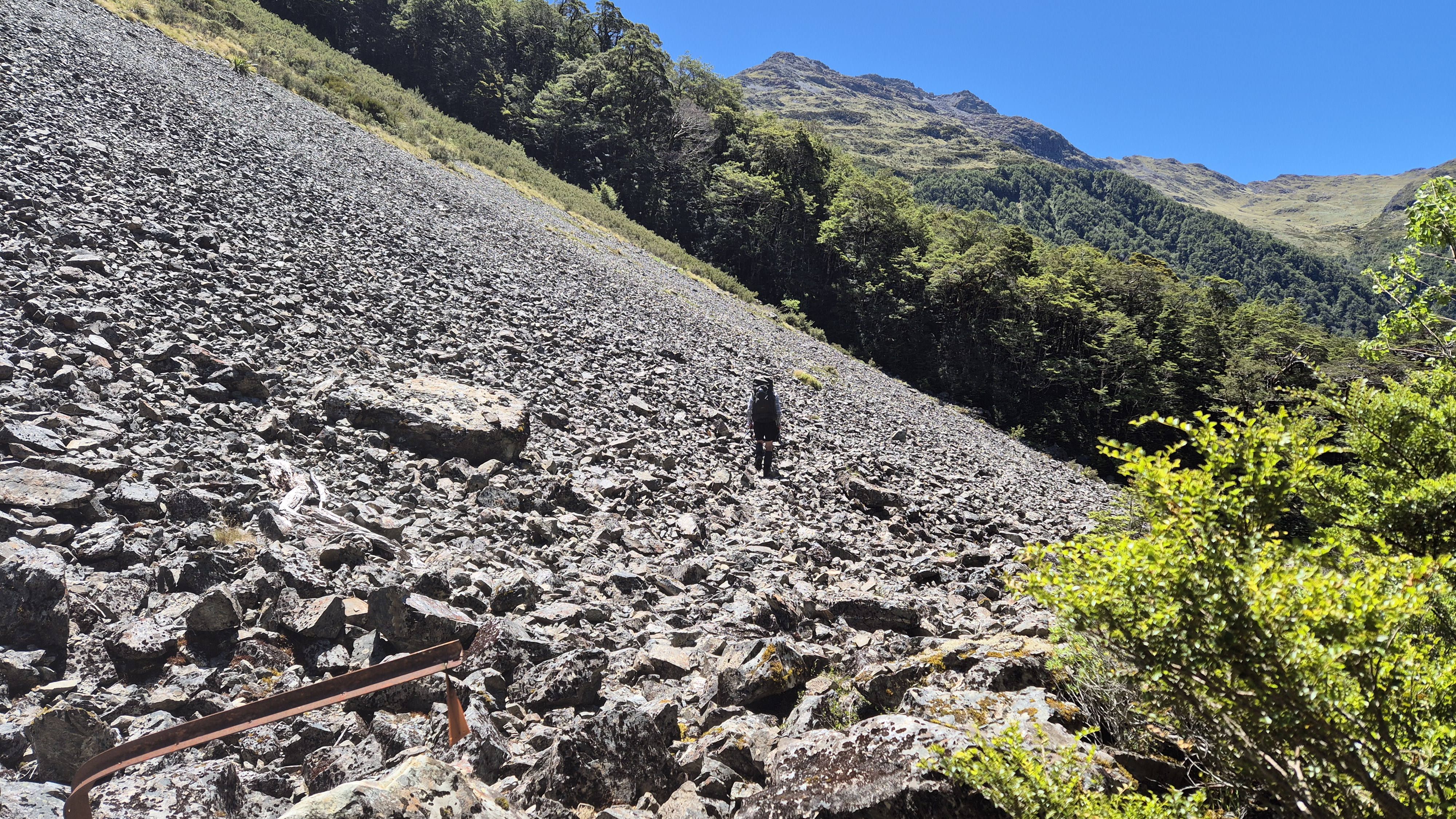
By 2.00 pm we were back in the beech forest again. Cool and mossy, almost goblin-like but drier than yesterday. We crossed a small scree slope directly, then, after a small navigational fail, reached a much larger one. A marker pointed the way to a faint track across the rocks. Beyond the screen, we re-entered the forest, tree rooty and rocky, before a short, steep descent. The track eventually came closer to the river and things became much easier. We reached a three-wire bridge at 3.00 pm, then followed an easy stretch to the hut, arriving just after 4 pm

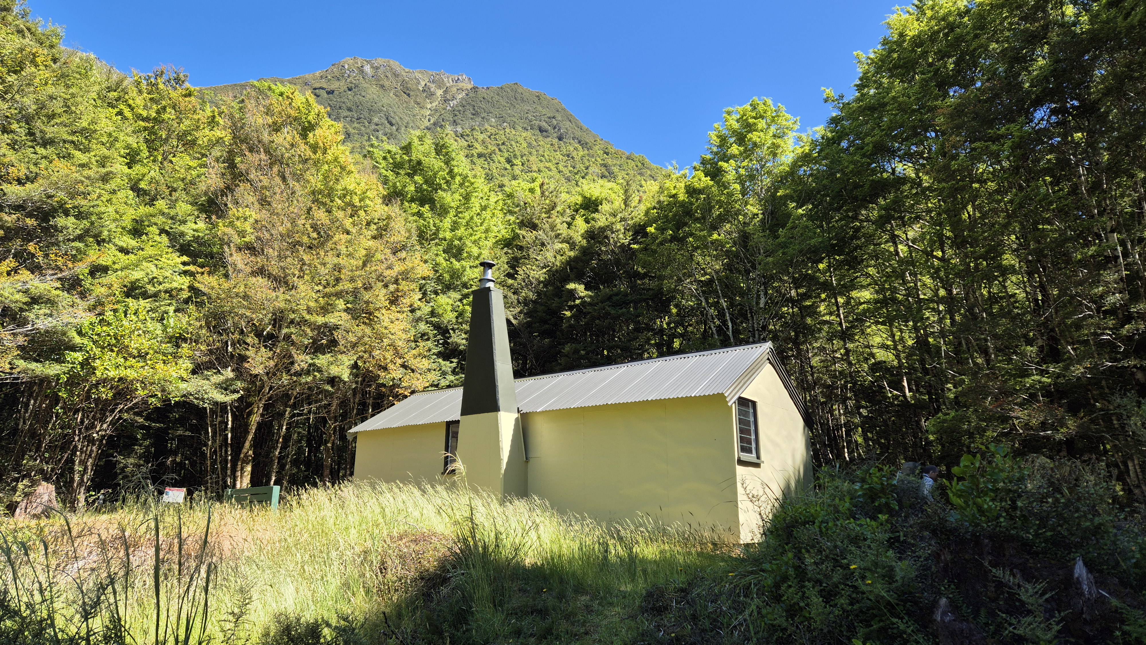
The 8-bed Lake Christabel hut was a welcome sight, well-situated on a clearing by the river. It even had a picnic table! The toilet, swarming with flies, was less impressive. After settling in, we headed down to the river for a swim, washed our filthy socks, and soaked up the late afternoon sun. A lovely young couple arrived from the road end at around 8 pm, looking worn out after a long and unexpectedly difficult day on the Lake Christabel Track. We had another early night as they pottered around sorting their well-deserved dinner.
Robinson Christabel Day 4
Lake Christabel Hut via Rough Creek Track to the Tops
Our times:
Lake Christabel hut to the bush line: 2h 20 mins
Lake Christabel hut to ridge to approx 1440m: 3h 30 mins
Our hut buddies left early to head over to Top Robinson hut. We took longer over breakfast and changed our plans, deciding to head up to Brass Monkey biv over the next 2 days instead of walking out. This would involve heading up to the tops via the Rough Creek Track and traversing east off the track to Pt 1482 to Brass Monkey Biv. When we left home a few days ago, the forecast looked promising, so it felt like a good opportunity to give it a crack. We set off at 7.55 am into a chilly morning, jumpers on to start. I’m unsure why, but I hadn’t counted on an immediate climb, so the layers came off within five minutes. The marked track was clear and easy to follow, just enough to lull us into thinking we were in for a cruisy morning.

The Climb
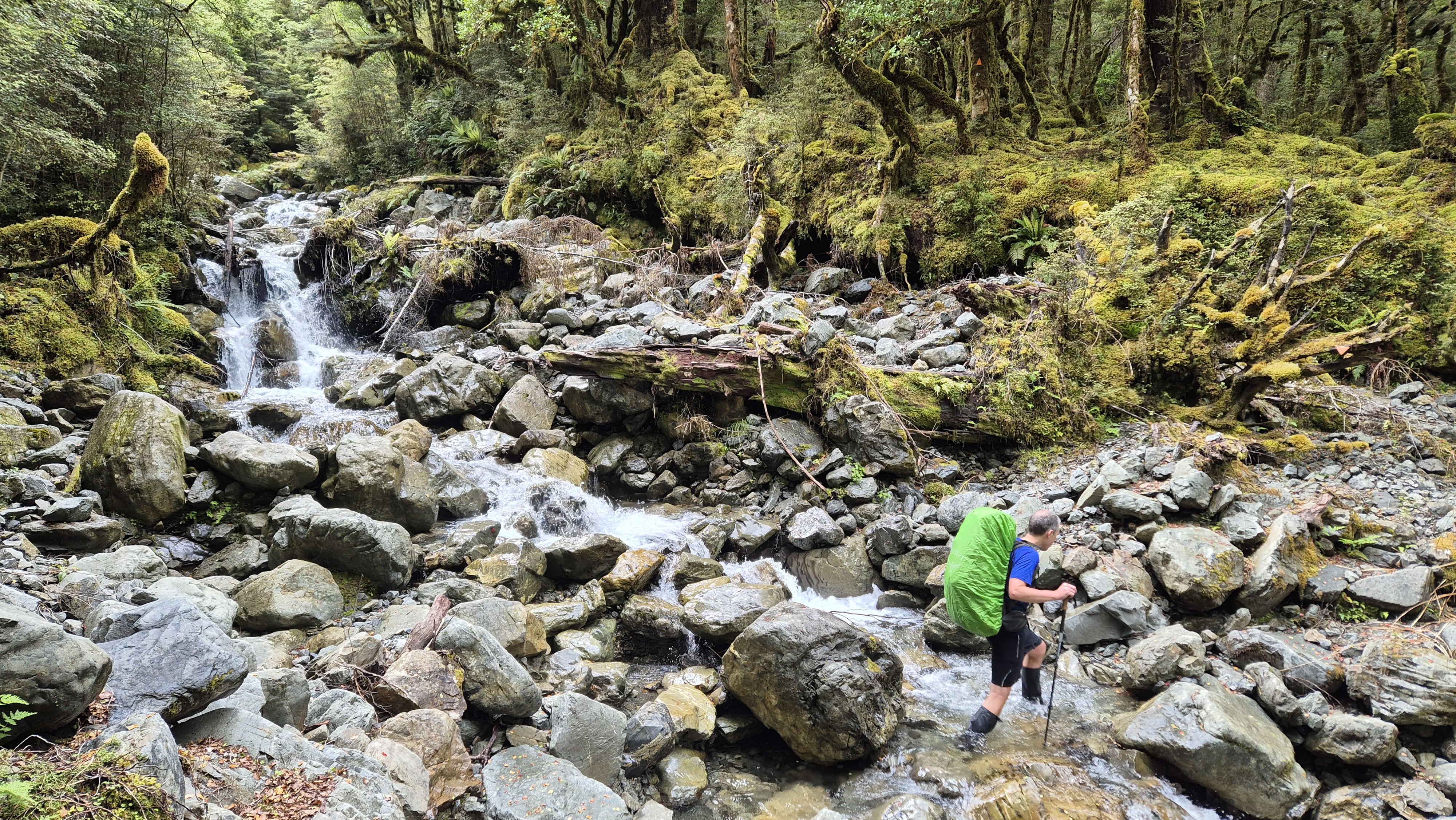
It changed pretty quickly! The track became overgrown and more difficult to follow, with plenty of clambering and pushing through the foliage. A highlight was walking through a magical section of giant mossy boulders. The track climbed high above the river before dropping down to meet it again in several places. Around 8.30 am, we caught a strong whiff of sulphur in the air – a hidden hot spring nearby. By 8.50 am, an hour in, we were surprised to find we’d only covered just over a kilometre. It felt more like three.
Our progress was slow, with occasional difficulty finding markers and needing to retrace our steps more than once. Eventually, the track led us into a clearer section. We took a quick break at 9.30 am, overlooking a wall of waterfalls across the river, just before the climb away from the river began.
Five minutes later, we were picking our way uphill, following a narrow trickle of a stream. The climb continued, becoming steeper and I think we were both feeling a little tired! Just after 10.15 am, the trees gave way to flax and scrub, and we popped out above the bush line to a magnificent view, with a stunning, wide, golden basin before us.
Towards the Ridge
From the bush line, the marker poles led off to our right. It was windy up the top, with high cloud rolling through. Hats on and sunscreen applied, we checked the map for a decent-sized tarn, and found one at around 1,335m to refill our water bottles.
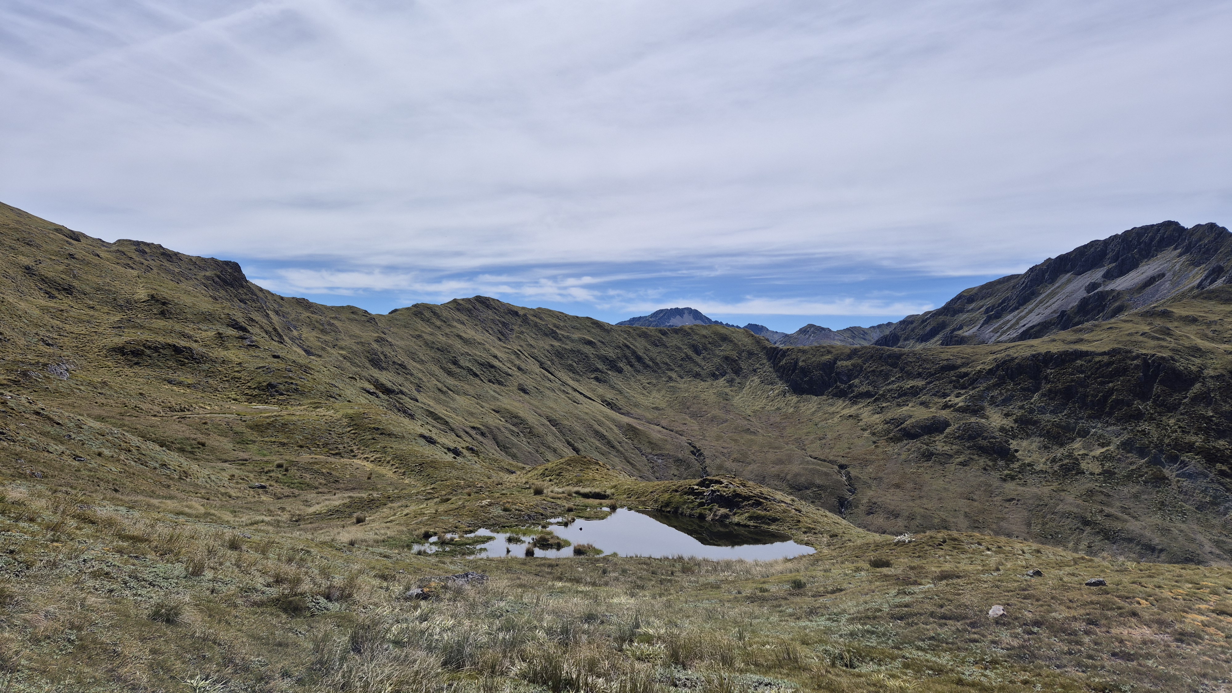
We headed left, to climb up from the tarn to the ridge around 11 am – a short, sharp grunt. Twenty-five minutes later, we reached the ridge at approx 1440m and stopped for a break. It had taken us just over 3.5 hours from Lake Christabel hut. The views from the ridge were outstanding. The marked route dropped north into Rough Creek and the Maruia. Behind us, across the basin to the south, the steep faces rose up to The Grand Duchess.
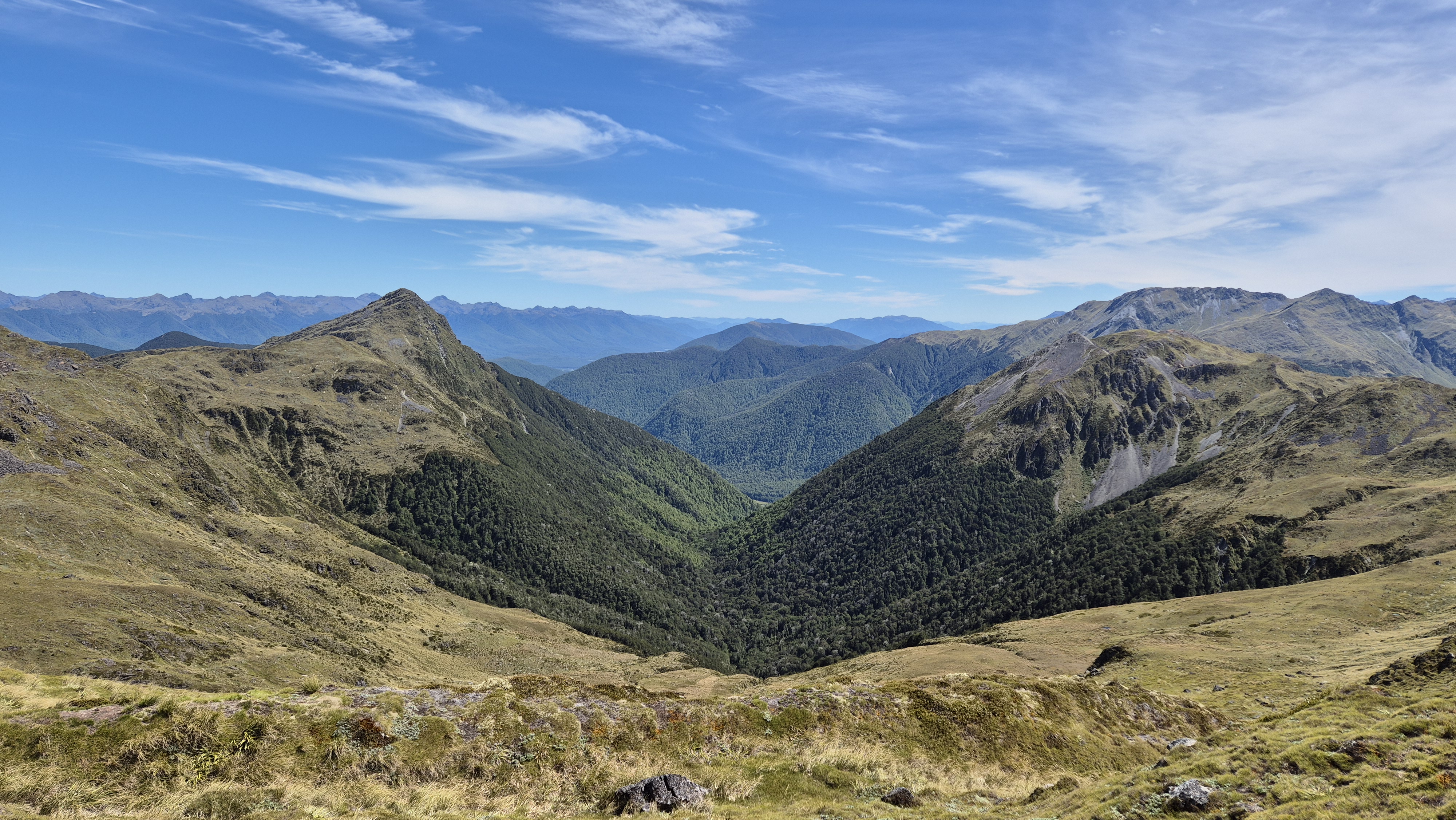
Brass Monkey Biv
I wandered west up the ridge to see if I could get a phone signal for a weather update. It was worth the extra walk for the glimpse of Lake Christabel! I got a signal, and it turned out that heavy rain was expected the day after tomorrow. We certainly didn’t fancy walking out in heavy rain, so we decided not to bother with Brass Monkey after all. This was the second time we hadn’t quite made it! The first being on our tramp over Lewis Tops and out via Lucretia. At the time of writing (May 25) the wonderful volunteers at the Backcountry Trust have just replaced the old Brass Monkey biv with a rather wonderful-looking new hut – which is brilliant! but we’re gutted we didn’t bag the old one!
However, as it was such a beautiful day today and tomorrow’s forecast was fine, we decided to spend tonight on the tops and head out via Lake Christabel tomorrow.

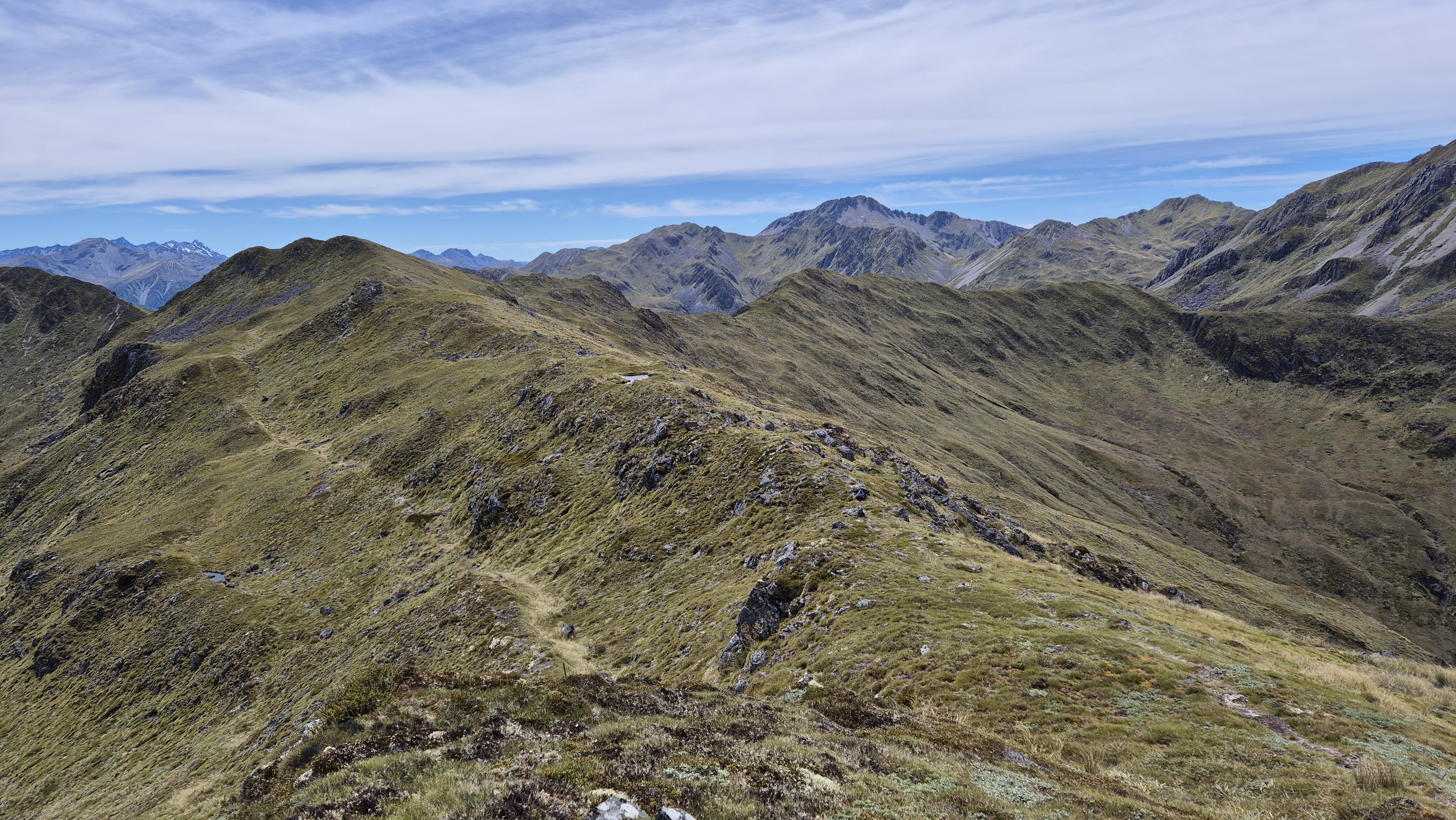
Along the Tops
After a break, we headed east across to Pt 1482 for a look down into the catchment of One Mile Creek and across to the back of Lucretia. It didn’t disappoint. We imagined our route to Brass Monkey for next time.
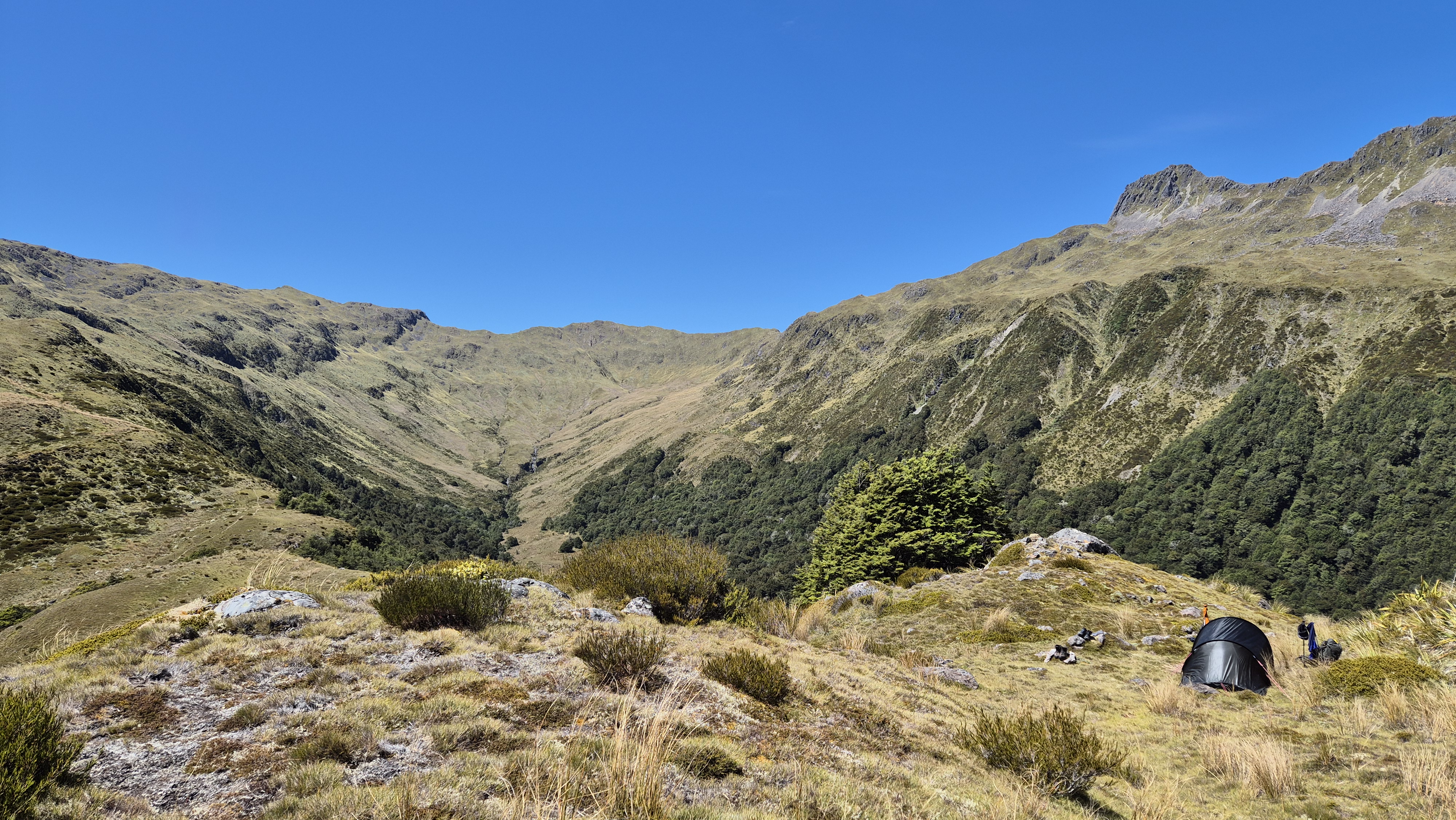
We now had a cruisy afternoon ahead of us, so we ambled back, dropping down to the tarns, enjoying the marvellous views. We crossed a stream and filled all our water bottles and containers. By 1.45 pm, we were back on the Rough Creek Track at the bush line and stopped for lunch beneath some low beech trees. We set off again half an hour later towards Pt 1231. Not far off we found a marvellous camp spot. Nearby, there was a beautiful tarn, and shade from a little stand of trees. Best of all, we had outstanding views across the valley towards the Duchess and Mt Hapless.

A Cruisy Afternoon
The afternoon was spent exploring, and we discovered some great views straight down to Lake Christabel to the northwest. Later, I sat beside a glorious tarn with my feet dipped in the warm, clear water. A swim was tempting, but I couldn’t bring myself to disturb the perfect ecosystem. The tarn was teeming with life. Beetles swam up from the depths to catch flies trapped on the surface, and other tiny creatures moved through the water just below. It turned out to be red damselfly mating day (*hazarding a guess at the species from Wikipedia). Pairs hovered and dipped, joined together in their dance, just above the water. To round off a perfect day, we ate dinner in the shade, then retreated into the tent as the evening cooled and the wind began to stir.

Robinson Christabel – Day 5
Lake Christabel hut to Palmer Road
Our time from camp (near Pt 1231) to Lake Christabel hut: 2h
Lake Christabel hut to Palmer Road
DOC time: 6-7h
Our time: 7h 30 mins
We got up at 6.30 am and watched the sun rise over the Duchess Range. Our camp was packed up and we were on the move by 8.15 am, heading back down to Lake Christabel hut and out to Palmer Road today. We dropped steeply down through the scrub to the stream and grassy stretch, then the waterfalls. By 9.10 am, we reached the river, and later stopped to investigate the strong sulphur smell. We found nothing but strings of white and brown slime. It was already muggy, so we were grateful for this first quick break of the day.

The return journey didn’t seem as slow going as yesterday. At one point, I took a couple of steps to my left onto what turned out to be a weak overhang above a small washout some metres high. The ground gave way underfoot and I grabbed a tree branch, which also gave way. I managed to grab a sapling with the other hand, which thankfully held. I dangled momentarily, my feet scraping around for a hold. A bit nerve-racking, and a good reminder of how precarious things can be.
Later, we ran into two guys we’d seen cross the tops from our campsite yesterday who’d been tramping from Rough Creek. They’d stayed at Lake Christabel hut the night and were heading home today. We reached Christabel Hut at 10.15 am and stopped for a quick break, leaving at 10.30 am to tackle the Lake Christabel Track.
Lake Christabel Track
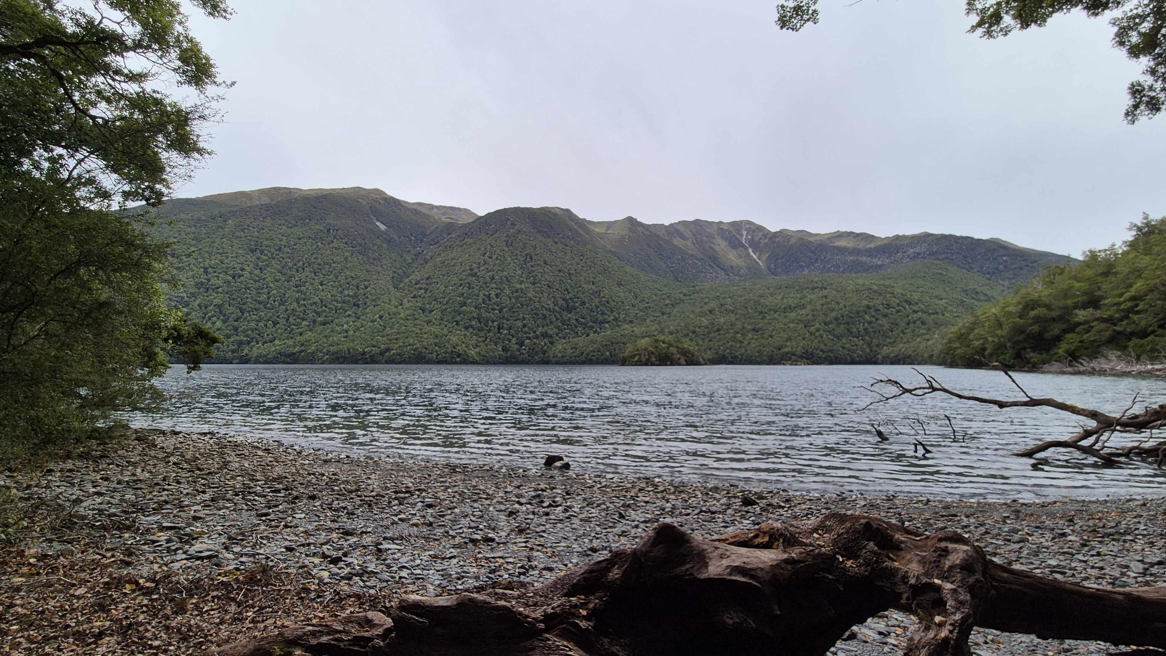
We’d heard the Lake Christabel track wasn’t in great shape, and the couple we’d met found it took longer than expected. To our surprise, it started like a highway. The track was well marked, winding through the forest of large beech trees with crown ferns and plenty of birdlife. We crossed a dry riverbed and wondered how much rain it would take to fill it. Around 11 am, we hit a patch of mānuka and head-high grass that left me itchy and covered in welts. Then we saw Lake Christabel – green, still, and stunning.


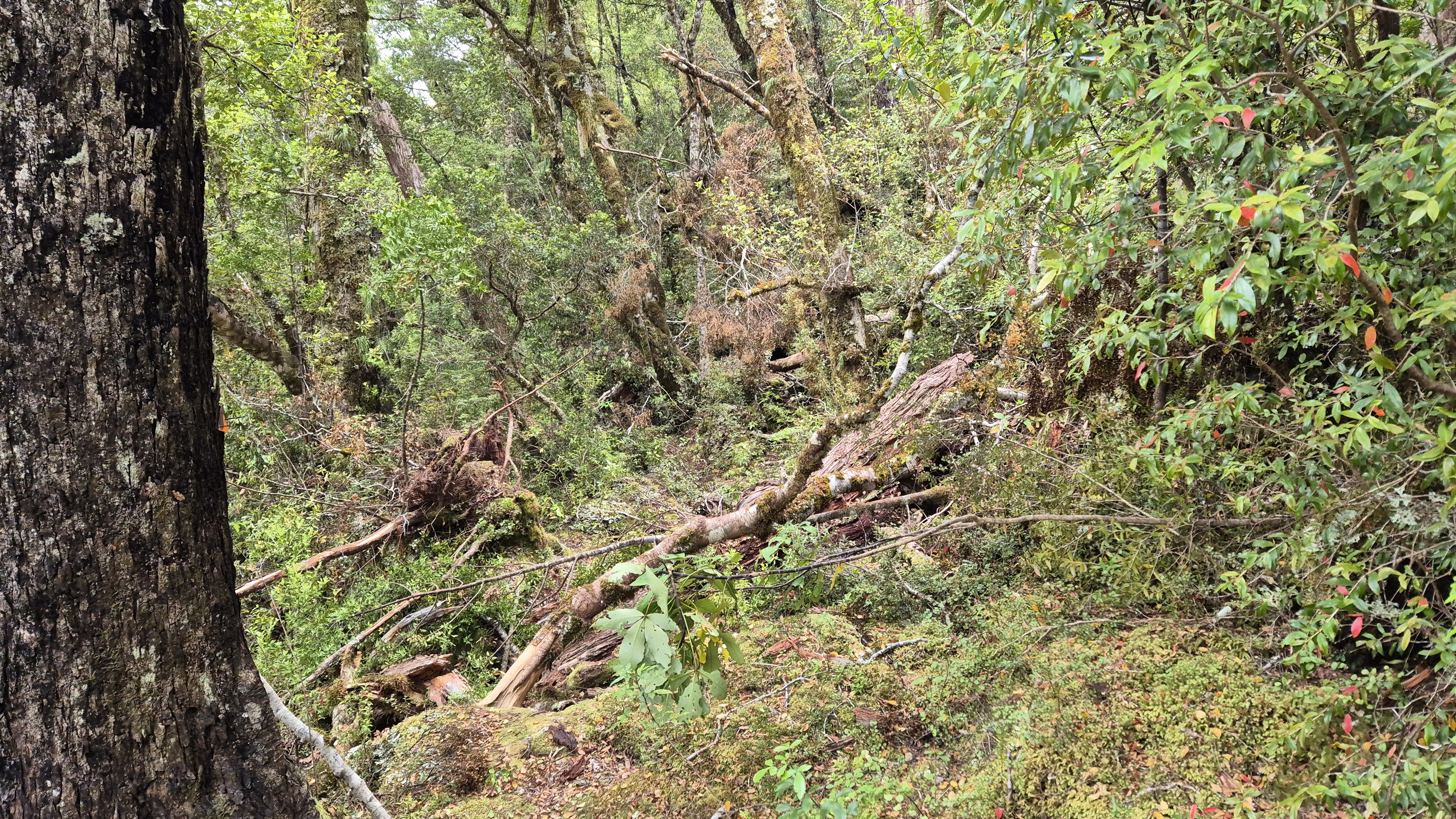
The track became steadily worse as we made our way around the lake, sometimes very narrow and overgrown. Our progress slowed as we balanced on boulders, pushed through bushes, and ducked under or climbed over fallen trees – a bit of everything. With about 1.5 km to go before reaching the end of the lake, a break in the trees gave us clear views back to the tops where we’d camped last night. Side streams offered a good chance to fill up our water.

Lunch on the Beach
We reached a beach at 12.50 pm, then a second, bigger one ten minutes later. The perfect time for lunch. It was still hot, so I had a swim while Rich got lunch together. Remarkably, there were no sandflies! By the time we left the beach at 1.30 pm, it turned overcast and a breeze was getting up.
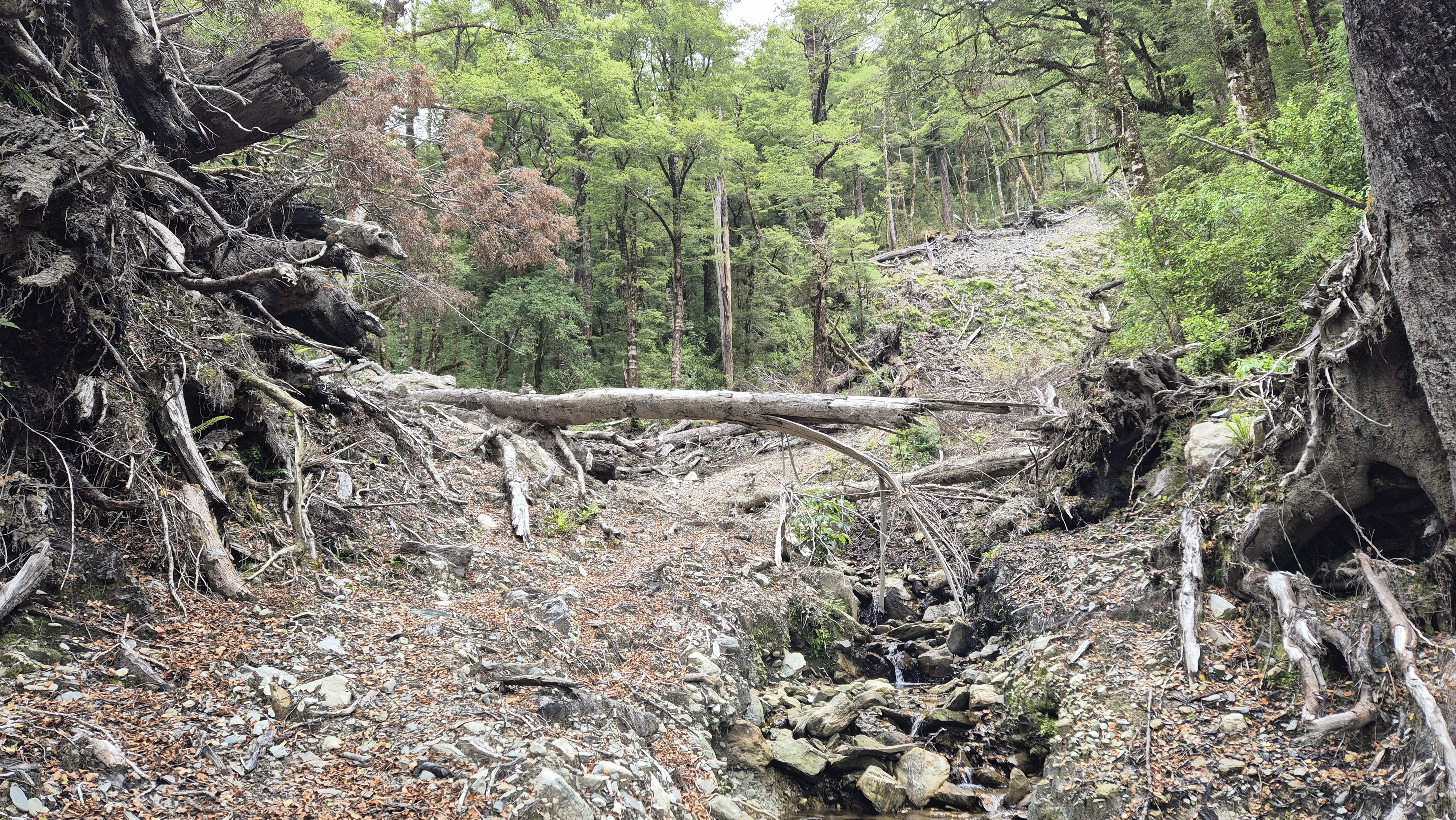
The next stretch was up and over the lake debris dam at the western end of Lake Christabel and a final walk out along the Blue Grey River. Around fifteen minutes after heading off, several cairns directed us up and left across a huge washout. Heaps of debris had washed down and broken trees were scattered across the slope. From here, we had a slow climb up and over the dam, followed by a descent into a boggy stretch. This section was a little easier than the narrow overgrown track along the lake itself, but with plenty of short ups and downs to remind our legs that we were nowhere near done yet.
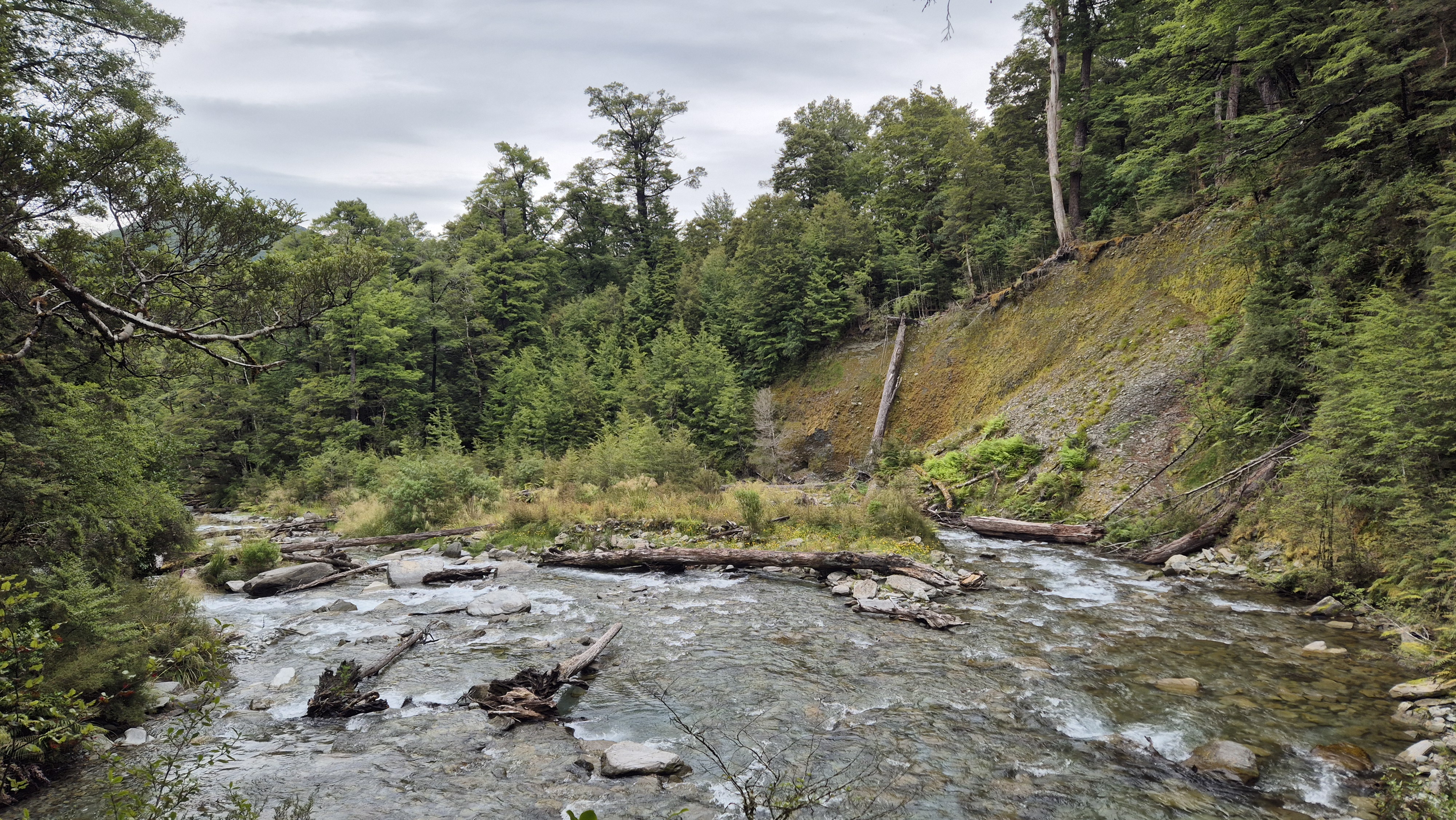
Blue Grey River
At 3 pm, we dropped down to the Blue Grey River at a sweeping left-hand bend, where the gravel cliffs had been washed away. We followed a faint ground trail straight ahead beneath the cliffs, which was solid underfoot. There was no need to cross the river. A couple of cairns and some large markers appeared. Judging by the map, we figured we still had over 6 km to go.
The walking wasn’t difficult, but still offered boggy sections, fallen trees, and more tangled overgrowth. Wasps buzzed around the honeydew on the beech trees, but left us alone. At 3.45 pm, we reached the Blue Grey River again at a lovely spot that lived up to its name. We stopped for a 20-minute break, enjoying the rest and the birdsong. Robins and fantails flitted around us, and somewhere nearby a kākā called out.

Getting moving again for the final push to the road felt like a chore. Our progress was slower than we’d have liked and mud, windfall, and more bush-bashing kept us honest. At 4.55 pm, we scrambled up and over a sizeable slip and then were just 2 km to go. Not far on paper, but we were both pretty tired. Poor Rich still faced a 10 km bike ride from the road back to the Robinson to collect the car. It was hot and muggy, and I could feel the makings of a blister in the dead centre underneath my heel. At around 5.45 pm, the track finally opened into a beautiful grassy clearing. Our spirits lifted – surely the road was just around the corner? Not quite. We were still 15 long minutes away, including a last final windfall to scramble over. We reached Palmer Road at 6 pm, 7.5 hours after leaving Lake Christabel Hut.
Palmer Road
A car was parked by the stile at the road. We dropped our packs beside it – such a relief to get them off our shoulders! Then, a perfectly timed stroke of luck/tramper karma occurred. Just as Rich pulled the bike out of the bushes, a car rolled up, heading out towards Springs Junction. Out jumped the couple we’d met at Lake Christabel Hut – they’d been road walking from the Robinson back to their car (which we were standing next to) and had luckily managed to get a lift. Fortunately for us, they’d dropped their packs not far from the Robinson road end to make their road walk easier and were driving back to fetch them. Without hesitation, they offered Rich a lift back to our car. Incredible timing – we couldn’t have planned it better if we’d tried!
I parked myself underneath a large beech tree in my over trousers and head net to fend off the rampant sandflies, and took a moment to reflect on our tramp. We had a wonderful time with mostly decent weather. My final thoughts were that whilst it’s a beautiful tramp, the Robinson Christabel is not without a few challenges, notably the overgrown descent into the Christabel from the saddle, and today’s long, obstacle-filled, overgrown track from Lake Christabel hut. Still, it’s a rewarding and memorable trip, well worth adding to the list.

Click the links below for more tramps in the area:
Mt Haast – day walk
Wheel Creek Hut – overnight
Lewis Tops, Lucretia Biv, Nina River – overnight
St James Walkway – 3 nights, 4 days
Nina Biv – overnight
Hope, Doubtful, Nina Rivers loop – 3 nights, 4 days
St James Walkway – 3 nights, 4 days
Waiuta to Big River – overnight
I really like your trip write ups.
Just the right amount of detail and photos.
Info is enough to make us think about doing them ourselves without spoiling it for us.
Keep posting them
Cheers Owen
Hi Owen, Thanks so much, glad you enjoy them! Happy tramping