Mount Te Kinga
The Aro o Te Kinga / Te Kinga Track at the southeastern end of Lake Brunner is a stunning, challenging day walk on the West Coast. Depending on whether you walk to the trig or the second summit, it is around 12-13kms return with 1100 – 1200m elevation. Te Kinga is suitable for fit, experienced trampers. If you’re walking to the summit expect a rough, muddy track, do it in good weather, and take plenty of water and warm clothes for the tops.
If you don’t have a full day or aren’t keen on walking to the summit, there are short walks to a couple of benches in the forest or a little further up, to a couple of lookouts.
Timing Mount Te Kinga
DOC rates the Mount Te Kinga Track as an Advanced Tramping Track / Expert Route.
DOC time – 8 hours return to the trig at 1196m.
My time – 5 hours 40 mins return to the trig at 1196m, including a 10-minute breakfast stop and 40 mins at the top.
My time up – 3 hours to the trig at 1196m (40 mins to the fenced lookouts).
My time down – 2 hours.
Local West Coast Mountains
Te Kinga, Mount French, Mount Tuhua and Mount Brown are my local mountains, and I first walked most of them within a couple of weeks of each other. All are demanding – steep, technical and muddy, with at least 1000m climbs and are Advanced or Expert level according to DOC. I’d say that out of the four, Te Kinga is the least difficult and the most beautiful. Click the links below for my other posts:
Mount Brown – early summer 2022
Mount Tuhua – winter 2024
Mount French – winter 2024
Getting to Te Kinga
The Te Kinga Track starts from Cashmere Bay on the southeastern side of Lake Brunner. On my outward journey, I drove from Hokitika via Kumara along the SH73, turned at Jacksons towards Inchbonnie on the Lake Brunner road continued to Te Kinga and took Cashmere Bay Road to the end. On my return, I drove via Moana to the SH7 and Greymouth. Both ways took about 1 hour 15 mins.

Mount Te Kinga
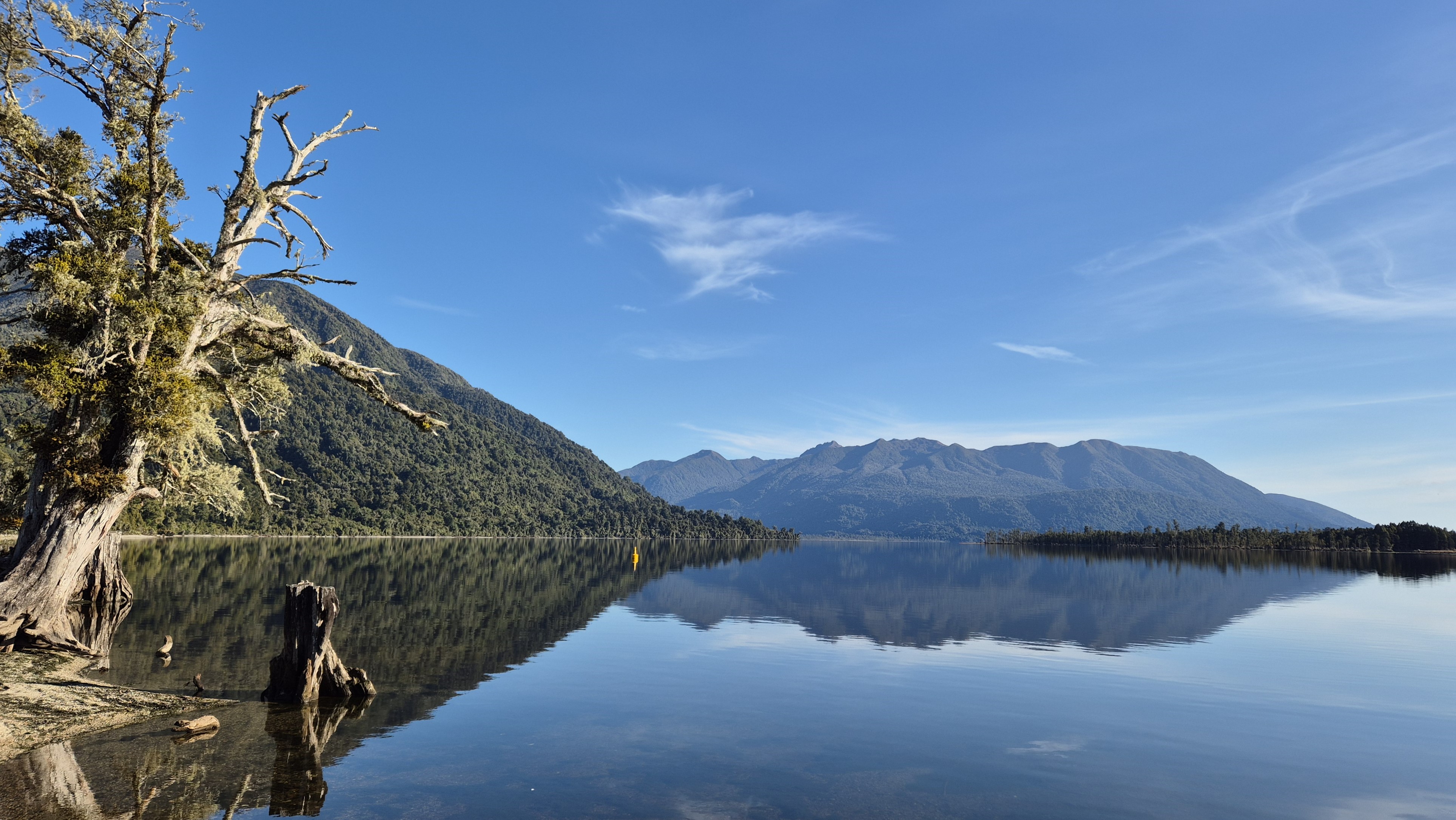
The West Coast had recently turned on some amazing winter weather. There were a couple of camper vans in the car park, but no one was up and about yet. I walked a little way down the lakefront. The view from here was incredible across to the Hohonu range where I’d walked up Mt French a few days earlier.
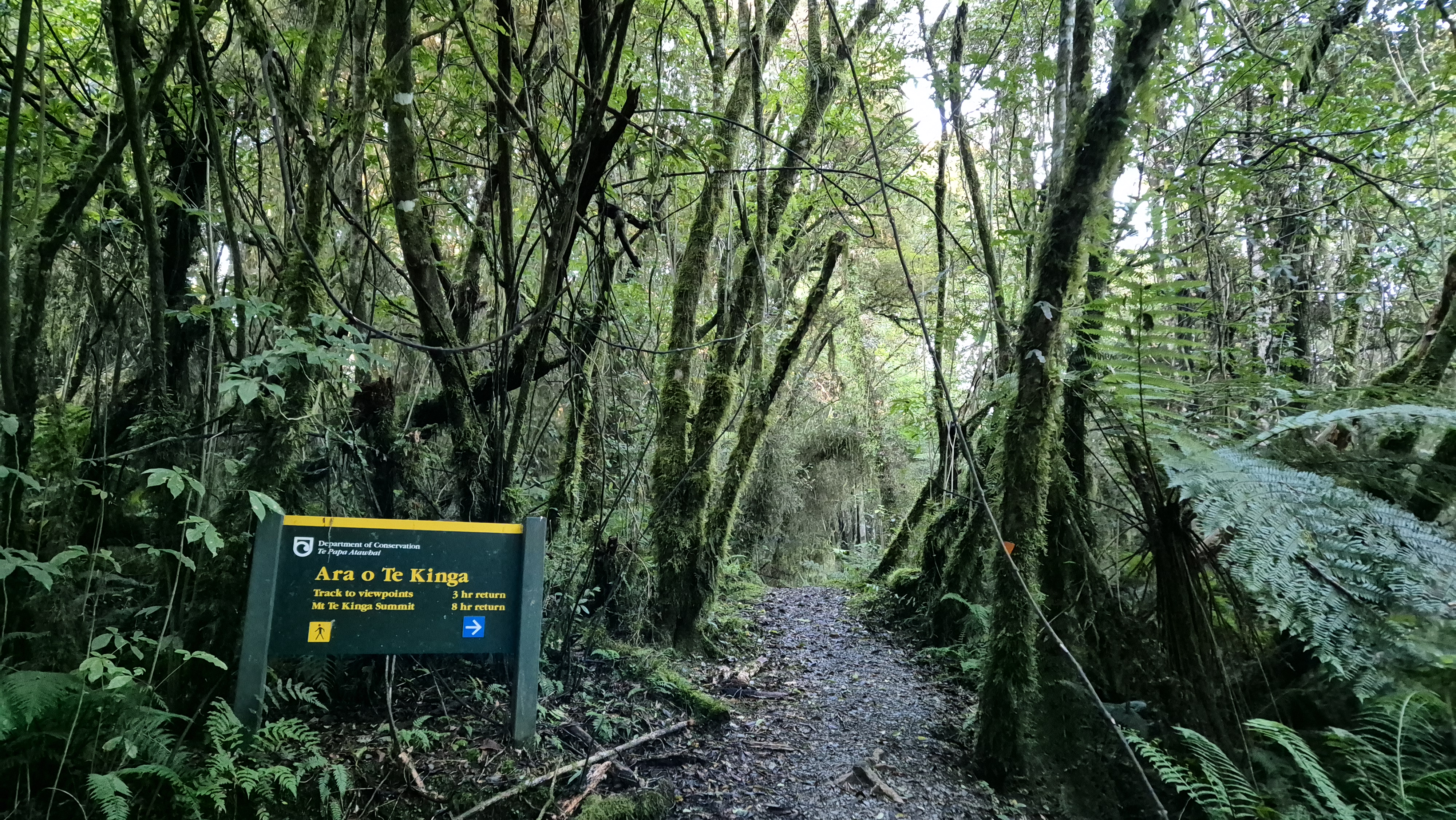
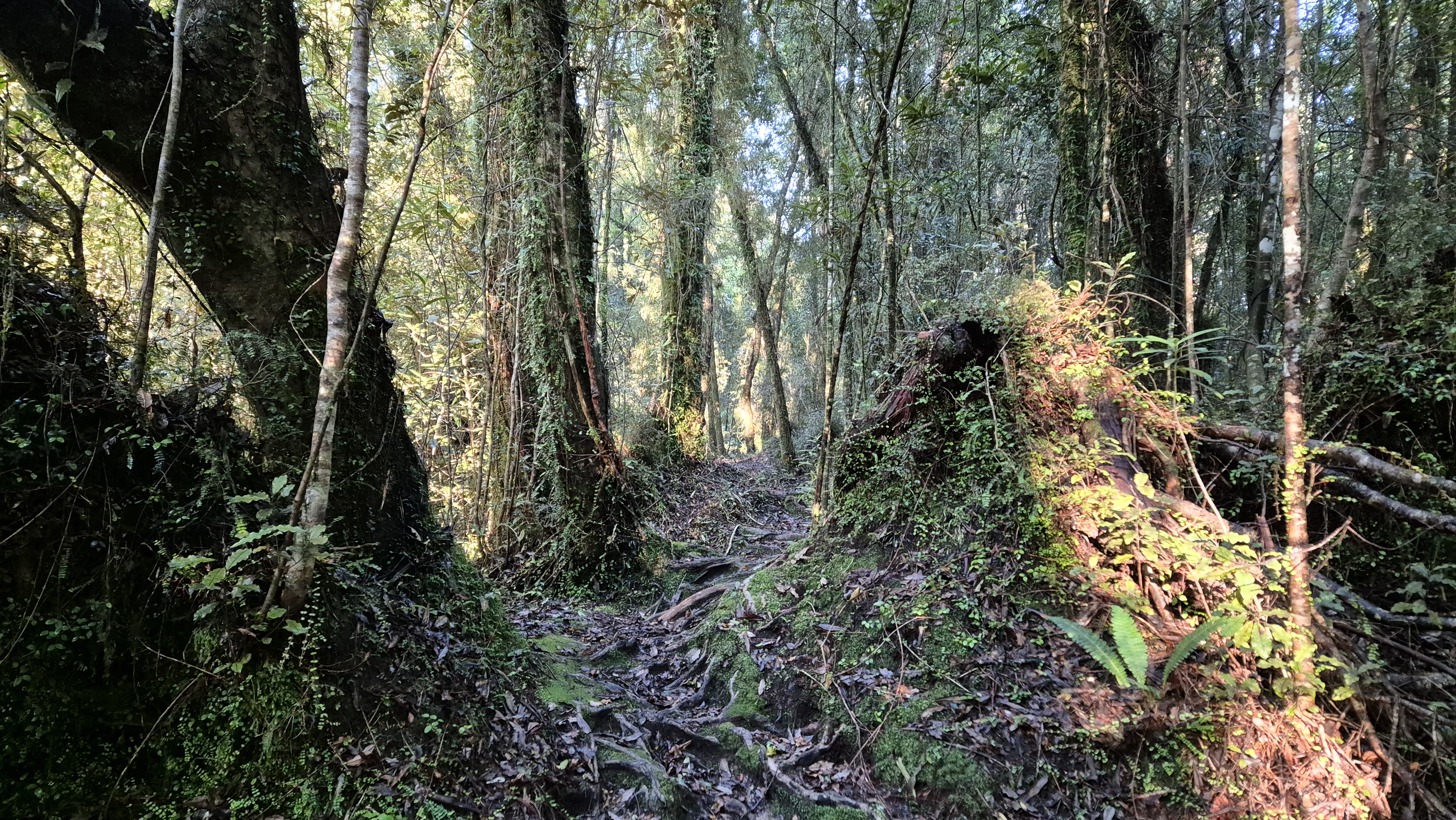
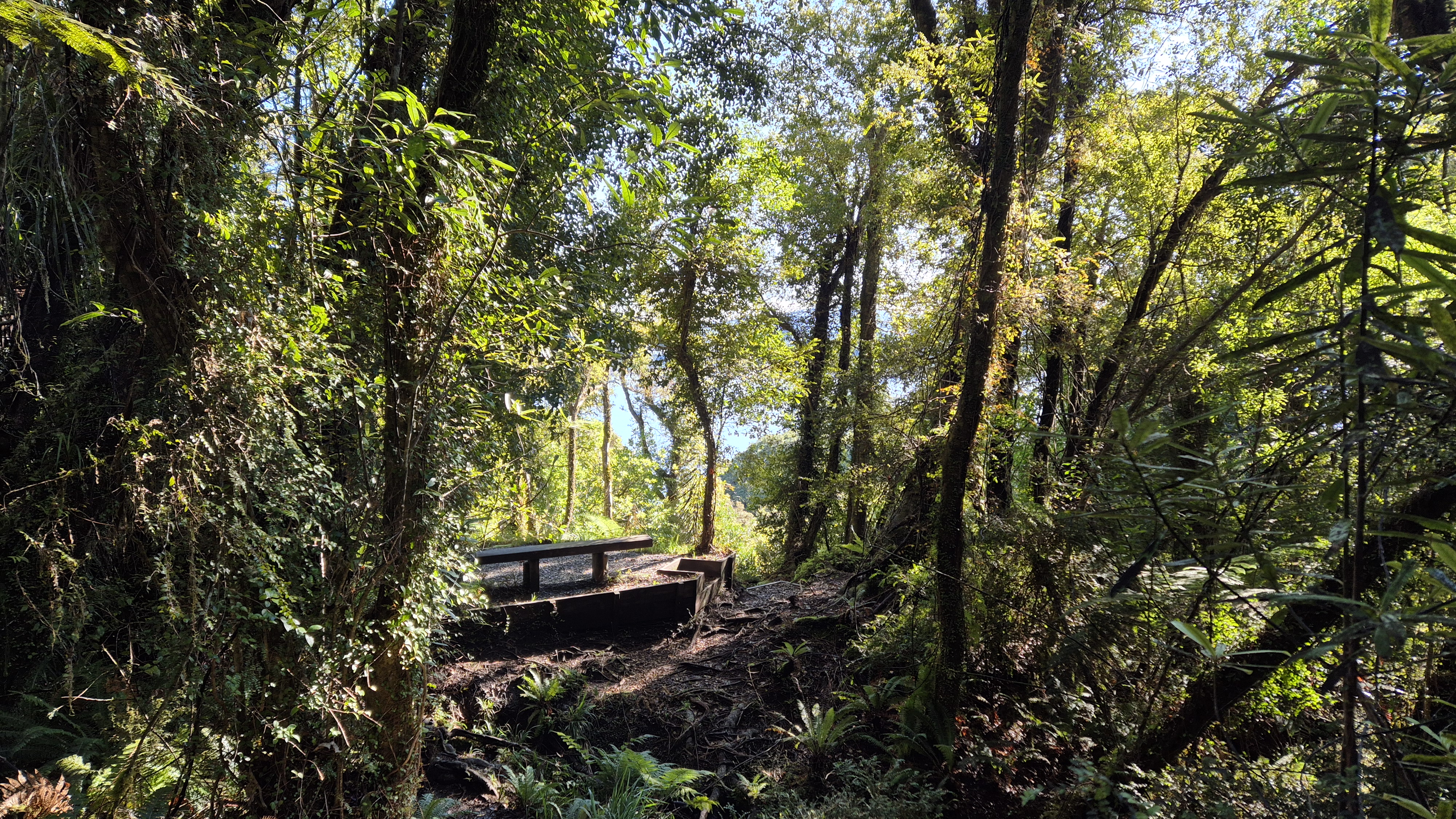
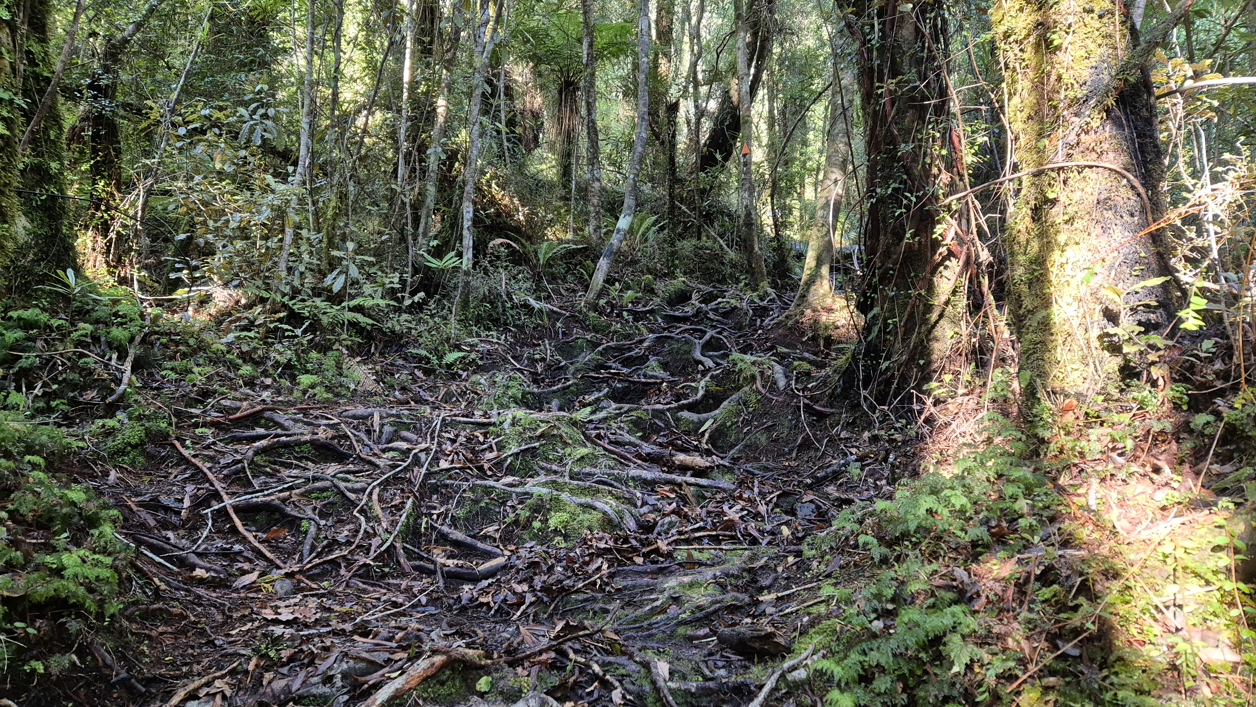
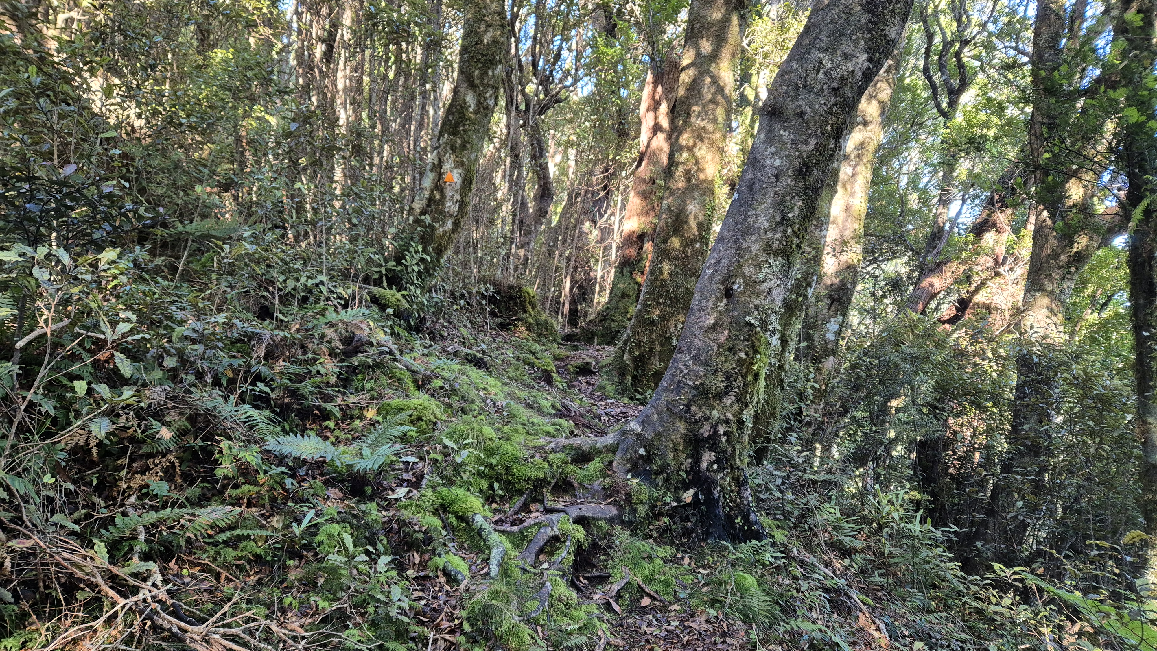
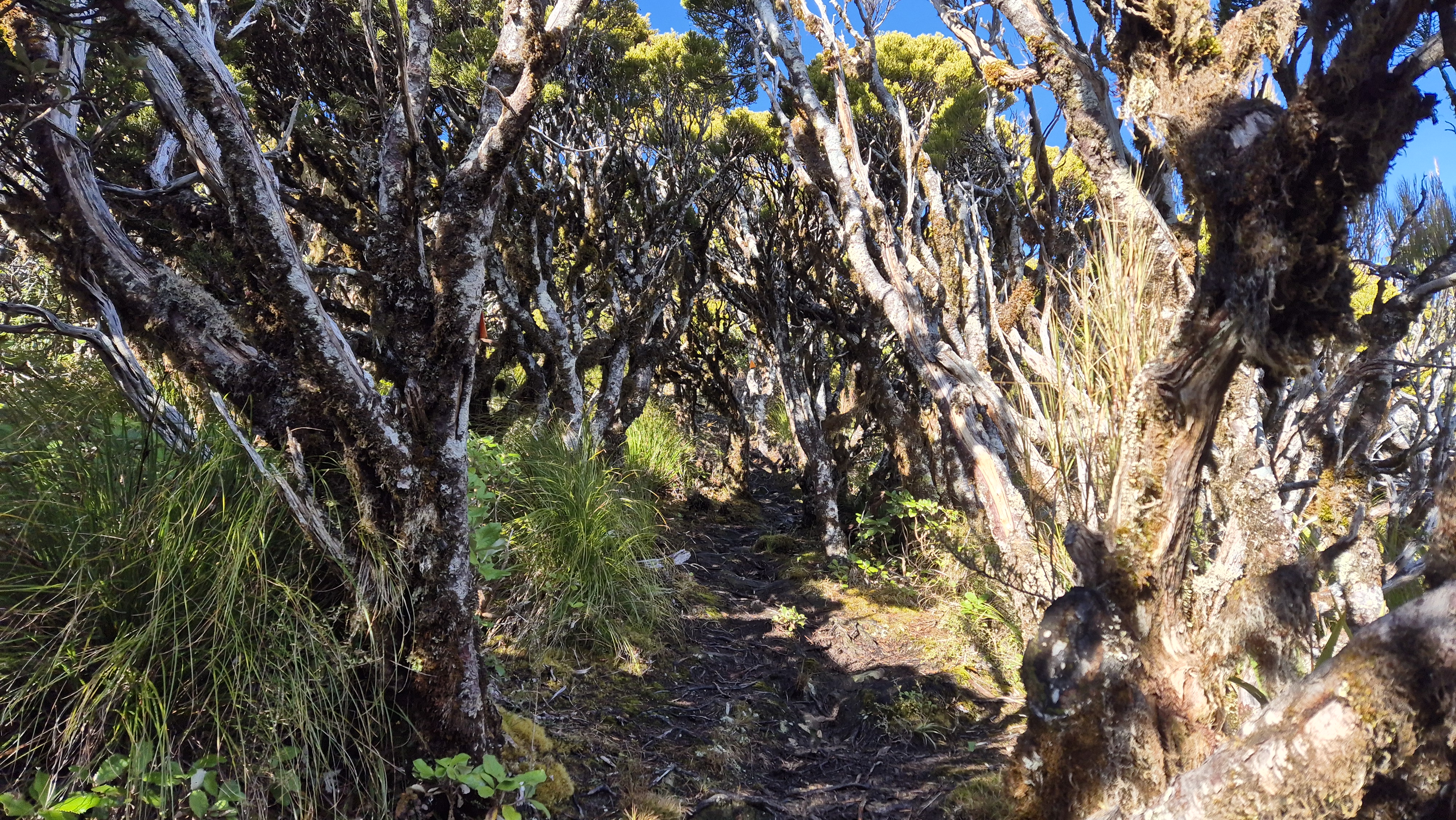
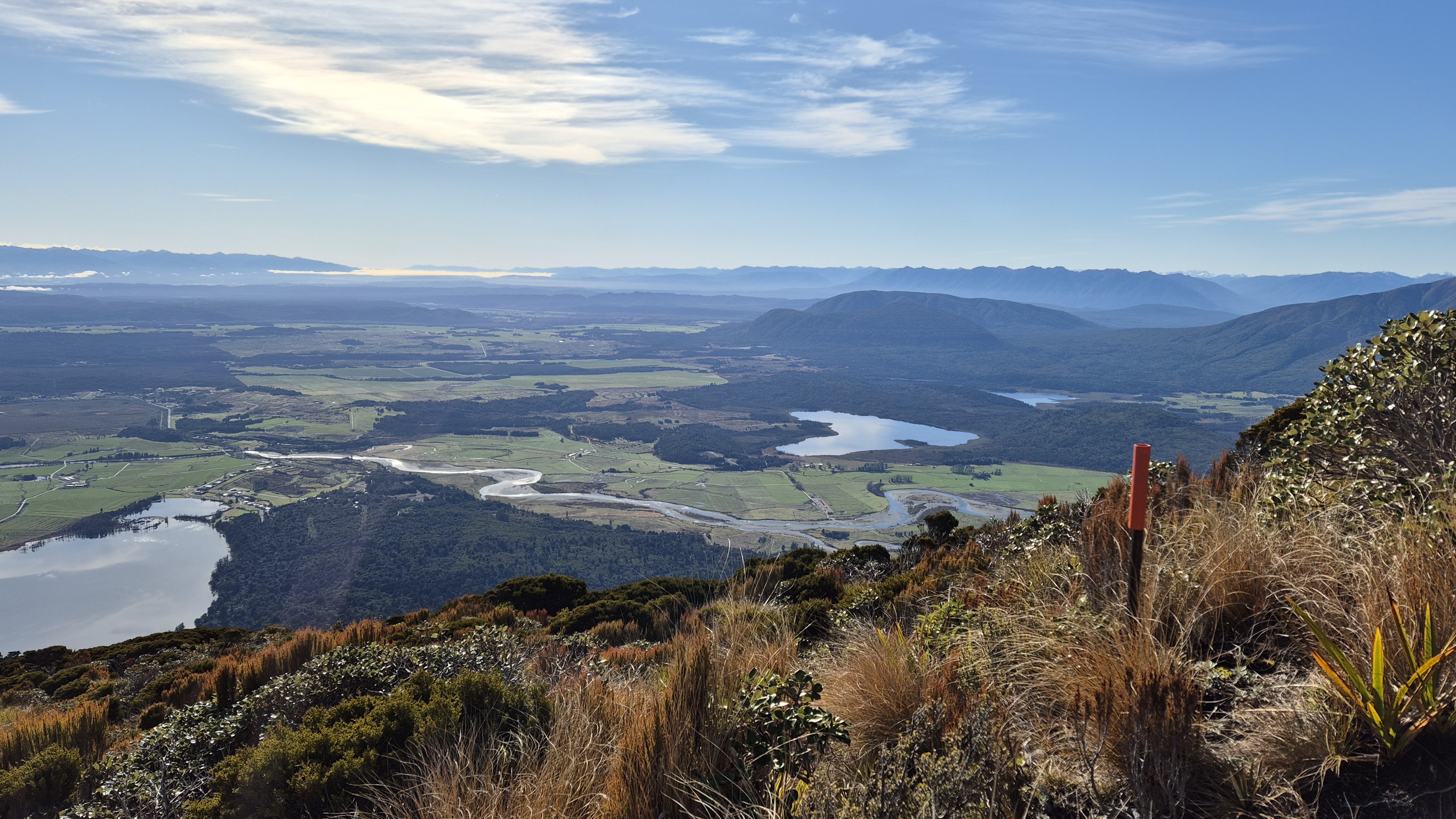
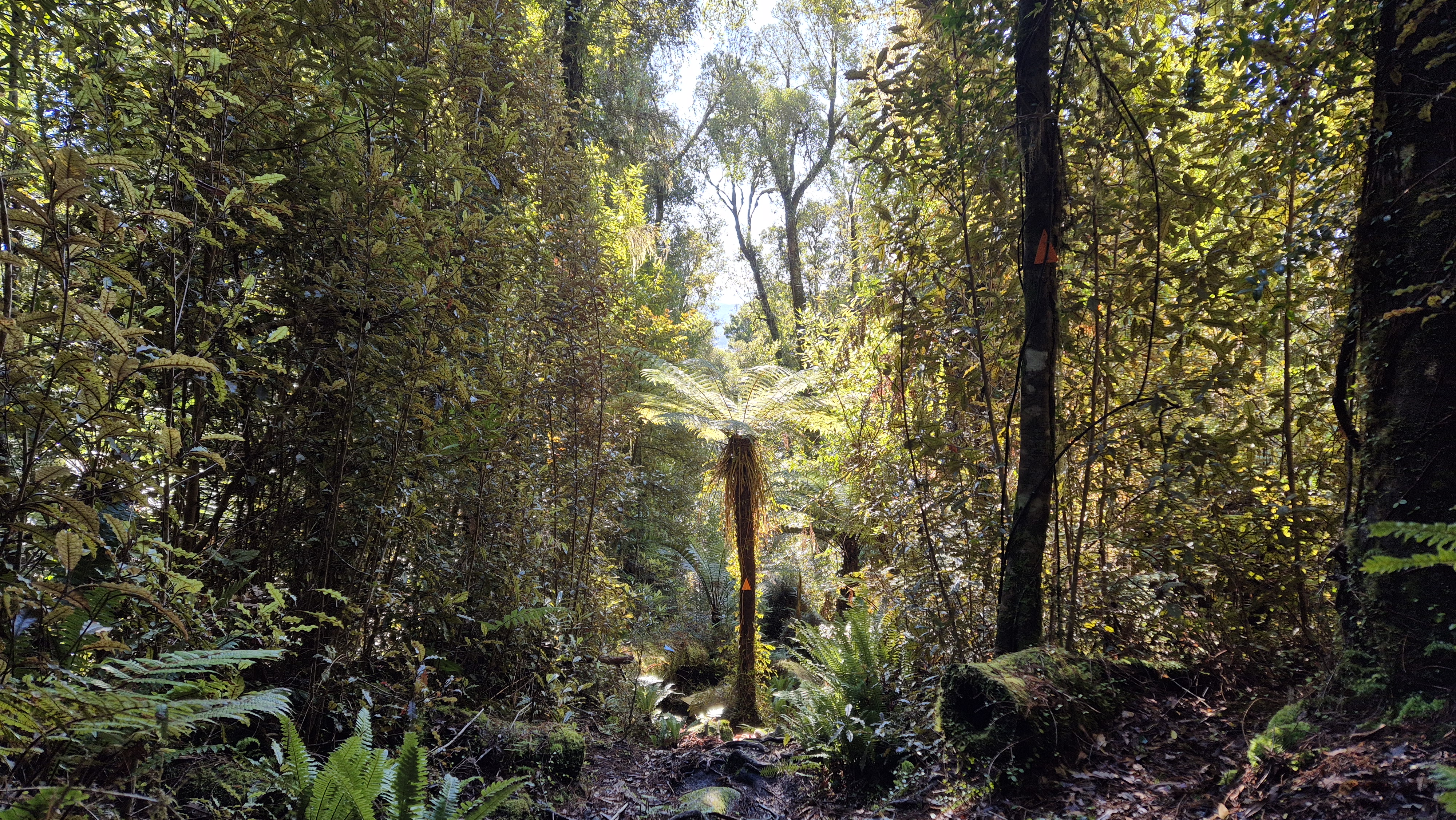
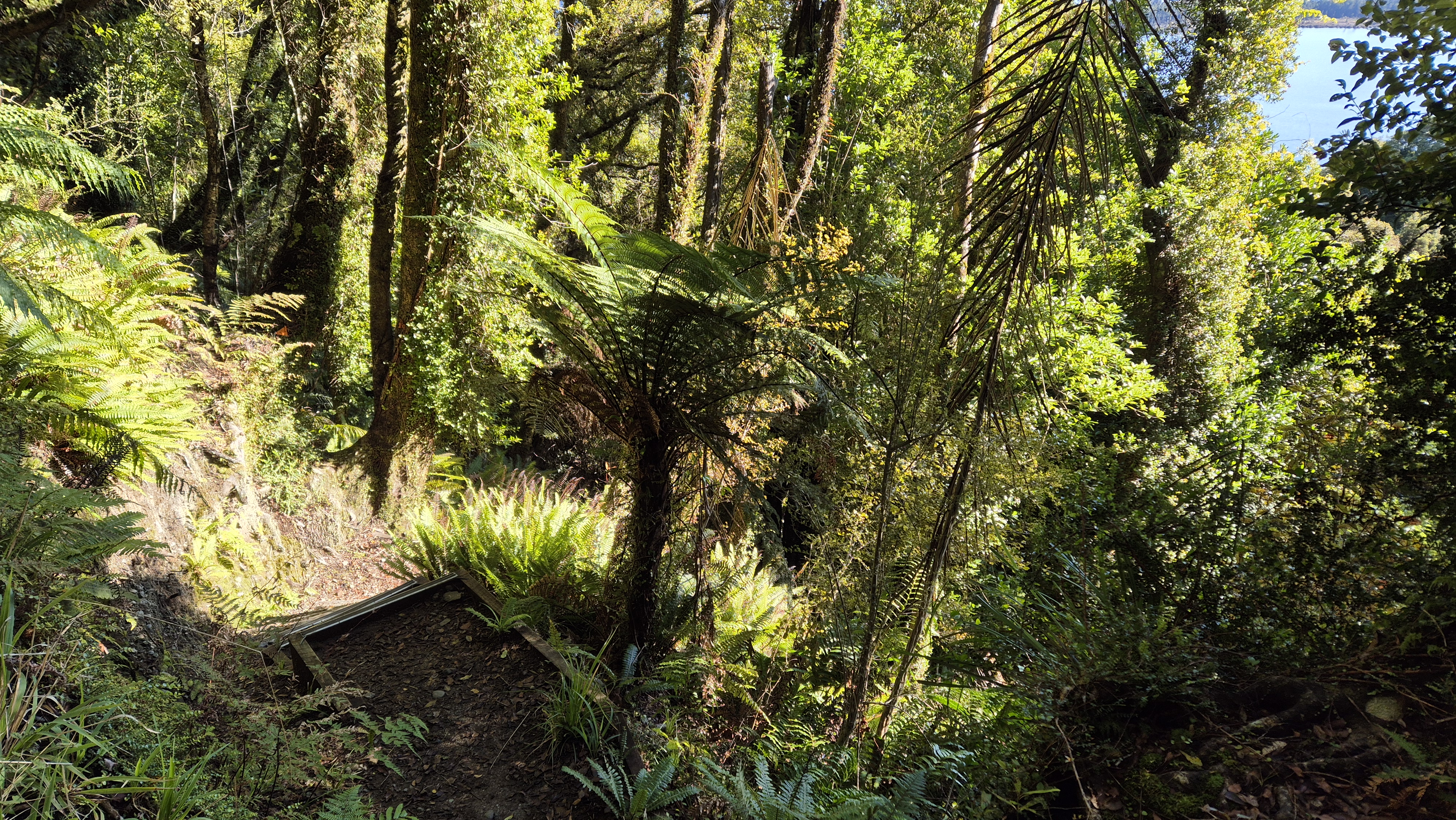
I started walking Aro o Te Kinga / Te Kinga Track at 8.45 am. The track started relatively wide, flat, nicely graded and well-marked. The podocarp forest was glorious with vines, moss and ferns draping everything and some amazing bird song. Panels along the track provided information on some of the trees. Bridges crossed several tiny streams and was a little muddy here and there. After about 20 minutes at 9.05 am, I arrived at some steps leading up to a bench with great views over the lake to Iveagh Bay.

To the Lookouts
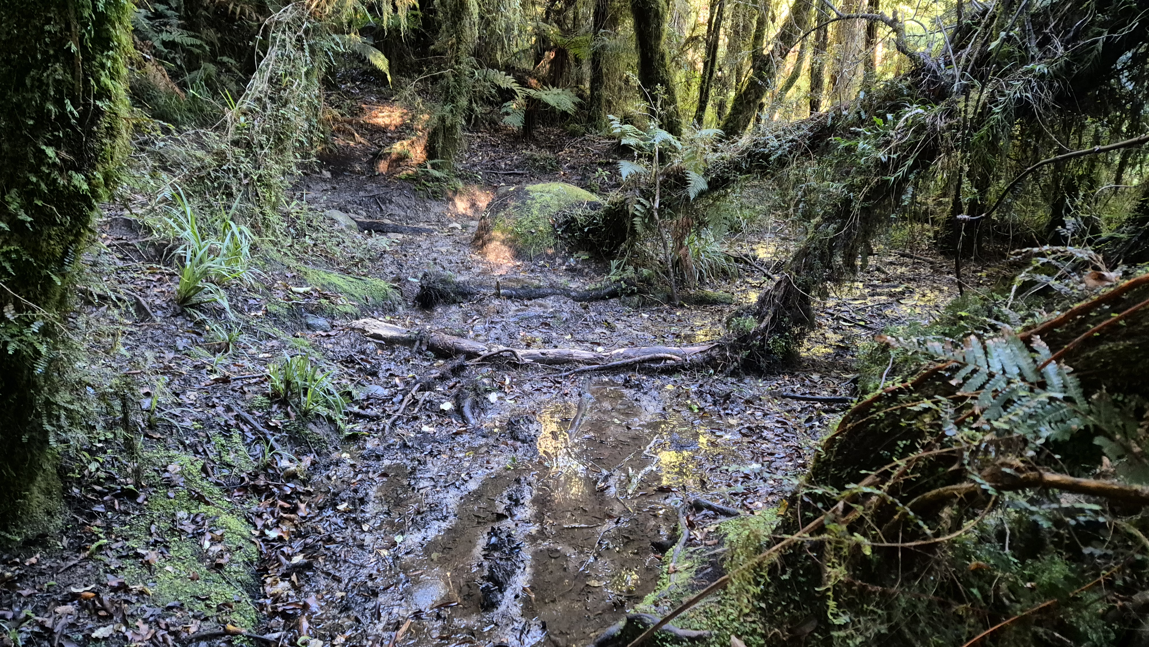
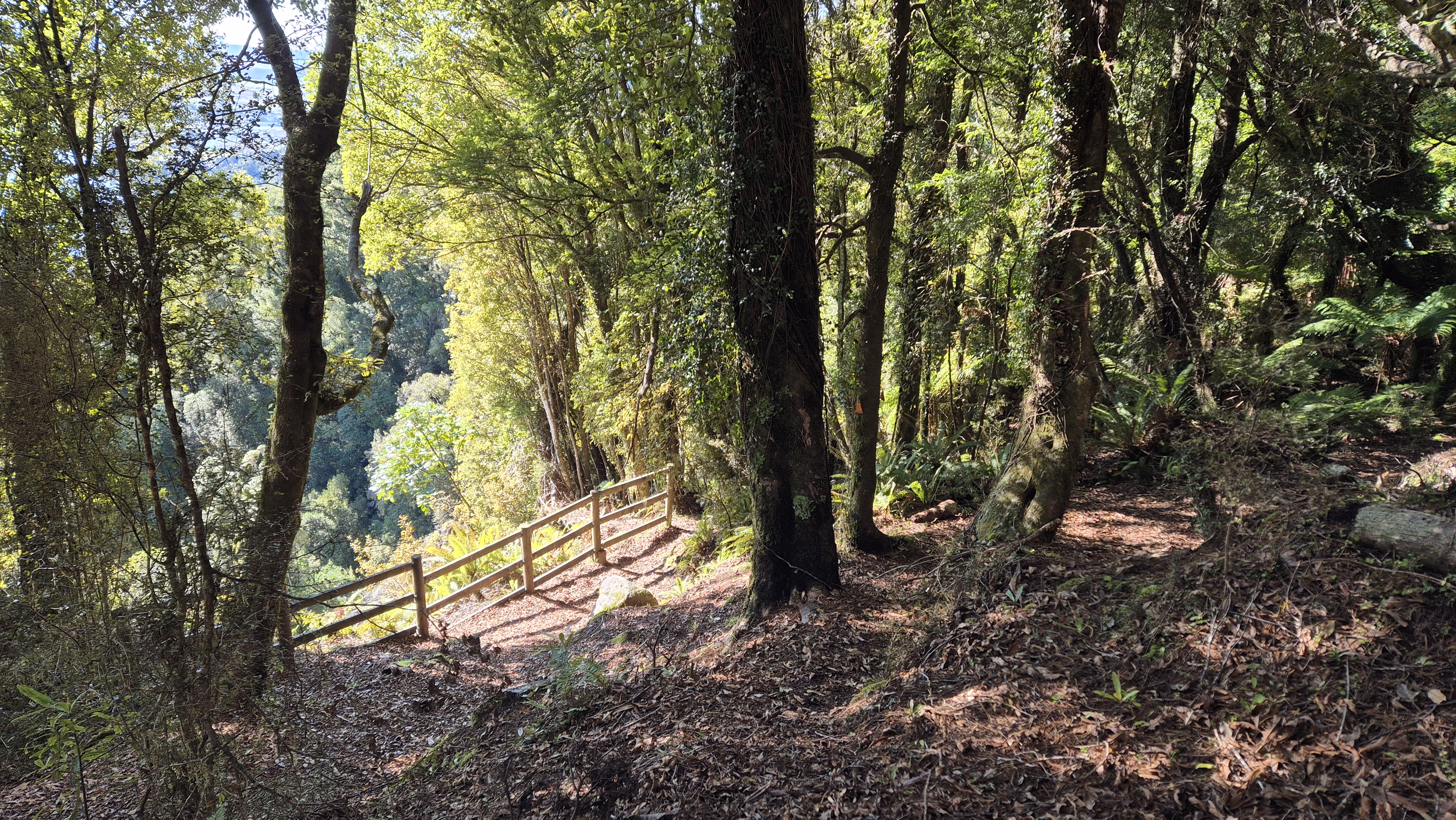
At the bench, a sign warned walkers that from here the track would be rough and muddy, which wasn’t wrong. It was certainly more of a tramping track and was gently tree rooty and quite muddy in places. It continued on a more gentle gradient for another 20 minutes to a fenced lookout and 10 minutes on to a second lookout at around 300m elevation. There was one fallen tree to climb over on this section, which someone had kindly chopped foot placements into.

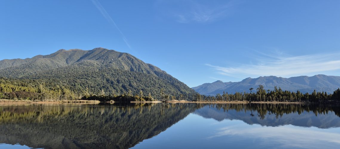
From the lookouts, there were great views across the Lake to the Paparoa Range far in the distance. I ate my breakfast with a kereru and a tui for company. At the second lookout was a sign to the (first) summit (1196m) – DOC time 6 hours return from here. From here it was a route rather than a tramping track.

The Mid Section
I left the lookout at 9.45 am. From here the route became steeper with more obstacles and after about 5 minutes led up a slippery, muddy rocky section. At 10 am I arrived at the only other significant fallen tree, turning left into the bush to walk around it.

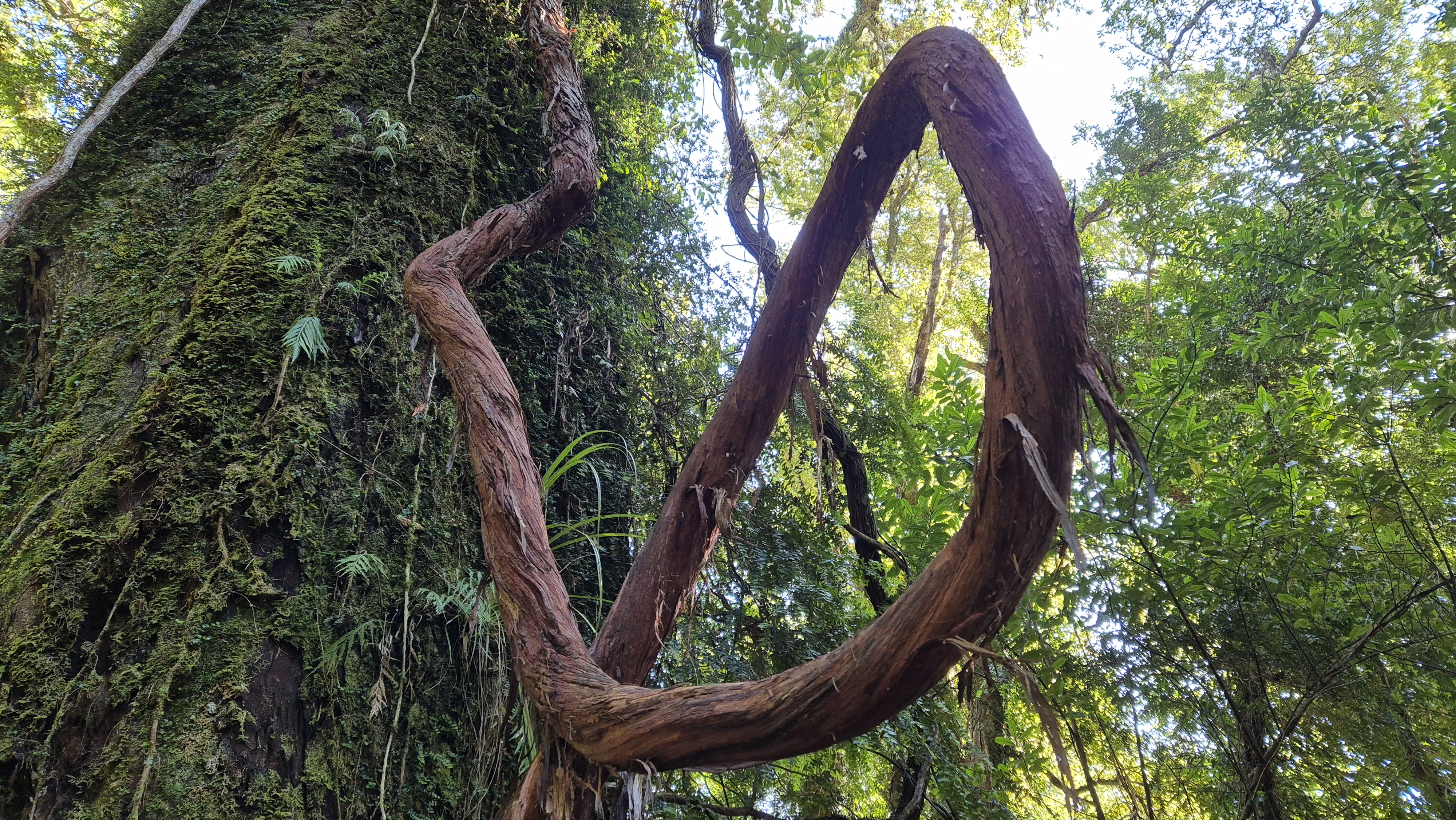
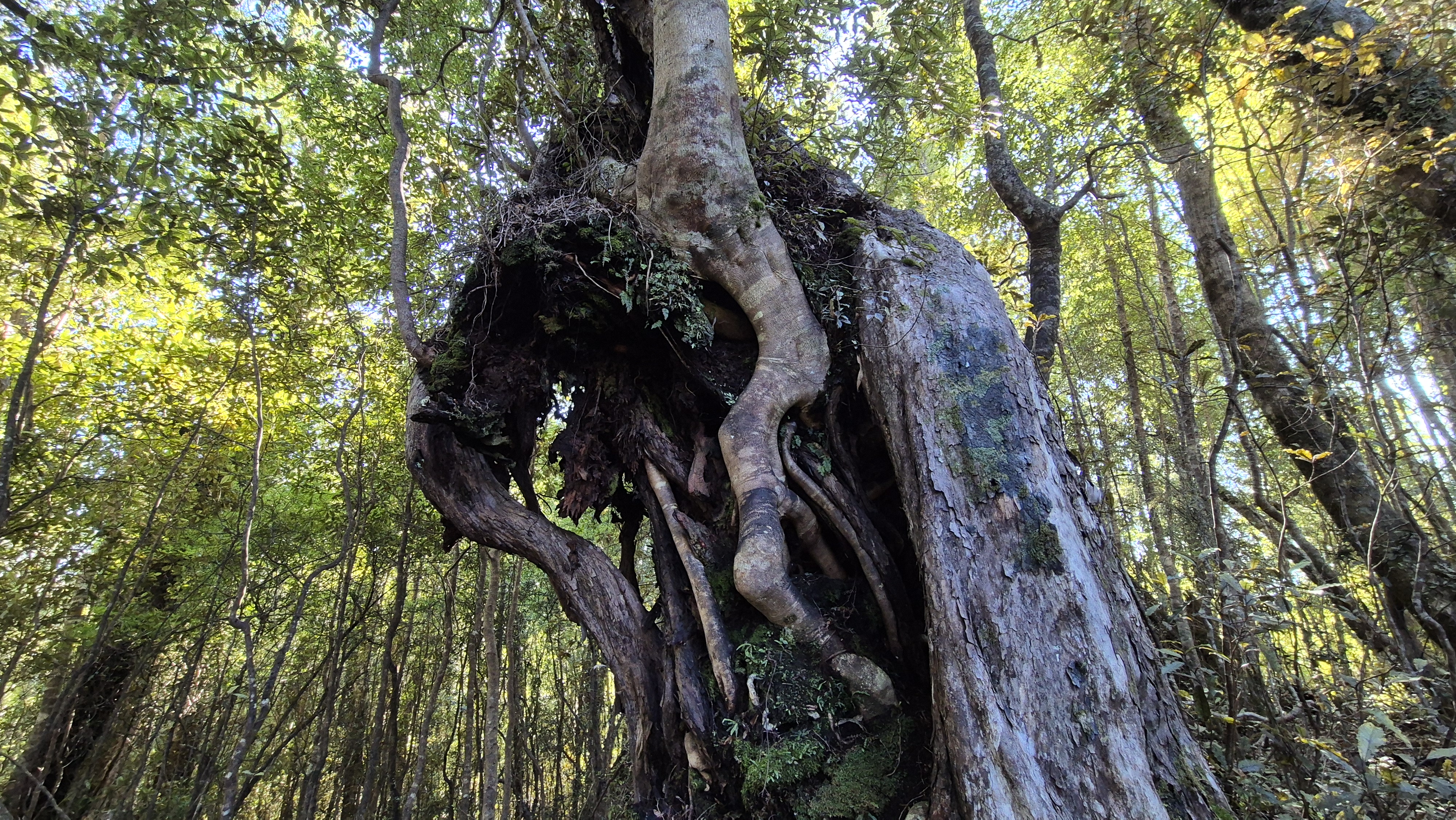
I spent most of this section marvelling at the giant trees and vines. There are plenty of them as you climb higher. At the 500m contour was a flatter part of the track where I got my first look at the tops. I disturbed a giant white goat which trotted along in front of me for a while.
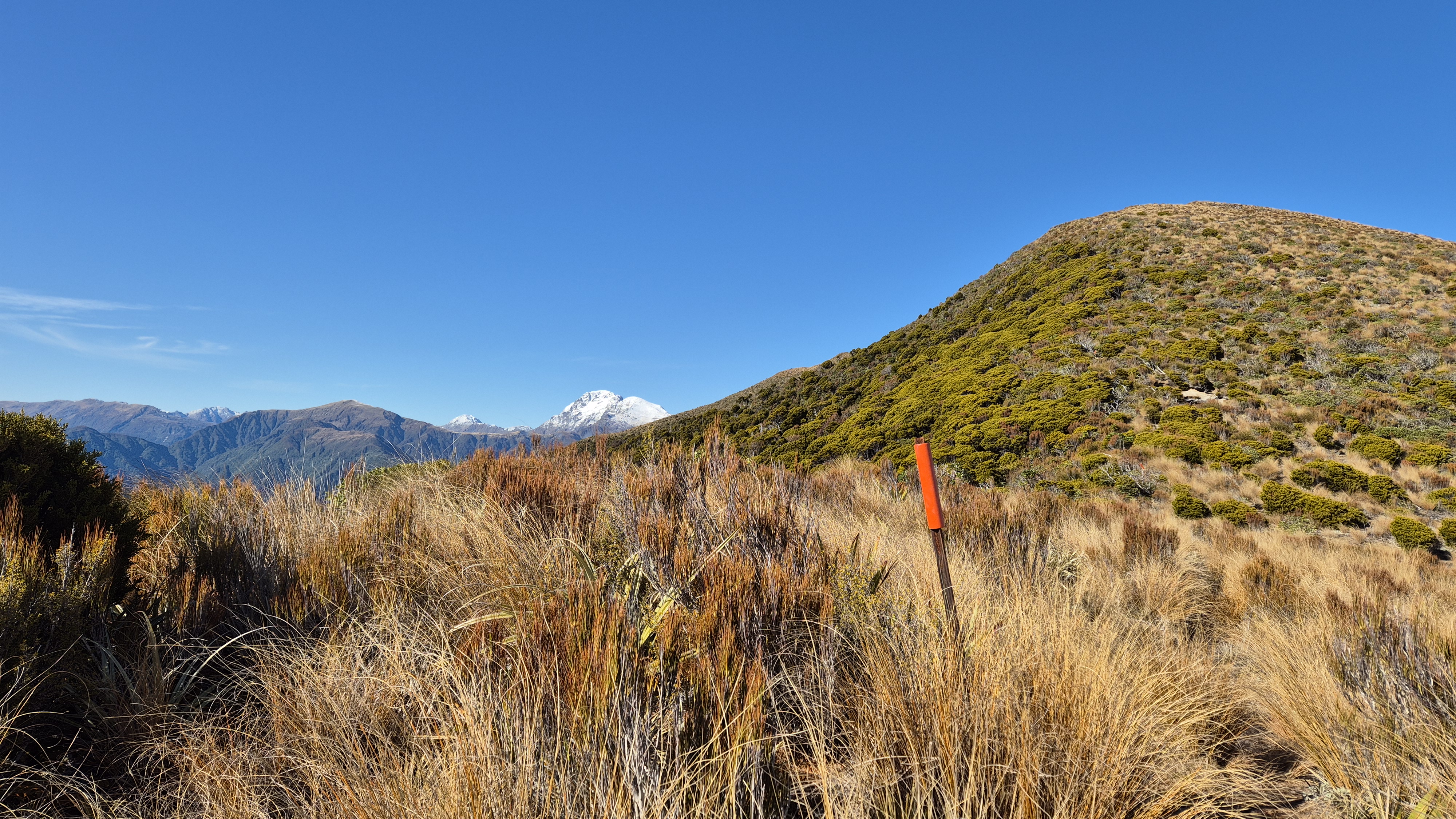
From here the track continued up the ridge. At 10.40 am, just under a couple of hours into the walk I was at the 700m contour, with Jays Creek down to my left. I arrived at an outlook with a couple of animal traps and enjoyed a micro break in the sun. The track eventually became more rocky and muddy, the trees more stunted and at 11.15 am I popped out of the trees into the wonderful colour of the subalpine bushes.
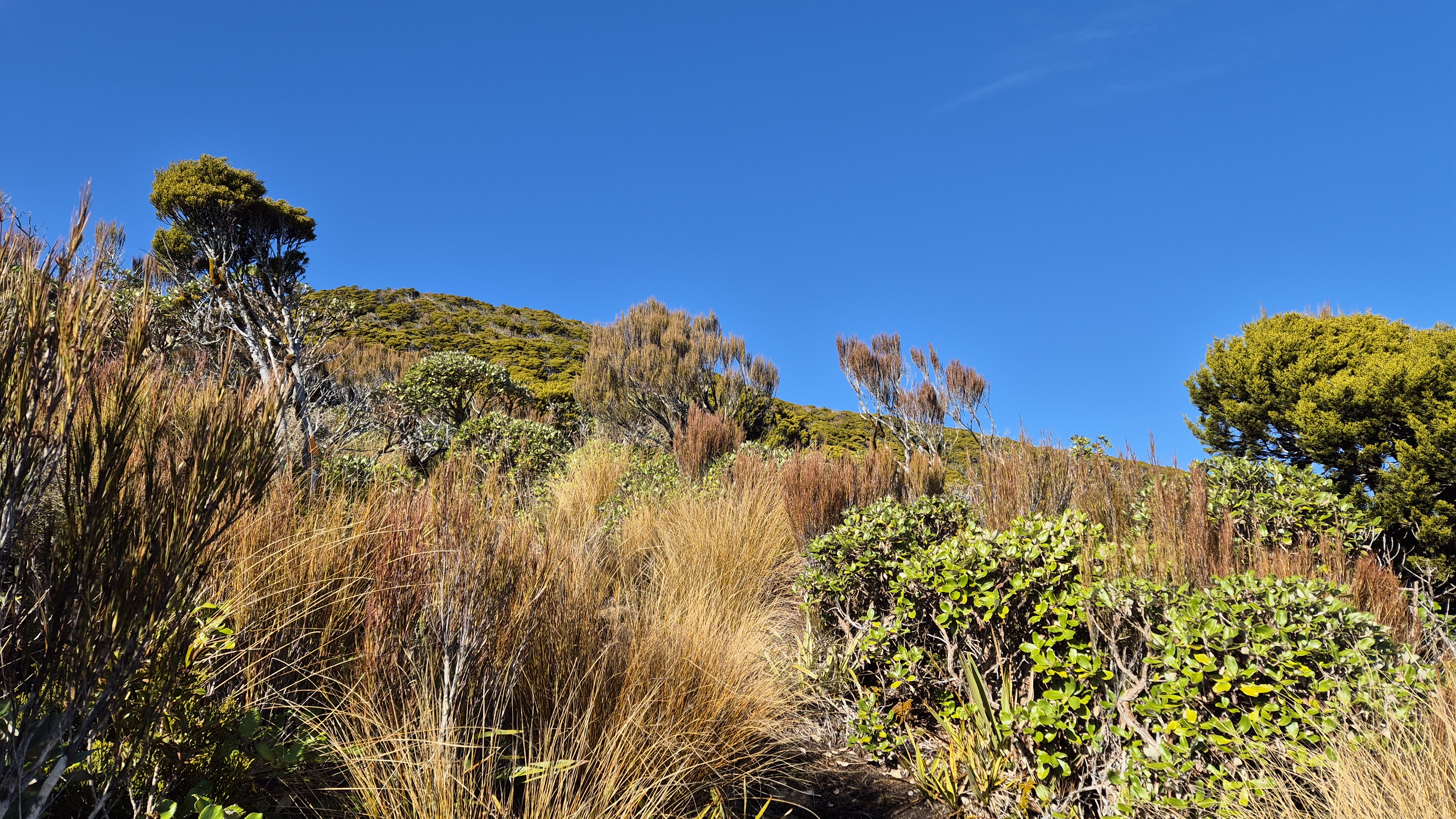
At the Tops
The track was poled above the tree line. I reached the first one at around 1000m at 11.25 am, with still around 150m elevation before reaching the trig. I made my way up a gouged-out track, before losing it and and making my way up, scanning for the markers in the bushes.
Predator Free Te Kinga
Ahead, I saw a couple of people in hi-vis coming downhill and we stopped to chat. They were working for Predator Free Te Kinga. Arms laden with gear, they’d been dropped off at the top by the helicopter I’d heard a while ago.
Predator Free Te Kinga is looking to completely remove possums from 3,700 ha of Mt Te Kinga, as part of a predator control effort in the Lake Brunner area, which will help restore native flora and fauna. Their website tells me it’s part of a wider/longer-term aim of Predator Free 2050 to link up with other areas as part of a ‘mountains to sea’ project from the Ahaura/Grey Rivers in the north to the Taramakau in the south. They are certainly putting some effort into it! Earlier, I’d seen a huge pile of traps back down the track waiting to be laid out.
Te Kinga Summit
I reached the trig just before 11.45 am (signposted Te Kinga summit). A gentle breeze swished the grasses and a tiny wisp of cloud danced back down at the tree line.
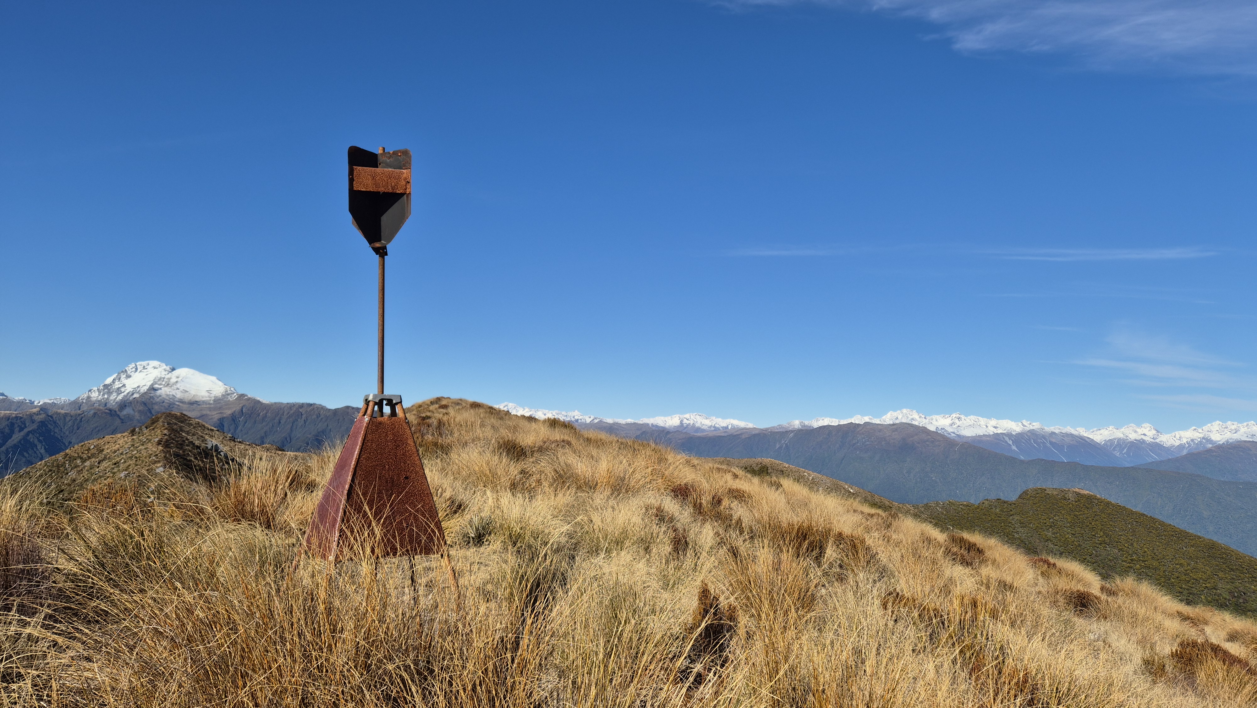
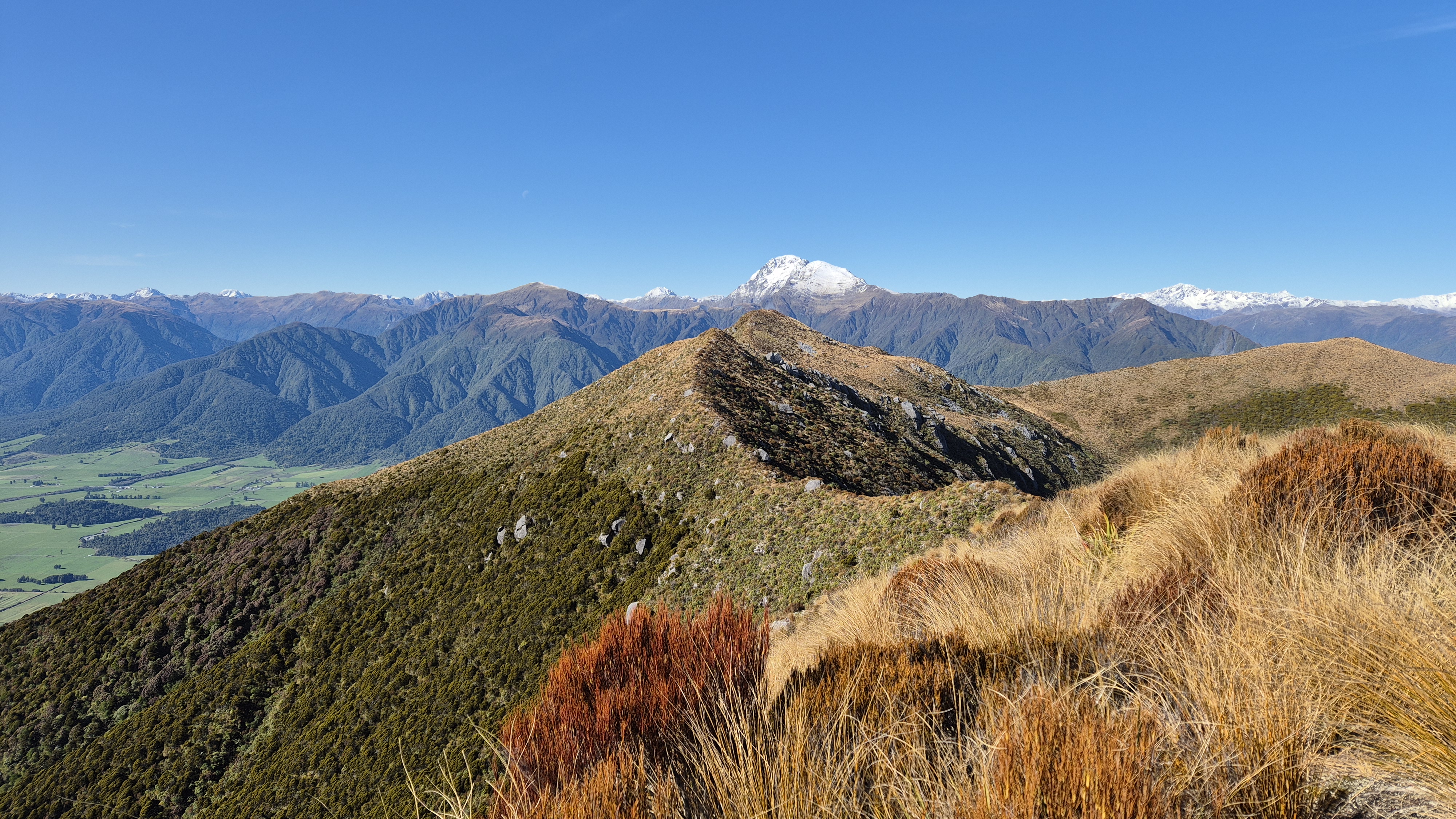
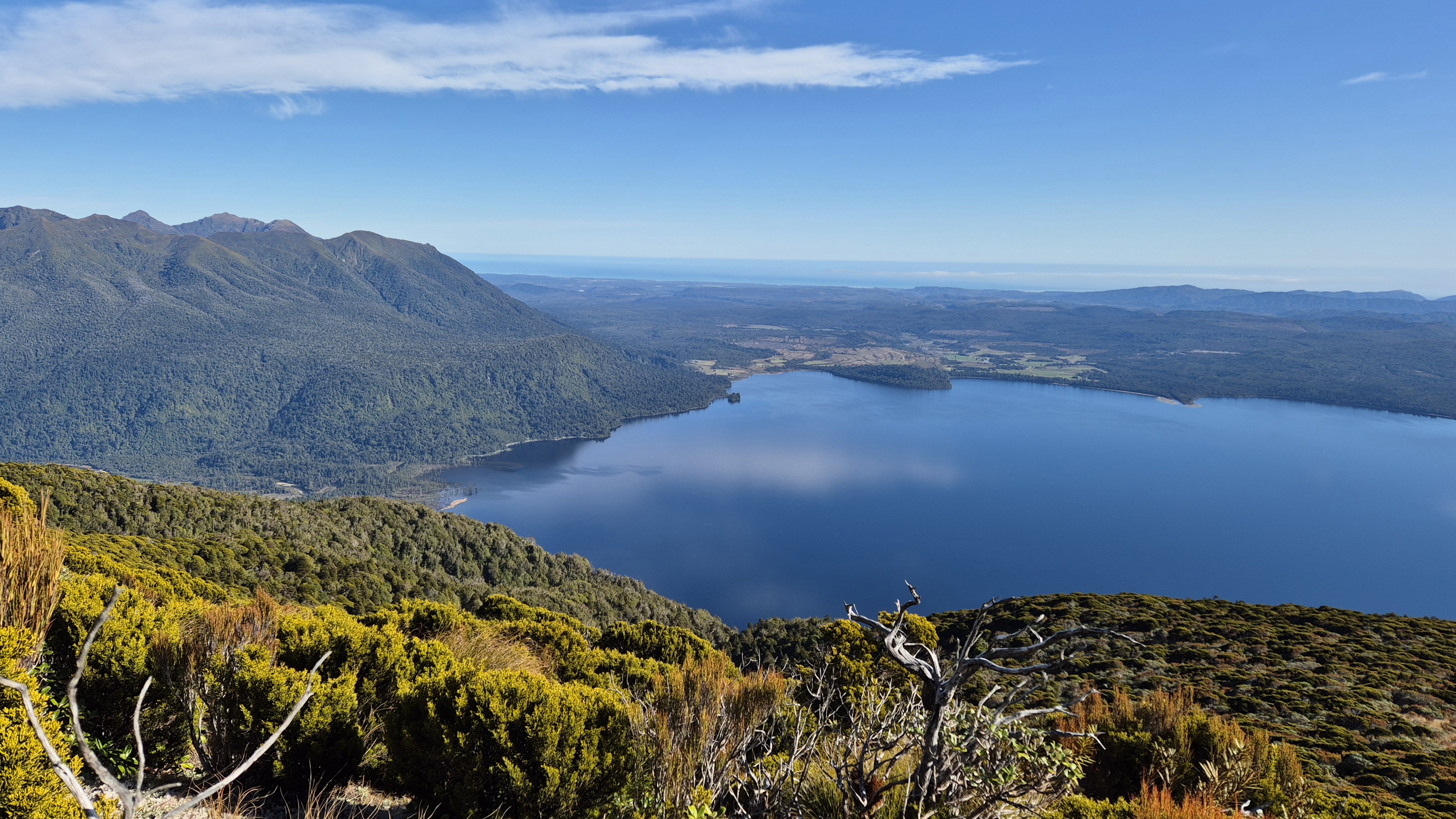
The views were incredible. Snow-capped Mt Alexander dominated to the east. I remembered being hassled up there a few times during the night by Kea a couple of years ago when we’d walked the Camp Creek to Mt Alexander Route. To the south, the Southern Alps stood bright behind the Bald and Kelly Ranges and the Hohonu Range looked magnificent to the southwest.
I made out the two summits of Mt French from a few days ago. Turning back, views of Lake Brunner led to the coast and the Paparoa Range. To the northeast were the smaller lakes, Kangaroo and Lady Lake. What a treat! I gave a quiet thanks, for the privilege of being able to be here and see it all.


Passing the trig, I walked about 100m further. It didn’t occur to me to go and bag the second summit. Leaving the trig at about midday I walked back to the just above the tree line for lunch with a view of the lake and the Hohonu Range.
Heading Back
A swim in the lake beckoned, so at 12.20 pm I headed back down, passing a couple of large markers in at the tree line. Once I was beyond the muddy, tree-rooty upper section, it was a reasonably quick descent. I stopped to take photos of the enormous trees and thick vines. At 1.30 pm I arrived at the lookout where I’d stopped for breakfast. Half an hour later I was back at the seat/steps and was back at the car park by 2.20 pm.
A couple of different camper vans had arrived, their occupants soaking up the sun and the views. I took a swim in the clear, cold lake before enjoying a cup of tea and a chat with a chap (a fellow Brit) who’d just spent the morning kayaking on the lake. We agreed what a wonderful place it was to call home.
Click the links below to check out some other walks in the area:
Myras Track and Mt William, Westport – day walk
Buckland Peaks, Westport – overnight
Inland Pack Track – overnight
Mt Watson Route to Ces Clarke Hut, Paparoas – overnight
Point Elizabeth Walkway, Greymouth – half-day walk
Camp Creek to Mt Alexander, nr Lake Brunner – 3 days 2 nights
Carroll Hut, Otira – day walk
Lake Mahinapua Walkway/Mananui Tramline Track, nr Hokitika – day walk
Cedar Flat and Adventure biv – overnight
Roberts Point Track Franz Josef – day walk
Alex Knob Track, Franz Josef – day walk
Okarito Coastal Track and Three Mile – half-day walk
Stafford Bay Route, Jackson’s Bay – day walk