
Anatoki Killdevil Pack Track
The Anatoki Killdevil Pack Track in the Kahurangi National Park is a beautiful multiday tramp, not far from Takaka in the Tasman region. We made it a three-day tramp in Autumn going clockwise from Uruwhenua Road to Anatoki starting along the Waingaro Track. This heads up the Killdevil Ridge to the Lockett Range, down to the Waingaro River and along to Lake Stanley. Follow the Stanley River to a saddle which crosses into the Anatoki.
The clockwise direction made the most of the best views in our good weather window, from the Lockett Range across the Kahurangi National Park. There are a few lovingly restored historic huts en route and the new but traditionally constructed Soper Shelter, a tent camp which shot straight to the top of the list of my favourite huts.

DOC rate the 52 km track as an ‘advanced tramping track’. A Wilderness magazine article (link below) mentioned that it entails 4000m of ascent which we couldn’t quite fathom despite all the small ups and downs. But be prepared for the solid 800m grunt on day one up the Killdevil Ridge.
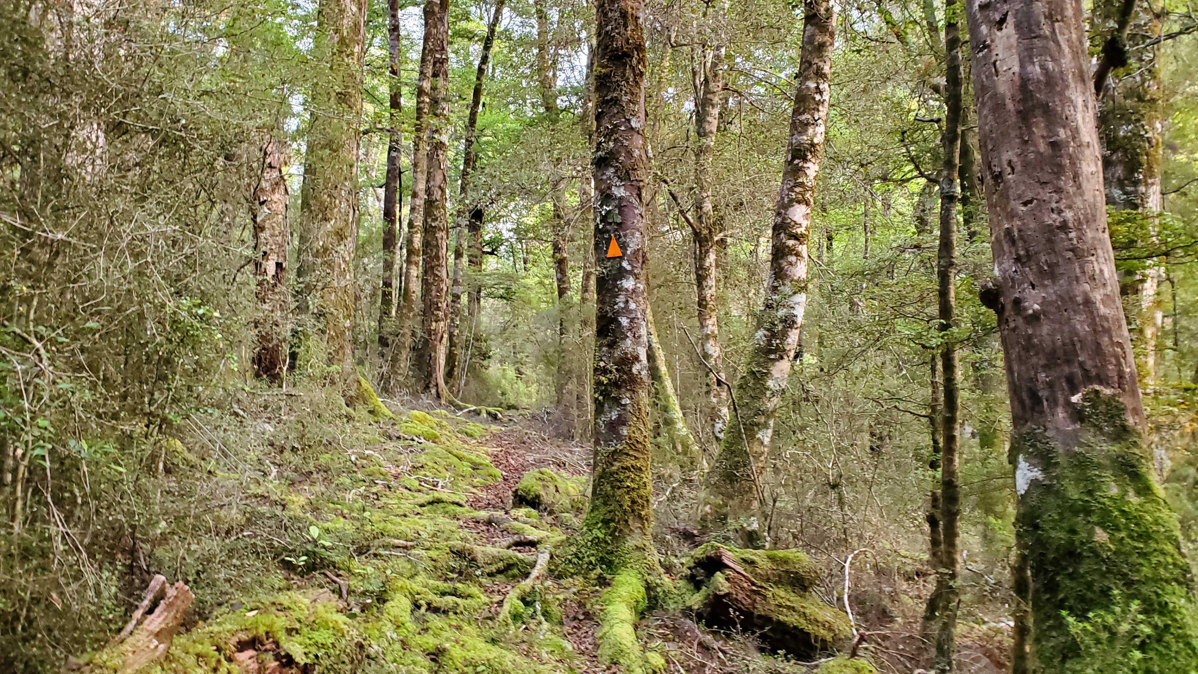
The Waingaro and Anatoki tracks were built as pack tracks in gold mining days, so a decent portion of the walk is on benched tracks. It was well-marked with an interesting array of DOC and New Zealand Forest Service markers. Don’t consider it to be too easy though. Plenty of the track was rough, tree-rooty, narrow or slippery. It was one of those tramps where we thought the DOC times were justified and you probably won’t end up doing it in half the DOC time unless you’re a fastpacker or an athlete. (We saw accounts in the hut books of trail runners coming through).

We didn’t encounter any problems until we came to the windfall along the Anatoki River from Anatoki Forks hut to the Anatoki Bend. Given that the weather had taken a turn for the worst by then, negotiating the windfall was a wet and dirty experience. Some of the side creeks involved clambering in and out of rocky gullies. The boulders were slippery and treacherous.
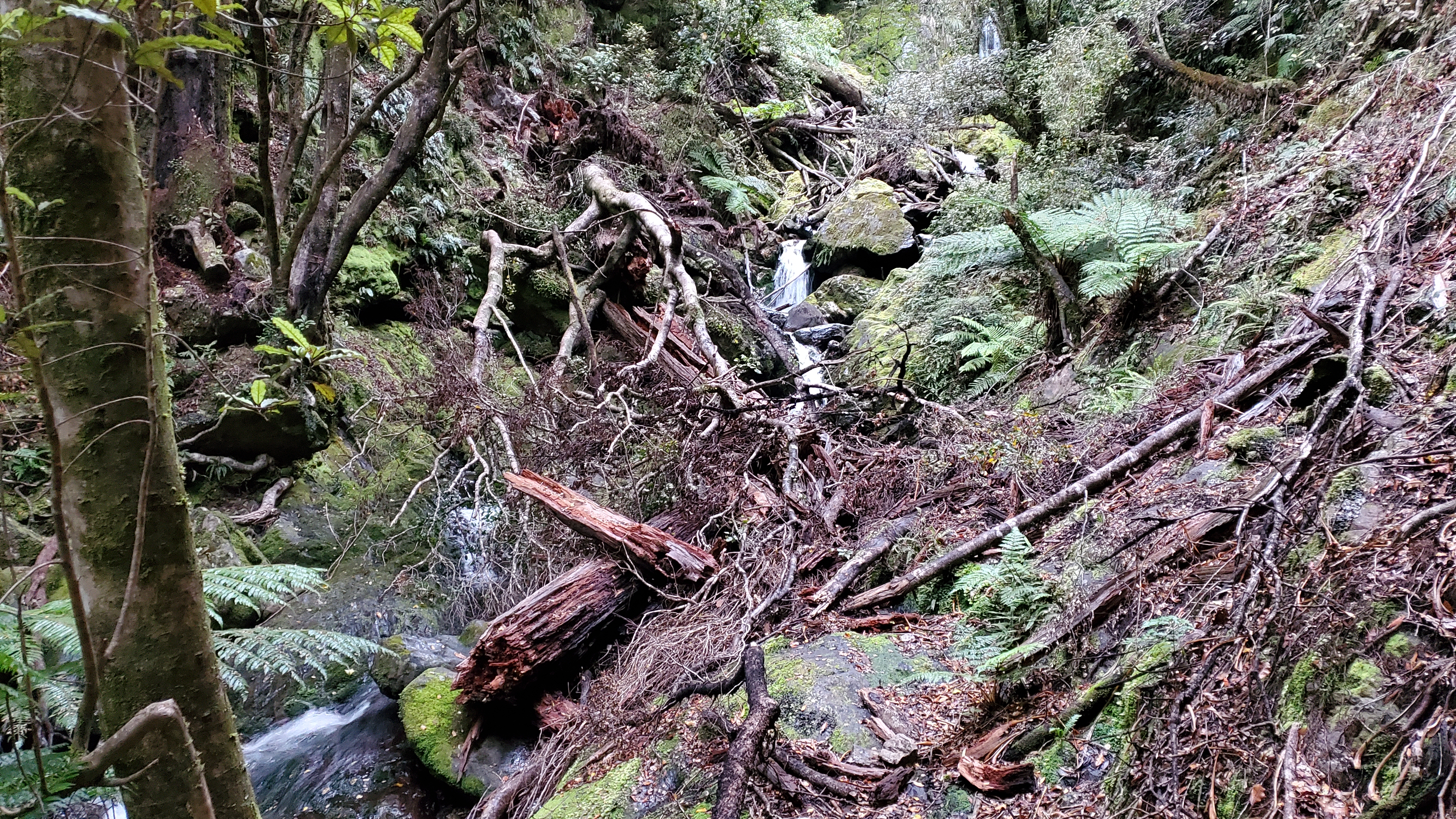
Watch too for those side creeks coming up in the rain. Check out the river levels for the Anatoki River for April 2023. Click the image below to link to the Tasman District Council river flows page.

Getting There Anatoki Killdevil
The Anatoki Killdevil Pack Track lies to the west of SH60 between Upper Takaka and Takaka in the Tasman region. To get to the Kelldevil end, from Nelson head over Takaka Hill on the SH60 then turn left at Lindsay’s Bridge along Uruwhenua Road before turning right (and taking the road closest to the house) to the car park. For the Anatoki end, continue towards Takaka then turn off about a kilometre south of Takaka (as if going to the salmon farm) but stay on Long Plain Road until you come to a marked right-hand turn almost at the end. Follow the road to the car park. The unsealed road was pretty rough towards the end.
We dropped a car at each end of the track, as the start/end of the track are both some distance down unsealed roads.

Timings Anatoki Killdevil
Day 1 – Road end, Killdevil to Waingaro Forks hut
DOC time: 6-7 hr
Our time: 6 hr 30 mins, including 30 mins (return) to Riordans hut and 30 mins lunch
Road end to Riordans Hut:
Wilderness mag time: 2 hr 15 mins
Our time: 4 hr 20 mins
Riordans hut to Waingaro Forks hut
Wilderness mag time: 4-5 hr
Our time: 2 hr 10 mins
Day 2 – Waingaro Forks hut to Anatoki Forks hut
DOC time: 7-10 hr
Our time: 6 hr 30 mins, including 30 mins lunch and 15 mins break
Waingaro Forks Hut to Soper Shelter
Wilderness mag time: 3.5 – 5 hr
Our time: 3 hr 50 mins
Soper Shelter to Anatoki Forks Hut
Wilderness mag time: 5-6 hr
Our time: 4hr 45 mins
Day 3 – Anatoki Forks Hut to road end
DOC / Wilderness mag time: 8 hr
Our time: 7 hr including 15 mins break
Click here for the DOC brochure on the walk and check out this Wilderness magazine article for their timings.
Day 1 – Uruwhenua to Waingaro Foks Hut
Killdevil Ridge
I was excited to be doing a trip over Takaka Hill as this meant a compulsory stop at the magnificent Ginger Dynamite cafe in Riuwaka. It was only when we drove into a suspiciously empty car park that we realised it was Good Friday and they were opening later than usual. Fighting my disappointment, we headed over to the Wholemeal cafe in Takaka for our goodies instead.
Once refreshed and toileted, we headed south out of Takaka and turned down Long Plain Road (enough said). Turn right almost at the end to get to the Anatoki Track car park. Rich left his car there and we drove mine back to Uruwhenua Road to start the walk. There were three cars in the car park. When we signed our intentions into the book, we observed that no-one else had bothered.
We started walking at 10.40 am and almost immediately got stuck into the 800m climb. An extremely slippery, thin carpet of moss over clay necessitated a fairly cautious approach. The track climbed up through mostly regenerating bush with numerous switchback turns. I read in a mountain biking article that there were over fifty! Take plenty of water, especially if you’re walking in the summer.
As we gained elevation, great views opened up of the Takaka Valley. Two hours into the walk, at 12.40 pm we stopped at a great viewpoint on top of the ridge overlooking the Devil Range.


Tin Hut Shelter
Twenty minutes later the taller one of us spotted the roof of Tin Hut Shelter to our left, and we arrived at the turnoff a minute or so later at 1 pm. This restored historic tin hut was once used by miners, then musterers. It doesn’t have any bunks or mattresses, and the water tank looked pretty ropey so I probably wouldn’t aim to stay here.


Riordans Hut
Shortly after leaving Tin Hut Shelter we rounded a corner with marvellous views down to the Waingaro River and stopped for lunch. There was little wind and we basked in the autumn sun for thirty minutes.
Afterwards, it was on to the three-bed Riordans hut. The track was great with excellent views of the Kahurangi National Park. Rain was coming in a couple of days, and we were glad to see the mountains and to piece together another unvisited corner of the park.
At 2.45 pm we arrived at the Riordans Hut turnoff. We clambered a short way up the track, dropped our packs in the bushes and fifteen minutes later reached the hut. It was a beauty.

Built in 1926 by brothers Laurie and Fred Riordan for use as a musterers hut. We had commented on the fencing on the way up and couldn’t quite believe that two thousand sheep were grazed here until the 1950s. The hut was also used as a stop-off for gold miners in the 1930s. When it was restored in 2003 some of the original timber was used and new wood was split and adzed onsite. An excellent information board in the hut paints the full picture.
Towards Waingaro Forks Hut
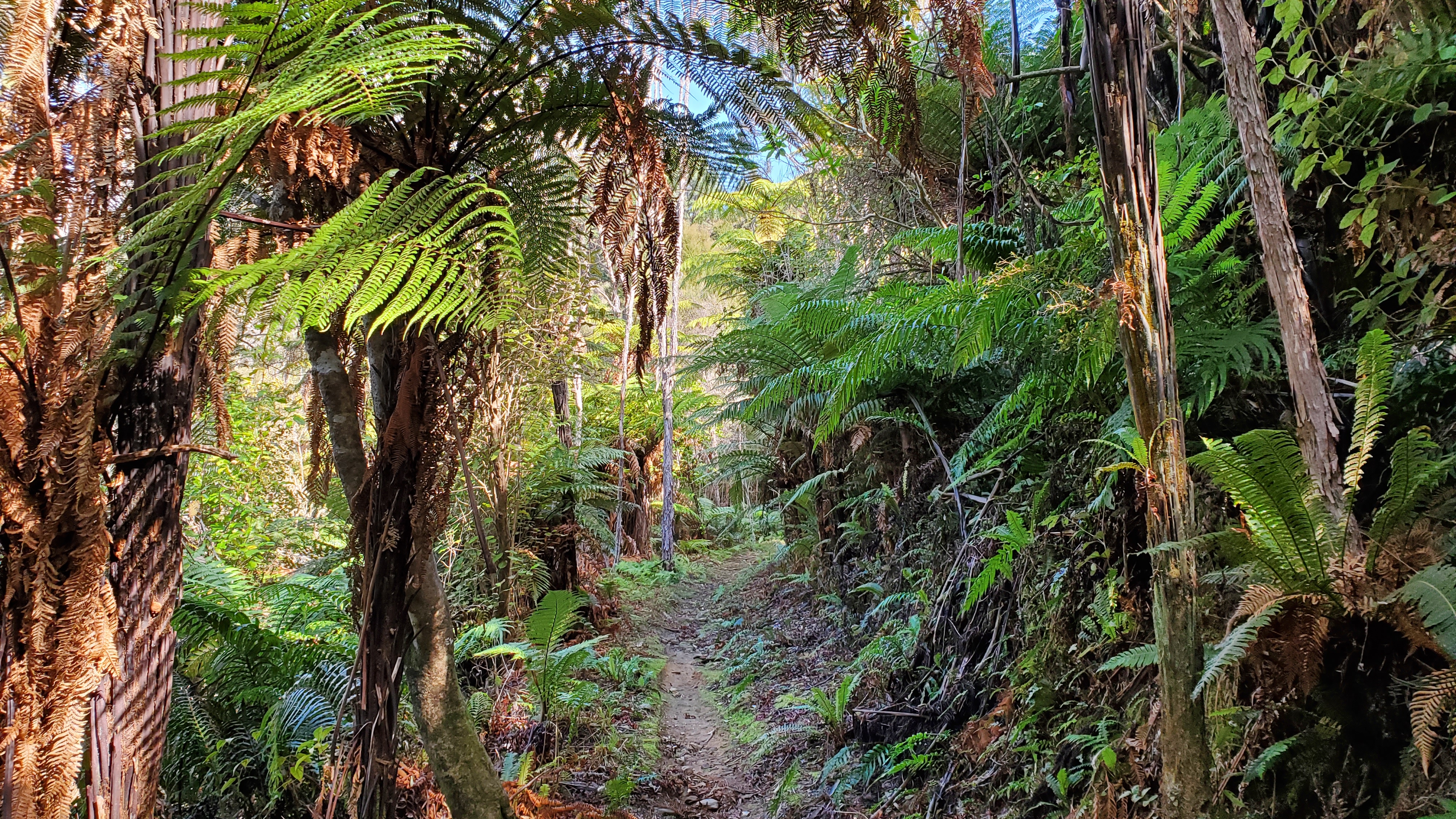
By 3.20 pm we were back at the track junction again. From here it was downhill most of the way to Waingaro Forks Hut. If you were intending to mountain bike it, things got significantly less appealing but in terms of tramping, it was perfect. The benched track led into beech forest and there were a few side creek crossings and the odd downed tree. Crown ferns dominated the forest floor in places and we came across numerous mushrooms.
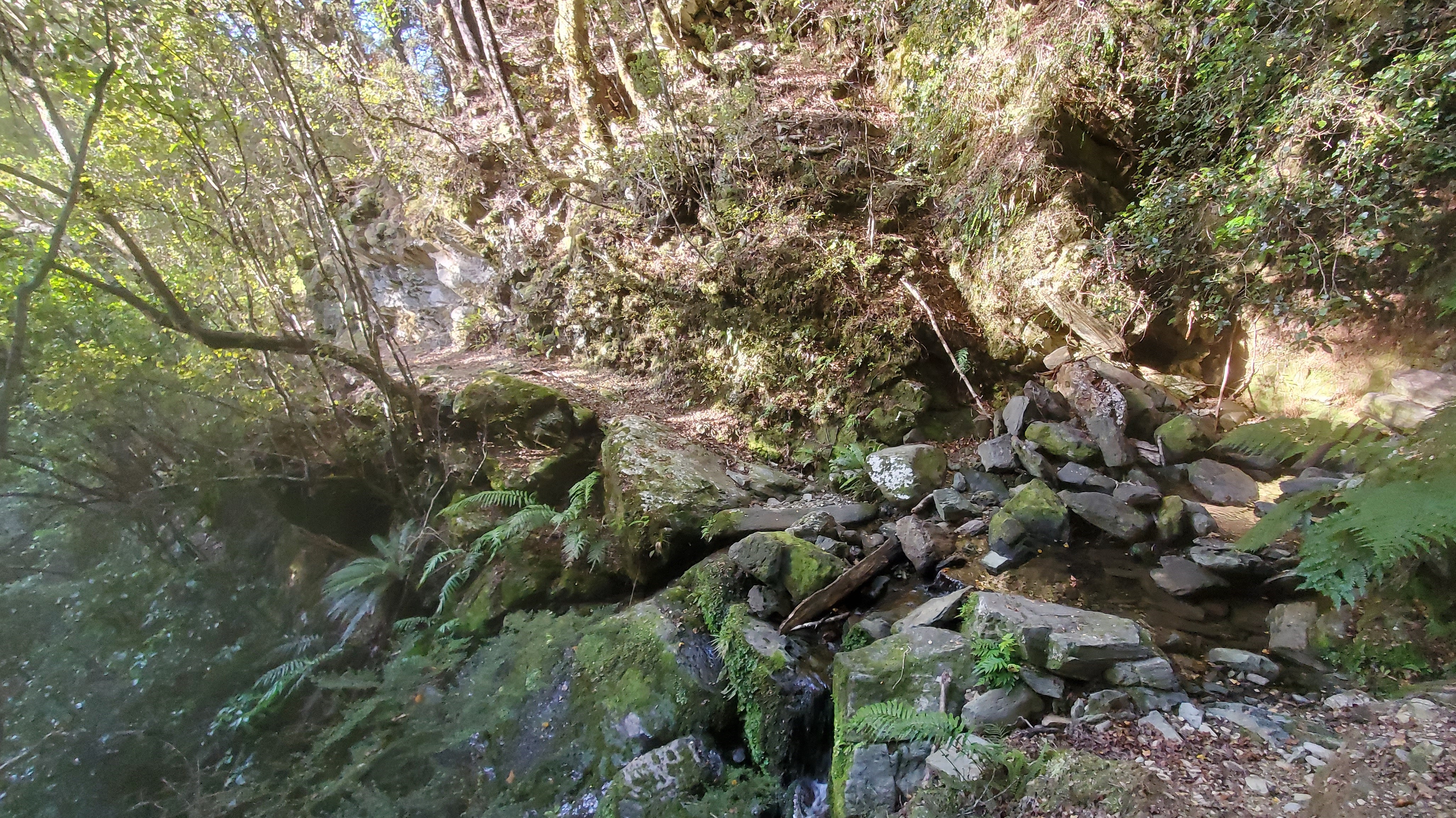
Having seen the occasional glimpse through the trees, the track eventually met the Waingaro River. A couple of whistles alerted us to a family of three whio (blue duck) dabbling amongst the rocks. About a kilometre later we crossed the Waingaro via the bridge over a lovely gorge before arriving at the hut a short distance away at 5.10 pm.

Waingaro Forks Hut Anatoki Killdevil
Four-bed Waingaro Forks hut was a miners’ hut in the 1930s and has been beautifully restored using timber sawn and adzed from windfall nearby. The bunks were magnificent too – the kind of carving you want to touch. We had the place to ourselves and got to work giving the place a sweep and a bit of a tidy before heading down to the river to collect water.
The hut was warm from the sun, so there was no need to light a fire. We started eating and played a few games of Yahtzee before going to bed at 8 pm.

Day 2 – Waingaro Forks Hut to Anatoki Forks Hut
Waingaro Forks to Lake Stanley
We both enjoyed a thoroughly restful night’s sleep. The hut stayed warm and there were no nocturnal visitors. A weka family with three fluffball chicks were patrolling the grounds when we poked our heads outside at 6 am.
We left at 7.40 am in anticipation of a long day (DOC time 8-10 hours). Out of the hut we immediately got stuck into the zigzags of the first short climb of the day, then sidled above the true right of the Stanley River. The track was marked and posed no problems. The occasional robin and fantail accompanied us through the beech forest and it was all very pleasant.
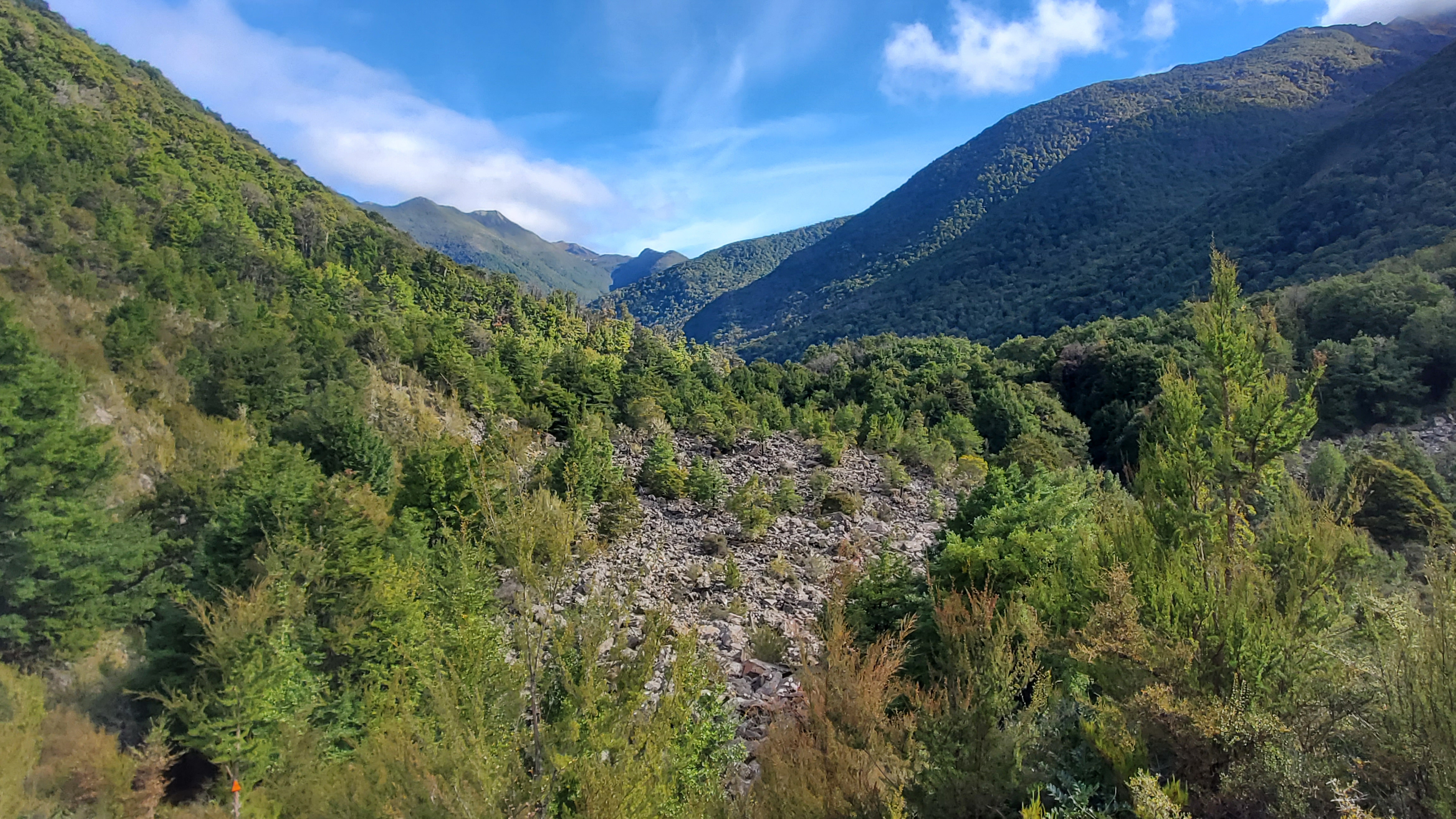
We came out onto the rocky river flats for a short while at about 9 am which offered something a little different. Following the markers back into the trees we walked close to the edge of a high gravel cliff before dropping down to rejoin the river again.

Lake Stanley was created by rock debris from an enormous chunk of Mt Snowdon which collapsed and dammed the river during the Murchison earthquake in 1929. By 10 am we had reached a huge rock face which led up to Mt Snowdon on our left (1859m) and a high gravel escarpment across the Stanley River to our right. It was pretty sobering to think about the geological action that had happened here. It made us feel pretty insignificant in the general scheme of things. A look at the topo map tells you everything you need to know about the scale of it.
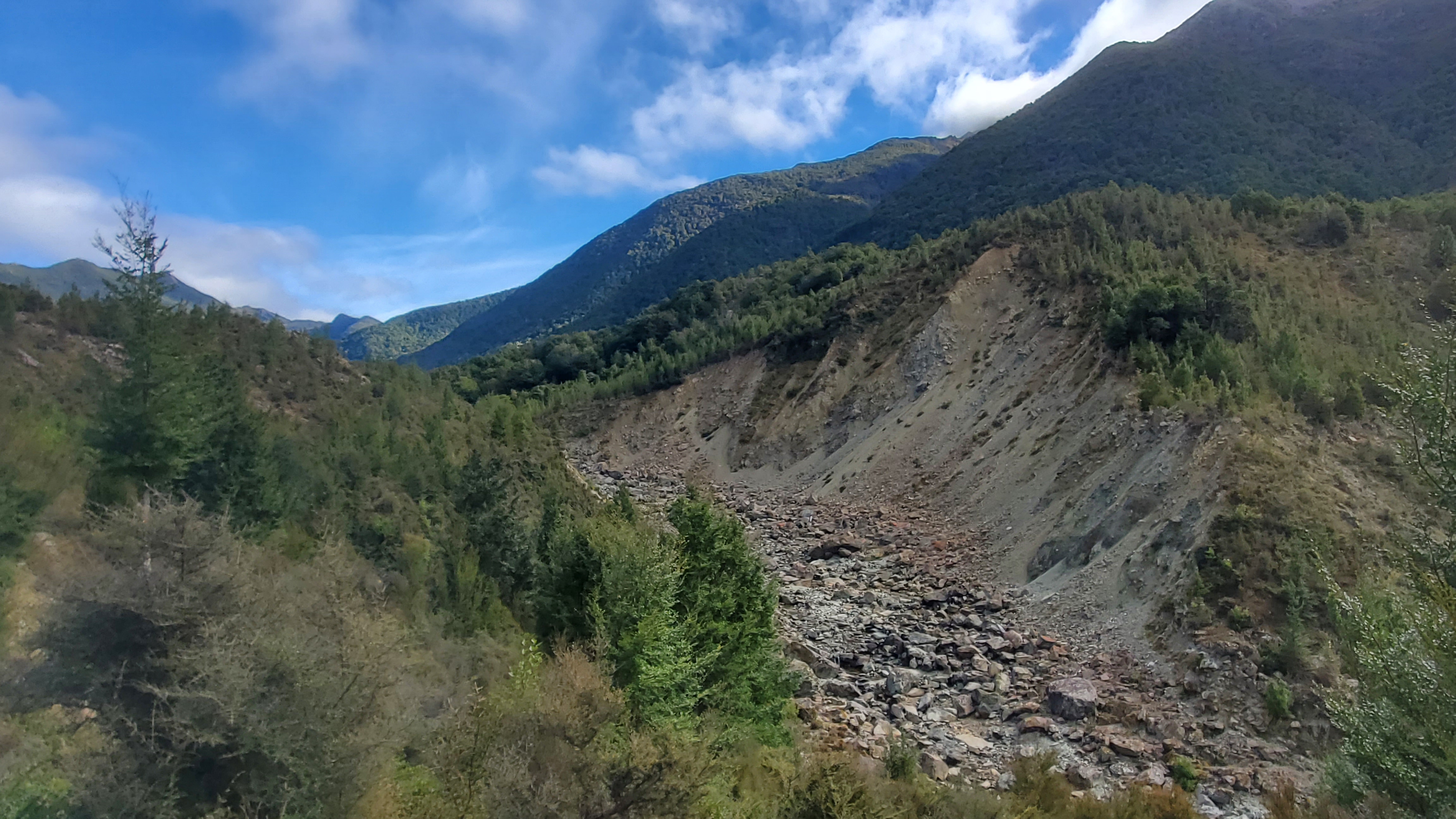
A large, old cairn marked a high point overlooking all the majesty with great views up the valley towards the Douglas Range.
We dropped our packs and enjoyed a fifteen-minute break to take it all in. Just before reaching the high point, we’d heard a deer bark so I got the scope out to see if we could find it. Given it was the roar we were high-vis’d to the max and stealth isn’t our strong point. All we found was a goat family over the river at the top of the scree.

Beside Lake Stanley
From the high point, we descended into a boulder field before reaching Lake Stanley at 10.35 am. I had seen a couple of pictures of the lake online but I hadn’t banked on it being so beautiful! It is certainly a jewel in the crown of Kahurangi National Park.

The track continued along the lake. It was easy walking with gentle undulations through beech forest interspersed with pockets of dracophyllum. Just under an hour later at 11.30 am we popped out at the shore on the western end of the lake.

Soper Shelter Anatoki Killdevil
The three-bed Soper Shelter sits on a little rise amongst the beech and draccy forest above the lake. Two mattresses lie at the back in the ‘tent’ part of the hut, with one more in the living area at the front.
Nothing I say can do sufficient justice to the Soper Shelter. Without a doubt, it’s now my favourite hut. Designed along the lines of the Tent Camp in the Cobb Valley, it was beautifully constructed in 2016 to replicate the tent camps of the NZ Forest Service built between the 1930s-1970s.
Soper Shelter is named after Frank and Berna Soper who were co-founders of the Golden Bay Alpine and Tramping Club. They were part of a group who according to the excellent information board in the hut, were “instrumental in persuading the government to form the North West Nelson Forest Park in 1970, which eventually became Kahurangi National Park”.

‘These Small Fields’ by Frank Soper
I digress for a while to mention some special reading material available in the hut that really touched me. A copy of Frank Soper’s (second) book of poetry “These Small Fields”. I’m generally not a reader of poetry but an outdoor life captured in the writings of a bushman, farmer and gentle poet unexpectedly had me in tears.
To quote the back cover “He writes of bird and beast, wind, rain and stars, of small flowers in the fields and a sliver of argillite in the sand. Above all these poems are love songs; always to his beloved Berna, often, thoughtfully and with great respect, to others who have shared his dreams and had their own”.
Click here to order a copy through River Press.
With the kind permission of Frank’s family and his publisher, I am able to share my favourite poem – the first one I read at the Soper shelter.
Today I thought it worth my while
to take some time to view
that rich array of precious gems
which sparkle in the dew.The morning sun bewitched my eyes
with diamonds rich and bright,
while here and there, an emerald
hung sparkling in the light.And if I turned my head just so,
A sapphire trembled there
and beamed and gleamed electric sparks
into the morning air.While, further on and far more rare,
a yellow topaz shone
as splendid as the morning star
before the night is gone.Thus, loitering along the lane
I lost some time, it’s true
But found myself much richer than
I had expected to.
Click the following links below if you are interested in finding out more about the Soper Shelter: Golden Bay Tramping Club – DOC article about Soper Shelter – Stuff article about Soper Shelter.

Lake Stanley to the Camping Area
After spending some time at the shelter we dropped back down to Lake Stanley. We made a boots-off crossing of a branch of the Stanley River before exploring the lake shore a little in the sun. At midday, we were on our way again, in a northbound direction up the true right of the other branch of the Stanley River.

It was another very pleasant walk along a decent tramping track. We detoured for a look down into a cool gorge along the river which belonged in an Indiana Jones movie. Several side-streams later we were lucky enough to spot our first whio of the day in a pool upstream.

At 1 pm and a couple of kilometres later we reached a boots-off crossing of the Stanley River at a left-hand bend and our second whio sighting. A quick look at the topo told us we’d found the flat spot before the start of the climb to a saddle, from where we’d drop down into the Anatoki. It was the ideal place for lunch.

We backtracked a little and found a great dry sunny lunch spot in the forest overlooking the river and the whio, who wasn’t at all bothered by our presence.
Camping Area to Anatoki Forks Hut
After lunch, we crossed the Stanley River at around 1.45 pm and shortly afterwards came to a large grassy clearing. From here it was a slow, occasionally quite steep and scrambly climb of approx. 250m on the true left of the river to a saddle at 1130m.


We reached the saddle at 2.30 pm. There wasn’t much to write about it apart from we were relieved to be walking downhill now. The track was pretty rugged and tree rooty with numerous ups and downs into and out of small gullies. Further down, from approx. the 900m contour, the track followed a nice spur with some dracophyllum.


I made my first sighting of what I hoped was a werewere-kōkako or Entoloma Hochstetteri mushroom. The one on the NZ $50 note. Usually, they are bright blue, but this one was a creamy grey colour, so I wasn’t convinced, but iNaturalist confirmed my observation.

We met the Anatoki River at 2.45 pm with about two kilometres to go before the Anatoki Forks hut. The track followed some old water races from here from the gold mining days. This section seemed longer than it was and was boggy in places. It did offer us the occasional views back to the Anatoki Peaks. I decided then, that I would put the Dragons Teeth low route on my list for my birthday tramp next summer.
Just before Anatoki Forks hut is the junction with the track which heads up around 800m to Yuletide Peak and Adelaide Tarn beyond.

Anatoki Forks Hut
We reached the six-bed Anatoki Forks hut at 4.30 pm. As three beds were already occupied we decided to camp (I’m a light sleeper). The hut had all mod cons – water, beds, table etc. but also a wetback stove that apparently heats water for the shower! Yes, there’s a shower. We didn’t light a fire or test the shower. It also had a weird door (as does the toilet) which you’d expect to find on a submarine.

The three other trampers came in shortly after us having done a full day up and back to Adelaide Tarn. A young French group in New Zealand on their working holiday – it was their cars we’d seen at the start. At least they’d written in this hut book if none of the others. They had been up to Adelaide Tarn today (five hours both ways). We ate dinner, retired to the tent and were asleep by 8.30 pm.
Day 3 – Anatoki Forks Hut to Road End
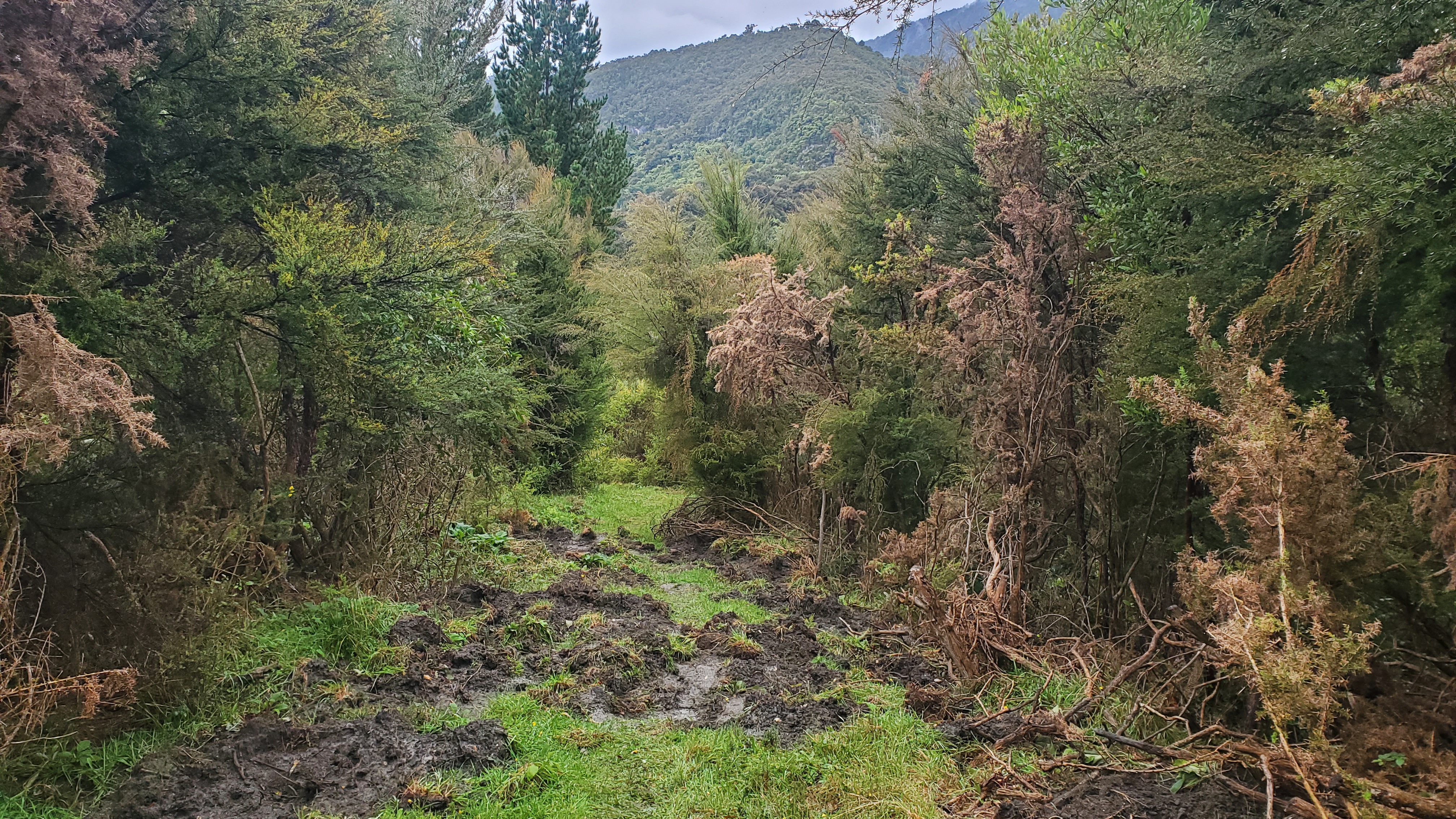
Anatoki Forks Hut to Anatoki Bend
Rain was due today before a proper downpour tomorrow. We were pleased it hadn’t rained when the alarm went off at 6 am, but the skies looked threatening so we packed up and ate our breakfast on the track in the forest. We left at 7.40 am along an excellent track which sidled bout 60 m above the true right of the Anatoki.


After making good progress for the first forty-five minutes, the state of things became progressively more difficult whilst crossing the side streams. Some were OK. Others involved slippery, dubious boulder scrambles, which turned into slippery, dubious boulder scrambles with the added bonus of windfall. It was very difficult to trust a foot placement with my already bad balance, so I made the most of all fours and the occasional bum slide where necessary.
The windfall wasn’t limited to the gullies. There were a couple of decent sections along the track too, which elicited a few choice words.

The track climbed slowly and we got our first decent views down to the Anatoki River at about 9.45 am. At 10.30 am it began to rain. We had just arrived at a lookout with a wonderful view and needed a break so sheltered under an overhanging rock. We ate our lunch, conscious that if the rain got heavy, we’d probably want to push on without stopping later.

As we were taking our break the French team overtook us. Fifteen minutes later we heaved ourselves up and carried on. The rain came down steadily and we plodded on. At 11.35 am we arrived at Anatoki Bend.


Anatoki Bend to the Road End
From Anatoki Bend the track climbed and generally improved. About half an hour later I was delighted to find a thick, shiny new chain had been fixed to a rock wall allowing scaredy-cats like me to cross the slippery face in the wet with some confidence.


The rain eased at about 1.20 pm as we were approaching the sweeping right-hand bend which took us up and over in the direction of the Anatoki Track Road. My winter raincoat held up brilliantly and I was toasty warm and dry upstairs. The bottom of my shorts below my jacket got a thorough soaking though. The water gradually seeped up my shorts so I ended up with wet undies (cue much grumbling).

The final forty-five minutes were spent walking downhill to the road end with private land on either side of the track and plenty of evidence that pigs had been through recently. It was fairly uninspiring but there were some nice views across the valley.
We arrived at the car park at 2.30 pm just under seven hours from Anatoki Forks hut. We signed out of the intentions book and made our way into Takaka for a burger at the Roots Bar (a must-do).
The Anatoki Kelldevil track was an unexpected delight. The location and transport logistics probably take it off most people’s radar so you probably won’t meet too many other people along the way. If I was going again, I would definitely try to factor in a stay at the Soper Shelter.
Check out some other walks in the Tasman area. Click the links below, or from the menu bar click NZ Hiking > Tasman for all my walks in the region or use the Search bar.
- Harwoods Hole Track – short walk
- Moa Park Track to Porter Rock – day walk
- Takaka Hill Walkway – short walk
- Abel Tasman Southern Loop – multiday
- Abel Tasman Northern Loop – multiday
- Puponga Hilltop Walkway – day walk
- Kahurangi Lighthouse – multiday tramp
- Tablelands Circuit – Asbestos, Salisbury, Peel – multiday
- Tablelands Loop – Arthurs, Gordons, Balloon, Flora – multiday

Lovely to see your pics. We did a variant of your trip some years ago, with climbing Mt Snowdon then heading up the North-west tributary of the Stanley to Lonely Lake, thence the low route to Adelaide Tarn and over Yuletide Peak to the Anatoki Forks Hut and out. Then it was an eventually sore 20-something km bike ride from Go Ahead Creek back to the Kill Devil road end.
Hi Honora, Thanks for the suggestion – sounds awesome! We saw some excellent alternative options in the hut books too. The trouble with visiting new places is that it opens up so many new tramps! My winter jacket is an Earth Sea Sky Hydrophobia 🙂