Moss Pass Route
The Moss Pass Route is a stunning and challenging crossing on the Mahanga Range, linking the Sabine and D’Urville River valleys in Nelson Lakes National Park. At 1780 metres, the pass is steep, rocky, and highly exposed to the elements – best suited for fit, experienced trampers (with good knees!). As the elevation suggests, it involves a significant climb and descent and can be treacherous in wet or frozen conditions. It is best attempted during a fine weather window, and outside of summer, snow is likely at the pass. Do your research before heading out. We walked the Moss Pass route as an ‘almost loop’ from the Sabine to D’Urville valleys. Depending on how many huts you’d like to stay at, it can take a few days or more. We completed the tramp in three days (February 2025), starting from Sabine hut on Lake Rotoroa, heading up to Blue Lake hut, crossing Moss Pass, and finishing at D’Urville hut, with two pretty big days in the mix.
Getting There
I drove up to Lake Rotoroa from the West Coast and spent the night before the tramp at the Lake Rotoroa campsite. Rich drove down from Nelson in the morning. We’d pre-booked the Lake Rotoroa Water Taxi to drop us at Sabine hut and collect us from D’Urville hut a few days later. Note that huts on the Travers Sabine loop (and Blue Lake hut) must be booked before you stay. West Sabine and Blue Lake huts are also on Te Araroa trail, so expect them to be very busy in summer. Trampers often add their own flavour to a Moss Pass crossing, weaving it into longer journeys approaching from various directions within Nelson Lakes National Park.
Timings
Sabine hut to West Sabine hut – DOC time: 5h, our time: 4h 40 mins
West Sabine hut to Blue Lake hut – DOC time: 3h 30 mins, our time: 2h 50 mins
Blue Lake hut to the tarns towards Moss Pass – Our time: 40 mins
Blue Lake hut to George Lyon hut – DOC time: 6h, our time: 6h
George Lyon hut to Morgan hut – DOC time: 4h, our time: 3h
Morgan hut to D’Urville hut – DOC time: 4h, our time: 4h 20 mins
Lake Rotoroa
The night before the tramp, I camped at the Lake Rotoroa DOC campsite. It was a lovely small campsite, and busy when I arrived at 4 pm on Waitangi Day. I wandered down to the lake, walked the nature trail, and fended off the many curious bumblebees bumbling around my bright blue shorts and yellow pack cover. I’d pre-booked tomorrow’s water taxi and chatted with the team about timings in the morning. That evening, I chatted with my neighbours before being forced inside my tent by the plague of sandflies. At least 50 squeezed into the tent with me. Finally, I settled down with my book, listening to the kākā chatter in the trees nearby.
It was still dark when my alarm went off at 6 am. I thought I’d be able to make a coffee before the sandflies were awake – no chance! Even at this hour, they were out in force. As I sat in my tent eating breakfast, the forest slowly came alive – the hum of insects high in the canopy, followed by the birdsong.

Moss Pass Route – Day 1
Lake Rotoroa to Sabine Hut
I met Rich at 8:15 am at the water taxi office. Following our hosts’ advice, we parked our cars a stone’s throw from the campsite, then wandered down to the jetty to meet the boat. It was a perfect morning for a ride across the lake. We’d been given instructions for a 3 pm pickup from D’Urville hut a few days later, and were to radio from the hut once we arrived. The 20-minute journey across Lake Rotoroa was beautiful. The last time I was up here was for a stint volunteering for DOC a couple of years earlier. I also had great memories of our trip kayaking up the lake a few years ago to tramp Mt Misery.


The jetty at Sabine hut was bustling with walkers and kayakers. We said our goodbyes and wandered the short distance to the 32-bunk Sabine hut, where we made a few last-minute adjustments to our kit. Rich whipped out a couple of savoury mince pies, bought from the fabulous Wakefield Bakery. Perfect!
Sabine Hut to West Sabine Hut
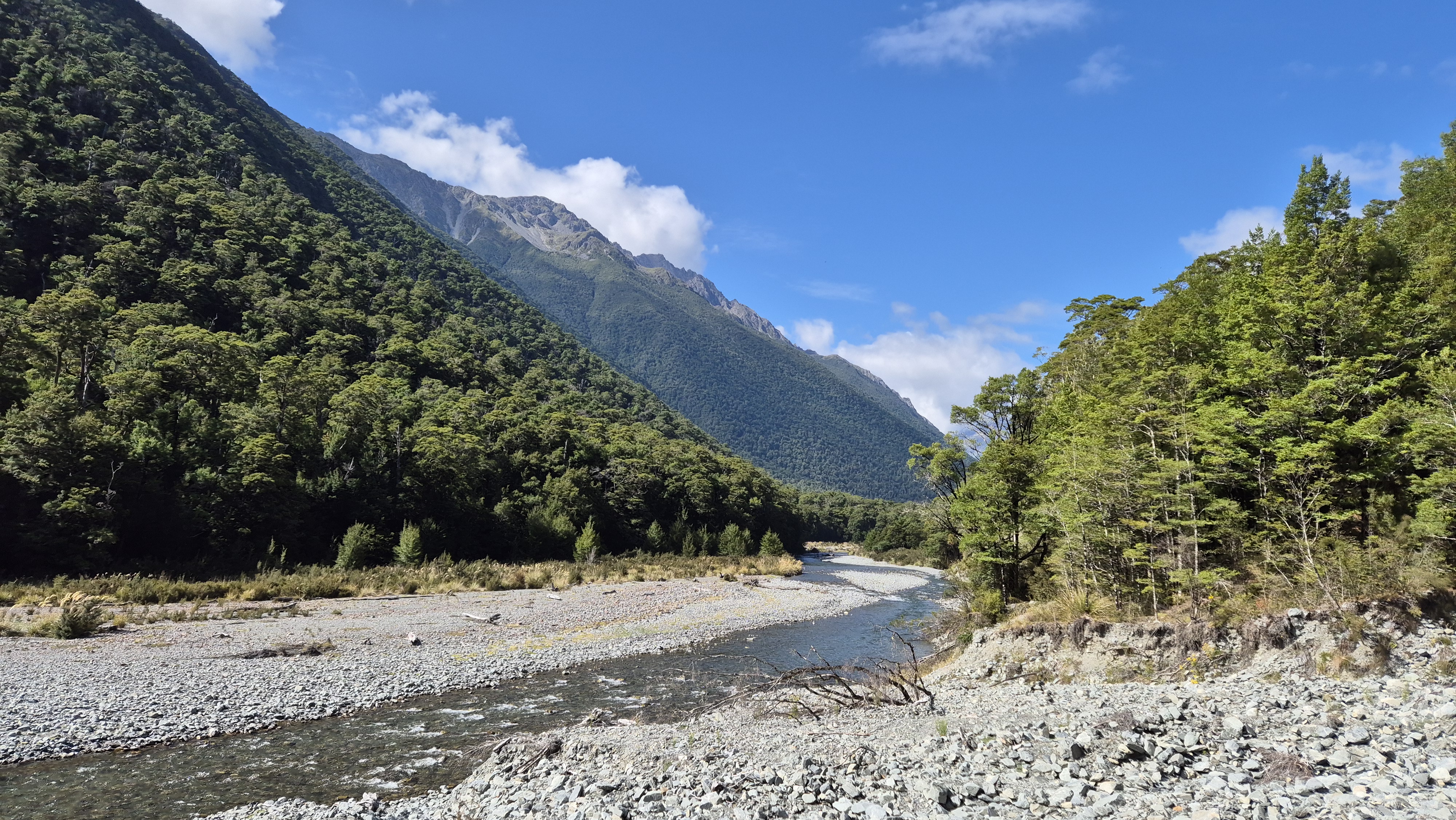
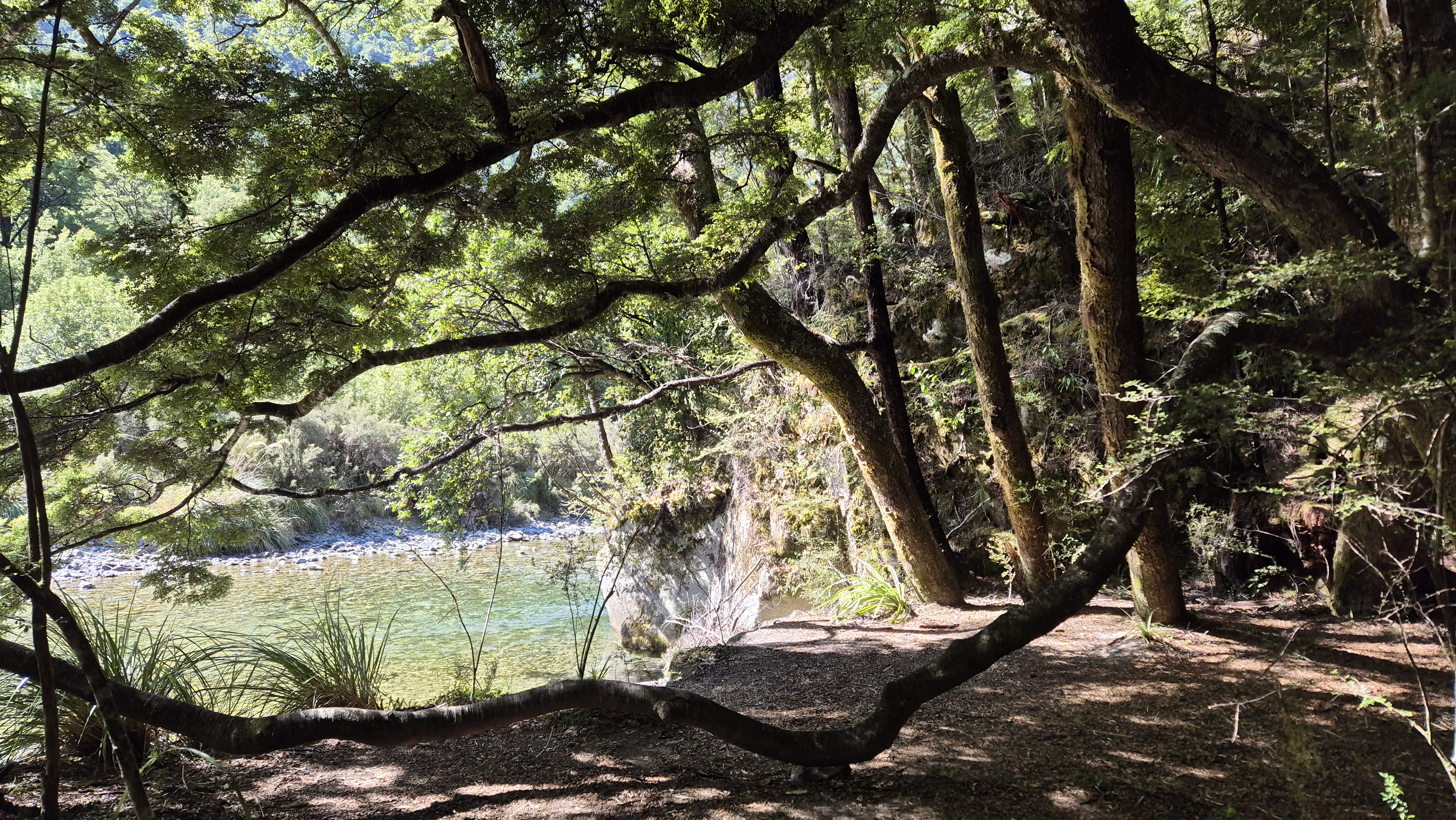
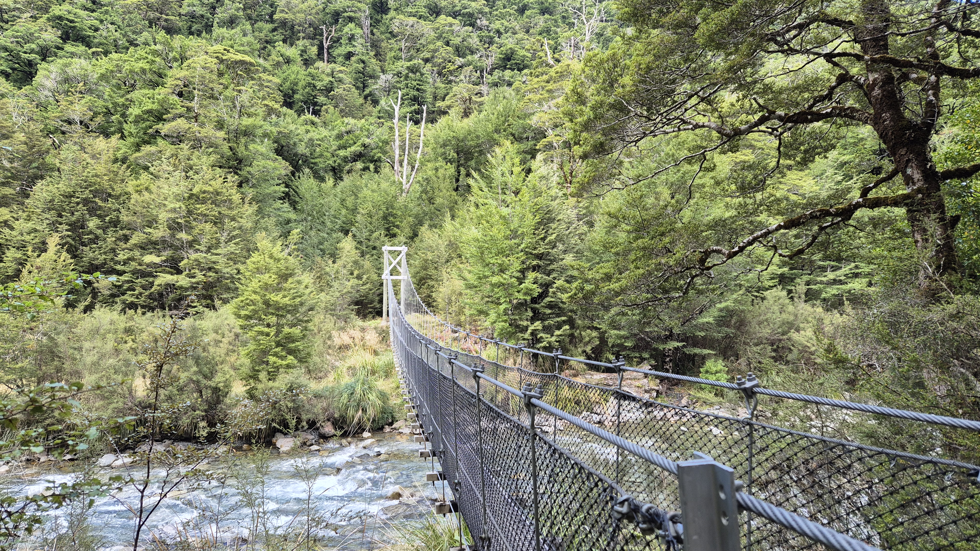
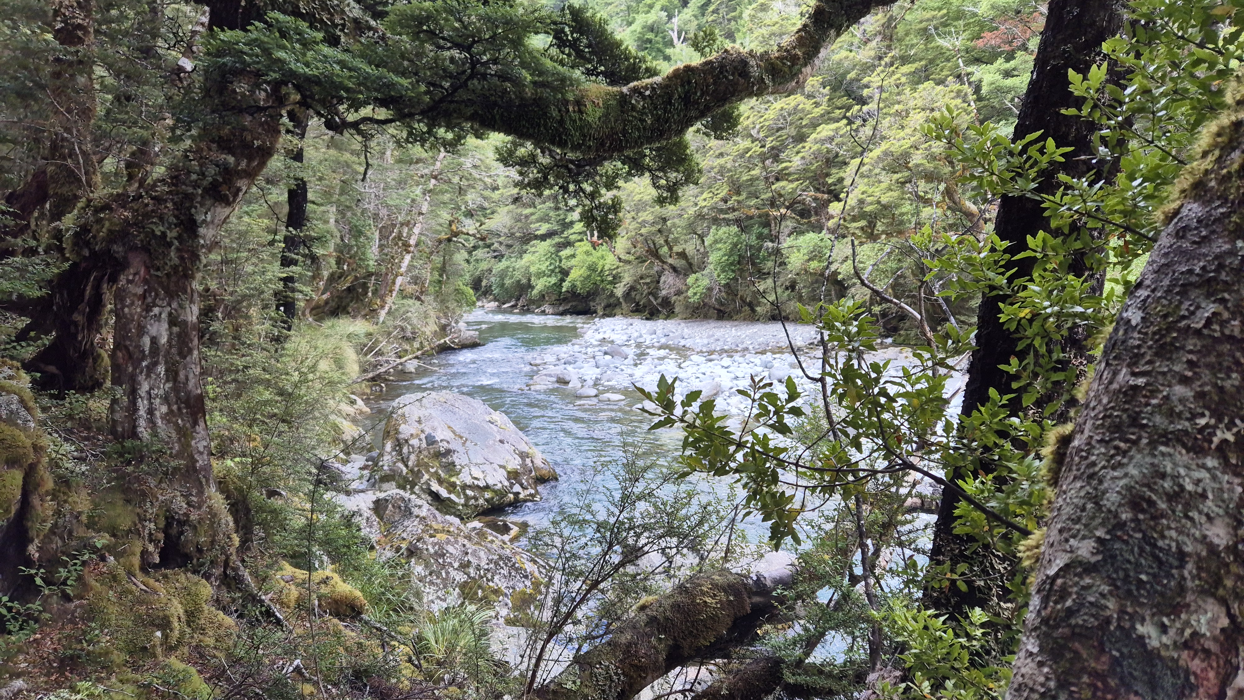
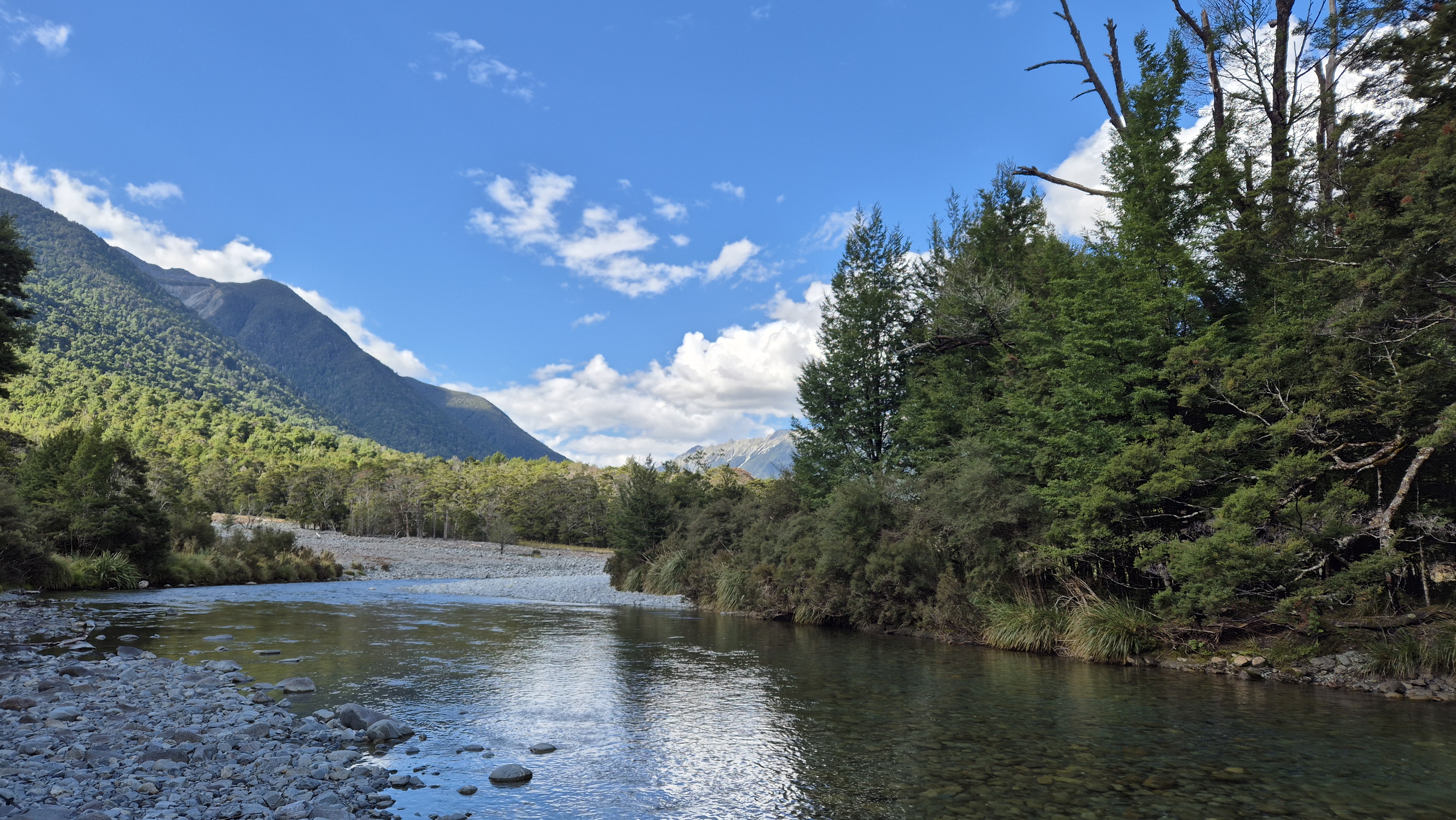
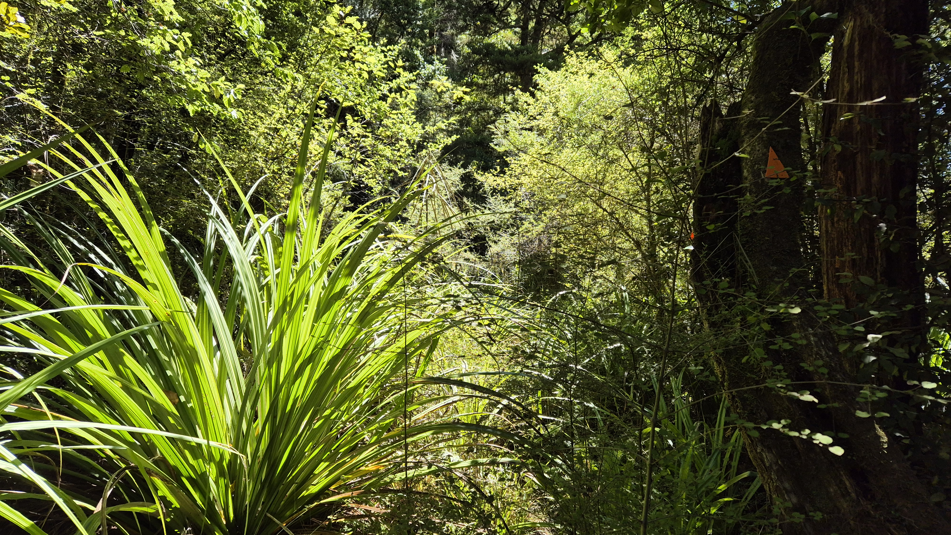
We left Sabine hut at 9.30 am. The track had recently been groomed, and it felt like a great walk, which I suppose, the popular Travers Sabine Circuit almost is. It was wide, dry, well-marked and easy-going, gently winding through the beautiful beech forest. The first small climb wasn’t until about 20 minutes in. At 10 am, we crossed a bridge over a beautiful gorge, where the clear, almost-green water shimmered in the morning sunlight. Shortly after, we passed the turnoff to D’Urville Hut, a couple of hours away. Our track continued southbound.


Along the way, we passed the Friends of Rotoiti trapping boxes. The wonderful Friends volunteers (whom I’d also done a couple of stints for) help protect the native wildlife of the Nelson Lakes by controlling introduced predators like rats, stoats and possums. Their 52 kilometres of trap lines up the Sabine and Travers valleys form one of the longest trapping lines in the country. Here, it’s part of the Te Whakarauora Whio project, which aims to support the growth of the whio (blue duck) population in the Nelson Lakes National Park.
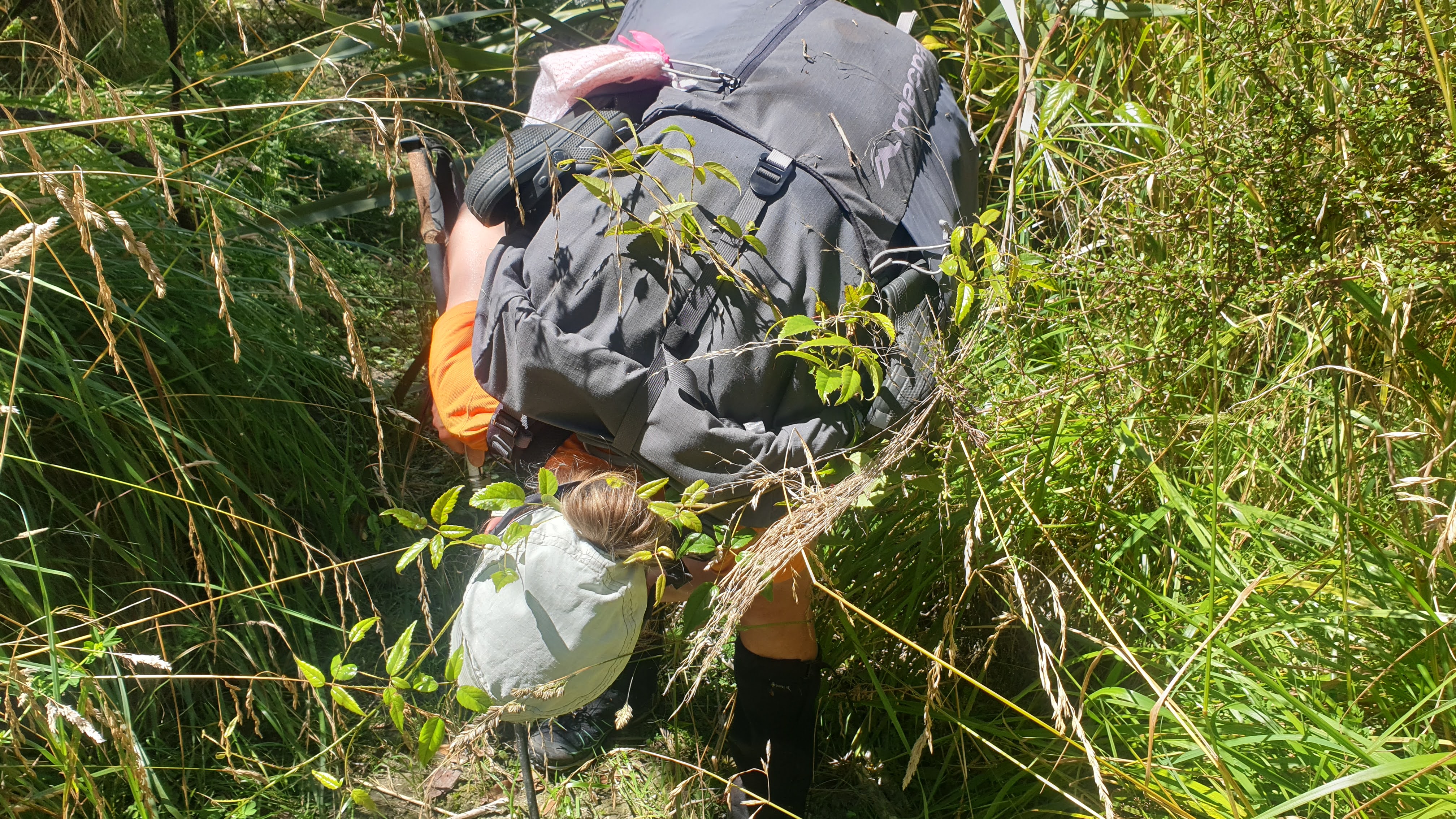
At around 10.40 am, after crossing a small bridge, we walked through open grassland for a time, enjoying the sun on our backs and the views upriver. Soon enough, we were weaving in and out of the forest, keeping close to the river, at times pushing through head-high reeds, and crossing side streams. The track was still in pretty good shape, but rather more tree rooty and undulating than the near-perfect track out of Sabine hut.
The perfect rest spot presented itself at 11.15 am on a bouncy, tree branch, by a rocky outcrop next to the river. We determined it would also make a perfect camp spot, but although it was relatively sandfly-free in the heat of the morning, we imagined you’d be ravaged in the evening. Rich pulled out another bakery delight – a giant almond croissant to share.
Towards West Sabine Hut
We got underway again at 11.30 am and soon afterwards succumbed to wet feet crossing a side stream. The early trampers coming from West Sabine hut began to pass us and we chatted with many of them. A chap in one group had suffered a significant boot sole failure. They’d scoured the hut for scraps of string and other assorted items, and had managed to engineer the best ‘keep your sole on’ setup I’ve ever seen. I wish I’d taken a picture.
The track continued through the forest before opening up into occasional rocky avalanche zones. From here, the views of the mountains ahead were stunning. It was a hot day, and we were chugging through our water, so we filled up from a small side stream. The scenery was beautiful – no wonder the Travers Sabine is such a popular tramp. I had previously walked West Sabine to Blue Lake and Waiau pass on Te Araroa trail 7 years ago, but this section of the track was new territory for me.
Seeing a random tramper sunning himself on a boulder gave me the urge for a swim too. Although the view was great, it would have been wrong to spoil his zen. We continued on and found our own perfect spot in a boulder-strewn, narrower section for a quick dip in a lovely pool. I felt like a new woman afterwards – even putting my sweaty clothes back on didn’t seem so bad.


West Sabine Hut
We arrived at the large bridge crossing the Sabine close to West Sabine hut, at 2.10 pm 4 hours 40 minutes after leaving Sabine hut. The 32-bunk West Sabine hut was busy with TA walkers, and we took a table inside to eat out of the sun. It was great hearing all the TA chat, reminding myself of the day I’d walked Upper Travers to Blue Lake. My legs could almost feel the downhill off the Travers Saddle again! The surprise bakery goodies kept coming for lunch! A tried and tested favourite, the savoury bacon scroll – perfect for splitting in half.
West Sabine Hut to Blue Lake Hut
We left West Sabine hut at 2.50 pm, crossing back over the bridge and heading left. The track was noticeably more rugged and tree rooty from here. West Sabine hut sits at around 690m whereas Blue Lake hut is around 1200m, so it was generally an uphill walk for the next few hours. We crossed more avalanche zones and for the first time, I saw DOC trail markers with a warning sign.

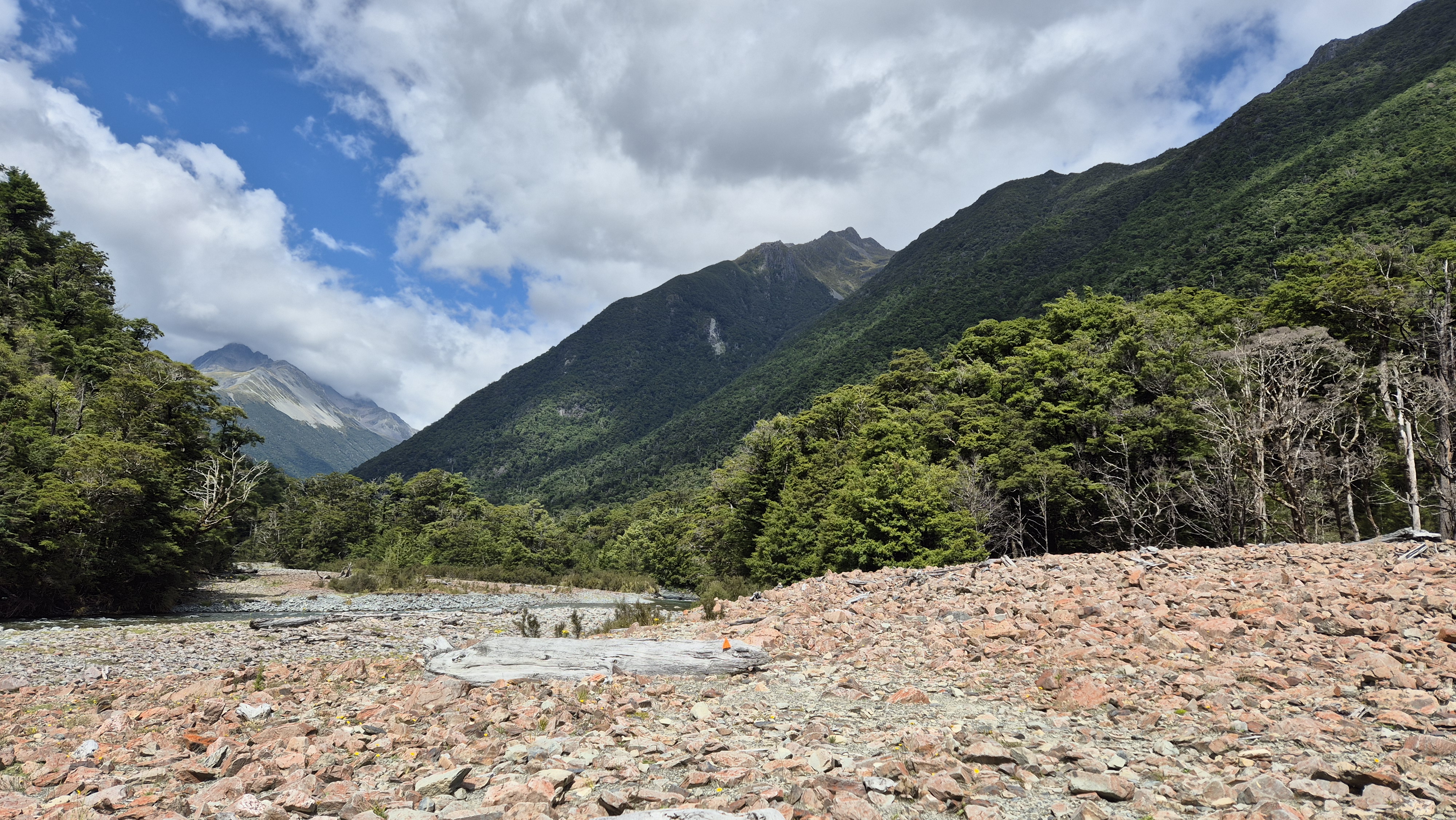
The views got better and better as we climbed, and at around 4.40 pm we emerged from the bush to a stunning vista I’d completely forgotten about. I guess when I walked this stretch on TA, the prize views worth mentioning were Blue Lake and Waiau Pass. Here, ahead of us, a waterfall cascaded down from the basin below Moss Pass, with the mountains surrounding the pass – tomorrow’s destination – rising in the distance. It was fantastic. As we climbed, we met and played overtakes with a lovely lady from the USA. We took a short break for a bite to eat before pushing on, up the final short, steep climb about a kilometre from Blue Lake hut.


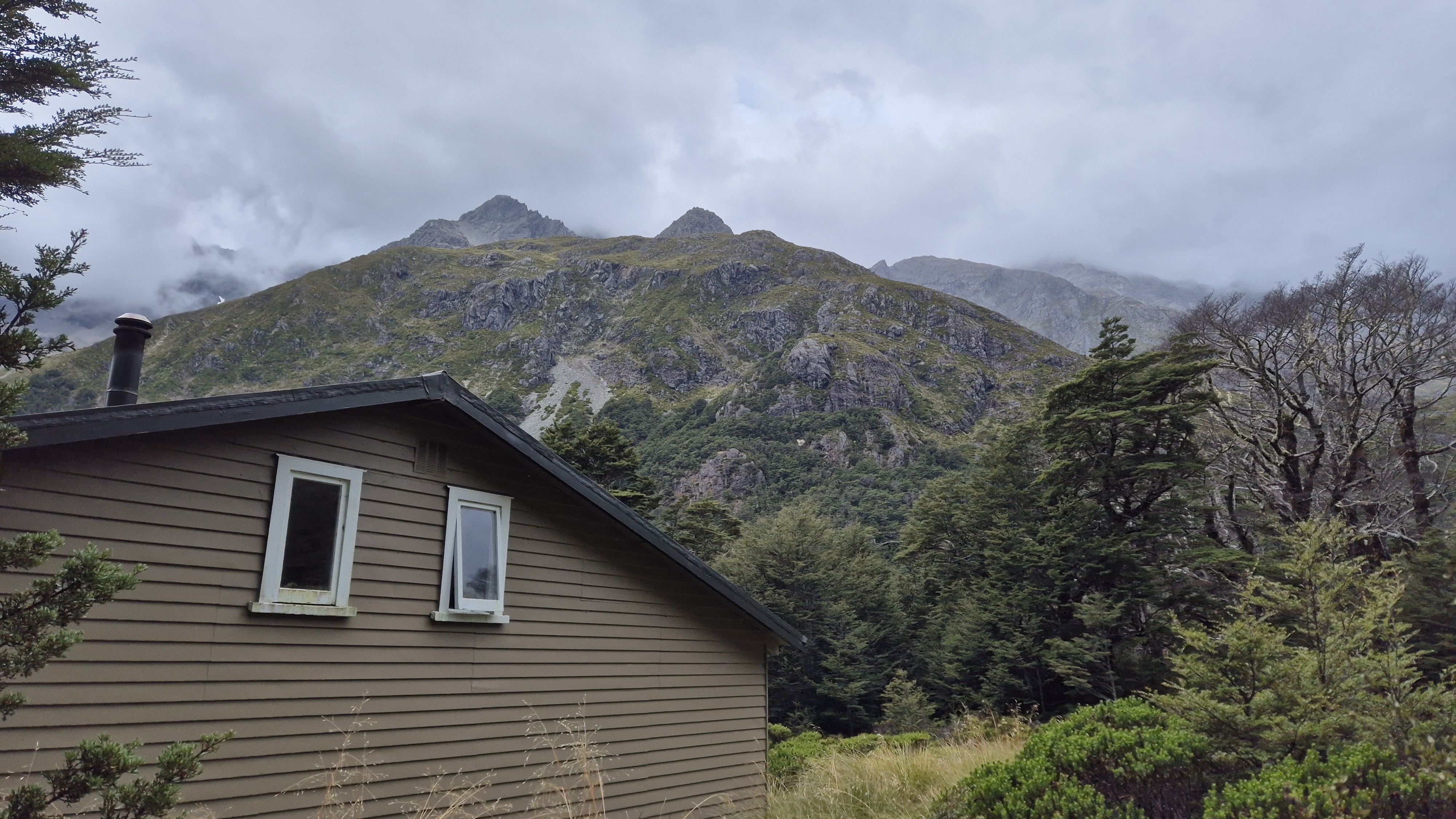
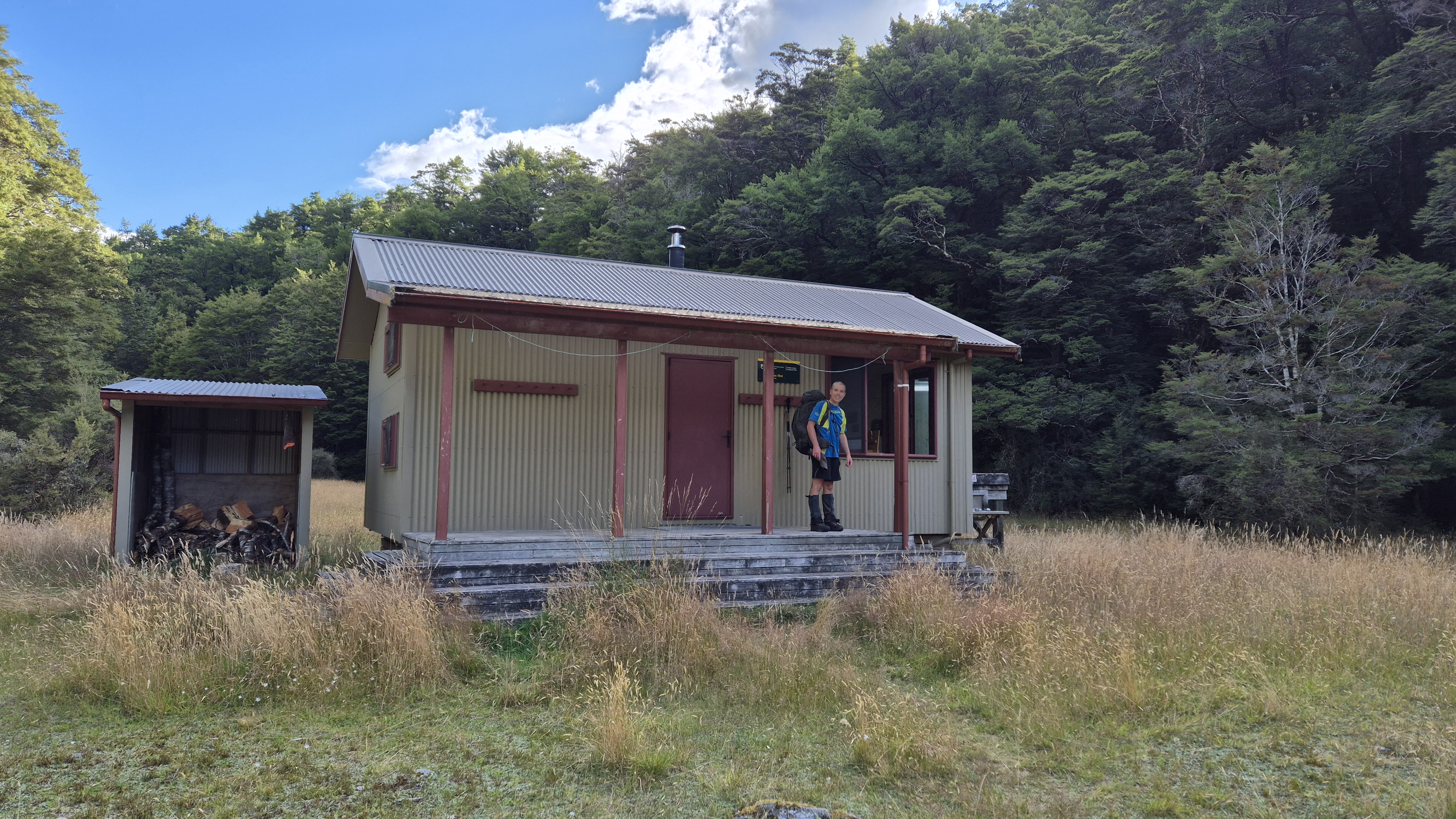
Blue Lake Hut
We reached the 16-bed Blue Lake hut at 5.40 pm. It was jam-packed, and a small tent city was pitched around the hut. We were camping at the tarns en route to Moss Pass tonight, so this was just a dinner stop. We found a spot in the corner of the kitchen and cooked our meal, sharing a table to eat with a lovely girl from Canterbury. As much as we both probably wanted to call it a day at Blue Lake hut, time was ticking and we knew we couldn’t get too comfortable. Showers were forecasted for the evening, so we heaved our tired bodies up from the bench and left the hut at 6.35 pm.
Towards the Tarns
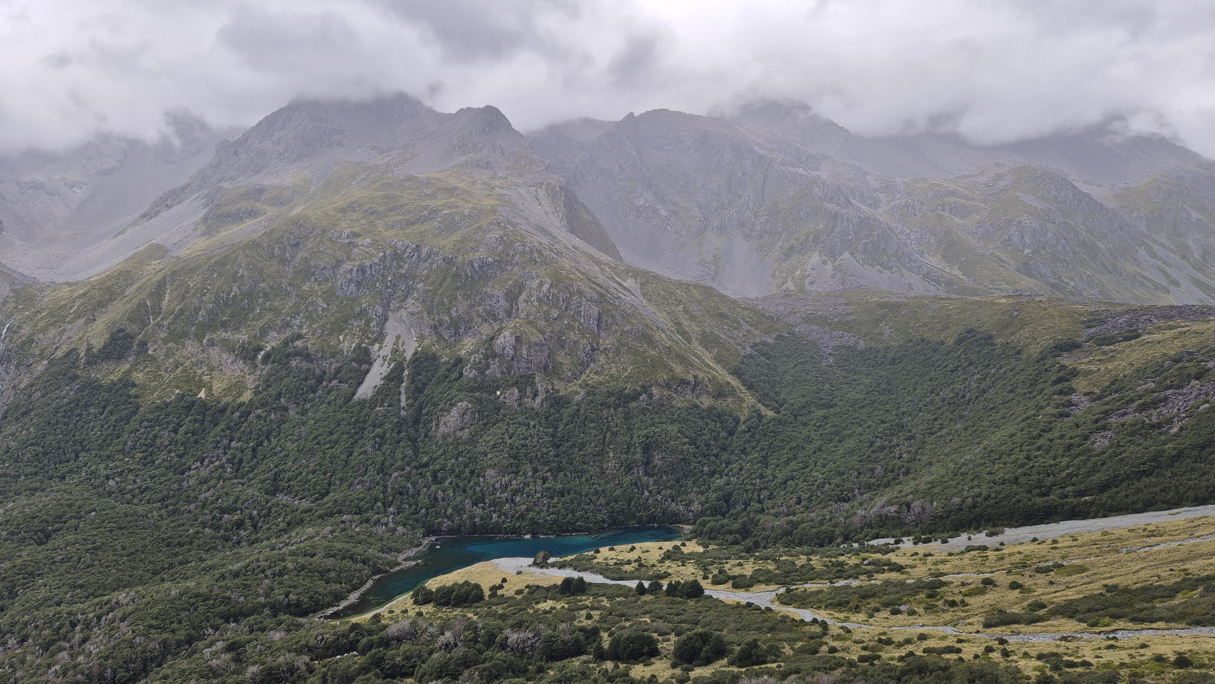
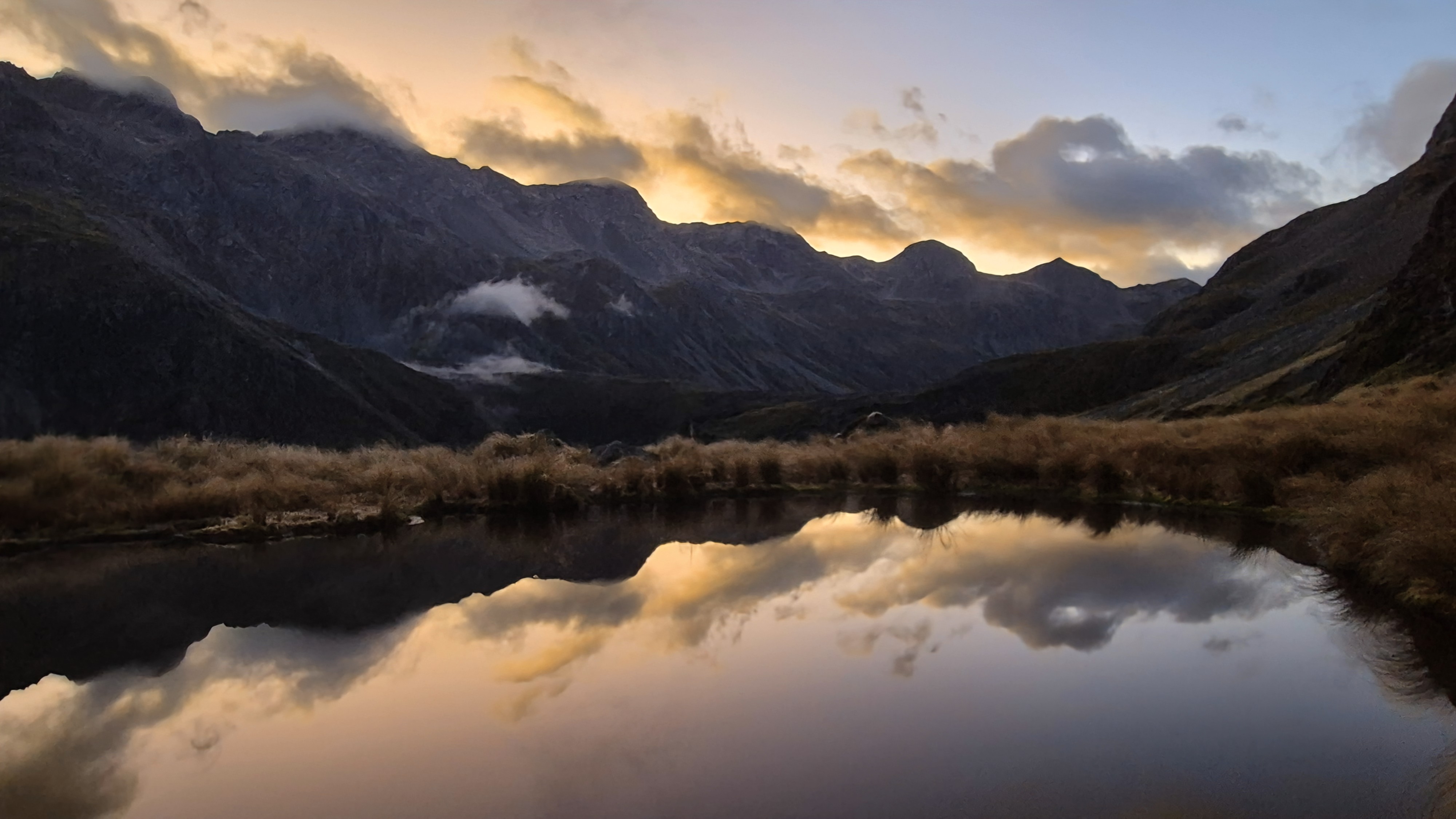
The marked route led from directly behind Blue Lake hut, past the campsite and wardens’ hut and into the forest. We knew we had a couple of hundred metres of climb ahead to reach the tarns, and even though we were tired, we also knew we’d be grateful in the morning, waking up in the high basin surrounded by mountains. The climb began steep and slippery up a small stream bed. Spits of rain turned into a light drizzle and low cloud hung over the mountains ahead. We got our heads down and pushed on, using the excuse of the incredible views back to Rotomairewhenua / Blue Lake (the clearest natural body of fresh water in the world) to stop for micro breaks.

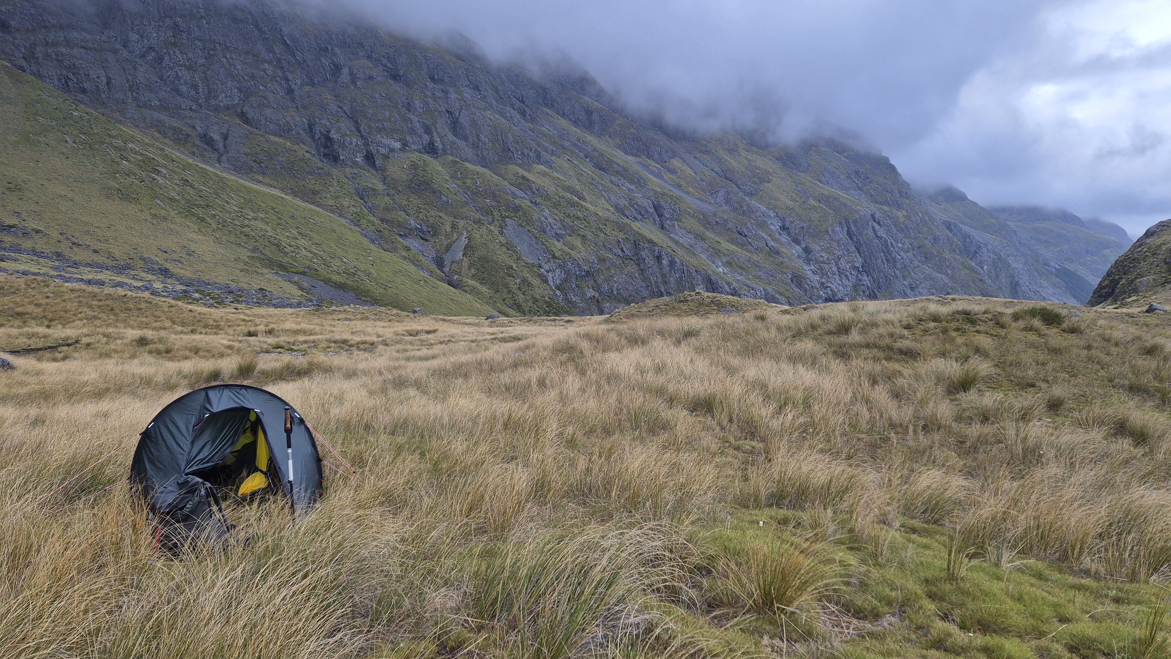
The climb continued up the rocky slope, and although still poled, the track petered out. We climbed a little too high, reaching approx. the 1420 contour, before turning right off the route and heading down towards the tarns. This turned out to be a good move as we got a decent look at the tarns coming down. As we neared the tarns, the drizzle became stronger. We threw our packs off and headed in different directions to scope out a camp spot. I am notoriously fussy about getting a flat pitch, but adding rain into the equation was a game-changer. We hurriedly set up the tent on the second spot we found between the first two tarns. Lumpy, with a slight downhill – suck it up buttercup.
I headed off to get water from the largest tarn while Rich put the finishing touches to the tent setup. As we bundled ourselves into the tent, it started to rain properly and we heaved a sigh of relief. Rich produced the final bakery surprise of the day, a rather battered, but delicious raisin scroll.
Find this helpful?
I write about my adventures to give you a personal view of the outdoors and inspire your own trips. Enjoy them? If you’d like to help me with my site costs, click here to make a donation. Thanks — it’s much appreciated!
Moss Pass Route – Day 2
Blue Lake hut to George Lyon hut – DOC time: 6h, our time: 6h
George Lyon hut to Morgan hut – DOC time: 4h, our time: 3h
Getting up for a midnight pee turned out to be totally worth it. Even without my contact lenses in, I could make out the stars, and light wisps of high cloud drifted above the towering peaks. I happily fell back to sleep and woke with the alarm at 6 am. The forecasted overnight downpour didn’t happen, but the long grass was drenched with dew. In the beautiful half-light, I went to top up our water from the tarn. We wasted no time getting up and sorting breakfast on a rocky outcrop close to the tent. Cloud descended over the mountains and mist crept up the Sabine towards us. At 7:20 am, a glimmer of sunlight broke through a gap in the clouds to light up the mountain. We took it as a sign that another beautiful day was on the way.
Towards Moss Pass
We left the tarns at 8.15 am and fifteen minutes later were back on the poled route. There wasn’t much to see around us as we were still in the cloud, so we cast our eyes downward to enjoy the flowers and intricate spider webs instead.

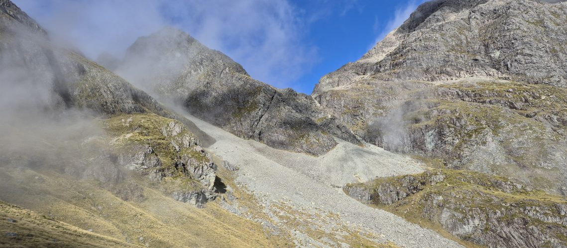
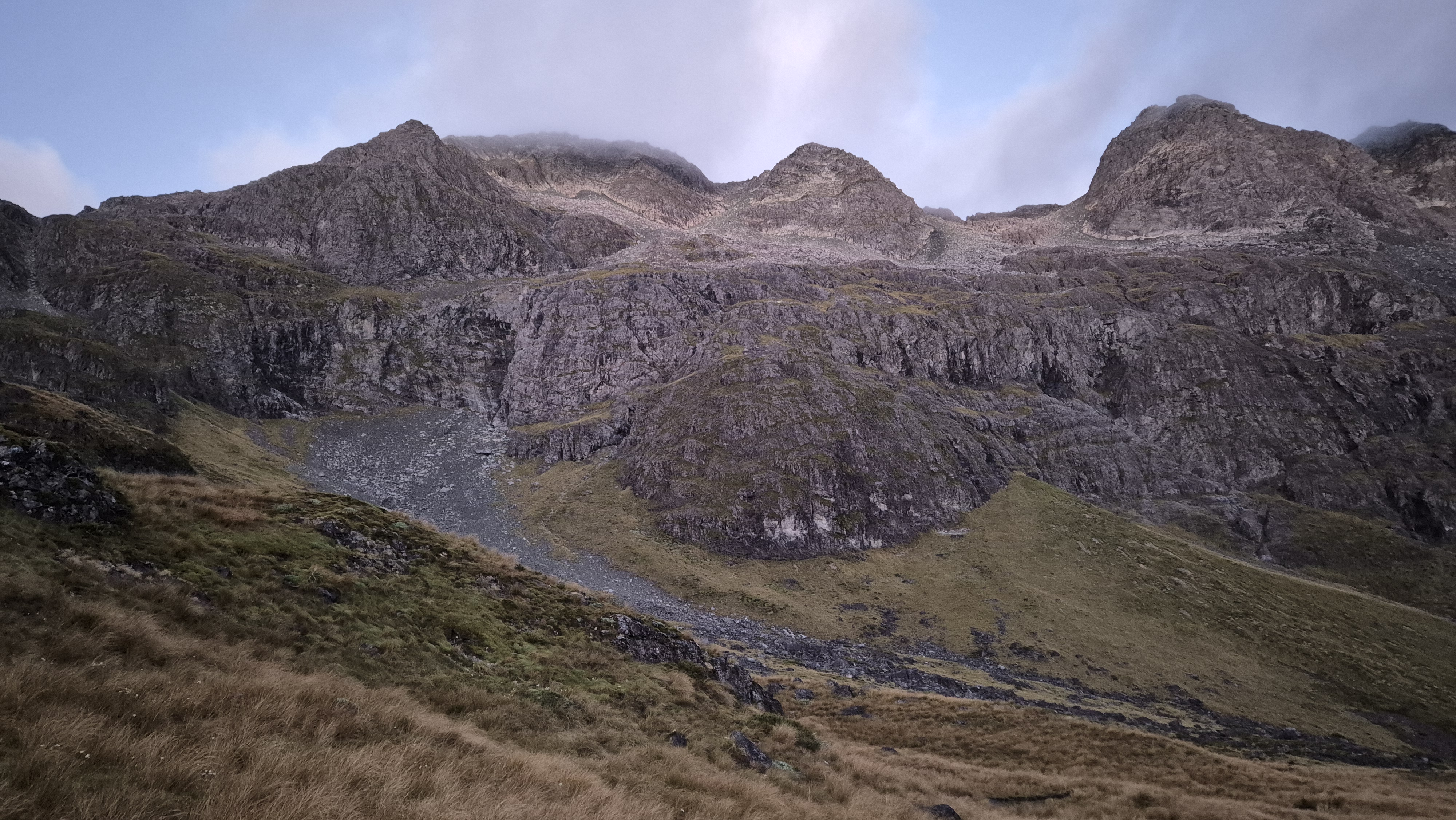
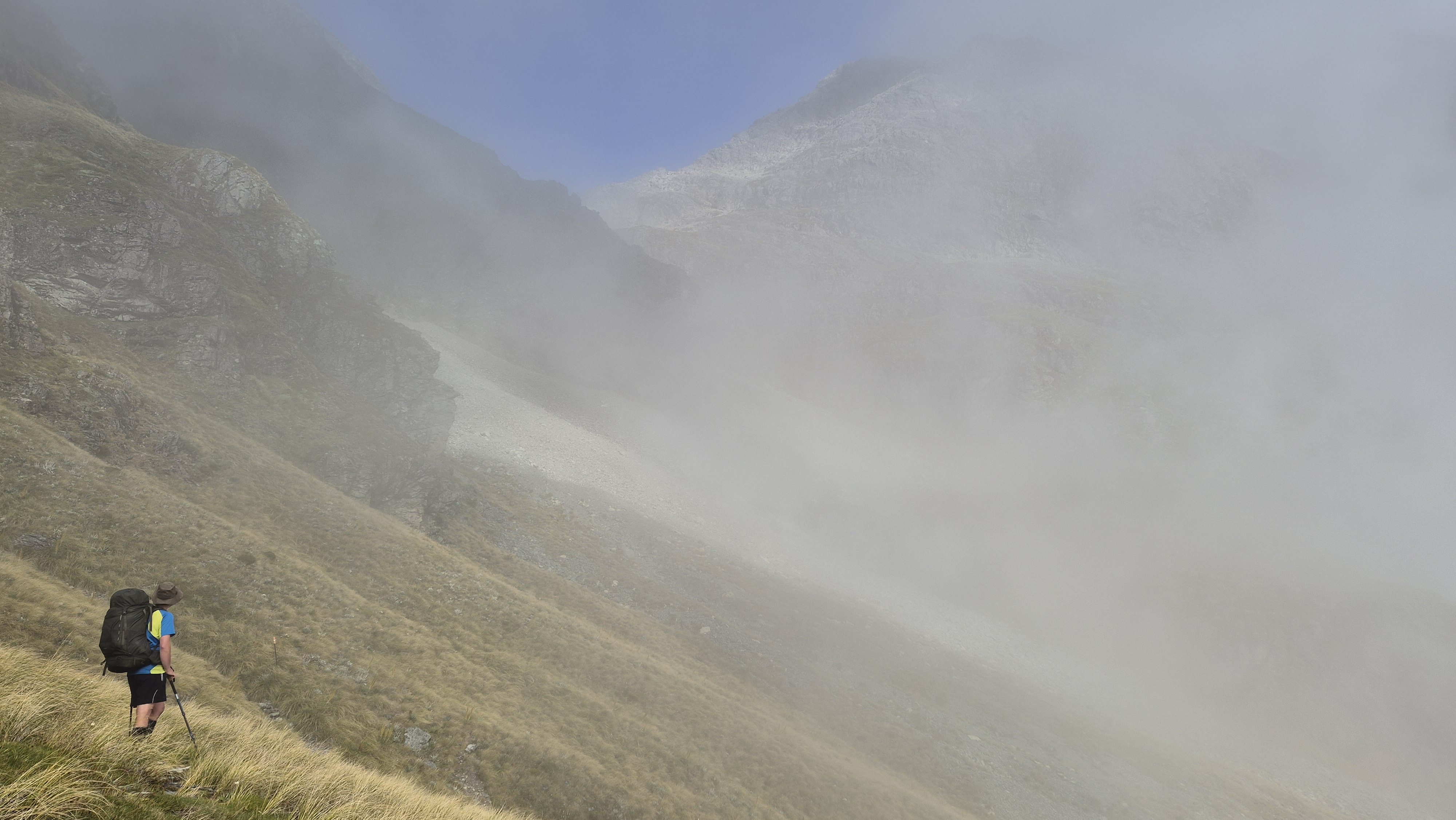
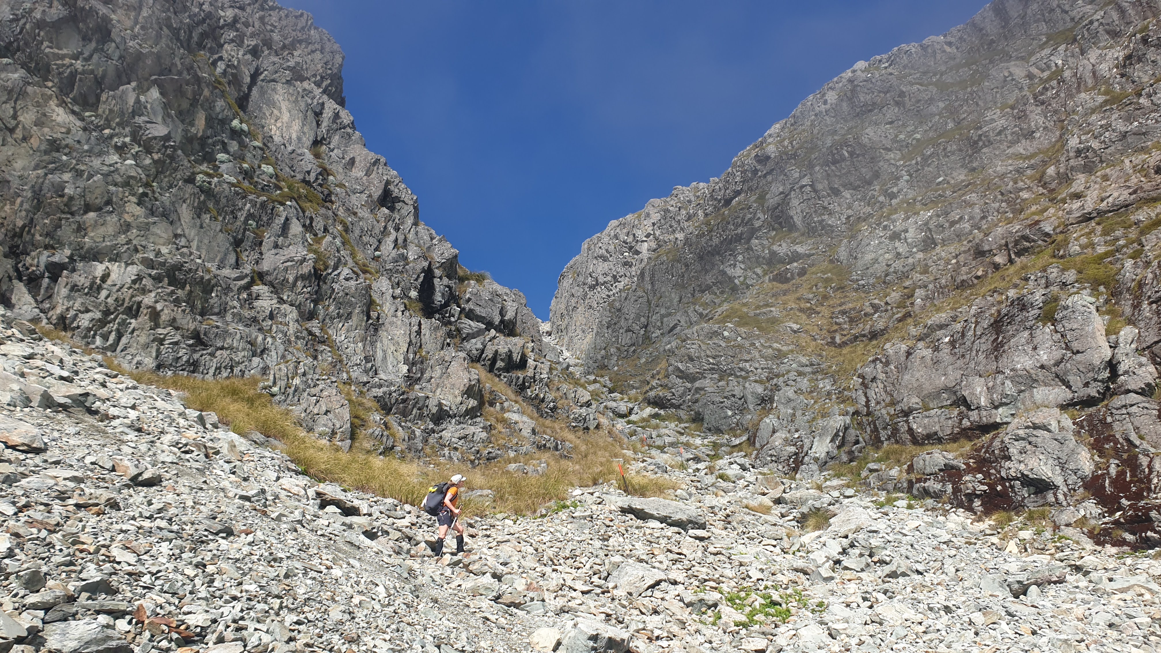
Back on the route, a couple of steep parts required some scrambling. The sun was showing promising signs of winning the battle with the morning mist, right in time for our arrival at the 1600m contour at around 8.55 am. We paused to assess the route and check out the marker poles heading across the grassy then rocky slope to a rocky outcrop. From there the final climb up to Moss Pass began to the left up a narrow, rocky chute. We checked our PLBs were secure, applied our sunscreen and headed on. The cloud was still coming and going. We drank from the small stream along the grassy slope before crossing the fairly solid scree slope. The day was already warm, and grasshoppers were everywhere, flinging themselves about at odd angles, making us smile. We reached the rocky outcrop at the base of the chute at about 9.30 am.

Up the Rock Chute
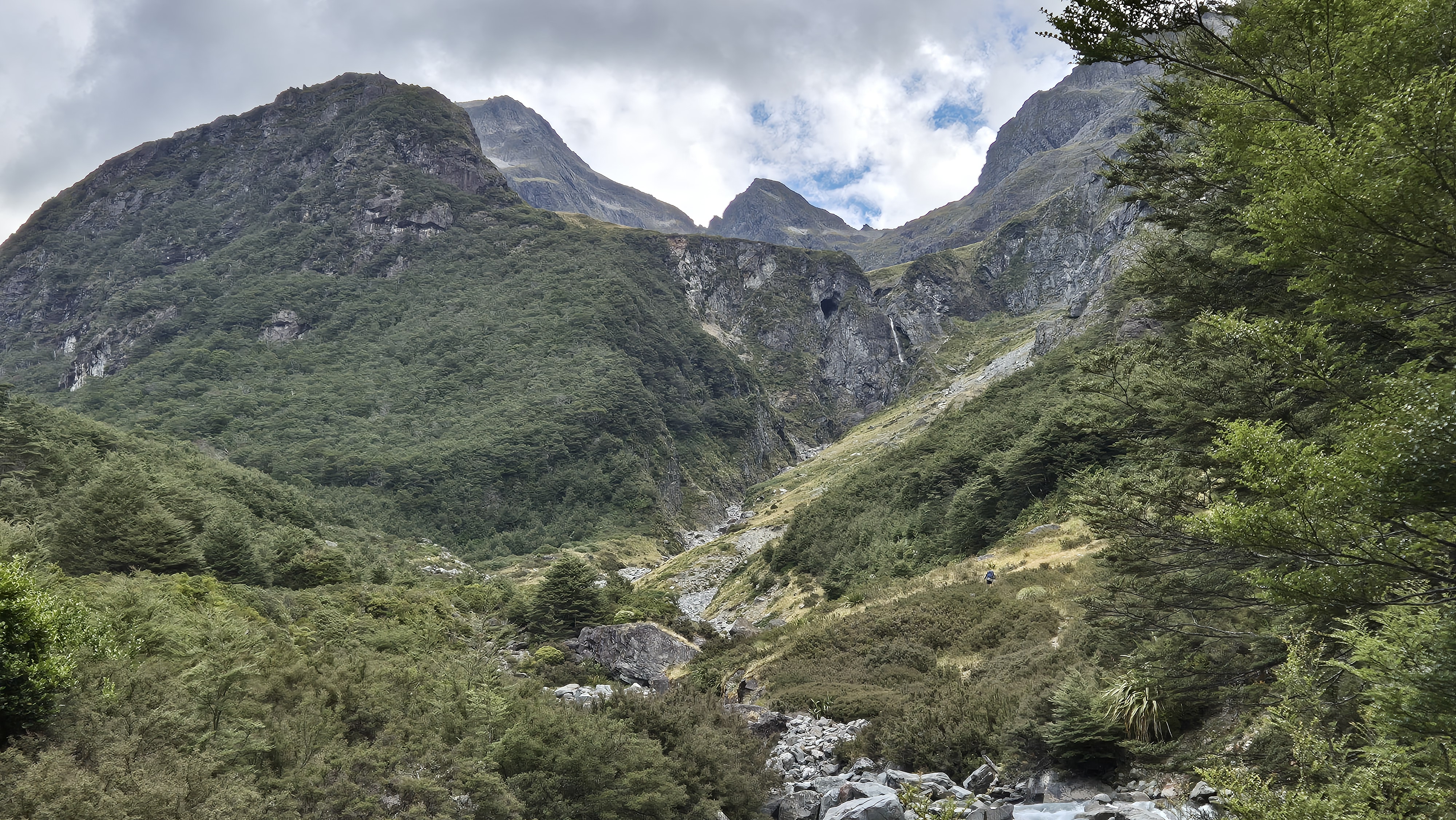
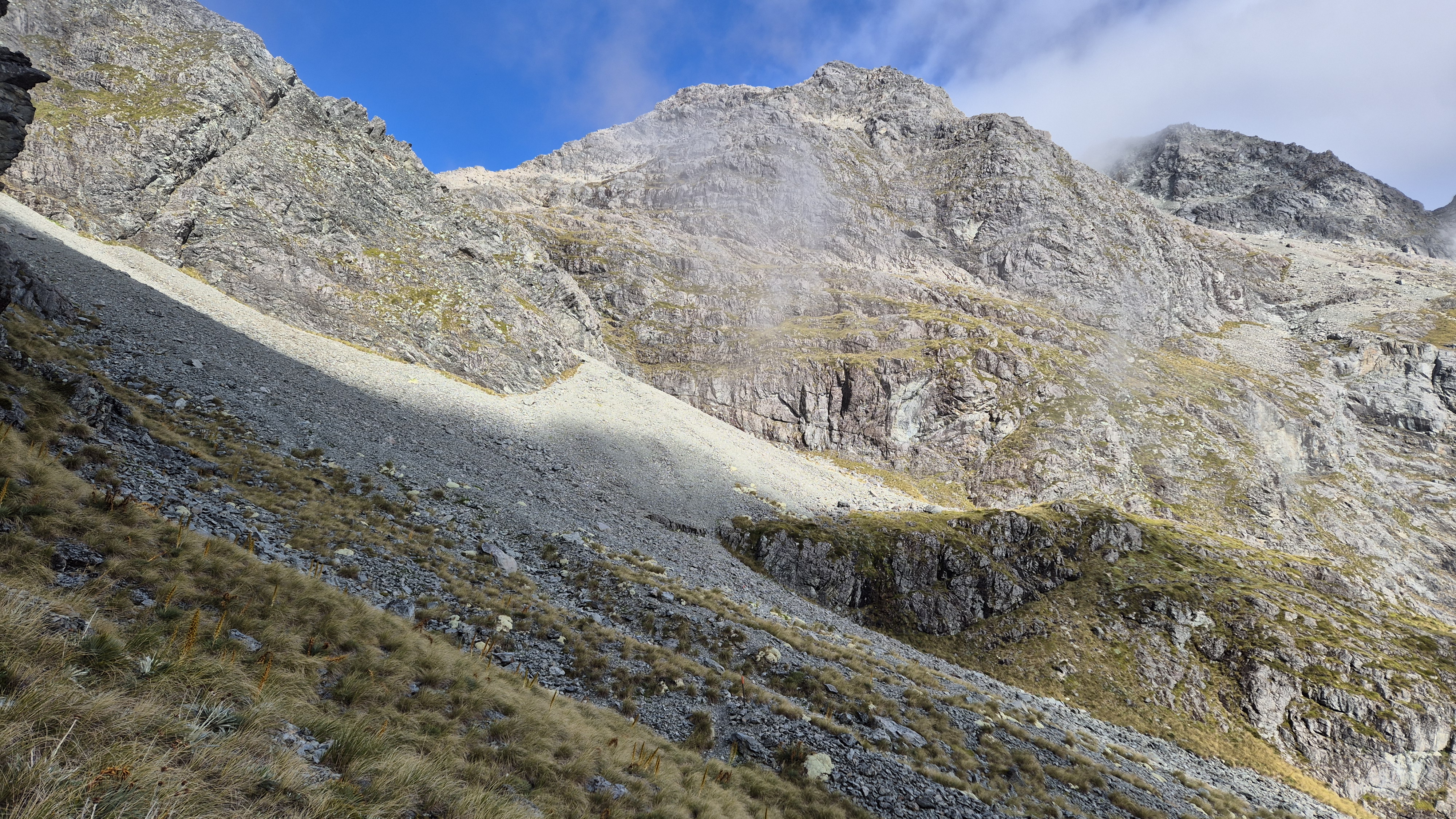
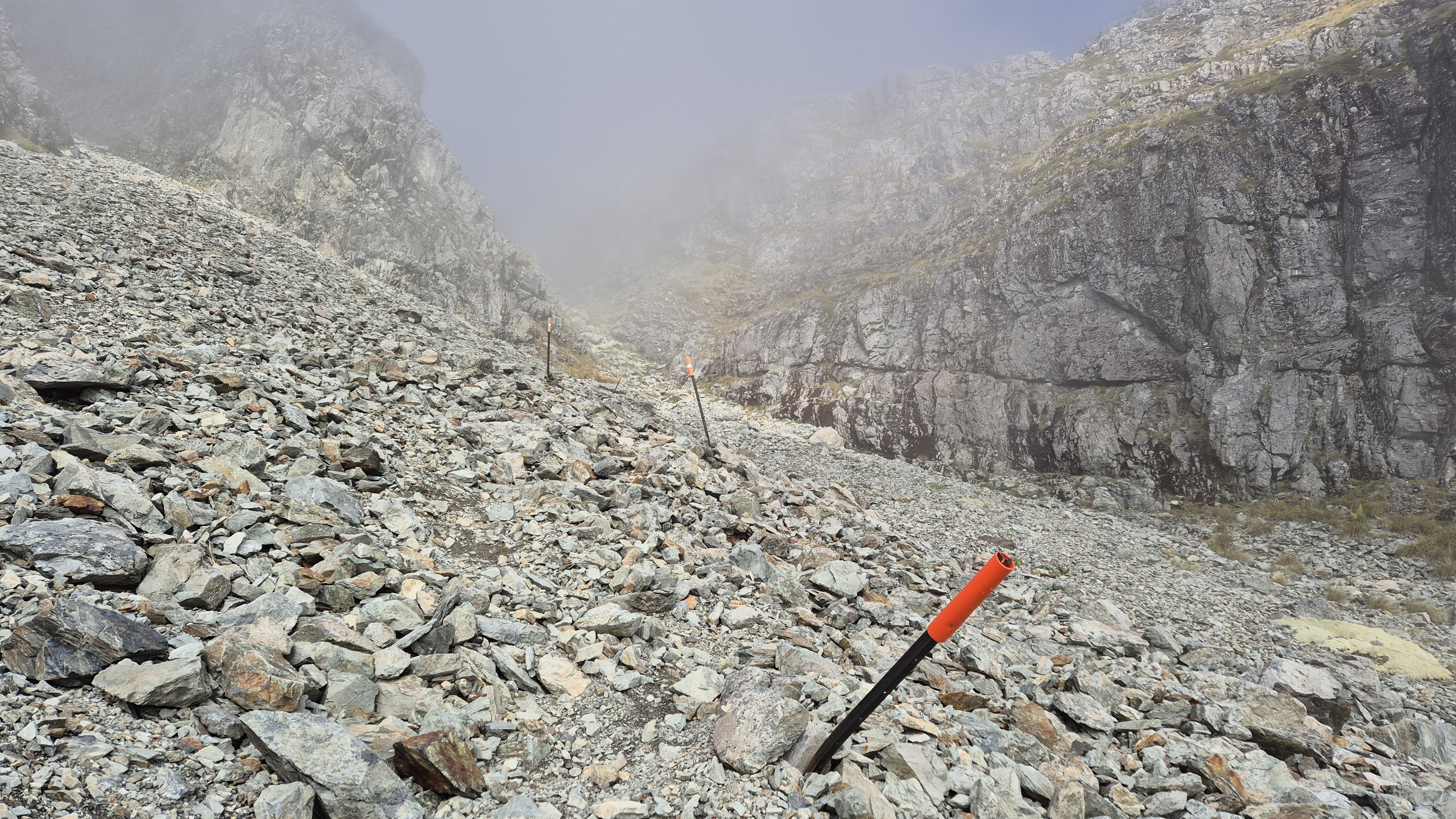
We looked up the rocky climb into the cloud – very cool. The markers offered a reassuring reminder that we weren’t about to make a serious navigational error! Scrambling up the rock jumble was hard work, but fun. We didn’t have much of a method—just followed whatever line looked easiest. I mostly stuck to the left, bear-crawling and climbing my way up for the most part. There were a couple of sections where it turned into loose gravel, making things a bit slippery, but nothing too sketchy in these conditions. It would be a completely different experience if it were wet or frozen. At 9.55 am, we arrived at a final open hollow where a short climb up another rocky slope took us up to Moss Pass.


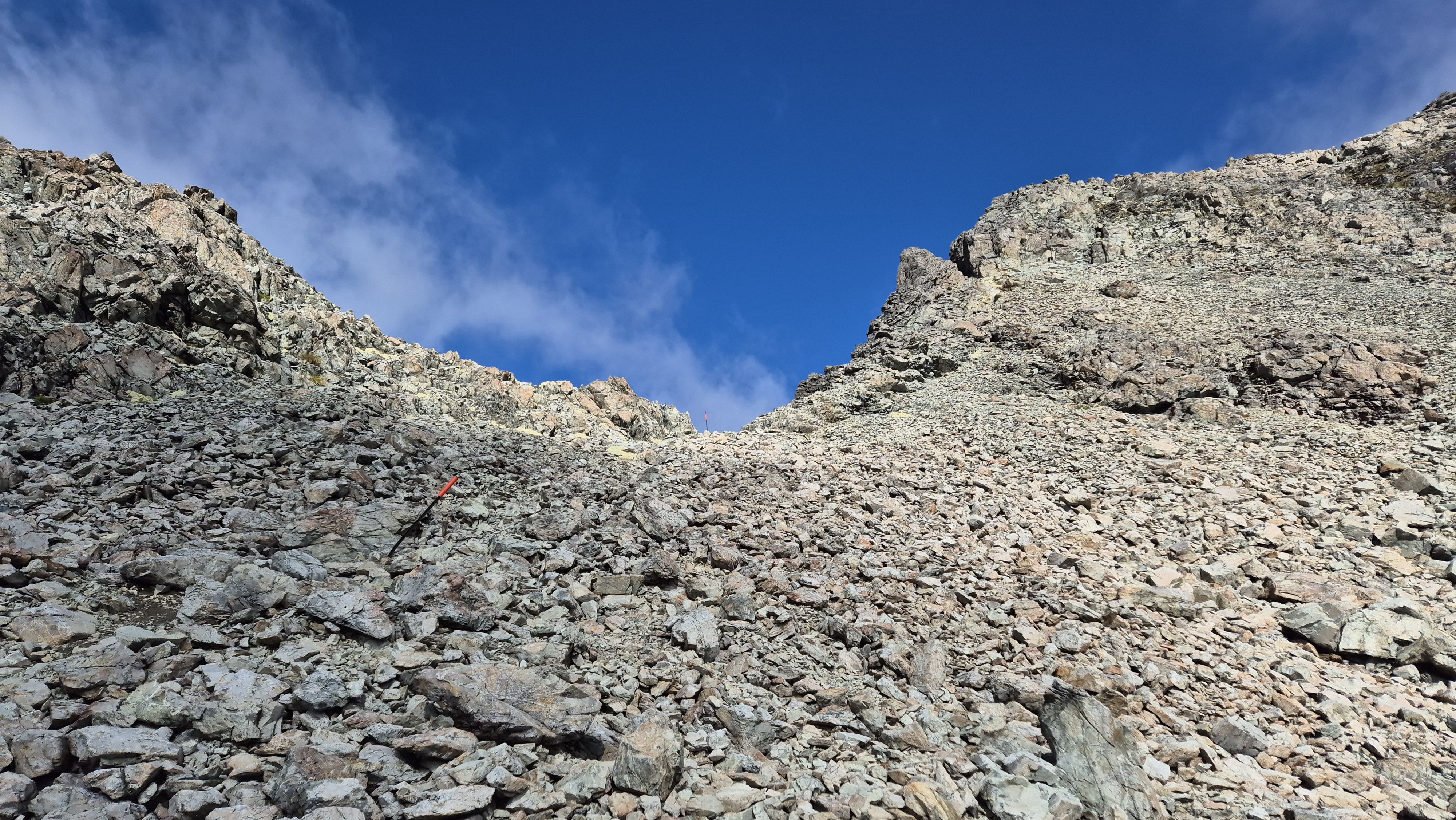
A lone bird announced our arrival at the pass. We broke out the ginger nuts and stood, lost for words at the beauty of the surroundings. Looking back at the chute made it seem worse than it was, although I would certainly prefer to come up it rather than go down it. The mountains of Franklin Ridge lay beyond, still partially obscured by cloud.

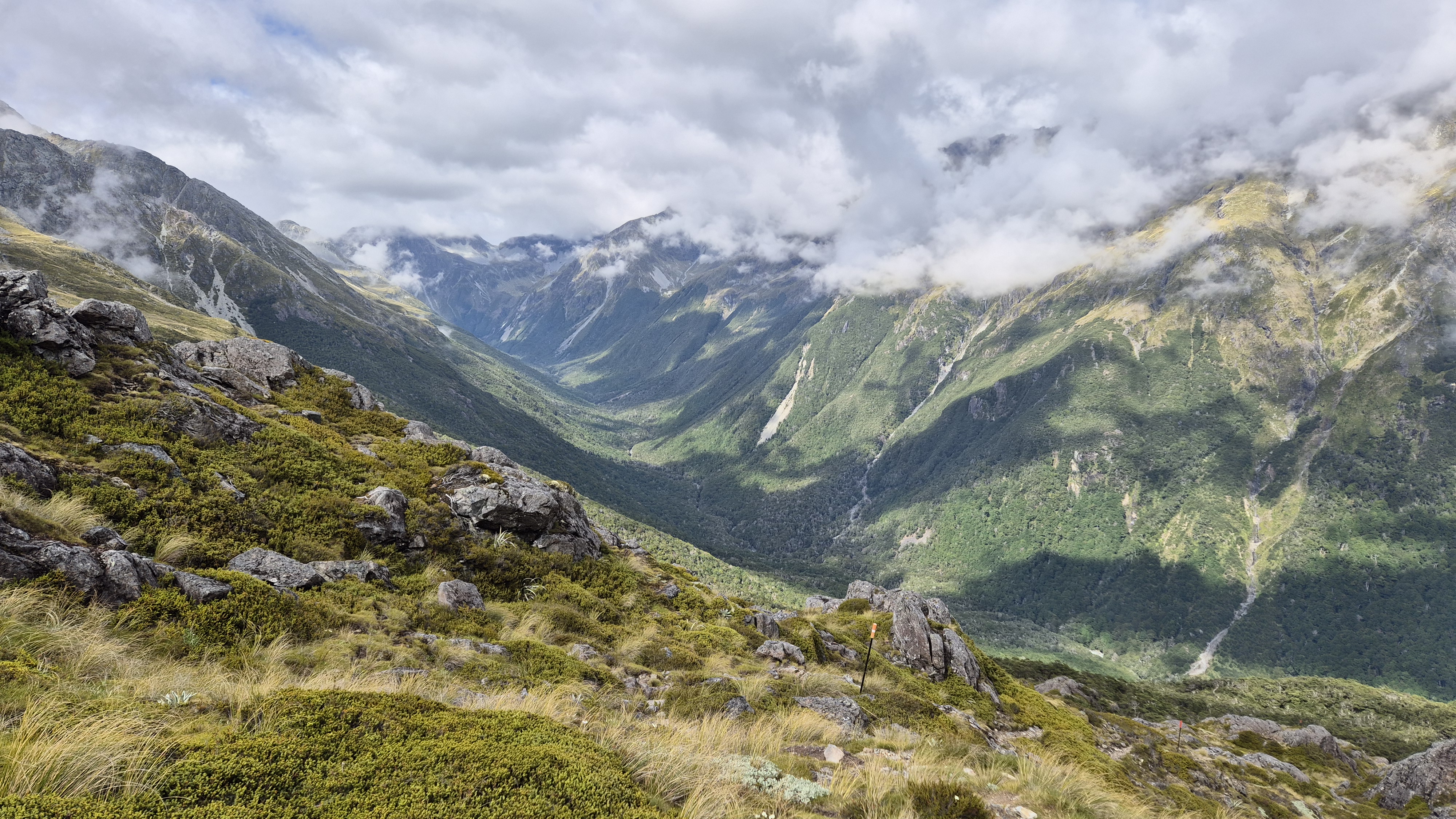
The views down into the D’Urville valley were just as spectacular, though completely different – a sea of green stretching out below. We could see nearly to the head of the valley. I went over to investigate the splendid vegetable sheep close by, one of which was in bloom – something I hadn’t seen before. Then we took the weight off our legs for twenty minutes.

Down from Moss Pass
After assessing the route down, we left the pass at 10.20 am. We followed the markers which headed left, down towards the tarn below. There wasn’t anything particularly difficult about the immediate walk down, except for one short, steep downclimb. We took it pretty steadily and reached the tarn half an hour later at around 10.50 am. Looking back up made it seem worse than it really was.
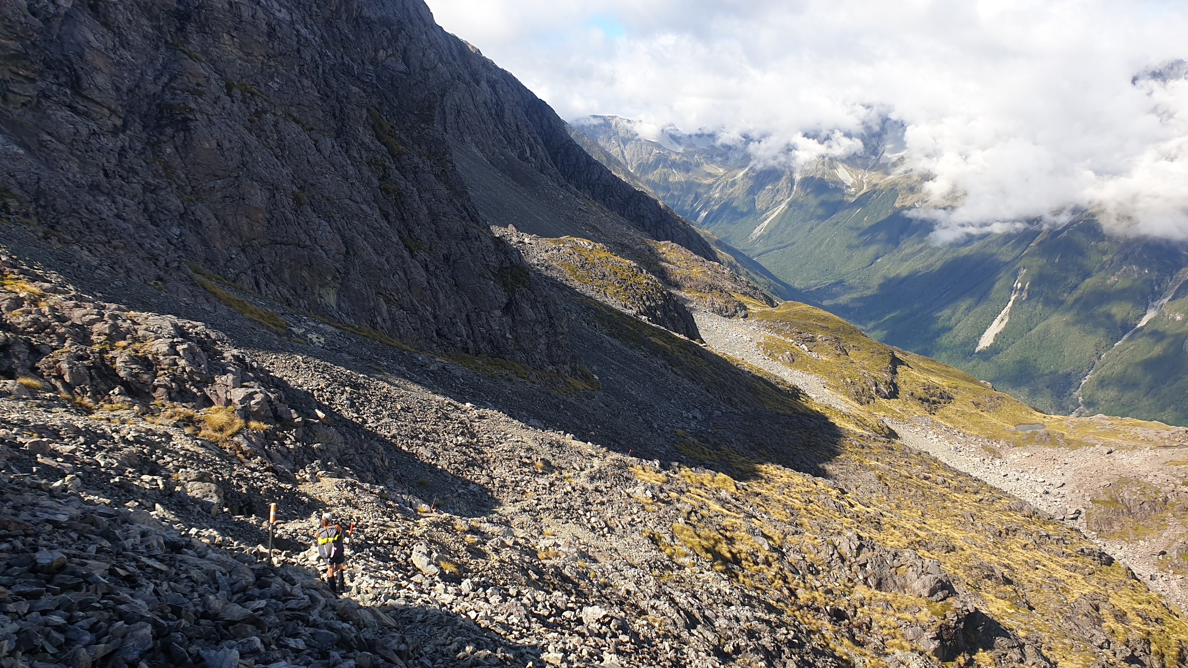

The route continued steeply down from the tarn. Around fifteen minutes later, in the alpine garden, the rocks became slick and slippery, coated in a brown layer, presumably the namesake of the pass. Despite taking it very cautiously, I slipped a couple of times.

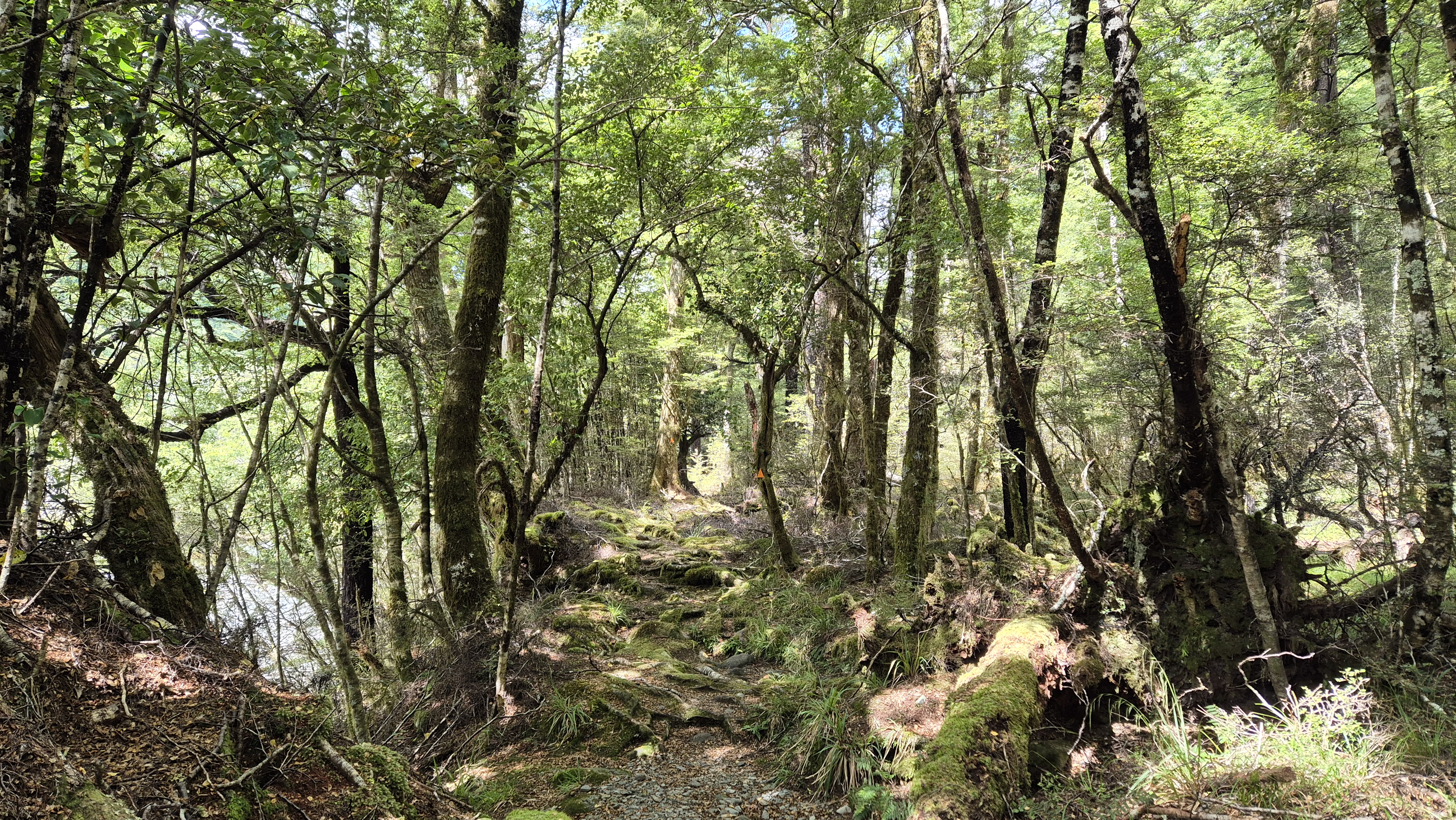
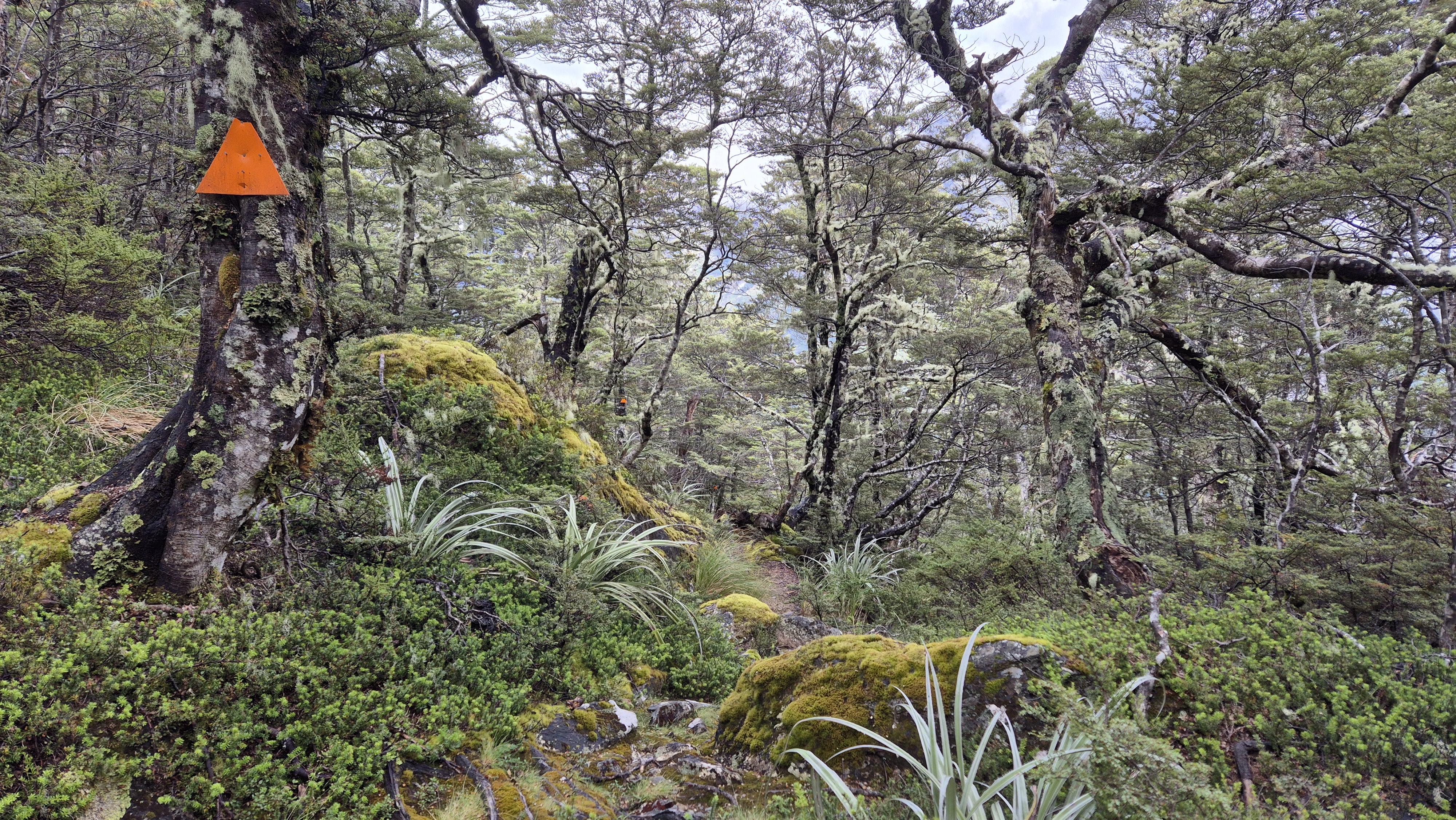
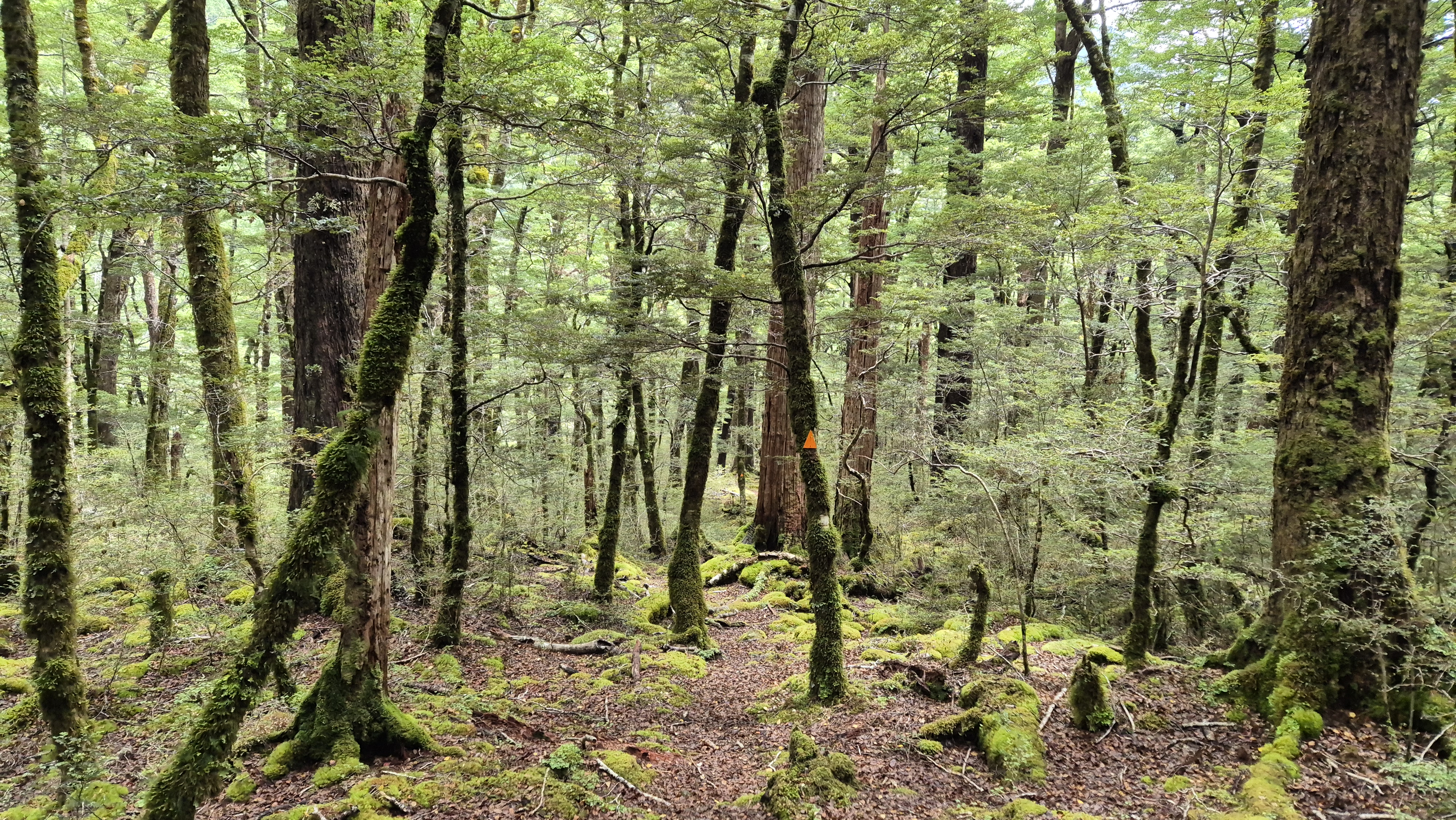
We reached the bush line at 11.30 am. A giant orange marker pointed the way, and we entered the forest – alive with birdsong, draped in lichen, and extremely beautiful. I pulled out the bird caller, which worked surprisingly well – several species flew in, curious to investigate. Fifteen minutes later, we spotted a surprise patch of red mistletoe. What a treat! We crossed a picture-perfect stream and enjoyed the soft, beech leaf carpet underfoot.

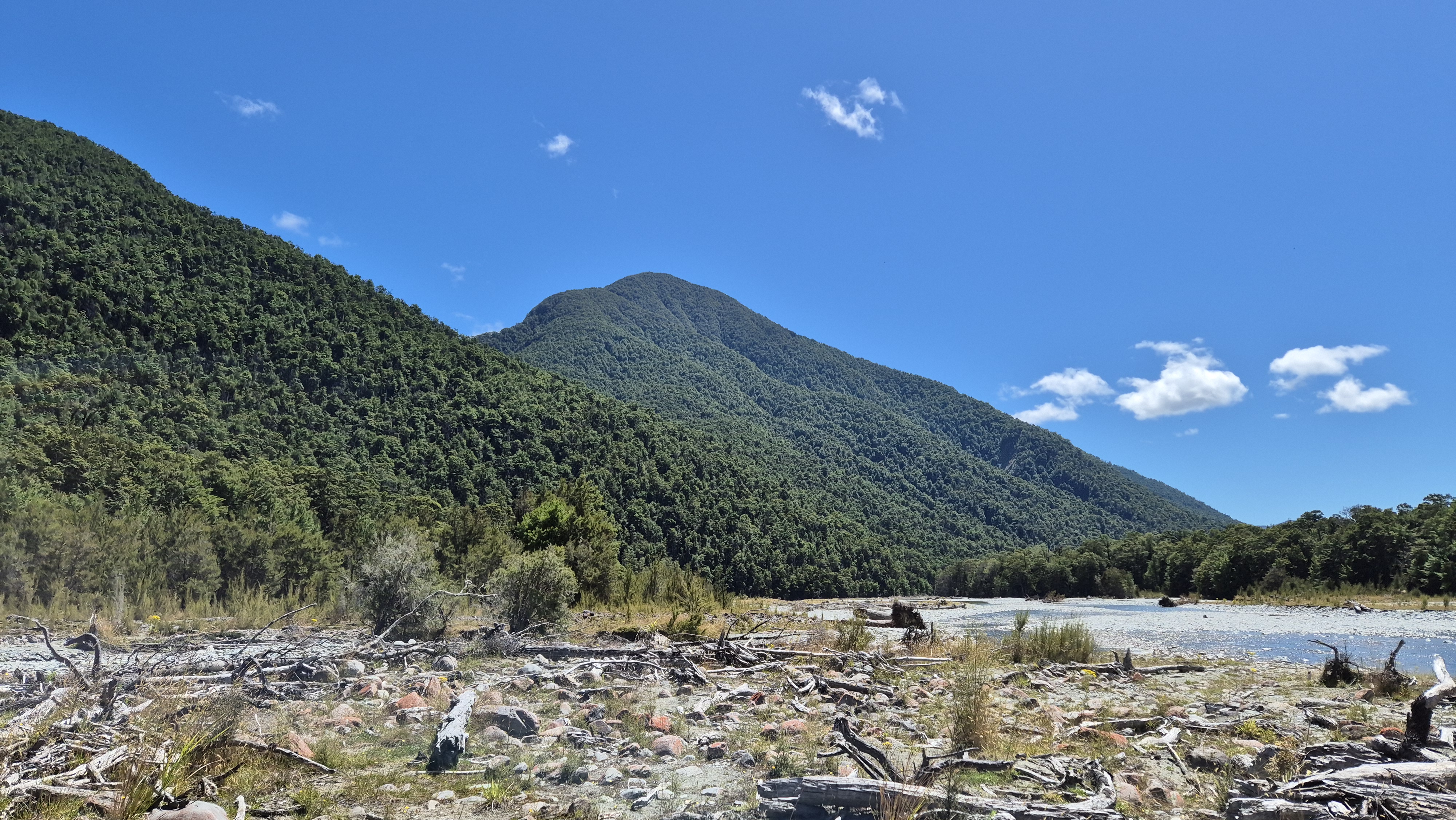
The next section of the route dropped steeply down about 250 metres in elevation. It was wet, mossy, and slippery, with plenty of obstacles to clamber over and navigate. Reaching the 900-metre contour was a welcome relief. From there, it felt like we practically skipped our way to the bridge at the D’Urville River.

Towards George Lyon Hut
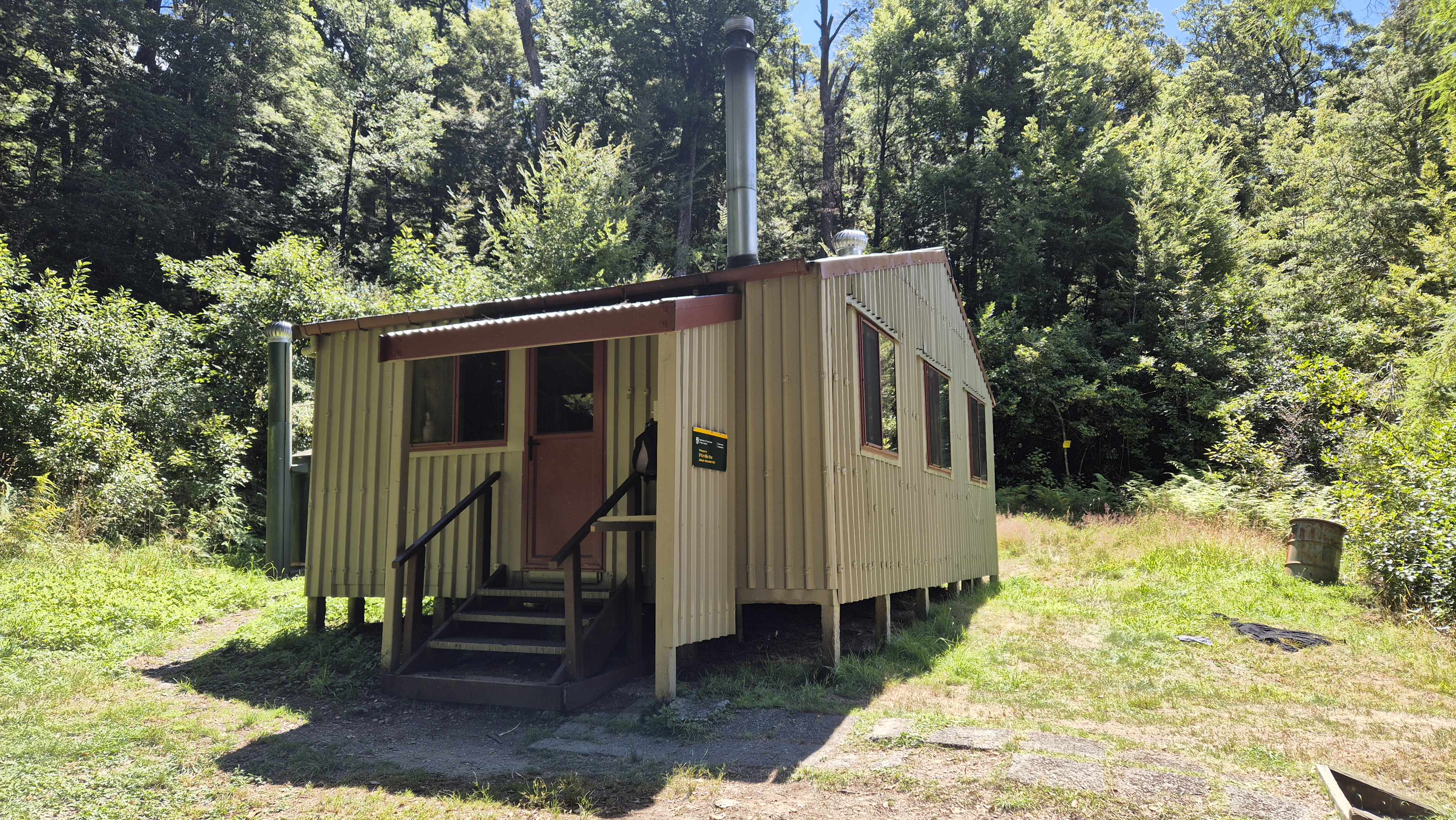
We crossed the D’Urville at 1 pm. It was only about 2km to George Lyon hut from the bridge, but it took us 50 minutes to get there. My notes for this section read two words: Flat!!! Technical. I obviously blanked out the tedious bits and only took photos of the nice bits. We reached the 16-bunk George Lyon hut at 1.50 pm. It was formerly named Ella hut after the mountain to the southeast and was renamed after George Lyon, the first chief ranger of Nelson Lakes National Park.

I do remember that we arrived at the hut starving and sweaty. We headed down to the river for a swim. The wait for lunch proved to be worth it. Breaking from our usual routine, we took a long lunch and even pushed the boat out by treating ourselves to a cup of soup. Rich (legend) had also saved a surprise for when we really needed a boost. A battered but perfectly edible giant pain au chocolat. We finally put our boots back on and left at 3.15 pm.
Towards Morgan Hut
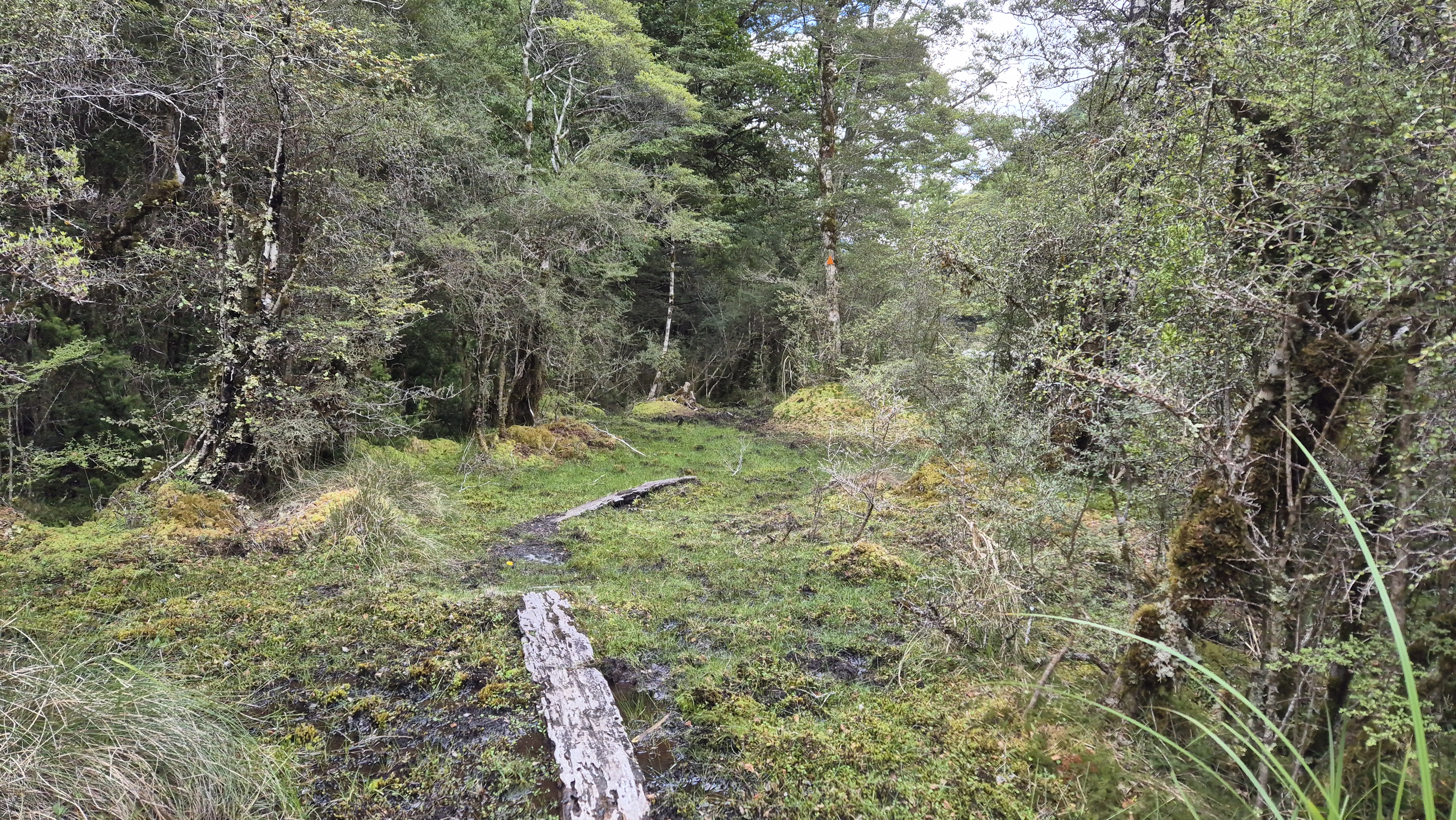
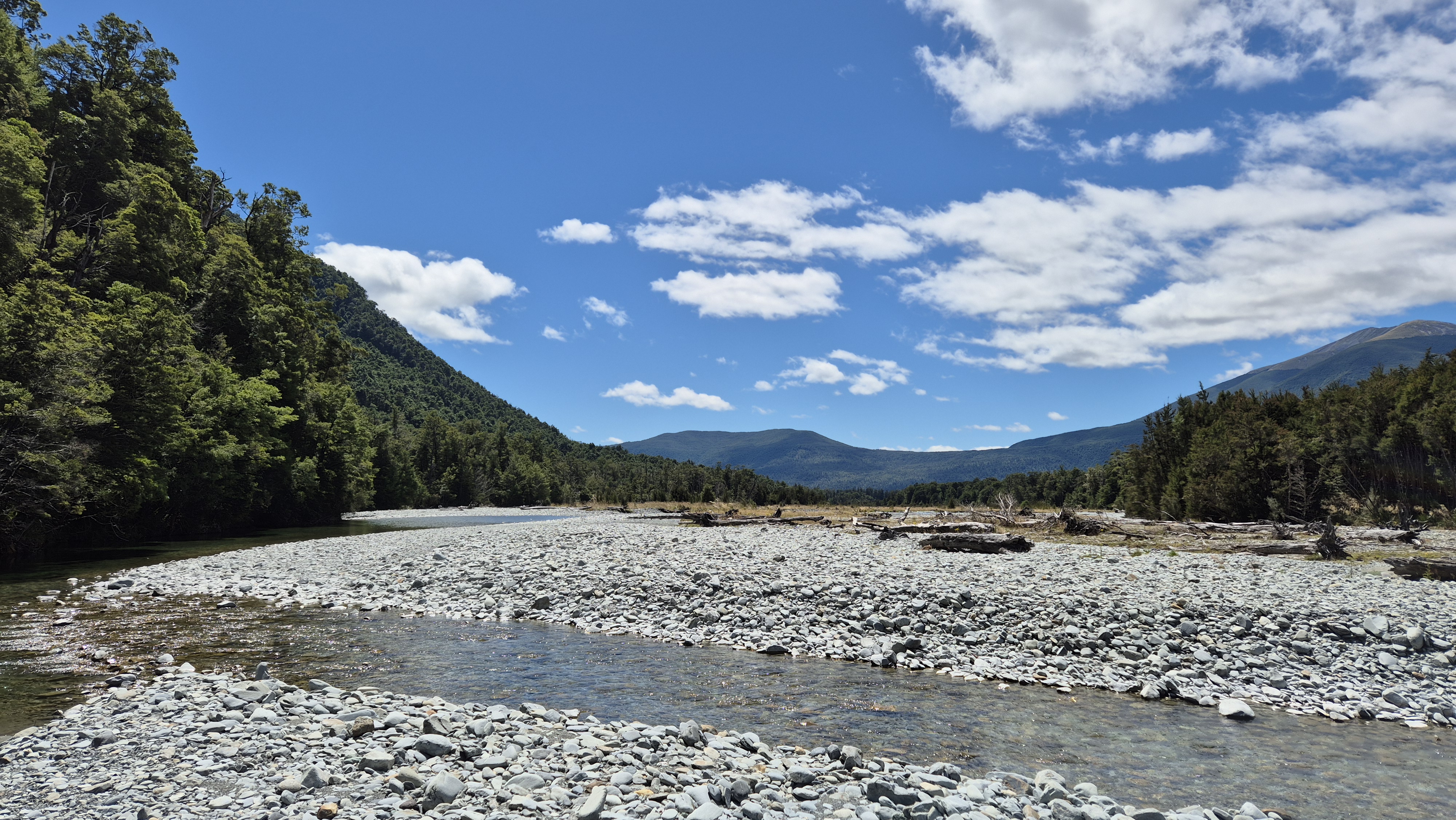
The track to Morgan hut was a mixed bag. Not far from George Lyon hut, it looked like there had been some kind of historic flooding event, where dead trees stood or were scattered around the river. The track undulated here and there, and in some of the lower-lying parts it was a bit boggy.

At 4 pm, we emerged onto an open, grassy flat with great views to the northern Ella range. We guessed we were looking up towards the Mole Tops, behind Morgan hut. By this point, we were both looking forward to reaching the hut, and the kilometres started to slip by. Around 5 pm, with about 2 km to go before Morgan Hut, we took a quick 10-minute break just before a wide, sweeping bend in the river. Not long afterwards, we headed up into the forest, following a re-route flagged with tape, to avoid the cliffs and a washed-out section of track.

With a warm sense of achievement after big day, we arrived at the light, airy 10-bed Morgan hut at 6.15 pm. We had our second swim of the day before settling in for dinner. We were joined at 7 pm by Meiers, a young guy from the USA. He was walking Te Araroa and was doing a rather epic detour from Lake Rotoiti to Blue Lake via the D’Urville. It had been a big day for him, too. He’d walked from Angelus hut over Mt Cedric to Sabine hut, across to D’Urville hut and up to Morgan and was heading over Moss Pass tomorrow.
He wasn’t travelling with a stove and to our horror, was about to soak instant noodles in cold water for dinner. The hut had a spare gas cannister, and we had spare hot chocolate and food, so we helped him out. I didn’t even give dessert a second thought (surely there couldn’t be any more surprises??!!) until Rich pulled a couple of iced passionfruit friands out of his pack. I’m still not sure which of the three of us enjoyed them the most. It wasn’t long after dinner before we all collapsed into our sleeping bags.
Moss Pass Route – Day 3
Morgan hut to D’Urville hut – DOC time: 4h, our time: 4h 20 mins
We woke up around 7 am to another stunning day. After handing Meiers a stash of leftover food, he set off at 7.45 am. After breakfast, with no rush to get going, I gave the hut a thorough clean, while Rich made good use of the bucket and brushes to give the toilet a proper scrub. A little stiff from yesterday’s efforts, we got going at 9.50 am.

About 1.5 km in, we had a slight navigational mishap in the bush. When we realised the track led us uphill – uphill! we were more than a little indignant. Rejoining the river shortly after, we eased back into the familiar rhythm, in and out of the bush, encountering a few slips and navigating some boggy sections. Even though the day’s walking had only taken a couple of hours so far, by 12.20 pm, lunch was more than welcome. We found a breezy, sandfly-free spot in the shade of the tall manuka trees.


Towards D’Urville Hut
With the boat pickup scheduled for 3 pm at D’Urville hut, we had plenty of time to get there. We wrapped up lunch around 1 pm feeling pretty relaxed. Maybe this was our reason for the second navigational failure of the day, not long later. It didn’t really matter as we were essentially following the river to the lake, and the river flats were wide and open. We followed the river downstream for a while before ducking back onto the track up a side stream, catching a swathe of bush lawyer and a generous helping of hook grass along the way. The track didn’t offer much relief, it turned out this stretch was hook grass alley as well.
Around 2 pm, at an elevated point above the river, we got some great views of Lake Rotoiti in the distance with Mt Cedric and Angelus rising up alongside. We came back down to river level and by 2.05 pm were at the Sabine hut turnoff. A final grassy section followed before we arrived at the 10-bed D’Urville hut at 2.20 pm.
At the hut we met Dom, an Englishman enjoying another long stay in our beautiful country. We figured he should surely be an honorary Kiwi, given the amount of time he’d spent in the backcountry here over the past 20 years. Rich radioed the boat, and we enjoyed a swim in the lake while waiting. The boat arrived right on time at 3 pm, to rescue us from the onslaught of sandflies.


Back at the Lake Rotoroa Campsite, the three of us enjoyed an ice cream from the water taxi office and reflected on our adventures. It was the perfect way to end the weekend.
Click the links below for more tramps in the area or use the search box in the main menu bar, top right:
- Mole Tops – overnight
- Bull Paddock Creek Hut – overnight
- Wye Route to Hidden Hut – 3 days, 2 nights
- Paske Hut – overnight
- Saxton, Severn Leatham Molesworth – 5 days 4 nights
- Lake Rotoroa to Mt Misery – overnight
- Tableland Circuit – Cobb Asbestos, Salisbury, Peel – overnight
- Tablelands Loop – Flora, Gordons, Salisbury, Balloon, Flora – overnight
- Mt Arthur – day walk
- Ellis Basin Route – 3 days, 2 nights
- Thousand Acre Plateau – 3 days 2 nights
- Leslie Karamea Track – 4.5 days 3 nights
Hello TinyTramper,
I really enjoyed your post about the Moss Pass trip – it brought back some nice memories of when I walked it with the Moa Hunters last year. You always take great photos – a couple of them are almost from the same spot that I snapped!
Cheers,
Adam and the Moa Hunters.